
Submitted:
16 March 2026
Posted:
17 March 2026
You are already at the latest version
Abstract
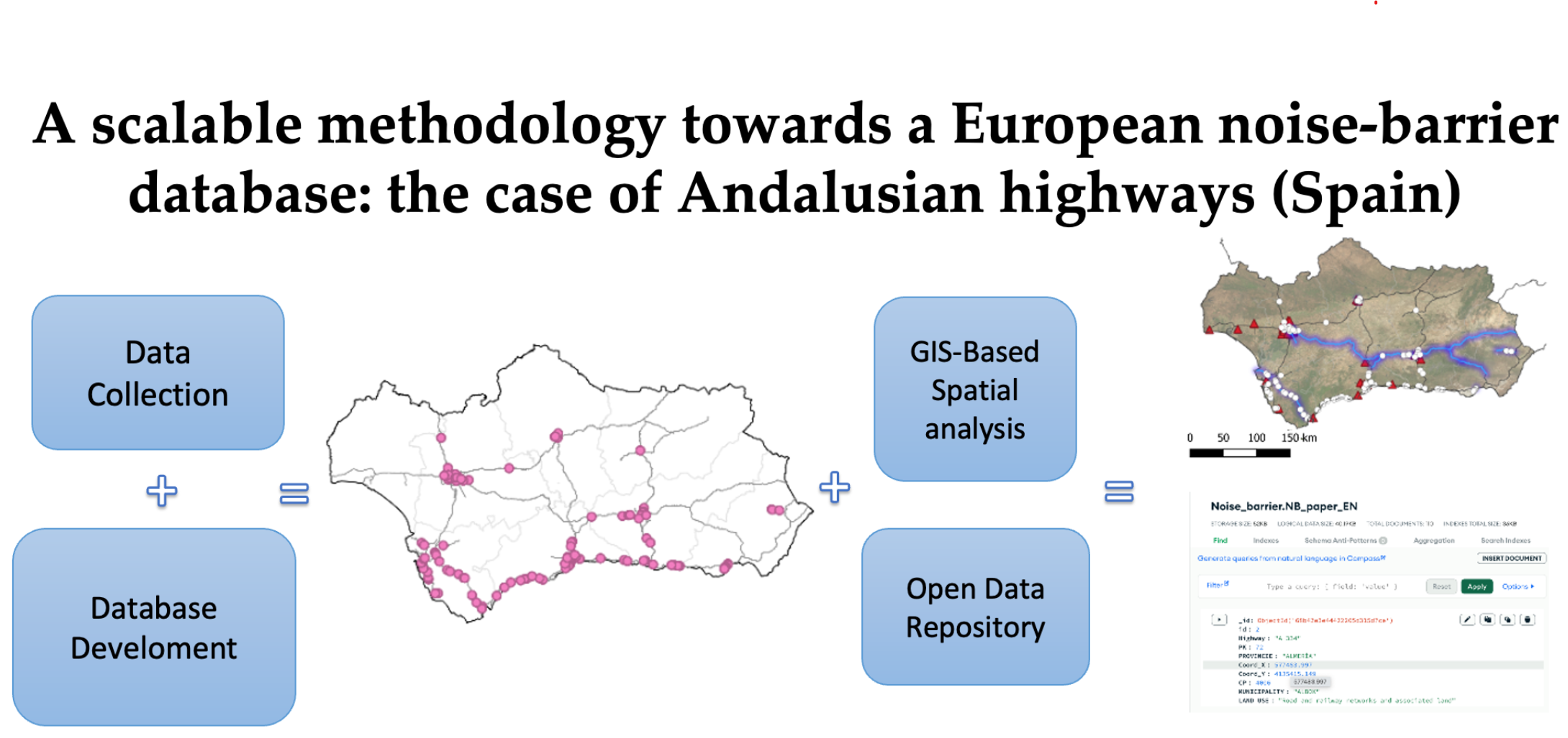
Environmental noise is increasingly recognized as a major environmental development challenge, with road traffic identified as the dominant source of acoustic pollution across Europe. Noise barriers are among the most widely implemented mitigation strategies. However, their spatial distribution and adequacy remain poorly documented, limiting their effectiveness for sustainable territorial planning. This study develops the first georeferenced database of highway noise barriers in Andalusia (Spain) and applies a reproducible, transdisciplinary geospatial workflow integrating field surveys, remote-sensing tools, and Geographic Information Systems (GIS). A total of 110 barriers were mapped, classified by material, geometry, and surrounding land use, and analyzed in relation to dwellings, schools, and hospitals. Results show that 1.6% of the Andalusian highway network is currently protected by barriers, with strong territorial disparities: over 50% of all structures are concentrated along coastal metropolitan corridors, while extensive inland areas remain unprotected. Misalignments were also detected between barrier placement and officially reported high-exposure segments, indicating limited correspondence between infrastructural deployment and acoustic priorities. Beyond generating a comprehensive regional dataset, the methodology provides a scalable basis for national and European initiatives seeking to harmonize the mapping and assessment of noise-mitigation infrastructures. By offering an open-access, transferable framework, this work supports policy professionals, environmental managers, and planners in evaluating mitigation gaps and informing more equitable and sustainable transportation and land-use strategies.
Keywords:
noise barriers
; road traffic
; GIS
; environmental
; spatial analysis
; Andalusia
Copyright: This open access article is published under a Creative Commons CC BY 4.0 license, which permit the free download, distribution, and reuse, provided that the author and preprint are cited in any reuse.


