

Submitted:
23 October 2024
Posted:
23 October 2024
You are already at the latest version
Abstract
The problem of land degradation has become a global issue. It is primarily caused by direct destruction of the natural ecosystems, irrational use and depletion of the land resources, and the growing agro-technogenic load on soils. The current state of sloped agricultural landscapes is characterized by a significant increase in the area of soils with varying degrees of erosion that require the development of scientifically based measures to protect against the erosion processes for the purpose of their further environmentally safe use, taking into account the requirements of sustainable development of the land use and farming systems, and the agricultural sphere, as a whole. There has been obtained and summarized modern scientific information on the development of adaptive-ecological and organizational-economic measures for the conservation (establishment) of erosion-degraded and low-productivity soils of arable sloped lands through the environmentally sound use of agricultural lands, the development and implementation of a soil-protective adaptive-landscape farming system. Contemporary scientific research has been carried out by means of field route studies and land inventory to determine the geomorphological and soil characteristics of the studied polygons, taking into account the basic principles of application in the geospatial analysis and practical use in the landscape studies by means of the Auto CAD computer program, the boundaries of the polygons - watersheds on raster topographic maps being determined, digitized in the local coordinate system (SK-63). The research methodology included the collection and analysis of cartographic and field experimental materials to determine the geoecological situation of the formation and manifestation of spatio-temporal erosion-hydrological processes in the area studied, conducting scientific research to study the erosion and washout of soils in the key areas, agricultural landscape polygons, determining the influence of natural and anthropogenic factors upon the estimated intensity of the erosion processes, and office processing of the results, obtained in the field. The reliability and validity of the results are confirmed by the large volume of data obtained and their statistical processing, based on the software: Office 2016, "Statistika 13", "Statgraphics 19" and "MapInfo Pro v12.5.5". It has been established that the introduction of a set of measures for the conservation of the degraded lands of the sloped agro-landscape systems by stopping intensive economic activity with subsequent use of the land plots as hayfields and pastures, ensured a significant reduction in soil loss due to erosion, while the soil loss on heavily and moderately eroded soils of the studied sites amounted to 2.38-4.19 t ha-1, which differs slightly from the maximum permissible standard indicators of soil loss for the heavily and moderately eroded soils. The main characteristics of the agrochemical, agrophysical and other properties of the washed-out chernozems have stabilized during the conservation period. At the same time, the humus content in the cultivated soil layer has increased to 3.85%, the optimal values are characterized by the soil acidity pH 7.1 - 7.3 (close to neutral). Attention has been focused on the specifics of the land conservation by excluding it from economic circulation with its subsequent use as pasture and hay lands.
Keywords:
phytomeliorative measures
; adaptive-landscape farming system
; organizational and economic measures
; soil erosion
; fertility of the washed-out soils
1. Introduction
The current use of land and climate change have led to a dangerous degradation of the erosive land. According to various estimates, these negative processes have spread to almost 15 million hectares, and, together with the wind erosion – to 20-21 million hectares. Every year, on average, about 15-20 t ha-1 of the fertile soil layer is lost, and the area of the eroded land increases to 100 thousand hectares. When the wind erosion and, especially, the dust storms occur, the soil losses reach 50-100 t ha-1. The amount of humus, nitrogen, phosphorus and potassium, lost as a result of erosion, significantly exceeds their introduction with organic and mineral fertilizers. Therefore, dehumification and depletion of the soil fertility are observed, which negatively affects not only the yield of agricultural crops but also the ecological condition of agricultural landscapes [1,2,3,4].
In the greatest part of territories, the risks of erosive degradation, dehumification and depletion of fertility are increasing, associated with both changing the climate conditions and imperfect agricultural practices [5].
Under the conditions of complex negative relief, the soil cover is particularly affected by such factors as rectangular organization of the agricultural lands, destruction of natural watercourses, deterioration of agrophysical properties of soils, sowing of the row crops on slopes >3°, destruction or deterioration of the forest belts and anti-erosion forest plantations, as well as suspension of state and regional programs for the protection of soils from erosive degradation. Along with the increase of temperature in the process of climate change in all natural and climatic zones over the past 30 years, there has been an increase in the torrential nature of precipitation, which, with an increase in the sown areas of such intensive crops as maize and sunflower, increases the risks of water and wind soil [6,7].
Consequently, the imperfection of agricultural practices and land management, as well as the underestimation of the impact of natural factors, in particular the climate change, increases the risks of intensified degradation of the agricultural lands, deterioration of the soil quality, and their ability to perform agroecological and biospheric functions in the agrosphere.
In the context of fairly rapid climate changes, intensification of agricultural production, high risks of degradation and desertification of agricultural lands, methods for the timely detection and identification of manifestations of degradation processes as a basic foundation for improving the land use systems and sustainable management of agricultural resources are becoming especially relevant.
At the present time in agricultural practice the main provision of the analysis of ecological and landscape conditions as a balanced relationship between the exploitation, conservation and improvement of the land fund of a specific type and kind of agricultural landscapes of a certain natural and climatic region is missed.
At the same time the development of aerospace survey technologies, automated methods for decoding satellite data and spatial simulation, using a geographic information system (GIS), make it possible to quickly identify and assess the risks of the soil degradation and monitor the ecological state of agricultural landscapes and land use systems [8,9,10,11,12,13,14,15,16,17,18].
The real threat of global land degradation and, in general, the disruption of the sustainability of the biosphere has caused justified concern in the world community and led to an understanding of the need for concerted and coordinated actions by states and the general population at the interstate level to prevent land destruction and mitigate the effects of drought and degradation.
In several countries a significant information database has been accumulated that characterizes the intensity of soil erosion on slopes, the properties of eroded soils, the effectiveness of individual anti-erosion measures and their complexes [19,20,21,22,23,24].
These facts require increased attention to the study, control and overcoming of erosive degradation, in particular, establishing the scale of degradation processes, identifying current threat.
The problem of determining the role of factors that influence the reduction of the risk of the water erosion processes has been studied by scientists since the middle of the 19th century with the aim to forecast and develop a methods for combating erosion, taking into account the global, regional and local levels. The rate of soil erosion depends on a number of factors, such as the geomorphological features, the soil characteristics, the land using systems, and land management practices [25,26,27,28,29,30].
Over the past decades the factor of the land using system (land ratio) has acquired particular relevance in connection with the large-scale progression of the erosion processes, which are associated with the increase in the arable land, and which, wih time, lead to the loss of biodiversity, soil degradation, and deterioration of the environmental services [30,31].
Thus, the global scientific community faces the need to find ways to solve the problem of rationalizing land use.
The EU countries are pursuing an active land policy to create a balanced system of natural resource management. Thus in Great Britain a concept of a scale of landscape conservation has been developed with the aim to solve the issues of the climate change, and to restore biodiversity in the conditions of a complex landscape [32].
In order to preserve and increase the biodiversity in the EU countries, a network of protected areas (Natura-2000) has been created. The elements of this network are types of natural environments (Special Areas of Conservation), rare and under threat of destruction [32,33].
Agricultural and management practices play an important role in the control of the soil erosion. For example, the rate of the soil loss decreases exponentially as the vegetation cover increases. The impact of the land usage and management is often parameterized in the covering management coefficient. The researchers propose a methodology for assessment of the covering management coefficient in the European Union (EU), using statistical data about agricultural crops and practices [34,35,36].
The aim of the research is to determine the soil conservation capacity of technologies for creating a system of phytomeliorative measures (land conservation), to establish patterns of restoration of herbaceous phytocenoses on anthropogenically transformed lands in the system of soil conservation agriculture in the context of the risks of increased manifestations of water and wind erosions and determining ways to solve existing problems.
2. Materials and Methods
As a basic territorial unit of research there was chosen an elementary river basin, characterized by a complex structure and mutual dependence relationships between the components, which meets all the requirements of a geosystem, but the integral function of the runoff was chosen by the physical impact, as the main territorial unit of research, through the influence primarily of physical factors, reflecting the development, functioning and state of the natural-territorial complexes.
The research methods. The field and laboratory methods to determine the interaction of the research object with weather and soil factors; the monitoring route, visual, descriptive, measuring and weighing and calculation – to determine the qualitative characteristics of the grass stands; the chemical – to determine the physical and chemical properties and agrochemical indicators of the washed-out soils; the mathematical and statistical – to determine the reliability of the results obtained; the ecological, economic and soil protection efficiency of the developed technological measures for the formation and reproduction of forage lands on eroded lands of agricultural landscapes.
3. Results
The organization of rational use and protection of lands of sloping agricultural landscapes is a multifaceted problem that requires a comprehensive approach to solving pressing legal, economic and environmental issues under the current conditions of completion of the land reform. The solution to this problem is possible through the development of scientific paradigms with the definition of necessary measures to increase productivity, protection and rational use of erosion-degraded lands, ecological stabilization of agricultural landscapes, optimization of the structure of lands, conservation of degraded sloping lands, based on their environmentally safe use. Taking into account the environmental situation that has developed in the agricultural land use by the state, there is an urgent need to develop new approaches to improve the system of soil and water conservation measures and to develop new ways of rational use and protection of land with the aim of innovative development of highly efficient agricultural production, minimization and achievement of a neutral level of degassing processes.
This actualizes the need to conduct scientific research, aimed at obtaining new knowledge about the patterns of functioning of agricultural systems and their individual components for the creation of new scientific products, including through the development of environmental management systems and technologies for protecting soils from the manifestation of erosion processes in agricultural landscapes of Ukraine. This actualizes the need to conduct scientific research, aimed at obtaining new knowledge about the patterns of functioning of agricultural systems and their individual components for the creation of new scientific products, including through the development of environmental management systems and technologies for protecting soils from the manifestation of erosion processes in agricultural landscapes of Ukraine. Conservation (restoration) of herbaceous communities on former arable lands is a complex and dynamic process in time, consisting of a series of temporary, determinately chaotically changing stages of overgrowing, each of which is characterized by a unique ecological-biological, morphological, floristic-individualistic structure and a special state of biodiversity.
The scientific foundations for creating highly productive herbages of natural forage lands, rational use of cultivated hayfields and pastures have already been brought to the level of methodological developments and practical recommendations. However, ensuring an efficient organization of land areas when using a system of anti-erosion measures in soil-protective adaptive agriculture requires their more thorough study for the purpose of further application by the business entities.
The soil-water conservation and agroecological efficiency of methods for creating and operating highly productive herbages on the degraded natural forage lands and on the lands in erosion-hazardous zones of agricultural landscapes, removed from intensive cultivation, remain unclear, which indicates the relevance of these studies.
The theoretical and methodological basis for the study of ecological optimization of the agricultural landscape were fundamental ecological, geographical, historical, socio-economic concepts, hypotheses of domestic and foreign authors, concepts of land relations in modern agricultural production.
The analysis of the results of studies, conducted in Ukraine, has shown that the meadow lands will function harmoniously only when they simultaneously fully perform not only a forage production role but also a nature conservation role. As has already been noted, with an increase in the forage production value of the meadow lands, that is, their productivity or ecological capacity, their nature conservation role, that is, their soil protection capacity, also increases [2,3,4,5].
With the increase in the forage production value of the meadow lands, that is, their productivity or ecological capacity, their nature conservation role, that is, their soil-protective capacity or buffer capacity also increases. In comparison with the field lands, the meadow lands involve significantly more mineral and organic substances in the biological cycle and do not allow them to go beyond their boundaries. Situated in the transition zone of agricultural landscapes, they represent a buffer zone and a reliable barrier to the surface migration of silt particles of soil and agrochemicals from arable lands, which often occurs during heavy rains, due to their dense grass cover and buffer capacity. Due to this capacity, they reliably protect soils, located on the slopes, from erosion, and the water sources from siltation and pollution. Situated in the transition zone of agricultural landscapes, they represent a buffer zone and a reliable barrier to the surface migration of silt particles of soil and agrochemicals from arable lands, which often occurs during heavy rains, due to their dense grass cover and buffer capacity. Due to this capacity, they reliably protect the soils, located on slopes, from erosion, and the water sources from siltation and pollution.
In this respect, when solving the problems of soil protecting from erosion and improvement of the condition of agricultural territories, a landscape approach is promising, which necessitates a systemic analysis, taking into account many factors that influence the environmental optimization of the agricultural landscape [11,12].
The scientists from the Department of Agricultural Land Use and Soil Erosion Protection of the National Scientific Centre “Institute of Agriculture of the National Academy of Agrarian Sciences”, in cooperation with the scientists from the Ulbroka Scientific Centre of the Latvian University of Life Sciences and Technologies are conducting regional monitoring of the territory of agricultural land use in the Kyiv region by means of cartographic and field surveys of the state of land in order to assess the natural resource potential and environmental stability of land use. (Figure 1).
In the study area, the rainfall erosion dominates over the meltwater erosion. High-intensity summer precipitation (up to 4 mm per minute) is observed, often falling in layers of more than 50 mm (Figure 2).
Along with the highly dissected relief and deep (up to 60 m) erosion base, heavy rains are the main factor in the intensive development of the erosion processes (Figure 3).
The main component of the soil conservation farming system is the implementation of a set of measures to optimize the structure of the land use of a specific farm by removing eroded arable and other low-productivity lands, located on slopes with an inclination of 3 degrees or more, from intensive cultivation, expanding the area of the forage lands and forest-covered lands.
When processing the methodological and methodical approaches to determine the directions of efficient use of phytomeliorative measures in the system of adaptive-landscape agriculture of the farm, typical research objects were selected - polygons, their geobotanical and land management field survey was carried out, the characteristics of the studied natural, social and anthropogenic factors within the element (polygons-tracts) were determined. The conducted scientific research is based on the methodology of landscape ecology, landscape science and applied methods of observation and determination by applying the methodological foundations of the land management field route, ecological-geographical and geomorphological studies and research, processing of cartographic materials and results, obtained in the field experiments. The results of the field landscape and landscape-geochemical studies and surveys, geobotanical descriptions of the investigated areas were used. Monitoring studies were conducted to study the dynamics of the species’ ecological and biological structure of spontaneously regenerating herbages in the process of their formation in six landscape-geochemical systems - tracts (polygons No. 1-3), and the geomorphological characteristics and condition of the studied polygons were determined. The scientific observations were performed through field route surveys and the land inventory.
The monitoring route studies were carried out at specific and recorded sites (polygons) on the ground (in nature), and on cartographic materials (polygons) at a scale of 1:10,000.
The area of the polygon 1 is 20 hectares. Slopes with the western, north western and southwestern exposures. The absolute maximum elevation of the earth’s surface is 177 meters, the minimum is 127 meters. The average length of the slopes is 149.1 meters, the steepness is 4.024% (Figure 4).
Soils: typical chernozems and highly degraded chernozems, moderately eroded, light loamy. The slopes are blackened and covered with grassy vegetation. The plant groups – phytocenoses of the ravine slopes are rich in their diversity and density. There are about 300–400 plants per 1 m2 (Figure 5).
The species saturation of the phytocenosis at the site belongs to the 1st density class – (a plant community) – the plants, close with their above-ground upper parts and form a 100% projective cover, which has a positive effect on the protection of soils from their washout and flooding by heavy rainfall. In spring, during the snow melting, the developed root system and dead above-ground grass mass (natural mulch) prevent the erosion processes.
There are also found the grassy grass groups, mainly represented by the creeping wheatgrass (Elymus repen), occasionally by the bristle grasses (Setaria), and by feather grass (Stipa pennata L). The slopes are turfed, covered with dense herbaceous vegetation; there are single bushes of silverberry (Elaeagnus commutata). The plant groups – phytocenoses of the ravine slopes are rich in their diversity and density. There are from 300 to 500 plants per 1 m2. The phytocenoses of mixed grasses have a rich species composition of tall plants, in particular; some of them: musk thistle (Carduus nutans); common milkweed (Asclepias syriaca L.); Common yarrow (Achillea millefolium); St. John’s wort (Hypericum perforatum L.); Common tansy (Tanacetum vulgare L.); White cinquefoil (Potentilla alba L.); Scentless chamomile (Unscented chamomile); sea mayweed (Tripleurospermum maritimum); hoary alyssum (Berteroa incana L.) musk thistle (Carduus nutans); common milkweed (Asclepias syriaca L.); Common yarrow (Achillea millefolium); St. John’s wort (Hypericum perforatum L.); Common tansy (Tanacetum vulgare L.); White cinquefoil (Potentilla alba L.); Scentless chamomile (Unscented chamomile); sea mayweed (Tripleurospermum maritimum); hoary alyssum (Berteroa incana L.), musk thistle (Carduus nutans); common milkweed (Asclepias syriaca L.); Common Yarrow (Achillea millefolium); St. John’s wort (Hypericum perforatum L.); Common tansy (Tanacetum vulgare L.); White Cinquefoil (Potentilla alba L.); Sea Mayweed (Tripleurospermum maritimum); hoary alyssum (Berteroa incana L).
The polygon 2 area is 25 ha. The slopes with eastern and northern exposure. The absolute maximum elevation of the earth’s surface is 190 meters, the minimum is 130 meters. The average length of the slopes is 112.2 meters, the steepness of slopes is 7.125% (Figure 6).
Soils: typical chernozems and highly degraded, highly eroded, light loamy chernozems. The slopes are turfed and covered with grassy vegetation. The plant groups – phytocenoses of the ravine slopes are rich in their diversity and density. There are up to 300 plants per 1 m2 (Figure 7).
The species saturation of the phytocenosis at the site is according to the Drude scale belongs to the 1st class of projective cover – the plants, close with their above-ground upper parts, forming 100% of the projective cover, which has a positive effect on the protection of the soils from their washout and flooding by rainfall.
In spring, during the melting of snow, the developed root system of perennial grasses and the dead above-ground grass mass (natural mulch) prevent the erosion processes.
The cereal grass groups are represented mainly by the creeping wheatgrass (Elymus repen), and occasionally by the bristle grasses (Setaria).
Phytocenoses of the mixed herbs have a rich species composition of tall plants, in particular, some of them: Common yarrow (Achillea millefolium); common St. John’s wort (Hypericum perforatum L.); field spurge (Euphorbia agraria); common tansy (Tanacetum vulgare L.); white cinquefoil (Potentilla alba L.); non-scented chamomile (non-scented tricostal); sea mayweed (Tripleurospermum maritimum); hoary alyssum (Berteroa incana L.); Common yarrow (Achillea millefolium); St. John’s wort (Hypericum perforatum L.); Euphorbia arvense (Euphorbia agraria); common tansy (Tanacetum vulgare L.); white cinquefoil (Potentilla alba L.); chamomile not fragrant (three-rib not odorous) sea mayweed (Tripleurospermum maritimum); hoary alyssum (Berteroa incana L). The grass cover is not mown and is not grazed by the livestock.
The area of the polygon 3 is 30 ha. The slopes with the eastern and north-eastern exposures. The absolute maximum marks of the earth’s surface are 170 meters, the minimum are 130 meters. The average length of slopes is 123.2 meters, the steepness of slopes is 6.49% (Figure 8).
Soils: typical chernozems and degraded chernozems, heavily eroded, light loamy. The slopes are turfed and covered with grassy vegetation. Plant groups – phytocenoses of the ravine slopes are rich in their diversity and density. There are up to 300 plants per 1 m2 (Figure 9).
The species saturation of phytocenosis at the polygon belongs to Class 1 projective cover – (a plant community) – plants, close with their above-ground upper parts, forming a 100% projective cover, which has a positive effect upon the protection of soils from their washout and flooding by heavy rainfall. In spring, during the melting of snow, the developed root system of the perennial grasses and the dead above-ground grass mass (natural mulch) prevent the erosion processes. The grassy grass groups are occasionally represented by creeping wheatgrass (Elymus repen).
The phytocenoses of mixed herbs have a rich species composition of tall plants, in particular, some of them: Common milkweed (Asclepias syriaca L.); Common yarrow (Achillea millefolium); common St. John’s wort (Hypericum perforatum L.); Common mullein (bear’s ear) (Verbascum thapsus L.); Field spurge (Euphorbia agraria); Hoary alyssum (Berteroa incana L.).
By the conducted determinations and geobotanical descriptions it has been established that the spontaneously restored herbages were distinguished not only by the presence of a significant number of species and increased projective cover but also by a sufficiently high diversity of taxonomic structure, as one of the important indicators of the state and functional properties of phytodiversity of cenoses, the implementation of their adaptive and soil-protective self-regulation capabilities and the formation of stable grassy ecosystems.
In spontaneous restoration of herbage on strongly and moderately washed soils in the composition of vegetative vegetation groups, drooping brome (Anisanthus tectorum), creeping wheatgrass (Elymus repen), common milkweed (Asclepias syriaca), hoary alyssum (Berteroa incana), i.e. representatives of various grasses with the exception of creeping wheatgrass, prevailed.
It should also be noted that in the composition of the spontaneously regenerating herbage in a fairly wide spectrum were represented adventive (introduced) species, such as Cheatgrass (Bromus tectorum), Common milkweed (Asclepias syriaca), Bitter wormwood (Artemisia absinthium), Wild radish (Raphanus raphanistrum), Annual fleabane (Erigeron annuus) (Figure 10).
Agrocenoses of perennial grasses to the greatest extent protect the washed-out soils of the slope agricultural landscapes from the active development of water erosion processes. At the same time the quantitative assessment of the soil conservation efficiency of perennial herbaceous agrocenoses reflects the multifactorial conditions of the formation of the erosion situation in a specifically designated territorial area (polygon).
There was carried out determination of the predicted soil losses as a result of water erosion within the territorial boundaries of the investigation sites No. 1-3. The soil losses were found out using the universal equation of erosive soil losses (Universal Soil Loss Equation – USLE):
where:
- W – the calculated total soil loss per year t ha-1;
- R – the rain erosive capacity factor;
- K – the soil susceptibility factor to the erosion processes, t ha-1;
- L – the slope length factor, m;
- S – the slope steepness factor, %;
- C – the vegetation and crop rotation factor;
- H – the soil conservation practice factor (dimensionless).
The calculated quantitative indicators of the soil loss due to the water erosion at the investigated sites W – 2.38; 4.19; 3.88 t ha-1 (Table 1) with maximum allowed erosion rates for typical eroded chernozems 1.1 - 1.5 t ha-1 indicate a very high anti-erosion efficiency of the soil protection (preservation) technologies from the soil loss and erosion. In addition, this makes it possible to judge about the comparative intensity of the erosion processes depending on the technologies for using the soil cover in erosion-hazardous agricultural landscapes, the methods and techniques for allocating land for conservation, and the development of management decisions in the design and implementation of the soil-protective agricultural systems (Table 1).
Under the conditions of complex relief of the slope agro-landscape systems as a result of irrational human activity, a sufficiently high part of the energy, contained in the soil in the form of humus and nutrients, can be lost with washed-out soil beyond the agro-ecosystem, which leads not only to a decrease in its productivity but also affects its sustainable functioning. The eroded soils of the studied polygons are represented by medium and highly eroded typical chernozems, where the fertile soil layer is completely or 75-80% washed away, and in many cases the upper transitional horizon is also washed away. In this case the humus losses amount to 50-65% in highly eroded soils and 40-45% in moderately eroded soils.
The degree of erosion of typical chernozem soil in the investigated areas had a significant impact on the humus content in the 0-20 cm soil layer (Table 2).
Thus, on the heavily eroded soil cover differences of polygons No. 2-3, the humus content indicators were 1.96–2.13%, with its initial values for the period of putting the slope lands into conservation being 1.75–1.98%. The moderately eroded typical chernozem, which, as a result of water erosion, has lost about one third of the upper genetic horizon with washout, with the humus content indicators corresponding to the average values (DSTU 4362:2004). The moderately eroded typical chernozem, which, as a result of the water erosion, has lost about one third of the upper genetic horizon with washout, with the humus content indicators corresponding to the average values (DSTU 4362:2004).
For the soils, formed on loess rocks, erosive losses of the surface genetic horizons lead to an increase in the content of the meadow and meadow-earth metals in the soil absorption complex, while the reaction of the soil solution (pH) approaches neutral values (7.1-7.3) (Table 2).
The practice of applying land conservation measures shows that, in agroecological terms, this technology ensures a significant reduction in the soil loss during agricultural use of such lands as part of forage lands (hayfields, pastures) and contributes to an increase in the fertility of the washed-out soils, improving the ecological state of the environment, as a whole.
During the functioning of spontaneously restorative herbage changes in the mineral component of the soil conditions are observed, as a result of an increase in fractions and gross forms of phosphorus, fixed potassium and total nitrogen that are difficult for plants to access, that is, changes occur in the direction of gradual restoration of the basic components of the fertility of the degraded soils.
4. Discussion
The results of the research on the development of a system of soil conservation technologies for phytoremediation (‘and protection) and the models developed for the restoration of grassland phytocenoses on anthropogenically modified land in the soil conservation agriculture system in the three polygons show that soil erosion is a critical environmental issue that affects agricultural productivity, water quality and ecosystem health. Erosion-prone farmland requires effective management strategies to reduce soil loss and improve sustainability. By comparing these with recent scientific studies of different technologies and approaches used to protect soil and the environment in erosion-prone areas.
It should be noted that one of the most effective methods of controlling soil erosion is the use of vegetative cover. Vegetation helps to stabilise the soil, reduce run-off and improve soil structure. A comprehensive review highlighted the importance of vegetative cover in reducing soil erosion, particularly in Mediterranean regions where vegetation plays a crucial role in maintaining soil health [37]. The authors of this study justified the need for regional assessments to develop and restore plant cover in high-risk areas.
Geospatial technologies, including remote sensing and GIS, are increasingly being used to monitor and monitor soil erosion. A study on the application of these technologies in the Dagu River Basin in China demonstrated their effectiveness in dynamically monitoring soil erosion and identifying key factors such as land use, vegetation cover and human activities. These technologies allow precise mapping and analysis, which is essential for the development of targeted erosion control measures [38].
Sediment fingerprinting is a technique used to identify the sources of sediment in water bodies, which can be used to inform soil conservation strategies. One of the studies used this approach in a small agricultural catchment to determine the contributions of different land uses and geological sources to lakeshore sediment. The results suggest that management of abandoned farmland and control of sediment sources can significantly reduce soil erosion [37,39].
A decision support tool, the Analytical Hierarchy Process (AHP), has been developed to prioritise areas at risk of soil erosion. A study integrating AHP with geospatial technologies identified susceptible areas and developed effective soil erosion management plans. This approach allows the systematic evaluation of multiple factors, including topography, land use and climate, to prioritise conservation efforts [39].
In a study, the authors point out that recent advances in soil erosion management include the development of new technologies and innovative applications. A review of these technologies highlights the potential of bioengineering, soil amendments and advanced monitoring systems to improve soil protection. Future trends point to the integration of traditional methods with modern technologies to achieve sustainable soil management [40,41,42].
Our investigations are aimed at overcoming the negative trends that have developed in the land usage, in general, and, in particular, in the land areas, located on sloping lands, by searching for ways how to solve the problems of rationalizing the land usage in order to form sustainable, ecologically balanced agricultural landscapes.
One of the factors which determins the ecological sustainability of the agricultural landscape is the criterion of the ratio of the agricultural land to the area of stable natural forage lands.
Based on the results of our investigations, we can conclude that the main components of an adaptive landscape farming system for the erosion-hazardous agricultural landscapes are principles, based on a systems approach and take into account the adaptability of crops and agricultural technologies to the landscape conditions of the area, environmental stability and balance, and their socio-economic expediency. The conversion of moderately, highly eroded and other degraded soils (the land conservation) into forage lands helps to increase the fertility of eroded soils and improves the ecological state of the environment, as a whole.
Consequently, the adaptive landscape farming system can be considered as an optimal model of environmental management of the land usage in erosion-hazardous agricultural landscapes at the local level.
5. Conclusions
Conservation of eroded slope lands is an important legislative measure in order to preserve and increase the fertility of the degraded cultivated soils of agricultural landscapes, and it also ensures optimization of the agricultural land use by removing lands, unsuitable for intensive economic use and transferring them to another category of land.
The removal of eroded soils of sloping agricultural landscapes from economic circulation; and conservation as part of agricultural lands for a certain period of time, to implement measures with the introduction of environmental management systems and technologies, to protect the soils from erosion, to restore their fertility and ensure an ecologically satisfactory state of soils, they must be considered as a complex of agro-ecological, organizational, economic and regulatory measures.
The practice of applying the land conservation measures shows that, in agroecological terms, this technology ensures a significant reduction in the soil loss during the agricultural use of such lands as part of forage lands (hayfields, pastures), contributing to an increase in the fertility of the washed-out soils, improving the ecological state of the environment, as a whole.
Effective soil erosion control on agricultural land requires a combination of traditional practices and modern technologies. Plant cover, geospatial technologies, sediment fingerprinting and decision support tools such as AHP are critical to the development of comprehensive soil conservation strategies. Continued research and innovation are essential to address the evolving challenges of soil erosion and ensure sustainable agricultural practices.
Author Contributions
Conceptualization: L.K.: I.S. and V.B.; Methodology: I.H. and O.T.; Formal Analysis: A.R., V.B. and L.K.; Funding Acquisition: L.K., I.S., I.H. and O.T.; Writing—Original Draft Preparation: L.K., I.S., I.H. and O.T.; Writing—Review & Editing: A.R., I.S., I.H., V.B. and O.T. All authors have read and agreed to the published version of the manuscript.
Conflicts of Interest
The authors declare no conflicts of interest.
References
- Baliuk S. A., Nosko B. S., Zaryshniak A. S., Lisovyi M. V. (2015). Agrochemical service in the system of factors for preserving and improving soil fertility. Kharkiv: TOV Smuhasta typohrafiia [in Ukrainian].
- Bulyhin S. Yu., Achasov A. B., Achasova A. O. (2014) Land quality assessment and forecasting system (status, concept and algorithms). Kyiv: Ahrarna nauka [in Ukrainian].
- Bulyhyn S. Yu., Belolynskyi V. A. (2012). Soil and water optimisation of agricultural landscapes. Kyiv: Ahrarna nauka [in Russian].
- Velychko V. A. (2010). Ecology of soil fertility. Kyiv: Ahrarna nauka [in Ukrainian].
- Pichura V., I. (2016). Geomodelling of water-erosion processes in the Dnipro River basin. Ahroekolohichnyi zhurnal 4, 66-73 [in Ukrainian].
- Balabukh V. O. (2008) Variability of rains and downpours in Ukraine. Naukovi pratsi UkrNDHMI, 257, 61-72 [in Ukrainian].
- Bulyhin S. Yu. (2015) Land quality as a basis for land use control. Ahroekolohichnyi zhurnal 1, 26-46 [in Ukrainian]. Kyiv: Ahrarna nauka [in Ukrainian].
- Zubov A. O., Ilienko T. V., Bilokin O. A. Assessment of the environmental danger of natural dumps for agricultural land in agro-industrial landscapes. A. Kyiv: Ahrarna nauka [in Ukrainian].
- The concept of soil erosion protection in Ukraine. (2008). za red. S. A. Baliuka, L. L. Tovakhnianskoho Kharkiv: NNTs «Instytut hruntoznavstva i ahro- khimii [in Ukrainian].
- Krasovskyi H. Ya., Petrosov. V. A. (2003). Information technologies for space-based monitoring of aquatic ecosystems and forecasting urban water consumption. Kyiv: Naukova Dumka [in Ukrainian].
- Popov M. A., Stankevych S. A., Kozlova A. A. (2012) Remote land degradation risk assessment using space images and geospatial modelling. Dopovidi NAN Ukrainy, 6,100-104 [in Ukrainian].
- Weslati O., Serbaji, MM. (2024). Spatial assessment of soil erosion by water using RUSLE model, remote sensing and GIS: a case study of Mellegue Watershed, Algeria–Tunisia. Environ Monit Assess 196, 14. [CrossRef]
- Aiello A., Adamo M., & Canora F. (2015). Remote sensing and GIS to assess soil erosion with RUSLE3D and USPED at river basin scale in southern Italy. Catena, 131, 174–185 [in English]. [CrossRef]
- Allafta H., & Opp C. (2022). Soil erosion assessment using the RUSLE model, Remote Sensing, and GIS in the Shatt Al-Arab Basin (Iraq-Iran). Applied Sciences, 12(15), 7776. [CrossRef]
- Borrelli P., Robinson D.A., Fleischer L.R., Lugato E.; Ballabio C., Alewell C., Meusburger K., Modugno, S., Schütt, B., Ferro V. (2013) An assessment of the global impact of 21st century land use change on soil erosion. Nat. Commun. 2017, 8.
- El Jazouli, A.; Ghafiri, A.; El Moutaki, S.; Ettaqy, A.; Khellouk, R. (2017) Soil erosion modeled with USLE, GIS, and remote sensing: A case study of Ikkour watershed in Middle Atlas (Morocco). Geosci. Lett., 4, 25.
- Şenol C., & Taş M. A. (2023). Trends of changing land use dynamics in the Terkos Lake basin between 1980 and 2023 and their impact on natural ecosystems. Frontiers in Life Sciences and Related Technologies, 4(1), 20-31 [in English]. [CrossRef]
- Panagos P., Borrelli P., Meusburger C., Alewell C., Lugato E., Montanarella L. (2015). Estimating the soil erosion cover-management factor at European scale. Land Use policy journal. 48, 38-50.
- Lialko V. I., Yelistratova L. O., Apostolov O. A. (2018). Rapid assessment of erosion-prone areas of soil cover on the territory of Ukraine using remote sensing data with consideration of climatic factors and vegetation. Dopovidi NAN Ukrainy,3, 87-94 [in Ukrainian].
- Lialko V. I., Yelistratova L. O., Apostolov O. A., Chekhnii V. M. (2017). Analysis of soil-erosion processes in Ukraine based on the use of remote sensing data. Visnyk NAN Ukrainy, 10, 34-41 [in Ukrainian]. [CrossRef]
- Lialko V., Popov M., Stankevych S. (2014). Remote sensing polygons in Ukraine: current status and directions for further research and development. Ukrainian Metrological, 2, 15-26 [in Ukrainian].
- Lialko V.I., Yelistratova L.O., Apostolov O.A. (2018). Rapid assessment of erosion-prone areas of soil cover on the territory of Ukraine using remote sensing data with regard to climatic factors and vegetation. Dopovid Natsionalnoi akademii nauk Ukrainy 3, 87-94 [in Ukrainian]. [CrossRef]
- Kaminskyi V., Kolomiiets L., Bulgakov V., Olt J. (2021) An investigation into the state of agricultural lands under water erosion conditions. Agronomy Research. 19, 2, 458 – 471. [CrossRef]
- Rucins A., Kaminskyi V., Kolomiiets L., Bulgakov V., Jyri Olt, Kaminska V., Shevchenko I., Ihnatiev Y. (2024). Research into soil resource management technologies in context of aggravating exogenic processes. Journal of Ecological Engineering (JEE), 25(6), 128–143. [CrossRef]
- Zuazo, V.H.D., Pleguezuelo, C.R.R. (2009). Soil-Erosion and Runoff Prevention by Plant Covers: A Review. In: Lichtfouse, E., Navarrete, M., Debaeke, P., Véronique, S., Alberola, C. (eds) Sustainable Agriculture. Springer, Dordrecht. [CrossRef]
- Shuang Wu, Chao Zhang, Changxu Lv, Zhurong Xing. (2008) Study on Soil erosion Dynamic monitoring Based on “3S” technology. IOP Conf. Series: Earth and Environmental Science 208 (2018) 012088. [CrossRef]
- Wang, X.; Zhao, Z.; Han, X.; Liu, J.; Kitch, J.; Liu, Y.; Yang, H. (2022) Evaluating the Evolution of Soil Erosion under Catchment Farmland Abandonment Using Lakeshore Sediment. Sustainability 14, 12241. [CrossRef]
- Jothimani, M., Getahun, E., Abebe, A., Gunalan, J., Shano, L., Oyda, Y. (2024). Application of Geospatial Technologies and AHP Technique in the Identification of Soil Erosion-Prone Zones in the Rift Valley, Southern Ethiopia. In: Choudhury, T., Koley, B., Nath, A., Um, JS., Patidar, A.K. (eds) Geo-Environmental Hazards using AI-enabled Geospatial Techniques and Earth Observation Systems. Advances in Geographic Information Science. Springer, Cham. [CrossRef]
- Udayagee Kumarasinghe. (2021) A review on new technologies in soil erosion management. Journal of research technology and engineering, Vol 2(1). Available online: https://jrte.org/wp-content/uploads/2021/01/A-review-on-new-technologies-in-soil-erosion-management.pdf.
- Dahanayake A.C., Webb J.A., Greet J., Brookes J.D. (2024) How do plants reduce erosion? An Eco Evidence assessment. Plant Ecology, 225. 593–604. [CrossRef]
- Mesfln, A. (1994). The Nile-source of regional cooperation or conflict. In Proceedings of the Eighth Iwra World Congress on Water Resources “Satisfying Future National and Global Water Demand”, Cairo, Egypt, 21–25 November 1994.
- Renard, K.G., Foster, G.R., Wessies, G.A., Porter, J.P. (1991). RUSLE-Revised universal soil loss equation. Journal of Soil and Water Conservation, 46, 30 – 33.
- Dutta, D. Dutta, D., Das, S., Kundu, A., Taj, A. (2015). Soil erosion risk assessment in Sanjal watershed, Jharkhand (India) using geo-informatics, RUSLE model and TRMM data. Modeling Earth Syst. Environ, 1, 37. Available online: https://link.springer.com/article/10.1007/s40808-015-0034-1.
- Terranova, O., Antronico, L., Coscarelli, R., Iaquinta, P. (2009). Soil erosion risk scenarios in the Mediterranean environment using RUSLE and GIS: An application model for Calabria (southern Italy). Geomorphology, 112, 228–245.
- Auerswald, K. (1992). Predicted and measured sediment loads of large watersheds in Bavaria. In Proceedings of the Fifth International Symposium on River Sedimentation, Karlsruhe, Germany, 6–10 April 1992; pp. 1031–1036.
- Auerswald, K. (2008). Water erosion. In: The Encyclopaedia of Soil Science, W. Chesworth (Ed.). Springer-Verlag, pp. 817–822.
- Aiello, A., Adamo, M. and Canora, F. (2015). Remote Sensing and GIS to Assess Soil Erosion with RUSLE3D and USPED at River Basin Scale in Southern Italy. Catena, 131, 174-158.
- England, N. (2011). Think BIG: How and why landscape-scale conservation benefits wildlife, people and the wider economy. Produced for the England Biodiversity Group, 44. Available online: http://publications.naturalengland.org.uk/publication/30047.
- Rural Development in the European Union: statistical and economic Information. Report 2013. Available online: http://ec.europa.eu/agriculture/statistics/rural-development/2013/full-text_en.pdf.
- Panagosa, P., Borrellia, P., Meusburgerb, K., Alewellb, C., Lugatoa, E., Montanarella L. (2015). Estimating the soil erosion cover-management factor at the European scale. Land Use Policy, 48, 38–50. [CrossRef]
- Pasquale, B. Pasquale, B., Robinson D. A., Fleischer L.R. et al. (2017). An assessment of the global impact of 21st century land use change on soil erosion. Nature Communications, 1. Available online: https://www.nature.com/articles/s41467-017-02142-7.
- Senol, C., Tas, M.A. (2023). Trends of changing land use dynamics in the Terkos Lake basin between 1980 and 2023 and their impact on natural ecosystems. Frontiers in Life Sciences and Related Technologies, 4(1), 20-31. Available online: http://dergipark.org.tr/en/pub/flsrt.
Figure 1.
Cartographic representation of the research site.
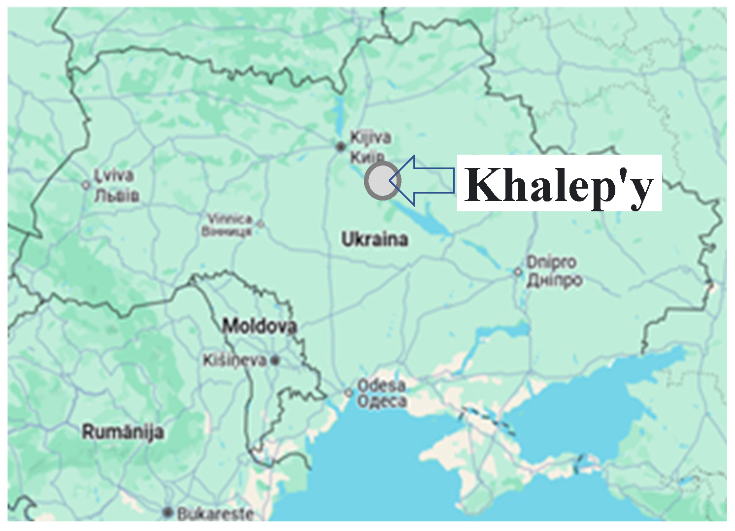
Figure 2.
Erosion situation on intensively cultivated arable lands of sloping agricultural landscapes.
Figure 2.
Erosion situation on intensively cultivated arable lands of sloping agricultural landscapes.
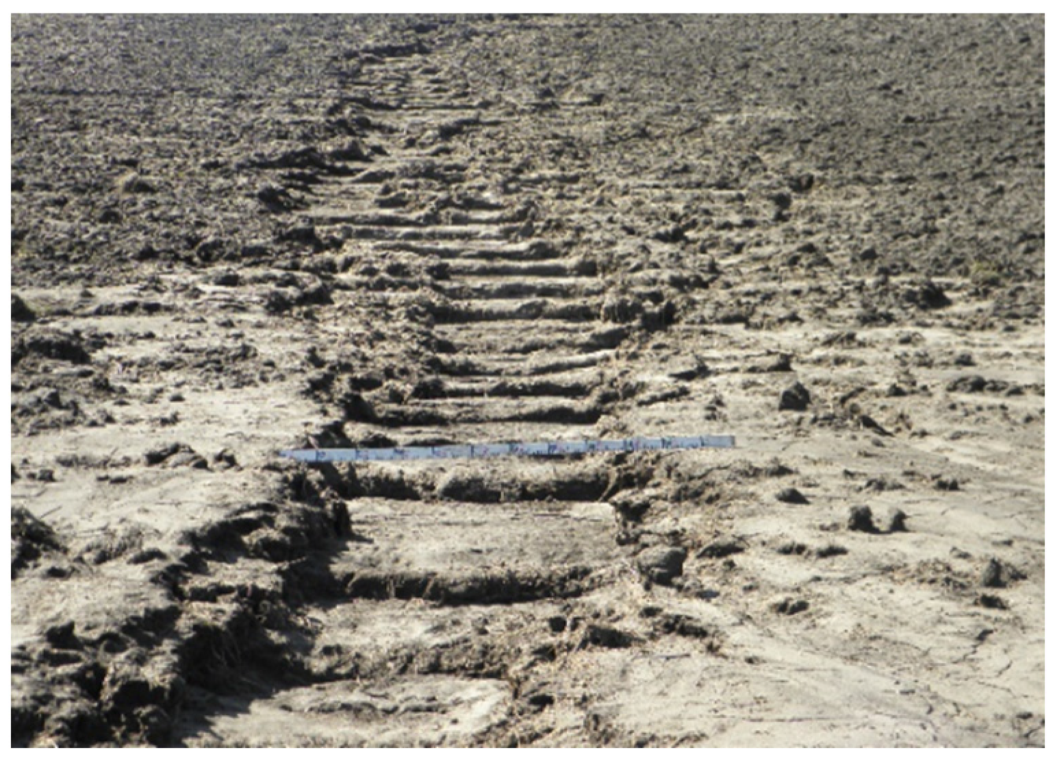
Figure 3.
Monitoring the development of the water-erosion processes.
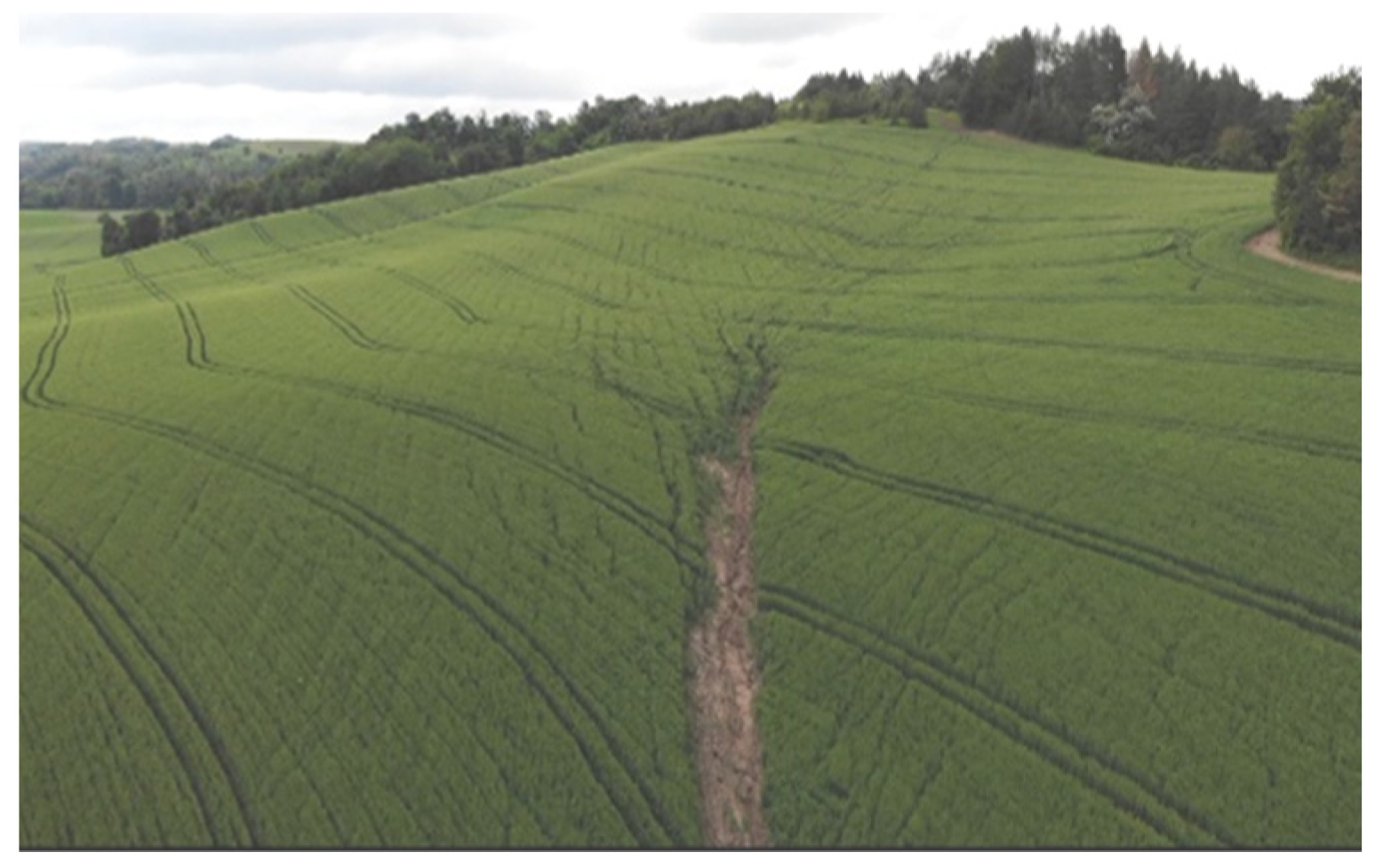
Figure 4.
Layout of the route research object. Polygon 1.
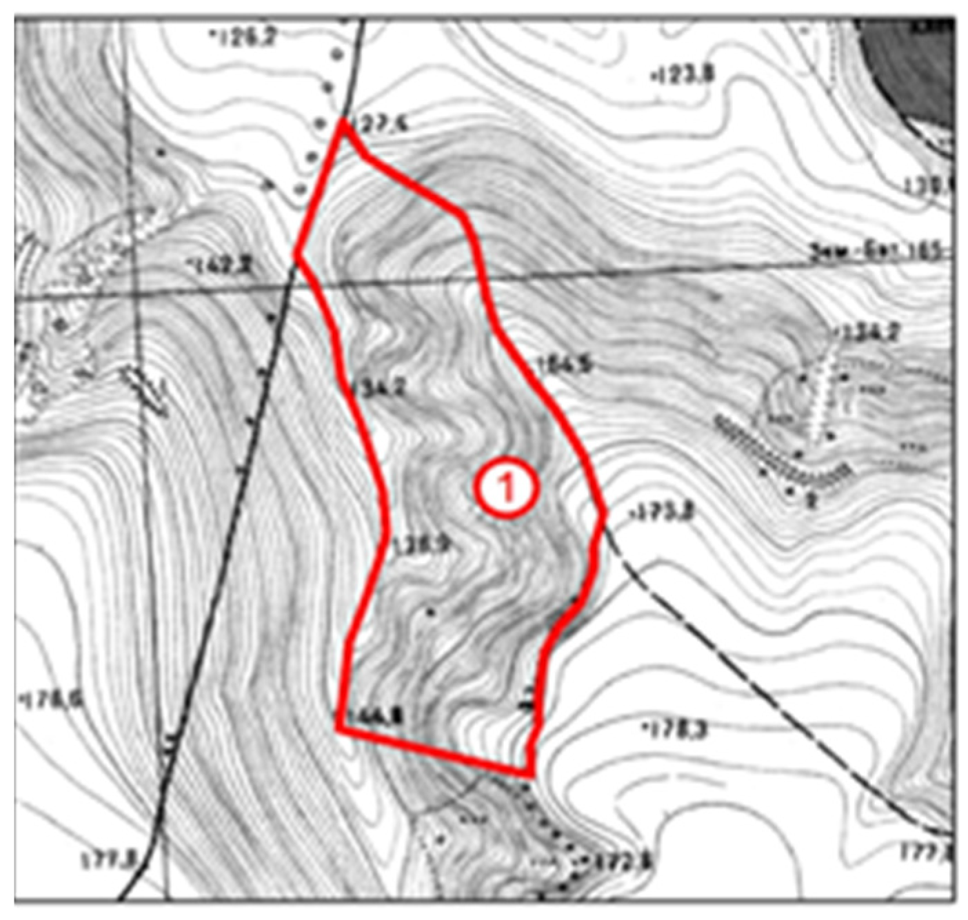
Figure 5.
Phytocenoses of slopes within polygon 1.
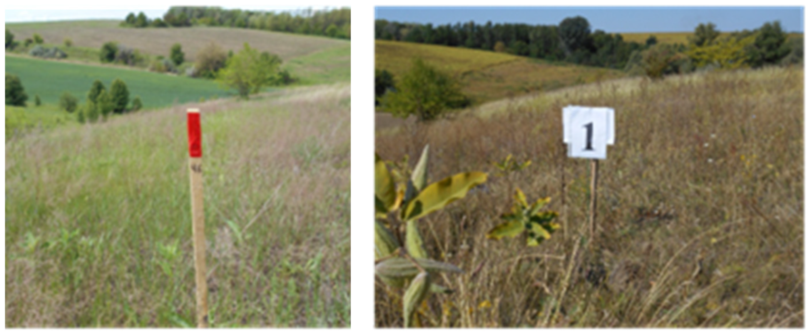
Figure 6.
Layout of the route research object. Polygon 2.
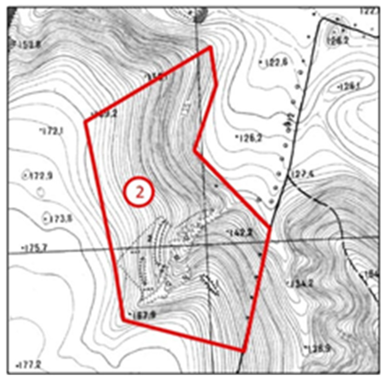
Figure 7.
Phytocenoses within Polygon 2.
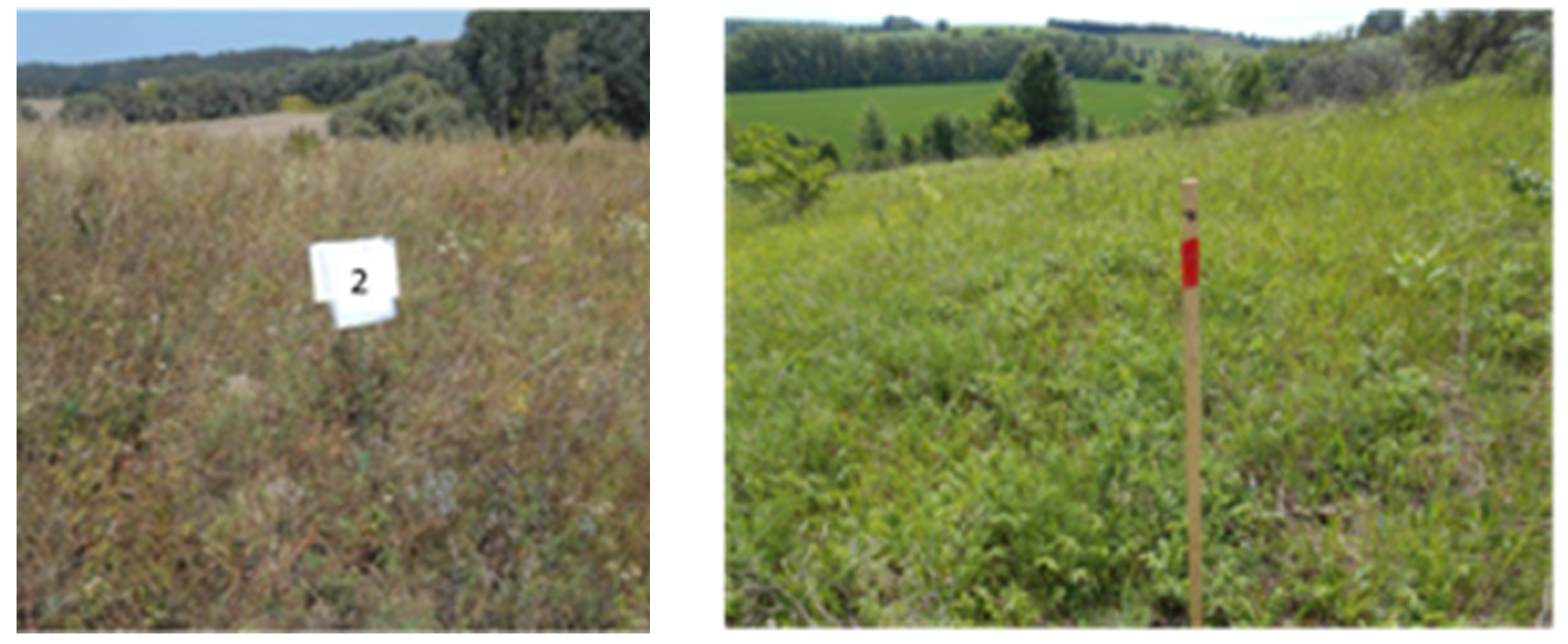
Figure 8.
Layout of the route research object. Polygon 3.
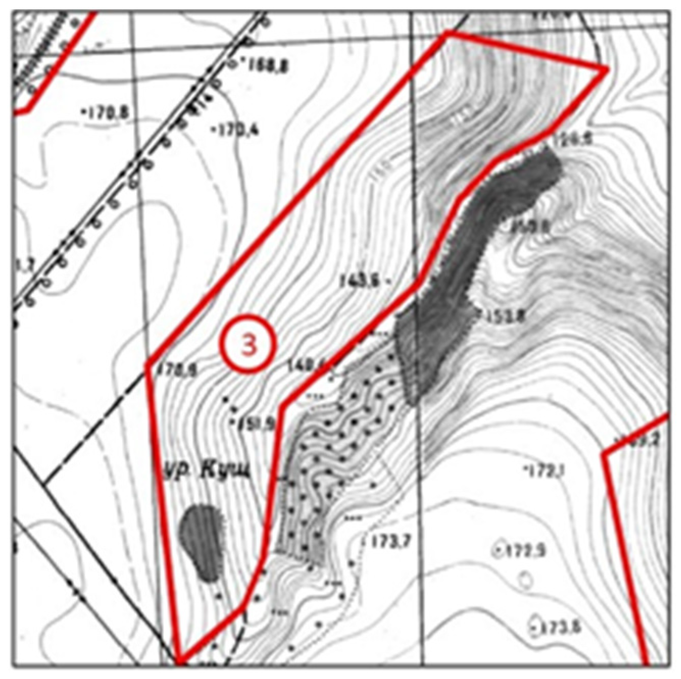
Figure 9.
Phytocenoses of slopes within polygon 3.
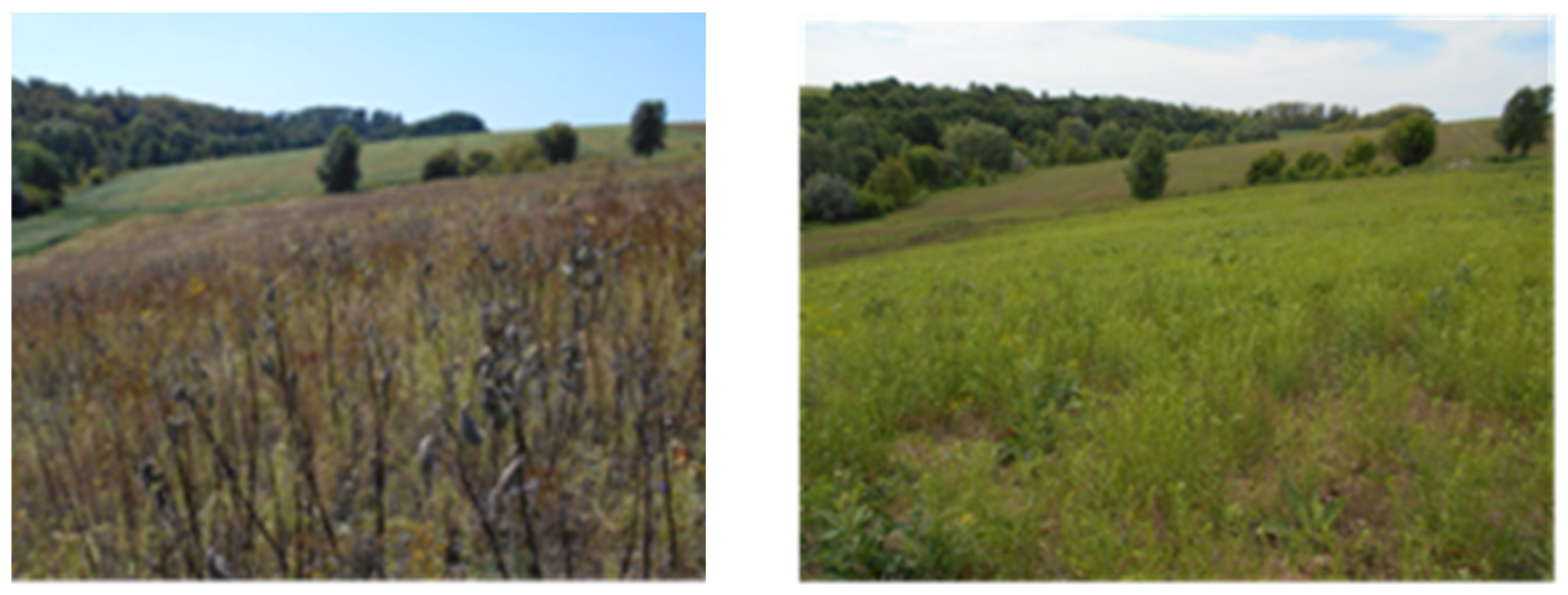
Figure 10.
Phytocenoses of slopes within polygon 3.
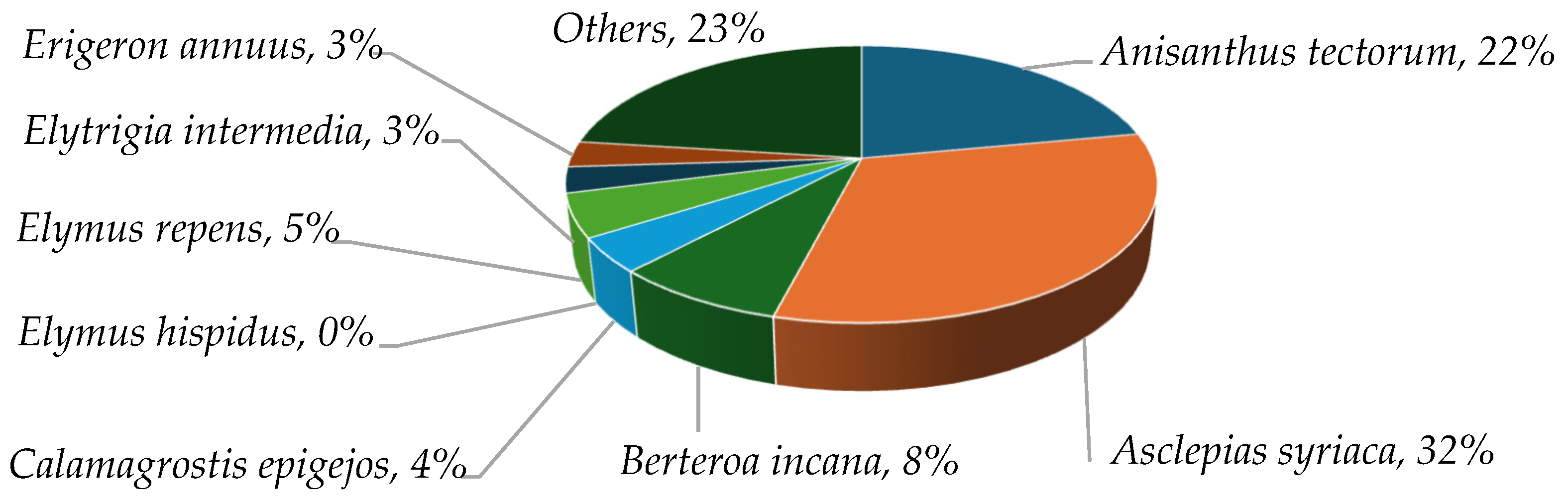

Table 1.
This is a table. Tables should be placed in the main text near to the first time they are cited.
Table 1.
This is a table. Tables should be placed in the main text near to the first time they are cited.
| Polygon number | Horizontal position of segments, m | Horizontal position of segments, m | Angle of inclination (steepness), αº | Slope length factor, m | Rain erosivity factor | Soil susceptibility factor to erosion processes, t ha-1 | Slope steepness factor, % | Vegetation and crop rotation factor | Factor of efficiency of anti-erosion measures | Calculated total soil loss per year, t ha-1 |
|---|---|---|---|---|---|---|---|---|---|---|
| 1 | 149 | 6 | 2.306 | 149.12 | 9.5 | 2.0 | 4.024 | 0.17 | 1 | 2.38 |
| 2 | 112 | 8 | 4.086 | 112.29 | 9.5 | 2.0 | 7.125 | 0.17 | 1 | 4.19 |
| 3 | 123 | 8 | 3.721 | 123.26 | 9.5 | 2.0 | 6.490 | 0.17 | 1 | 3.88 |
Table 2.
Fertility indicators of the washed-out soil depending on the method of using sloping lands and the period of their conservation.
Table 2.
Fertility indicators of the washed-out soil depending on the method of using sloping lands and the period of their conservation.
| Polygon number | Type of soil | Method of using sloping lands | Number of years of grassing | Slope inclination, degrees | Contents | ||||
|---|---|---|---|---|---|---|---|---|---|
| pH | Humus, % | N, mg kg-1 | P2O5, mg | K2O, mg | |||||
| 1. | Typical medium-eroded light loamy chernozem | Spontaneous restoration of the herbage (conservation) | 22 | 11–12 | 7.3 | 3.85 | 16.1 | 19.3 | 12.7 |
| 2. | Typical heavily eroded light loamy chernozem | Spontaneous restoration of the herbage (conservation) | 21 | 7–10 | 7.1 | 1.96 | 9.6 | 5.5 | 9.7 |
| 3. | Typical chernozem, medium and highly eroded, light loamy. | Spontaneous restoration of the herbage (conservation) | 23 | 8–9 | 7.3 | 2.13 | 7.8 | 8.5 | 15.7 |
Disclaimer/Publisher’s Note: The statements, opinions and data contained in all publications are solely those of the individual author(s) and contributor(s) and not of MDPI and/or the editor(s). MDPI and/or the editor(s) disclaim responsibility for any injury to people or property resulting from any ideas, methods, instructions or products referred to in the content. |
© 2024 by the authors. Licensee MDPI, Basel, Switzerland. This article is an open access article distributed under the terms and conditions of the Creative Commons Attribution (CC BY) license (https://creativecommons.org/licenses/by/4.0/).
Copyright: This open access article is published under a Creative Commons CC BY 4.0 license, which permit the free download, distribution, and reuse, provided that the author and preprint are cited in any reuse.


