
Submitted:
25 March 2020
Posted:
27 March 2020
You are already at the latest version
Abstract
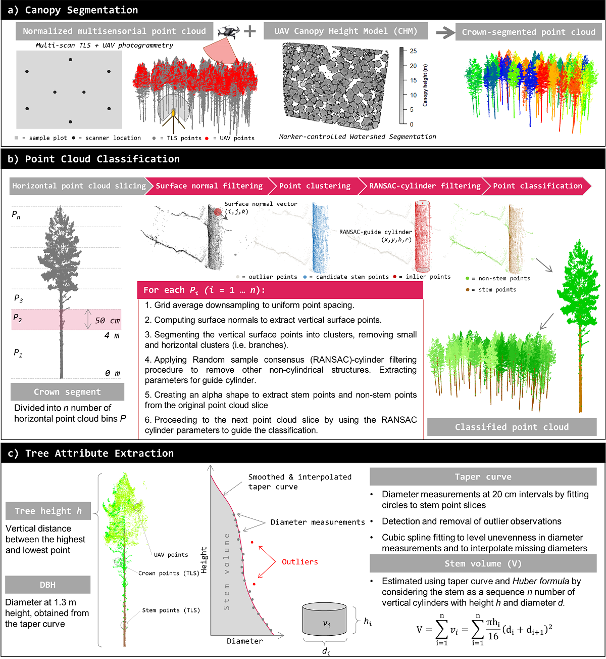
Terrestrial laser scanning (TLS) provides detailed three-dimensional representation of the surrounding forest structure. However, due to close-range hemispherical scanning geometry, the ability of TLS technique to comprehensively characterize all trees and especially the upper parts of forest canopy is often limited. In this study, we investigated how much forest characterization capacity can be improved in managed Scots pine (Pinus sylvestris L.) stands if TLS point cloud is complemented with a photogrammetric point cloud acquired from above the canopy using unmanned aerial vehicle (UAV). In this multisensorial (TLS+UAV) close-range sensing approach, the used UAV point cloud data was considered feasible especially in characterizing the vertical forest structure and improvements were obtained in estimation accuracy of tree height as well as plot-level basal-area weighted mean height (Hg) and mean stem volume (Vmean). Most notably the root mean square error (RMSE) in Hg improved from 0.88 m to 0.58 m and the bias improved from -0.75 m to -0.45 m with the multisensorial close-range sensing approach. However, in managed Scots pine stands the mere TLS captured also the upper parts of the forest canopy rather well. Both approaches were capable of deriving stem number, basal area, Vmean, Hg and basal area-weighted mean diameter with a relative RMSE less than 5.5% for all of the sample plots. Although the multisensorial close-range sensing approach mainly enhanced characterization of forest vertical structure in single-species, single-layer forest conditions, representation of more complex forest structures may benefit more from point clouds collected with sensors of different measurement geometries.
Keywords:
terrestrial laser scanning
; unmanned aerial vehicle
; image matching
; remote sensing
; forest inventory
Copyright: This open access article is published under a Creative Commons CC BY 4.0 license, which permit the free download, distribution, and reuse, provided that the author and preprint are cited in any reuse.


