Submitted:
29 December 2020
Posted:
30 December 2020
You are already at the latest version
Abstract
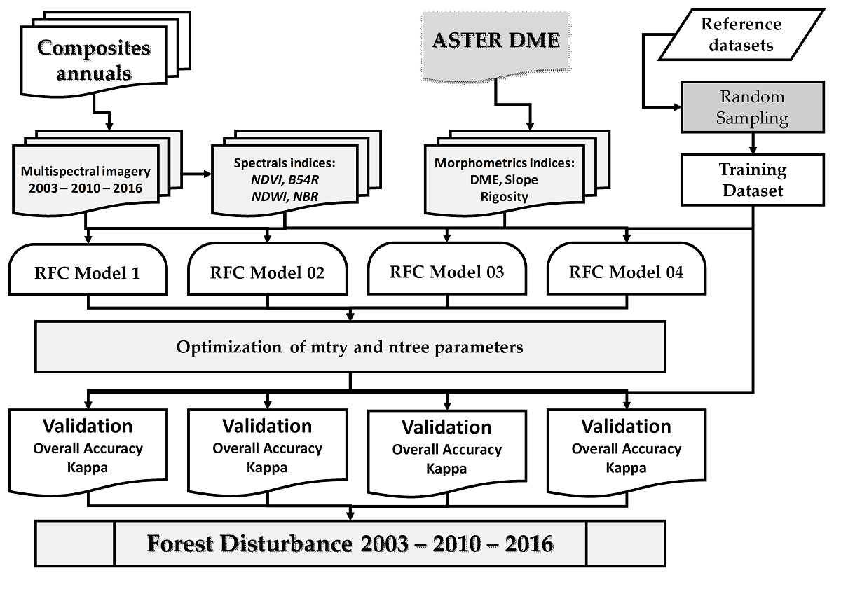
The evaluation of deforestation by optical remote sensing remains a challenge in the humid tropical region due to high cloud cover. This paper develops a simple and reproducible method for mapping deforestation of the old-growth forest using open access software. A map of old-growth forest depletion was created using composites from three different dates (2003, 2010, 2016). Four models were tested: the first model using spectral bands (nir, swir1, swir2 and red), the second model was based on the association of spectral bands and spectral indices (NDVI, B54R, NDWI and NBR), the third model was constructed using spectral bands and geomorphological indices (DEM, Slope and Roughness) and the last model combined spectral bands, spectral indices and geomorphological indices. The optimal random forest ntrees and Mtry parameters were determined for each model to optimize the mapping in each model. The out-of-bag error for these four models was 2.15 %, 2.05 %, 1.86 % and 1.85 %, respectively. The fourth model had the lowest error and was hence used to predict deforestation of the old-growth forest. The annual rates of deforestation amounted 0.26 % (69861 ha) and 0.66 % (145768 ha) between 2003 – 2010 and 2010 – 2016, respectively. The area of the old-growth forest in 2016 was 3601607 ha and 215629 ha of forest lost between 2003 and 2016. These results showed that the Random Forest Classification (RFC) model was able to effectively map the reduction of old-growth forests.
Keywords:
Random Forest
; machine learning
; multispectral imagery
; deforestation
; PFBC landscapes
Copyright: This open access article is published under a Creative Commons CC BY 4.0 license, which permit the free download, distribution, and reuse, provided that the author and preprint are cited in any reuse.


