
Submitted:
18 June 2018
Posted:
19 June 2018
You are already at the latest version
Abstract
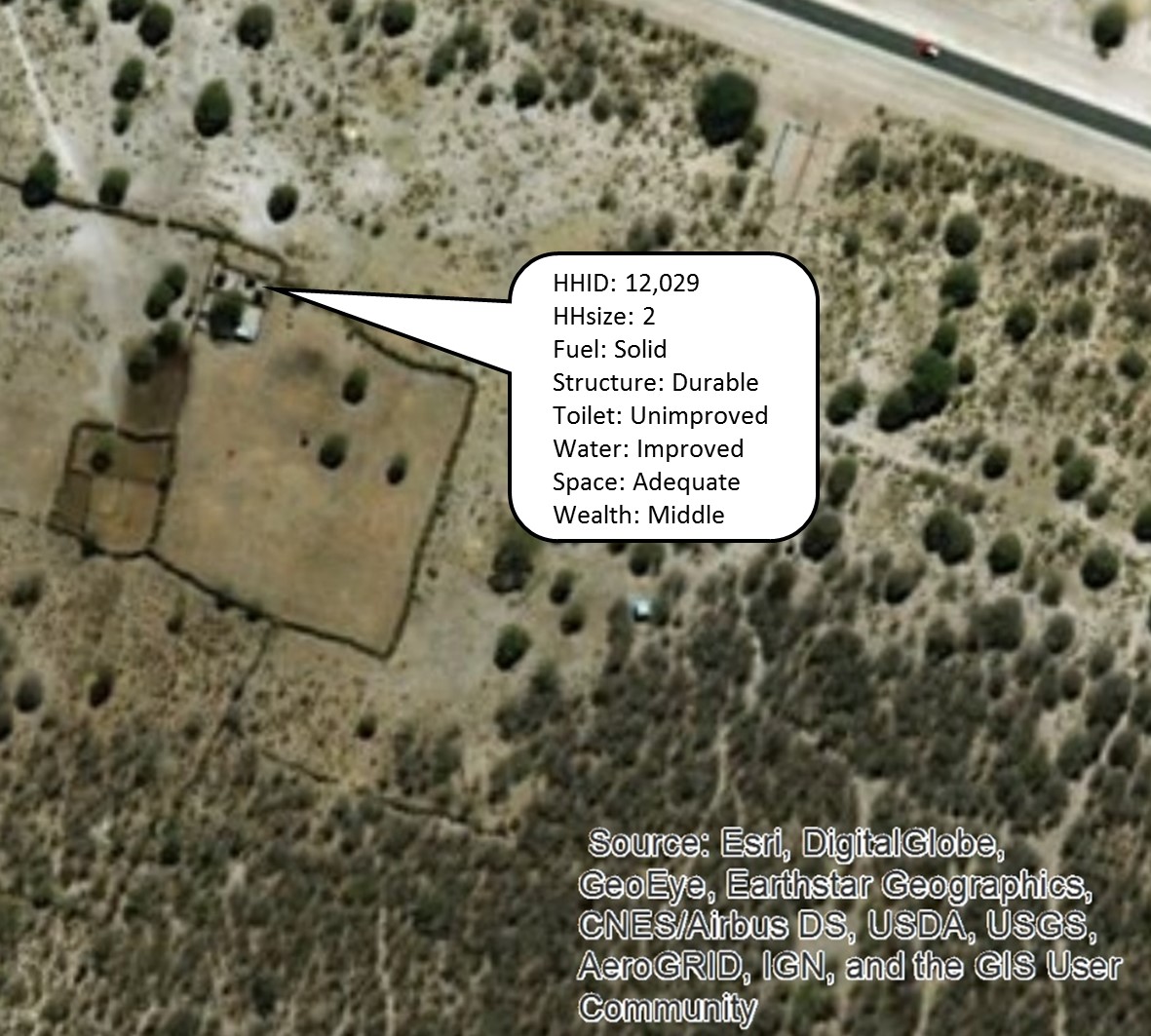
Whether evaluating gridded population dataset estimates (e.g. WorldPop, LandScan) or household survey sample designs, a population census linked to residential locations are needed. Geolocated census microdata data, however, are almost never available and are thus best simulated. In this paper, we simulate a close-to-reality population of individuals nested in households geolocated to realistic building locations. Using the R simPop package and ArcGIS, multiple realizations of a geolocated synthetic population are derived from the Namibia 2011 census 20% microdata sample, Namibia census enumeration area boundaries, Namibia 2013 Demographic and Health Survey (DHS), and dozens of publicly available spatial datasets. Realistic household latitude-longitude coordinates are manually generated based on public satellite imagery. Simulated households are linked to latitude-longitude coordinates by identifying distinct household types with multivariate kmeans analysis, and modelling a probability surface for each household type using Random Forest machine learning methods. We simulate five realizations of a synthetic population in Namibia's Oshikoto region, including demographic, socioeconomic and outcome characteristics at the level of household, woman, and child. Comparison of variables in the synthetic population were made with 2011 census 20% sample and 2013 DHS data by primary sampling unit/enumeration area. We found that synthetic population variable distributions matched observed observations and followed expected spatial patterns. We outline a novel process to simulate a close-to-reality microdata census geolocated to realistic building locations in a low- or middle-income country setting to support spatial demographic research and survey methodological development while avoiding disclosure risk of individuals.
Keywords:
simulation
; census
; simpop
; LMIC
Copyright: This open access article is published under a Creative Commons CC BY 4.0 license, which permit the free download, distribution, and reuse, provided that the author and preprint are cited in any reuse.


