Submitted:
17 May 2026
Posted:
19 May 2026
You are already at the latest version
Abstract
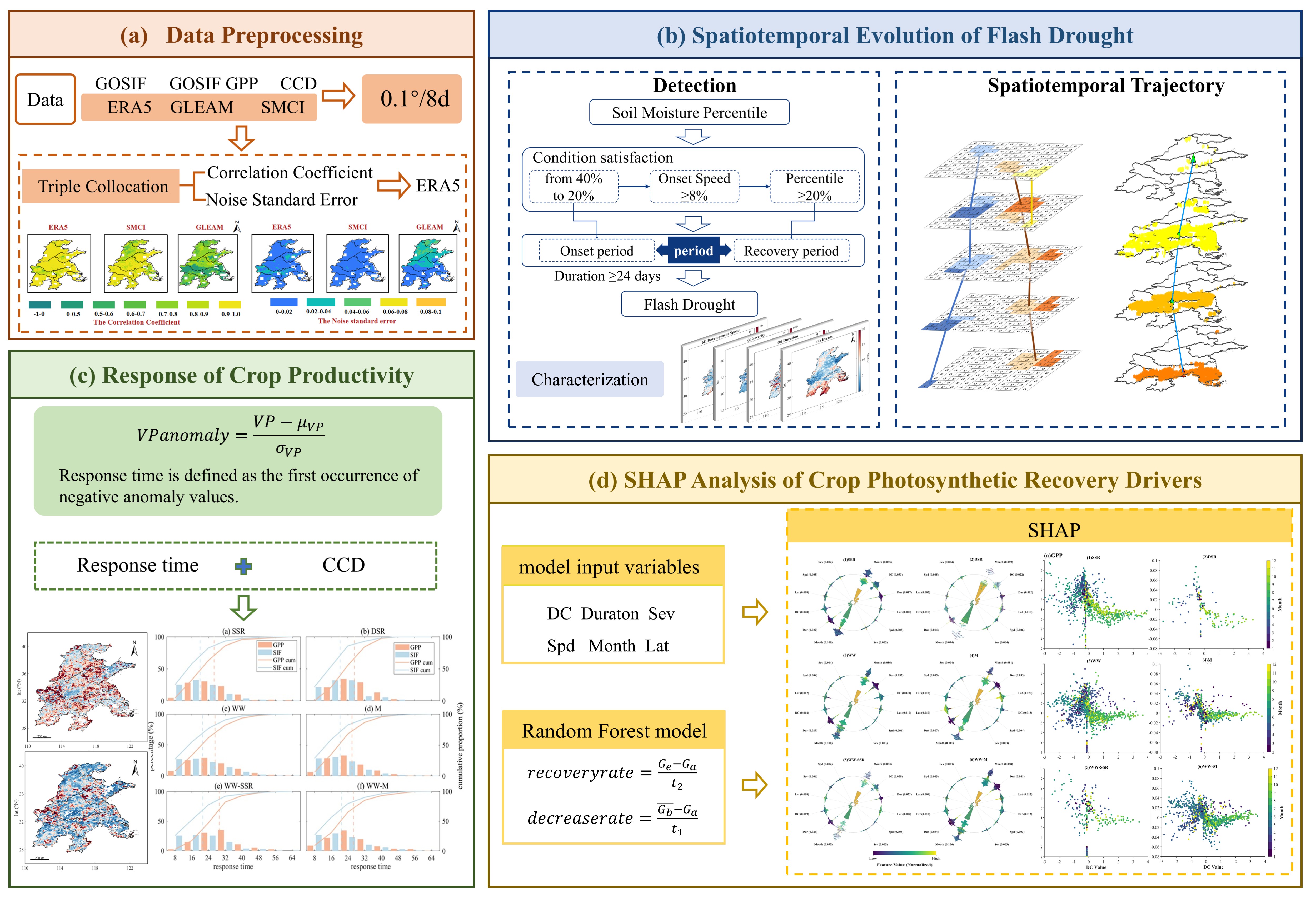
Flash drought, as a rapidly developing form of drought, has become an increasing threat to agricultural production, ecosystem stability, and regional carbon cycling, par-ticularly in croplands within monsoon regions. Existing studies have mainly focused on point-scale identification or conventional vegetation indices, while a systematic understanding of the regional spatiotemporal evolution of flash droughts and crop-specific differences in photosynthetic recovery remains limited. Using mul-ti-source remote sensing data from the North China Plain and the Middle-Lower Yangtze Plain during 2001–2024, this study integrated triple collocation error assess-ment, root-zone soil moisture percentile-based identification, connected component tracking, and Random Forest–SHAP analysis to characterize flash drought trajectories and their impacts on vegetation. The results showed that the southern Middle-Lower Yangtze Plain exhibited a high-frequency but low-intensity pattern, whereas the cen-tral North China Plain was characterized by relatively low frequency but higher inten-sity and longer duration. Rice-based systems were more vulnerable to frequent flash drought shocks, while rainfed and rotation systems faced stronger cumulative risks. Solar-induced chlorophyll fluorescence (SIF) responded to flash droughts 6–9 days ear-lier than gross primary productivity (GPP), and all cropping systems exhibited a “rapid physiological response–lagged carbon assimilation recovery” pattern. The month of occurrence, drought duration, and decline rate were identified as the dominant factors controlling photosynthetic recovery. These findings extend the flash drought monitor-ing framework from the perspectives of regional connectivity and crop recovery mechanisms, and provide a remote sensing-based scientific basis for agricultural early warning, drought mitigation, and food security management.
Keywords:
flash drought
; solar-induced chlorophyll fluorescence
; gross primary productivity
; cropping systems
; spatiotemporal evolution
; photosynthetic recovery
Copyright: This open access article is published under a Creative Commons CC BY 4.0 license, which permit the free download, distribution, and reuse, provided that the author and preprint are cited in any reuse.


