Submitted:
06 May 2026
Posted:
07 May 2026
You are already at the latest version
Abstract
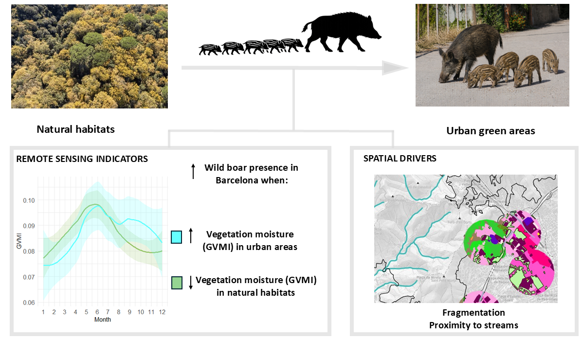
Urbanisation is reshaping ecosystems and increasing human–wildlife interactions. Wild boar (Sus scrofa), a highly adaptable species, is increasingly common in European cities, where it exploits natural and anthropogenic resources, often leading to conflict. Predicting when and where wild boar enters urban areas remains challenging, particularly using scalable tools such as remote sensing. Here we show that temporal and spatial drivers of urban presence are decoupled in Barcelona over a 14-year period. Seasonal vegetation dynamics influenced the timing of urban incursions, with peaks in spring and late summer associated with changes in vegetation moisture and likely reinforced by increased energetic demands during reproduction and early lactation. However, remotely sensed vegetation indices captured these dynamics only partially, limiting their predictive power when used alone. Spatial variation in urban green area use was primarily explained by landscape structure, with proximity to streams and habitat fragmentation contributing similarly. Green areas near natural corridors concentrated higher and more variable presence, while heterogeneous landscapes likely facilitated repeated use by increasing access to foraging and refuge. Integrating remote sensing with landscape metrics can improve anticipation and management of human–wildlife conflicts.
Keywords:
wild boar
; urban ecology
; landscape structure
; human–wildlife conflict
; Mediterranean ecosystems
Copyright: This open access article is published under a Creative Commons CC BY 4.0 license, which permit the free download, distribution, and reuse, provided that the author and preprint are cited in any reuse.


