Submitted:
15 April 2026
Posted:
15 April 2026
You are already at the latest version
Abstract
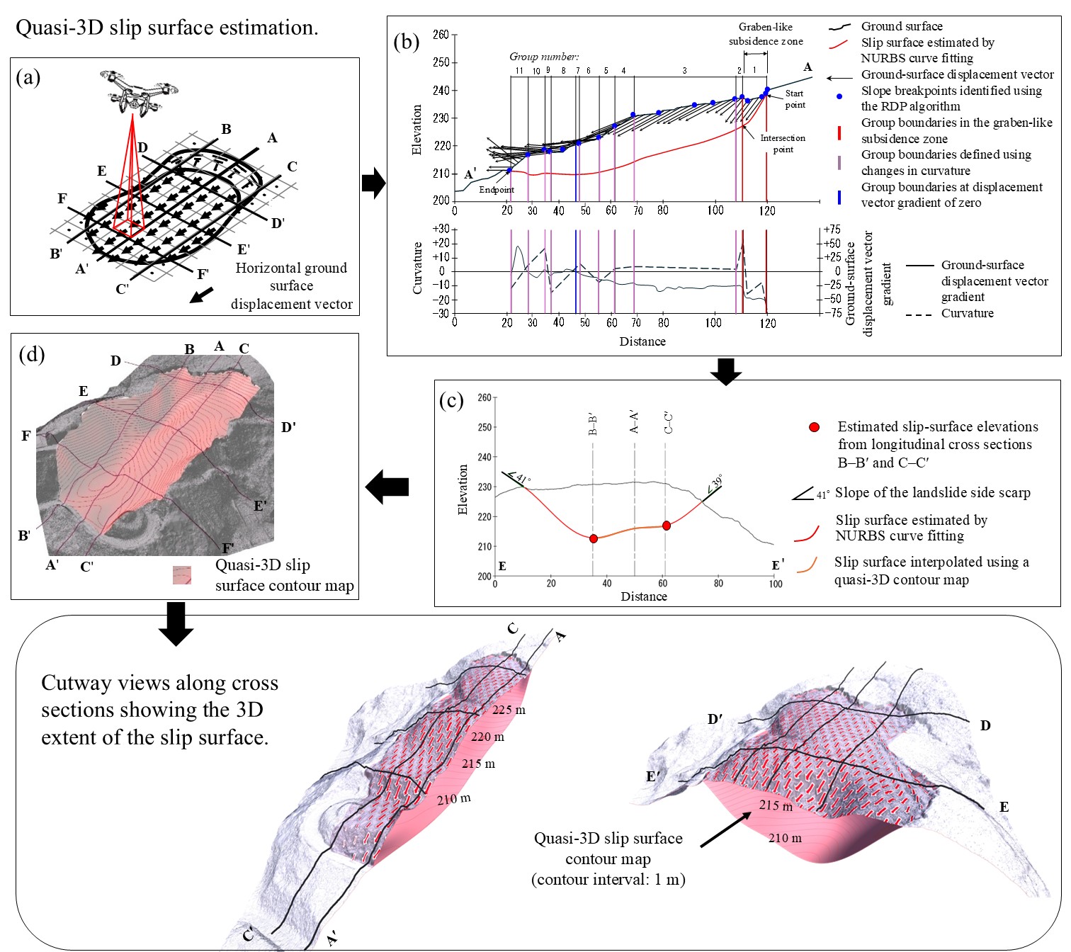
Accurate delineation of buried slip surfaces remains a major uncertainty in landslide hazard assessment, especially where subsurface data are limited. This study evaluates a displacement-based approach to estimate quasi-three-dimensional (quasi-3D) slip surfaces using ground-surface displacement vector gradients derived from multi-temporal UAV-based LiDAR data. Two landslides in Japan (Jimba and Kamitokitozawa), representing contrasting scales, were analyzed to assess the method’s applicability and limitations. Two-dimensional (2D) slip-surface profiles were derived through group-wise median grouping of displacement gradients and weighted non-uniform rational B-spline fitting along longitudinal sections. Transverse profiles were constrained using side-scarp gradients and depths estimated from longitudinal profiles. These profiles were integrated into quasi-3D surfaces and validated against borehole-derived slip surfaces. At the Jimba landslide, characterized by relatively coherent movement, the estimated surfaces closely match borehole data in both depth and geometry. At the larger Kamitokitozawa landslide, the method reproduces first-order geometry and extent but shows larger local deviations, particularly in a graben-like subsidence zone. Nevertheless, the estimated displaced volume reaches 96% of that derived from borehole data. These results demonstrate that the method provides useful first-order constraints on slip-surface geometry for preliminary hazard assessment, borehole planning, and 3D stability analysis.
Keywords:
landslide slip surface
; UAV LiDAR
; surface displacement vector gradient
; quasi-3D modeling
; borehole data
; landslide hazard assessment
Copyright: This open access article is published under a Creative Commons CC BY 4.0 license, which permit the free download, distribution, and reuse, provided that the author and preprint are cited in any reuse.


