
Submitted:
03 January 2026
Posted:
05 January 2026
You are already at the latest version
Abstract
Purpose: This study conducts a systematic literature review on the intersection of real estate exposure and geotechnical hazards, focusing specifically on seismic and subsurface risks. The objective is to synthesize key thematic trends, methodologies, and governance frameworks that informrisk-informed planning in seismically vulnerable urban areas. Design/methodology/approach: A Boolean search query was implemented on Lens.org, identifying 55 peer-reviewed articles published between January 2020 and May 2025. Inclusion criteria required explicit focus on property exposure to seismic or ground instability risks. Thematic analysis was conducted based on title and abstract data, supported by a Python-generated word cloud to inductively identify five core clusters: (1) seismic assessment and earthquake risk, (2) building vulnerability and structural performance, (3) subsurface hazards and ground instability, (4) urban areas, heritage, and social vulnerability, and (5) risk mitigation, planning, and resilience frameworks. Findings: The review reveals a shift from hazard-centric, engineering-based models toward integrated, multi-scalar frameworks that embed risk within socio-economic, spatial, and institutional contexts. While consensus exists on the importance of probabilistic modeling, retrofitting, and GIS-based tools, divergences persist around behavioral valuation, policy uptake, and equity in implementation. Heritage cities and informal settlements emerge as under-addressed but critically vulnerable domains. Originality/value: This study systematically maps interdisciplinary research on real estate exposure to seismic and subsurface risks post-2020. By bridging engineering, planning, behavioral economics, and disaster governance, the review provides a unique synthesis relevant for academics, urban planners, and policymakers seeking to design equitable and resilient urban futures.
Keywords:
seismic risk
; real estate exposure
; urban resilience
; subsurface hazards
; vulnerability assessment
1. Introduction
Urban seismic risk has emerged as a multifaceted concern at the intersection of engineering, spatial planning, economics, and environmental governance. As cities expand into seismically active and geotechnically unstable territories, the exposure of real estate assets to earthquake and subsidence hazards grows more acute (Rezvani et al., 2023; Fernández-Torres et al., 2021). Traditionally viewed through a structural or geophysical lens, seismic risk is increasingly recognized as a systemic challenge that implicates valuation dynamics, cultural heritage, and public policy (Giuliani et al., 2022; Martino & Varone, 2020). These evolving understandings demand integrative frameworks that can account for physical fragility, social vulnerability, and the operational complexities of urban governance.
Recent global events—such as Türkiye’s 2023 Kahramanmaraş earthquakes, recurring subsidence in megacities like Shanghai and Mexico City, and renewed interest in retrofitting historic building stock—have heightened academic and policy attention on the need for comprehensive risk diagnostics (Alam & Ali, 2023; Zhan et al., 2025). At the same time, methodological advances in probabilistic modeling, geospatial analysis, and behavioral economics are expanding the toolkit available for understanding real estate exposure to seismic and subsurface risks (Lee et al., 2022; Willemsen et al., 2020).
Despite these advances, scholarly responses remain fragmented across disciplines and geographies. Some studies focus narrowly on structural typologies or hazard scenarios, while others emphasize valuation impacts or institutional capacity. A comprehensive synthesis is thus necessary to clarify thematic convergences and identify persistent gaps. This review responds to that need by systematically mapping the academic literature from 2020 to 2025, integrating contributions from engineering seismology, real estate economics, urban resilience, and geospatial planning.
By organizing the literature into five thematic clusters—(1) seismic assessment and earthquake risk; (2) building vulnerability and structural performance; (3) subsurface hazards and ground instability; (4) urban areas, heritage, and social vulnerability; and (5) risk mitigation, planning, and resilience frameworks—this study offers a transdisciplinary lens on how seismic and geotechnical risks are conceptualized, operationalized, and governed within the urban real estate context. The findings aim to inform not only academic debate but also the design of data-informed, context-sensitive risk governance strategies for vulnerable urban regions.
2. Methodology
This study employed a systematic literature review methodology to investigate the intersection of real estate exposure and geotechnical risks, focusing on seismic and subsurface hazards. A comprehensive search was conducted using Lens.org, a scholarly database integrating peer-reviewed literature and patents. The Boolean query—(“real estate” OR “property value”) AND (“seismic hazard” OR “ground instability”) AND (“risk assessment” OR “vulnerability”)—was applied to identify relevant articles published between January 1, 2020, and May 26, 2025. The initial search yielded 55 scholarly works after screening for duplicates and relevance. Inclusion criteria required studies to explicitly address real estate or infrastructure exposure to seismic or subsurface risks, while excluding purely geological or non-infrastructural research. Metadata and titles were exported into an Excel spreadsheet), and thematic analysis was performed on the title texts.
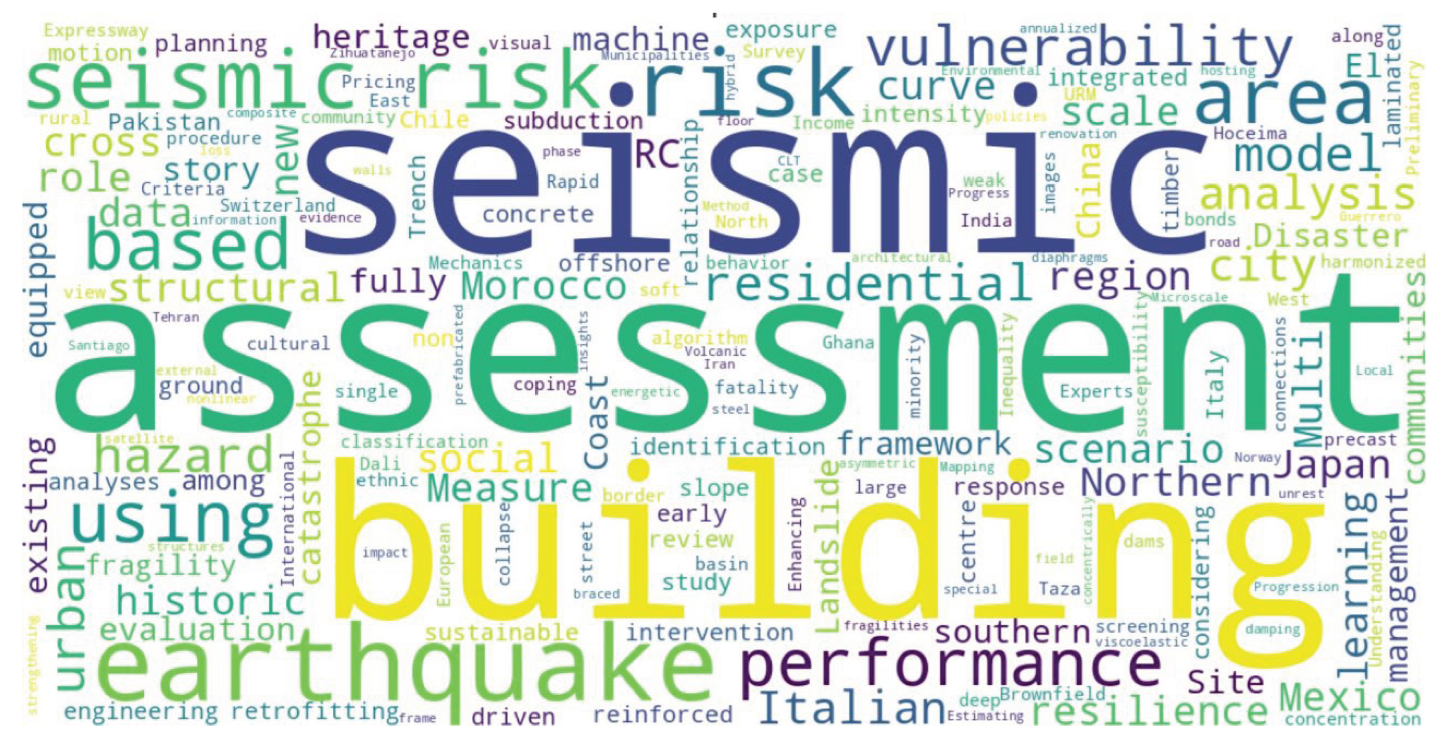
To support inductive theme development, a word cloud (Figure 1) was generated using Python’s WordCloud package, visualizing dominant terms such as “seismic,” “assessment,” “risk,” “building,” “earthquake,” and “vulnerability.” This visualization guided the manual coding of abstracts and the identification of five core thematic clusters: seismic assessment and earthquake risk; building vulnerability and structural performance; subsurface hazards and ground instability; urban areas, heritage, and social vulnerability; and risk mitigation, planning, and resilience frameworks. This thematic framework structured the literature synthesis, enabling a multidisciplinary understanding of how seismic and geotechnical risks are conceptualized and integrated in real estate and urban research domains.
This word cloud visualizes the most frequent keywords from the titles of 55 selected scholarly articles. Prominent terms include “seismic,” “assessment,” “risk,” “building,” “earthquake,” and “vulnerability,” reflecting the analytical focus of recent literature on structural performance, spatial risk modeling, and hazard-informed planning.
3. Thematic Analysis Literature Review
Seismic Assessment and Earthquake Risk
A growing body of interdisciplinary literature highlights the complexity and urgency of assessing seismic risk in the real estate sector, with convergence around probabilistic modeling, data granularity, behavioral valuation effects, and regulatory governance. Seismic risk is no longer seen as a localized engineering issue but as a multidimensional challenge that encompasses financial decision-making, market psychology, urban planning, and macroeconomic stability.
From an engineering-financial perspective, Lee et al. (2022) propose a structured framework for portfolio-wide seismic risk assessment that expands traditional single-building evaluations. Their model, built on stochastic simulations and ASTM standards, introduces Portfolio Expected Loss (PEL) and Portfolio Upper Loss (PUL), with their ratio functioning as a proxy for estimation reliability. Crucially, they develop the Tail Contribution Index (TCI) to identify high-impact assets and the Portfolio Level of Investigation (PLI) as a metric to balance engineering depth and cost. This study establishes a practical and scalable toolset for real estate stakeholders seeking to integrate seismic diagnostics into capital allocation and insurance planning.
Contributing at a broader spatial and institutional level, Yepes-Estrada et al. (2023) offer a complementary approach through a harmonized global exposure model incorporating residential, commercial, and industrial stock from 215 countries. Unlike Lee et al.’s asset-focused lens, this model adopts a bottom-up strategy using high-resolution census and cadastral data, employing the GEM taxonomy to harmonize over 1,000 building types. A key point of convergence between the two studies is the emphasis on probabilistic modeling and structural heterogeneity. Yet they diverge in application: Lee et al. serve institutional asset managers, while Yepes-Estrada et al. target international disaster risk governance. Both agree that risk-informed spatial modeling is fundamental for resilience planning, but their scales and audiences vary.
The behavioral economics of seismic risk, addressed by Shi and Naylor (2023), Espedal (2023), Ikefuji et al. (2022), and Tu et al. (2023), reveals consistent patterns in how seismic information is internalized in housing markets. Shi and Naylor’s New Zealand case demonstrates a pre-event undercapitalization of seismic risk, followed by post-event price corrections driven by direct experience and insurance outcomes.
Similarly, Espedal finds that even a low-damage event like the Nisqually earthquake triggered significant long-term price declines, governed more by perceived than actual risk. These findings align with Ikefuji et al., whose Japanese hedonic pricing model shows long-term seismic risk is priced into property values, while short-term risk perceptions follow a distorted, prospect-theory-driven weighting. Tu et al.’s study of Taiwan supports these insights, showing steep pricing discounts in earthquake- and flood-prone zones more than a decade after the Jiji earthquake. Together, these studies agree that housing markets adjust to seismic risk asymmetrically and are shaped by both objective hazard and subjective cognition. However, the degree and persistence of price effects vary by geography and demographic context.
At the urban governance level, several studies emphasize the role of localized exposure mapping in risk reduction. Angova Kolevska and Vitanova (2024) present a city-scale structural inventory for Strumica, North Macedonia, illustrating how modest seismicity, outdated stock, and incomplete census data combine to create hidden vulnerabilities. Similarly, Kohrangi et al. (2021) develop a probabilistic seismic hazard model for Isfahan, Iran, highlighting weak code enforcement and outdated building practices in historical cores as major risk factors. Both studies advocate for accessible exposure datasets and microzonation-informed urban planning, and their methodologies provide scalable templates for other middle-income, hazard-prone urban centers.
At the macroeconomic scale, Alam and Ali (2023) extend the discussion to national systems, using Türkiye’s 2023 earthquake as a test case. By integrating a Dynamic Inoperability Input–Output Model (DIIM) with a Fuzzy-FUCOM decision framework, they expose sectoral vulnerabilities and governance failures—particularly construction amnesties and corrupt practices—that amplified economic losses. Their conclusions resonate with Glavcheva et al. (2022), who point to seismic illiteracy and regulatory gaps in Sofia’s real estate ecosystem. While one study models inoperability cascades and the other calls for targeted education and microzonation, both underline the importance of institutional integrity and cross-sectoral coordination.
Despite variations in method and scale, a central theme emerges across the literature: seismic risk is not solely a technical challenge—it is a socio-economic and governance issue. Whether through asset-level metrics (Lee et al., 2022), national exposure inventories (Yepes-Estrada et al., 2023), behavioral price shifts (Shi & Naylor, 2023; Espedal, 2023; Ikefuji et al., 2022; Tu et al., 2023), or macro-structural modeling (Alam & Ali, 2023; Kohrangi et al., 2021), seismic risk intersects with valuation systems, institutional trust, and public communication. One point of divergence, however, lies in the relative emphasis on perception versus technical resilience. Behavioral studies prioritize informational triggers and cognitive responses, while engineering-focused works stress data precision and modeling complexity. Bridging these views remains an open challenge for seismic risk governance.
Building Vulnerability and Structural Performance
Seismic vulnerability in the built environment is a multidimensional issue shaped by structural typology, topographic context, socio-economic conditions, and public policy. Recent literature converges on the inadequacy of traditional assessments to capture these complexities and underscores the need for context-sensitive retrofitting strategies, behavioral considerations, and inclusive design frameworks. However, divergences persist in how different regions value or act upon seismic resilience, highlighting both cultural and regulatory asymmetries in global practice.
Hadipour (2025) offers a foundational and holistic framework by tracing seismic risk from its geophysical roots to engineering responses. His classification of vulnerabilities—spanning architectural irregularities (e.g., soft stories, mass-stiffness asymmetries) and structural deficiencies (e.g., weak materials, poor foundations)—aligns with broader engineering literature. Particularly notable is the practical integration of retrofitting techniques such as FRP composites, dampers, and steel jacketing through a real-world case in Sofia, underscoring the importance of applied engineering in risk mitigation.
Complementing this, Kadam et al. (2020) demonstrate the tangible benefits of ferrocement retrofitting on an unreinforced masonry (URM) school in northern India, reporting significant performance gains across multiple seismic intensity measures. Their use of pushover analysis and fragility curves, consistent with ASCE 41 and FEMA 356 guidelines, highlights an evidence-based shift toward low-cost, high-impact solutions for socially critical infrastructure. Both studies reinforce the value of retrofit, yet while Hadipour adopts a comprehensive hazard-to-solution arc, Kadam et al. focus narrowly on retrofitting efficacy—demonstrating methodological complementarity.
D’Alpaos and Bragolusi (2020) introduce an economic dimension often absent in engineering-focused studies by measuring willingness to pay (WTP) for retrofitting in Italy. Their contingent valuation approach reveals strong homeowner preferences for higher seismic risk classes, with WTP aligning closely to retrofit costs. This finding aligns with Kadam et al.’s evidence of technical feasibility, collectively supporting the argument that both perceived and real improvements in safety are valued. However, this stands in contrast to findings by Januário et al. (2025), who show that Lisbon’s housing market does not explicitly price seismic resilience, even in a high-risk context. The contradiction between Italian and Portuguese cases may be attributed to differing regulatory visibility, consumer awareness, or housing stock conditions—pointing to a need for further comparative research.
On the policy front, Murphy (2020) interrogates the implementation of New Zealand’s mandatory retrofitting policy, exposing tensions between safety mandates and market realities. While the policy aims to reduce risk across all zones, its uniform compliance thresholds disproportionately affect owners in low-risk regions, particularly Auckland. This critique contrasts sharply with D’Alpaos and Bragolusi’s (2020) market-aligned incentive structure, suggesting that retrofitting uptake is more feasible when embedded in localized, economically rational frameworks rather than blanket mandates.
The urban informality dimension is critically explored by Burlotos (2020) and Burlotos et al. (2020), who dissect Haiti’s seismic vulnerabilities through both engineering and market lenses. Their work reveals how informal economies, lack of technical oversight, and insecure land tenure obstruct resilience, despite the availability of structurally sound design options like masonry-infilled moment frames. Importantly, Burlotos et al. (2020) extend this critique with the concept of a “housing market value chain” (HMVC), emphasizing the systemic interdependencies across land governance, financing, and construction. These contributions echo Murphy’s (2020) call for broader compliance pathways but extend it to LMIC contexts, emphasizing the necessity of participatory, socially embedded models.
Khansefid et al. (2023) expand the definition of vulnerability beyond structural failure by quantifying the economic effects of occupant discomfort in buildings exposed to induced seismicity from geothermal power plants (GPPs) in Germany. Their dual “fragility–comfortability” framework introduces a behavioral valuation of risk, demonstrating that even non-damaging vibrations can depreciate property values. This idea conceptually parallels Espedal’s (2023) findings in seismic perception, further discussed in the previous section, and contributes to a broader understanding of how low-level hazards impact asset valuation. The study also adds nuance by integrating probabilistic simulations with locational variables such as site-to-source distance, reinforcing the call for spatialized risk assessments.
Jarapala and Menon (2023) tackle another neglected domain: buildings constructed on sloped terrain. Their typological classification of sloped RC buildings—particularly the vulnerability of step-back structures—underscores how vertical irregularities, torsional effects, and code inadequacies conspire to elevate seismic risk. Their review critiques current rapid visual screening (RVS) tools for failing to address the unique dynamics of sloped ground, echoing Khansefid et al.’s concern about underrepresented variables in mainstream assessment frameworks. Both studies converge on the urgent need for refined descriptors and modeling tools that account for context-specific geometries and usage patterns.
Taken together, this corpus reveals several points of thematic convergence. First, the technical efficacy of retrofitting is consistently demonstrated across settings (Kadam et al., 2020; Hadipour, 2025), yet market and regulatory uptake vary, as shown by contrasting findings in Portugal (Januário et al., 2025), Italy (D’Alpaos & Bragolusi, 2020), and New Zealand (Murphy, 2020). Second, vulnerability is increasingly understood not just in structural terms but as a product of social, behavioral, and policy systems (Burlotos et al., 2020; Khansefid et al., 2023). Finally, multiple authors underscore the limitations of existing assessment tools, whether in accounting for slope effects (Jarapala & Menon, 2023) or non-structural risk (Khansefid et al., 2023).
Subsurface Hazards and Ground Instability
Land subsidence has emerged as a pervasive yet often underestimated hazard, with increasing relevance for urban risk governance, especially in seismically active or densely developed regions. Across global contexts, recent studies converge on the recognition that subsidence—whether induced by natural processes, mining, groundwater extraction, or urban infrastructure—poses compounding risks to structural integrity, housing markets, and social equity. Collectively, the literature underscores the value of multi-scalar, geospatial, and integrative methodologies while revealing significant divergences in policy responses, public awareness, and adaptive capacity.
A foundational economic perspective is provided by Willemsen et al. (2020), who quantify the effect of land subsidence on property values across Dutch cities. Their hedonic pricing model demonstrates that subsidence is consistently penalized by housing markets, with regular subsidence reducing prices by 6–7% and differential subsidence by about 2%. Interestingly, surrounding subsidence shows no significant price effect, suggesting limited buyer awareness of indirect impacts such as infrastructure degradation. These findings highlight a key tension in the literature: while market behavior reflects sensitivity to visible or experienced subsidence effects, it often fails to capture latent systemic risks—a theme echoed in studies focusing on infrastructural vulnerability (e.g., Fernández-Torres et al., 2025).
A similar diagnostic emphasis is evident in Riesgo Fernández et al. (2020), who address attribution complexity in Boo, Spain, by disentangling the roles of post-mining subsidence and natural landslides in generating property damage. Their geotechnical modeling with InSAR and 3DEC software reveals that many claims attributed to mining impacts were, in fact, driven by hydrogeological or slope-related factors. This calls into question legal and insurance frameworks that oversimplify cause attribution, echoing broader concerns about the adequacy of policy instruments in high-risk terrains.
From a regional tectonics perspective, Portela et al. (2024) shift the focus to crustal deformation in El Salvador, integrating InSAR and GNSS data to refine the kinematic model of the El Salvador Fault Zone. While not explicitly tied to urban property loss, their work illustrates how inter-plate deformation processes—particularly strike-slip and locking-depth variation—underpin broader seismic risk patterns. This contributes a crucial geodynamic backdrop for understanding subsidence in complex tectonic settings, particularly where fault activity interacts with urbanization.
Multiple studies focus on major urban centers, with Shanghai receiving significant scholarly attention. Zhan et al. (2025) and Zhang et al. (2023) both deploy AHP-based multi-criteria frameworks, combined with InSAR and GIS technologies, to map land subsidence risk across hazard, exposure, and vulnerability dimensions. Their findings converge in identifying central Shanghai and Pudong as hotspots due to population density, underground infrastructure, and construction activity. While Zhan et al. validate their hybrid AHP-Entropy method against historical data, Zhang et al. introduce the Ground Subsidence Hazard Index (GSHI), enriching methodological rigor. These studies exemplify the strength of coupling remote sensing with decision analysis to inform spatial planning—a sentiment echoed by Hishammuddin and Wang (2021), who propose the USEM model as a planning instrument integrating subsidence, underground space use, and economic dynamics. Notably, their cross-comparative lens includes Jakarta, providing a rare South–South policy comparison and emphasizing the interdependence of underground development and land deformation in megacities.
The socioeconomic dimension is further emphasized by Fernández-Torres et al. (2021), who apply an AHP-weighted vulnerability model to Mexico City, revealing the spatial intersection of intense subsidence, low resilience, and high poverty. This study is methodologically aligned with the Shanghai studies yet adds a critical equity layer, showing how low-income communities disproportionately bear the brunt of land deformation. Their follow-up work (Fernández-Torres et al., 2025) quantifies the economic risk of differential subsidence using building code-defined distortion thresholds and cadastral values. A key insight here is the pronounced loss in masonry structures—amounting to over $10 billion—compared to steel-frame buildings, which fare better under identical ground deformation. These results reinforce the policy implications of building typology and soil–structure interaction, which are often overlooked in broader land use planning frameworks.
Ohenhen et al. (2025) provide a national-scale lens, mapping land subsidence across the 28 largest U.S. cities. Their use of Sentinel-1 InSAR and probabilistic modeling reveals a direct link between groundwater extraction and subsidence rates, particularly in Houston and Dallas. The study’s novelty lies in coupling angular distortion metrics with demographic exposure, identifying that 33.8 million people live in high-risk zones. Their copula-based hazard model demonstrates variable sensitivity across cities, suggesting that universal mitigation strategies are unlikely to be effective—a point aligned with Hishammuddin and Wang’s (2021) argument for city-specific adaptive spatial policy.
Mostafiz et al. (2021) extend the subsidence discourse into the realm of sinkhole risk, focusing on salt dome geology in Louisiana. Their multi-scalar framework demonstrates how localized geological hazards, when intersected with socio-economic and land-use trends, can lead to pronounced spatial disparities in property risk. Although distinct from broader subsidence caused by groundwater depletion, this study enriches the literature by showcasing a transferable methodology adaptable to other karst or subsurface-volatile regions.
Agarwal et al. (2023) offer a granular case study in Battersea, London, linking construction-induced groundwater drawdown and land subsidence using PSInSAR and Granger causality analysis. Their findings affirm that intensive piling and tunnel work—especially around infrastructure megaprojects—can accelerate surface deformation. In policy terms, this underscores the need for integrated hydro-geotechnical modeling in urban development, resonating with USEM’s call for scenario simulations and inter-institutional planning.
Across the corpus, several areas of consensus emerge. There is widespread agreement on the utility of InSAR and geospatial modeling (Portela et al., 2024; Zhan et al., 2025; Fernández-Torres et al., 2025) as cost-effective, scalable tools for tracking subsidence over time and space. Authors also converge on the disproportionate exposure of vulnerable communities to land deformation (Fernández-Torres et al., 2021; Mostafiz et al., 2021), suggesting a critical intersection between geotechnical and socio-economic risk. Moreover, groundwater extraction is universally recognized as a key anthropogenic driver (Ohenhen et al., 2025; Agarwal et al., 2023), though the precise interaction with urban infrastructure varies by context.
However, the literature also reveals tensions. While Willemsen et al. (2020) suggest that housing markets internalize subsidence risk, Januário et al. (2025) and Fernández-Torres et al. (2025) imply that such valuation may be delayed or incomplete, especially for latent, differential effects. Furthermore, although risk modeling is increasingly sophisticated, actionable policy integration—particularly in legal liability, insurance, or planning codes—remains underdeveloped in many contexts (Riesgo Fernández et al., 2020; Murphy, 2020).
Urban Areas, Heritage, and Social Vulnerability
The intersection of seismic risk, cultural heritage, and social vulnerability in urban contexts has garnered increasing scholarly attention, particularly within historic centres facing demographic decline, tourism pressures, or informal development. Across the literature, a shared concern emerges: conventional seismic risk frameworks remain predominantly technocratic and building-focused, often neglecting the sociocultural and spatial complexity of historic urban environments. In response, recent contributions converge on the need for integrated, multi-scalar, and participatory risk assessment models that foreground both tangible and intangible dimensions of vulnerability.
A key point of consensus is that physical vulnerability alone offers an incomplete picture of seismic risk in heritage cities. For example, Baquedano-Juliá et al. (2024) develop a dual-index model in La Serena, Chile, that combines physical vulnerability (focused on unreinforced masonry façades) with a social vulnerability index derived from census data. Their GIS-based mapping approach identifies risk “hotspots” where structural fragility and demographic precarity coalesce—an approach echoed by Giuliani et al. (2022) in the Tuscan region, where social processes like gentrification and abandonment are shown to magnify structural exposure. These studies underscore the value of spatially explicit, composite indices that capture the co-production of risk through built form and socio-demographic conditions.
Expanding on this, Nadi and Hamdy (2025) and Duro (2023) call for the institutionalization of vulnerability assessment within urban planning. Nadi and Hamdy critique hazard-centric models in Egypt and advocate for integrating social, economic, and environmental dimensions of vulnerability into land-use regulation and zoning strategies. Duro, working in Portugal and Albania, operationalizes this call through a spatial multi-criteria evaluation (SMCE) model that incorporates both expert knowledge (via AHP) and local data inputs to generate decision-support tools for planners. These frameworks advance the conversation from risk mapping to resilience governance, emphasizing that effective DRR requires institutional coordination and policy embedding.
Similarly, Terracciano and Ferramosca (2023) position the city of Messina, Italy, as a paradigmatic case of multi-hazard, multi-dimensional urban vulnerability, where seismic risk is entangled with hydrogeological instability, climate change, and infrastructural degradation. Their “Integrated Risk Map” demonstrates how GIS tools can synthesize diverse datasets to support anticipatory spatial planning, prioritizing interventions in Urban and Environmental Regeneration Areas (ARUs). This resonates with Berzhinskaya et al. (2022), whose territorial-scale risk framework in Irkutsk (Russia) likewise identifies dispersed layouts and green buffer zones as adaptive strategies to reduce exposure in seismically active regions.
In the domain of cultural heritage protection, the literature reveals a persistent disconnect between conservation and seismic risk mitigation. Giuliani et al. (2021) provide a national-scale review of Italy’s DRR policies, noting that despite post-earthquake recovery expertise, the country lacks a dedicated seismic risk strategy for heritage cities. They advocate for urban-scale DRR frameworks that integrate hazard mapping, scenario planning, and stakeholder incentives—a position supported by Canuti (2021), who emphasizes the importance of probabilistic fragility models for evaluating damage and repair costs in historic churches. Canuti’s dual analytical–empirical model also addresses a key methodological gap: the incorporation of epistemic and aleatory uncertainty into fragility assessments, ensuring more reliable predictions for diverse structural typologies.
Advances in digital modeling and machine learning are further reshaping how vulnerability in historic urban areas is assessed. Eudave (2023) introduces a hybrid methodology that integrates GIS, BIM, HBIM, and parametric modeling to assess structural risk in Mexican heritage cities. A notable innovation is the use of machine learning to calibrate vulnerability indices with post-earthquake damage data, enhancing both predictive accuracy and adaptability. This digital approach contrasts with the more qualitative, participatory emphasis in Martins et al. (2020), who explore the socio-symbolic dimensions of seismic risk in Lisbon’s Baixa Pombalina. By foregrounding place identity and lived experience—captured through interviews with residents and tourists—they reveal how cultural narratives mediate perceptions of vulnerability and influence support for mitigation strategies.
The literature also highlights divergent policy responses and gaps in public awareness. Giuliani et al. (2022) note that institutional fragmentation and uneven capacity impede coordinated action in Italy’s historic towns. Likewise, Berzhinskaya et al. (2022) underscore the psychosocial toll of repeated seismic shocks in Irkutsk, advocating for targeted public education campaigns. These findings align with Baquedano-Juliá et al. (2024) and Duro (2023), who argue that resilience planning must be inclusive, accounting for community perceptions, local governance constraints, and historical urban morphologies.
Despite these convergences, tensions remain. Whereas Canuti (2021) and Eudave (2023) emphasize model precision and large-scale simulation, Martins et al. (2020) and Giuliani et al. (2022) warn against over-reliance on technical solutions that overlook cultural meaning and social dynamics. This techno-social divide reveals a fundamental debate within the field: should seismic risk management prioritize quantitative optimization or qualitative contextualization? Increasingly, scholars suggest that the most effective strategies synthesize both, leveraging data-rich modeling while embedding it within participatory, heritage-sensitive frameworks.
Risk Mitigation, Planning, and Resilience Frameworks
Contemporary approaches to seismic risk mitigation and urban resilience have moved beyond traditional, hazard-centric models to embrace integrated, data-driven, and multi-scalar frameworks. A unifying theme across recent studies is the recognition that effective risk governance requires the convergence of technical rigor, spatial analytics, institutional coordination, and participatory planning. This literature emphasizes a transition from reactive emergency management to proactive, resilience-based urban governance.
One of the most advanced frameworks in this regard is the Risk-Informed Asset-Centric (RIACT) decision-making model proposed by Rezvani et al. (2024). This model operationalizes resilience planning by aligning seismic risk metrics with ISO standards (ISO 31000 and ISO 55000), while integrating GIS-based spatial analysis and entropy weighting to quantify resilience across Portuguese municipalities. The model’s novelty lies in its dual attention to capital and operational expenditures (CAPEX and OPEX), enabling both long- and short-term investment planning. In contrast to top-down models, RIACT incorporates stakeholder feedback, echoing the broader call for participatory and multi-criteria decision-making frameworks in urban disaster risk governance (Rezvani et al., 2023).
Similarly, Vona (2020) critiques traditional emergency-focused planning and introduces a resilience index centered on robustness, redundancy, resourcefulness, and rapidity. Applied to a historic town in Southern Italy, the model simulates damage, recovery costs, and retrofitting scenarios. Vona’s approach complements the RIACT model by embedding resilience metrics within territorial governance and planning law, reinforcing a critical agreement in the literature: seismic risk reduction must be legislatively and institutionally embedded, not merely technically robust.
The spatial dimension of resilience is emphasized by Baldassarre et al. (2024), who present a GIS-compatible, four-phase methodology for seismic risk mapping at the urban scale. Unlike engineering-centric frameworks, their method translates vulnerability scores into planning-relevant spatial zones, offering actionable outputs for local governments. This approach aligns with Rezvani et al.’s call for tools that bridge asset management and land-use planning, and with Vessia et al. (2021), who advocate for seismic microzonation (SM) as a foundational layer in risk-informed planning. Vessia et al. further stress the necessity of geotechnical and geological integration in resilience models, particularly through HVSR and 1D/2D numerical modeling. Their curated volume of 26 studies reflects a disciplinary consensus that SM enhances zoning, building codes, and emergency logistics, enabling cities to act on site-specific amplification risks.
Attention to under-addressed geographies and hazard categories provides a valuable corrective to overgeneralized models. For instance, Church (2023) explores the unique political and regulatory barriers in low seismic hazard zones (LSHZs), showing how public complacency, legacy land rights, and inconsistent national guidance obstruct risk reduction in places like Dunedin, New Zealand. This complements Zhang et al. (2022), whose international policy comparison reveals that seismic retrofit success hinges not only on technical mandates but also on financial incentives and federal-local policy integration. Countries like Japan and Italy are lauded for their holistic, top-down frameworks, while the U.S. is critiqued for its decentralized and fragmented approach.
The juxtaposition of these two studies highlights the tension between institutional capacity and local autonomy, suggesting that resilience outcomes depend as much on governance architecture as on technical solutions.
Moreover, a suite of recent studies expands the understanding of spatial and temporal variability in resilience. Rahimi et al. (2025) introduce a spatio-temporal framework that incorporates dynamic population data to assess risk in Bojnord, Iran. Their GIS-based model identifies daily fluctuations in exposure and resilience, a rare but essential innovation for 24/7 disaster preparedness. In parallel, Meimandi Parizi et al. (2024) develop a Local Climate Zone (LCZ)-based assessment in Tehran, applying ISM–ANP methods to evaluate urban form indicators (e.g., street width, density) across the DRM phases of preparedness, absorption, recovery, and adaptation. These studies converge in recognizing the importance of scale-sensitive, temporally explicit, and morphologically grounded resilience metrics, especially in dense, dynamic urban settings.
Another notable thread concerns the role of engineering geology in shaping both structural and social resilience. Martino and Varone (2020) position engineering geologists as key intermediaries between science and policy, emphasizing their contributions to seismic microzonation, land-use regulation, and emergency response planning. Drawing on comparative case studies—such as Lisbon, L’Aquila, and Mexico City—the authors underscore how integrating geological expertise enhances institutional preparedness and public education. Their contrast between Japan’s culture of personal preparedness and California’s institutional governance also reveals contextual divergences in resilience paradigms, reinforcing that effective seismic governance must be culturally and institutionally situated.
Finally, the methodological sophistication of these frameworks is rapidly advancing. Several authors adopt hybrid approaches that blend expert judgment, geospatial analytics, and statistical optimization. Rezvani et al. (2023) and Baldassarre et al. (2024) leverage AHP and entropy weighting to balance subjectivity and data-driven precision. Meanwhile, Rahimi et al. (2025) apply fuzzy logic and DANP integration to manage complex criteria hierarchies, and Meimandi Parizi et al. (2024) rely on ISM–ANP to model networked dependencies among spatial variables. This methodological convergence signals a field-wide shift toward multi-criteria, interdisciplinary decision-support systems, capable of guiding urban development under conditions of deep uncertainty.
4. Discussion
This literature review reveals a significant evolution in how seismic risk is conceptualized, assessed, and integrated into planning and resilience frameworks. Across diverse geographies and epistemologies, there is broad scholarly convergence around the need for multidimensional, data-driven, and spatially explicit approaches that transcend the limitations of technocratic and hazard-centric models. Seismic risk is increasingly understood not only as a function of geophysical hazard and structural exposure, but also as a socially embedded, economically mediated, and politically governed process (Giuliani et al., 2022; Alam & Ali, 2023).
One of the most striking patterns across the four thematic domains is the methodological shift toward hybrid frameworks—combining probabilistic modeling, geospatial analytics, and stakeholder-informed decision-making—to address the layered complexity of seismic vulnerability. In the domain of seismic assessment, for instance, models such as Lee et al.’s (2022) asset-level metrics and Yepes-Estrada et al.’s (2023) global exposure dataset operate at radically different scales, yet both emphasize standardized typologies, uncertainty quantification, and portfolio-level diagnostics as foundational to risk-informed decision-making. This reflects a broader trend toward nested scale integration, where micro-level hazard assessments are increasingly nested within macroeconomic and policy structures (Kohrangi et al., 2021; Rezvani et al., 2024).
At the behavioral and valuation interface, a robust subfield has emerged around the cognitive processing of seismic information, with studies consistently demonstrating asymmetries in risk internalization before and after seismic events (Shi & Naylor, 2023; Espedal, 2023). These findings call into question the assumptions of rational risk pricing in housing markets and support the integration of behavioral economics into disaster risk reduction (DRR) frameworks. Yet, divergences remain: while studies in Japan and Taiwan (Ikefuji et al., 2022; Tu et al., 2023) suggest long-term memory effects in property values, research in Portugal (Januário et al., 2025) and the Netherlands (Willemsen et al., 2020) indicates that market signals may lag behind physical or infrastructural deterioration, especially for slow-onset hazards like land subsidence.
A parallel insight emerges in the literature on building vulnerability and structural performance, where there is unanimous agreement on the efficacy of retrofitting (Hadipour, 2025; Kadam et al., 2020) but persistent disagreement on its market uptake and regulatory feasibility (Murphy, 2020; D’Alpaos & Bragolusi, 2020). The juxtaposition of Italian homeowners’ willingness to pay for seismic upgrades with New Zealand’s top-down mandates and Haiti’s informal housing challenges illustrates how institutional design, enforcement culture, and socio-economic context profoundly mediate policy outcomes. This comparative tension reinforces calls for locally adapted, financially viable, and participatory retrofitting frameworks, particularly in low- and middle-income countries (Burlotos et al., 2020).
The subtheme of ground instability and subsurface hazards pushes this conversation further by introducing a vertical dimension to urban risk. Studies in Shanghai, Mexico City, and U.S. cities reveal how land subsidence, often overlooked in seismic policy, creates latent, spatially variable risk for millions of urban residents (Fernández-Torres et al., 2025; Zhan et al., 2025; Ohenhen et al., 2025). Importantly, these studies highlight how infrastructure vulnerability, groundwater policy, and building typologies intersect to produce compounded effects—often with disproportionate impact on socioeconomically marginalized populations. The geospatial sophistication of these models is notable, but what remains underdeveloped is the translation of such risk intelligence into legal, financial, and planning instruments (Riesgo Fernández et al., 2020).
Nowhere is the need for such translation more urgent than in historic urban centres, where physical vulnerability and cultural significance collide. The reviewed studies (e.g., Baquedano-Juliá et al., 2024; Giuliani et al., 2021) offer persuasive evidence that current DRR frameworks inadequately account for place-based identity, heritage value, and demographic fragility. The emerging consensus is that seismic resilience in heritage cities demands a multidimensional approach that bridges conservation, social equity, and technical risk assessment (Canuti, 2021; Eudave, 2023). Nevertheless, the literature diverges on epistemological grounds: while some scholars advocate for high-resolution modeling and digital calibration (Eudave, 2023), others warn against technocratic overreach and epistemic exclusion (Martins et al., 2020), arguing for deeper community engagement and qualitative risk narratives.
Finally, in the domain of risk mitigation and resilience frameworks, the literature demonstrates growing maturity. Models such as RIACT (Rezvani et al., 2024), Baldassarre’s urban zoning framework (Baldassarre et al., 2024), and Meimandi Parizi’s ISM–ANP index (Meimandi Parizi et al., 2024) all show how multi-criteria methods can be embedded in spatial planning to prioritize interventions. However, these tools are often disconnected from institutional capacity and governance cultures, as illustrated by Church’s (2023) findings in low seismic hazard zones, and Zhang et al.’s (2022) comparative analysis of national retrofit policies. A key takeaway is that technical tools alone are insufficient—what matters is how they are institutionalized, financed, and communicated.
5. Conclusion
This review has synthesized a rapidly evolving body of literature on seismic risk, vulnerability, and resilience, revealing the growing complexity and interdisciplinary nature of the field. Across engineering, urban planning, behavioral economics, and geospatial science, a clear shift is underway—from isolated, technical assessments toward holistic, system-level approaches that recognize seismic risk as both a physical hazard and a socio-institutional phenomenon.
The findings underscore that effective seismic risk governance requires more than robust structural modeling or hazard mapping. It demands the integration of economic behavior, urban morphologies, cultural heritage values, and institutional frameworks.
Retrofitting and structural interventions remain essential, but their effectiveness is fundamentally shaped by policy incentives, market signals, community engagement, and local context.
Moreover, the emergence of geospatial tools, machine learning, and multi-criteria decision-making methods offers promising avenues for developing more precise and participatory risk management strategies. These innovations enable cities to move from reactive responses toward anticipatory planning, aligning risk reduction with broader goals of urban resilience and sustainability.
However, persistent challenges remain. There are notable gaps in public awareness, regulatory consistency, and equitable access to resilience measures—particularly in informal settlements, heritage-rich areas, and regions facing compound hazards such as land subsidence or induced seismicity. Addressing these gaps will require not only technical refinement but also political will, cross-sectoral coordination, and inclusive governance models.
Ultimately, this review calls for a new paradigm in seismic risk management—one that is data-informed but also socially grounded; technologically advanced but contextually aware. Future research should continue to bridge disciplinary divides and support the co-production of knowledge between scientists, policymakers, and communities. Only through such integrative efforts can we meaningfully reduce seismic vulnerability and foster resilient, inclusive urban futures.
6. Disclosure
This document has been revised and improved with the help of an AI-based language model (Large Language Model - LLM). The AI tool was used to refine the text structure, correct spelling and grammar, and improve the overall quality of the content. This disclosure is made to maintain academic integrity and transparency in the use of artificial intelligence in academic work.
References
- Agarwal, V.; Kumar, A.; Qin, Z.; Gomes, R.L.; Marsh, S. Lessons for sustainable urban development: interplay of construction, groundwater withdrawal, and land subsidence at Battersea, London. Remote Sensing 2023, 15, 3798. [Google Scholar] [CrossRef]
- Alam, I.; Ali, Y. Studying the effects of Türkiye earthquake disaster and its impact on real estate industry: A risk analysis based on input-output & non-linear optimization models. International Journal of Disaster Risk Reduction 2023, 96, 103920. [Google Scholar]
- Baldassarre, B.; Conticelli, E.; Santangelo, A. Planning for more resilient and safer cities: a new methodology for seismic risk assessment at the urban scale, applied to a case study in Italy. Sustainability 2024, 16, 1892. [Google Scholar] [CrossRef]
- Baquedano-Juliá, P; Ferreira, T.M.; Arriagada-Luco, C.; Sandoval, C.; Palazzi, N.C.; Oliveira, D.V. Multi-vulnerability analysis for seismic risk management in historic city centres: an application to the historic city centre of La Serena, Chile. Natural Hazards 2024, 120, 9223–9266. [Google Scholar] [CrossRef]
- Berzhinskaya, L.P.; Radziminovich, Y.B.; Salandayeva, O.I.; Novopashina, A.V.; Lukhneva, O.F.; Ivanova, N.V. Comprehensive assessment of seismic hazard and vulnerability of construction objects as a prospect for further urban planning of territories. Seismic Instruments 2022, 58, 350–361. [Google Scholar] [CrossRef]
- Burlotos, C.A. Advancing Resilience in Urban Residential Construction: Formalizing Housing Design and Delivery in the Developing World. Doctoral dissertation, University of Notre Dame, 2020. [Google Scholar]
- Burlotos, C.; Kijewski-Correa, T. L.; Taflanidis, A. A. The housing market value chain: An integrated approach for mitigating risk in informal residential construction in Haiti. Sustainability 2020, 12, 8006. [Google Scholar] [CrossRef]
- Church, C.G. Planning for Disaster: How do Planners Navigate Earthquake Hazards and Risk in Low Seismic Hazard Zones? Doctoral dissertation, University of Otago, 2023. [Google Scholar]
- D’Alpaos, C.; Bragolusi, P. The market price premium for buildings seismic retrofitting. Sustainability 2020, 12, 8791. [Google Scholar] [CrossRef]
- Duro, E. A multi-criteria methodology for the integration of Risk Assessment into Spatial Planning as a basis for territorial resilience. In The case of Seismic Risk; 2023. [Google Scholar]
- Espedal, R. The Impact of Subjective Risk Analysis on Real Estate Prices in the Nisqually Region Following the 2001 Nisqually Earthquake. 2023. [Google Scholar]
- Eudave, R.R. Towards an Integrated Vulnerability-Based Approach for Evaluating, Managing and Mitigating Earthquake Risk in Urban Areas. Doctoral dissertation, Universidade do Minho (Portugal)), 2023. [Google Scholar]
- Fernández, P. R.; Granda, G.R.; Krzemień, A; Cortés, S.G.; Valverde, G.F. Subsidence versus natural landslides when dealing with property damage liabilities in underground coal mines. International Journal of Rock Mechanics and Mining Sciences 2020, 126, 104175. [Google Scholar] [CrossRef]
- Fernández-Torres, E. A.; Cabral-Cano, E.; Novelo-Casanova, D.A.; Solano-Rojas, D.; Havazli, E.; Salazar-Tlaczani, L. Risk assessment of land subsidence and associated faulting in Mexico City using InSAR. Natural Hazards 2022, 112, 37–55. [Google Scholar] [CrossRef]
- Fernández-Torres, E. A.; Cabral-Cano, E.; Salazar-Tlaczani, L.; Solano-Rojas, D. Economic risk of differential subsidence in Mexico City (2014–2022). Natural Hazards 2025, 121, 2507–2534. [Google Scholar] [CrossRef]
- Ferramosca, G.; Terracciano, A. From Urban Vulnerabilities to Resilience: Lessons from Messina’s Integrated Risk Approach. Journal of Contemporary Urban Affairs 2023, 7, 219–243. [Google Scholar] [CrossRef]
- Giuliani, F.; De Falco, A.; Cutini, V. Unpacking seismic risk in Italian historic centres: A critical overview for disaster risk reduction. International Journal of Disaster Risk Reduction 2021, 59, 102260. [Google Scholar] [CrossRef]
- Giuliani, F.; De Falco, A.; Cutini, V. Rethinking earthquake-related vulnerabilities of historic centres in Italy: Insights from the Tuscan area. Journal of Cultural Heritage 2022, 54, 79–93. [Google Scholar] [CrossRef]
- Glavcheva, R.; Ranguelov, B.; Matova, M.; Kisyov, A. THE SEISMIC HAZARD AND RISK COMPONENTS–NECESSARY KNOWLEDGE FOR THE REAL ESTATE BUSINESS (SOFIA CASE). Сбoрник пoпулярни и научни дoклади 82.
- Hadipour, M. seismic vulnerability of existing buildings. Doctoral dissertation, Politecnico di Torino, 2025. [Google Scholar]
- Hishammuddin, M.A. H.; Wang, J. X. Towards sustainable, resilient and adaptive urban underground space (uus) exploration, land subsidence and economic impact spatial model (usem) in Shanghai, pr China: systematic reviews, model framework, initial results and pre-determined challenges. IOP Conference Series: Earth and Environmental Science 861, 072033. [CrossRef]
- Ikefuji, M.; Laeven, R. J.; Magnus, J.R.; Yue, Y. Earthquake risk embedded in property prices: Evidence from five Japanese cities. Journal of the American Statistical Association 2022, 117, 82–93. [Google Scholar] [CrossRef]
- Januário, J. F.; Varum, H.; Sousa, V.F.E.; Cruz, C.O. Real Estate Resilience: Unveiling Seismic Preferences through Real Estate Prices in Lisbon, Portugal. Journal of Urban Planning and Development 2025, 151, 04025028. [Google Scholar] [CrossRef]
- Jarapala, R.; Menon, A. Seismic performance of reinforced concrete buildings on hill slopes: a review. Journal of The Institution of Engineers (India): Series A 2023, 104, 721–745. [Google Scholar] [CrossRef]
- Kadam, S. B.; Singh, Y.; Bing, L. Seismic fragility reduction of an unreinforced masonry school building through retrofit using ferrocement overlay. Earthquake Engineering and Engineering Vibration 2020, 19, 397–412. [Google Scholar] [CrossRef]
- Khansefid, A.; Yadollahi, S. M.; Taddei, F.; Müller, G. Fragility and comfortability curves development and seismic risk assessment of a masonry building under earthquakes induced by geothermal power plants operation. Structural Safety 2023, 103, 102343. [Google Scholar] [CrossRef]
- Kohrangi, M.; Bazzurro, P.; Vamvatsikos, D. Seismic risk and loss estimation for the building stock in Isfahan: part II—hazard analysis and risk assessment. Bulletin of Earthquake Engineering 2021, 19, 1739–1763. [Google Scholar] [CrossRef]
- Kolevska, N. A.; Vitanova, M. Building exposure model for seismic risk assessment of the city of Strumica. MATERIJALI I KONSTRUKCIJE 2024, 211. [Google Scholar] [CrossRef]
- Lee, Y.; Graf, W. P.; Thiel, C.C., Jr.; Hu, Z.; Ellis, M. Seismic risk assessments for real estate portfolios: Impact of engineering investigation on quality of seismic risk studies. Earthquake Spectra 2022, 38, 726–755. [Google Scholar] [CrossRef]
- Martino, S.; Varone, C. From seismic hazards to resilient cities. The contribution of engineering geology. Italian journal of engineering geology and environment 2020, 2, 31–42. [Google Scholar]
- Martins, A. N.; Pereira, A.A.; Forbes, C.; de Lima, J.L.; Matos, D. Risk to cultural heritage in Baixa Pombalina (Lisbon Downtown)-a transdisciplinary approach to exposure and drivers of vulnerability. International Journal of Architectural Heritage 2021, 15, 1058–1080. [Google Scholar]
- Mostafiz, R. B.; Friedland, C.J.; Rohli, R.V.; Bushra, N. Property risk assessment of sinkhole hazard in Louisiana, USA. Frontiers in Environmental Science 2021, 9, 780870. [Google Scholar] [CrossRef]
- Murphy, C.P. New Zealand’s unreinforced Masonry Buildings: Facing up to the earthquake. IOP Conference Series: Earth and Environmental Science 2020, 410, 012106. [Google Scholar] [CrossRef]
- Nadi, F.; Hamdy, O. The role of vulnerability assessment in urban planning for mitigating seismic risk. International Design Journal 2025, 15, 195–206. [Google Scholar] [CrossRef]
- Ohenhen, L. O.; Zhai, G.; Lucy, J.; Werth, S.; Carlson, G.; Khorrami, M.; Shirzaei, M. Land subsidence risk to infrastructure in US metropolises. In Nature Cities; 2025. [Google Scholar]
- Parizi, S. M.; Taleai, M.; Sharifi, A. A spatial evaluation framework of urban physical resilience considering different phases of disaster risk management. Natural Hazards 2024, 1–36. [Google Scholar] [CrossRef]
- Portela, J.; Staller, A.; Béjar-Pizarro, M.; Hamling, I. J.; Hernández, D. Tectonic deformation in El Salvador from combined InSAR and GNSS data. Tectonophysics 2024, 882, 230364. [Google Scholar] [CrossRef]
- Rahimi, F.; Sadeghi-Niaraki, A.; Ghodousi, M.; Choi, S.M. Spatial-temporal modeling of urban resilience and risk to earthquakes. Scientific Reports 2025, 15, 8321. [Google Scholar] [CrossRef] [PubMed]
- Rezvani, S. M.; Falcão Silva, M.J.; de Almeida, N.M. The Risk-Informed Asset-Centric (RIACT) Urban Resilience Enhancement Process: An Outline and Pilot-Case Demonstrator for Earthquake Risk Mitigation in Portuguese Municipalities. Applied Sciences 2024, 14, 634. [Google Scholar]
- Rezvani, S. M.; Falcão, M.J.; Komljenovic, D.; de Almeida, N.M. A systematic literature review on urban resilience enabled with asset and disaster risk management approaches and GIS-based decision support tools. Applied Sciences 2023, 13, 2223. [Google Scholar] [CrossRef]
- Shi, S.; Naylor, M. Perceived earthquake risk in housing purchases. Journal of Housing and the Built Environment 2023, 38, 1761–1787. [Google Scholar] [CrossRef]
- Tu, C. H.; Andersson, D.E.; Shyr, O.F.; Lin, P.H. Earthquake risk, flooding risk and housing prices: evidence from Taichung, Taiwan. Applied spatial analysis and policy 2023, 16, 923–938. [Google Scholar]
- Vessia, G.; Laurenzano, G.; Pagliaroli, A.; Pilz, M. Seismic site response estimation for microzonation studies promoting the resilience of urban centers. Engineering Geology 2021, 284, 106031. [Google Scholar] [CrossRef]
- Vona, M. Proactive actions based on a resilient approach to urban seismic risk mitigation. The Open Construction & Building Technology Journal 2020, 14. [Google Scholar] [CrossRef]
- Willemsen, W.; Kok, S.; Kuik, O. The effect of land subsidence on real estate values. Proceedings of the International Association of Hydrological Sciences 2020, 382, 703–707. [Google Scholar] [CrossRef]
- Yepes-Estrada, C.; Calderon, A.; Costa, C.; Crowley, H.; Dabbeek, J.; Hoyos, M. C.; Silva, V. Global building exposure model for earthquake risk assessment. Earthquake Spectra 2023, 39, 2212–2235. [Google Scholar] [CrossRef]
- Zhan, Y.; Zhang, Y.; Zhang, J.; Xu, J.; Chen, H.; Liu, G.; Wan, Z. Risk assessment of land subsidence in Shanghai municipality based on AHP and EWM. Scientific Reports 2025, 15, 7339. [Google Scholar] [CrossRef]
- Zhang, Y.; Fung, J. F.; Johnson, K.J.; Sattar, S. Review of seismic risk mitigation policies in earthquake-prone countries: lessons for earthquake resilience in the United States. Journal of earthquake engineering 2022, 26, 6208–6235. [Google Scholar] [CrossRef]
- Zhang, Z.; Zhang, S.; Hu, C.; Zhang, X.; Yang, S.; Yan, H.; Zhang, Z. Hazard assessment model of ground subsidence coupling AHP, RS and GIS–A case study of Shanghai. Gondwana Research 2023, 117, 344–362. [Google Scholar] [CrossRef]
Figure 1.
Thematic Word Cloud – Real Estate Exposure to Seismic and Subsurface Risks.
Disclaimer/Publisher’s Note: The statements, opinions and data contained in all publications are solely those of the individual author(s) and contributor(s) and not of MDPI and/or the editor(s). MDPI and/or the editor(s) disclaim responsibility for any injury to people or property resulting from any ideas, methods, instructions or products referred to in the content. |
© 2026 by the authors. Licensee MDPI, Basel, Switzerland. This article is an open access article distributed under the terms and conditions of the Creative Commons Attribution (CC BY) license (http://creativecommons.org/licenses/by/4.0/).
Copyright: This open access article is published under a Creative Commons CC BY 4.0 license, which permit the free download, distribution, and reuse, provided that the author and preprint are cited in any reuse.


