1. Introduction
Landslides are defined as the downward movement of soil, rock, and organic materials under the influence of gravity. They typically occur when the shear strength of slope materials is exceeded by shear stress, often due to external triggers such as intense rainfall, seismic activity, or human disturbances [
1]. Globally, landslides pose a significant threat to both human life and infrastructure. Between 1995 and 2014, over 3,876 documented landslide events led to approximately 11,689 injuries and 163,658 fatalities. In 2014 alone, at least 174 landslides occurred worldwide, resulting in severe human and environmental losses [
2].
Regional statistics also highlight the devastating impacts of landslides. In the United Kingdom, a prolonged period of above-average rainfall from April to December 2012—one of the wettest periods in the country’s meteorological history—triggered a marked increase in landslide events, as recorded in the National Landslide Database (NLD) maintained by the British Geological Survey (BGS) [
3]. Similarly, across Europe from 1995 to 2014, 476 landslides were reported, causing 1,370 deaths and 784 injuries. The most affected countries during this period included Turkey (335 deaths), Italy (283), Russia (169), and Portugal (91) [
4].
Landslide countermeasures are actions taken to prevent slope instability or to reduce its impacts. These measures can be broadly classified into two categories: structural and non-structural. To implement the most appropriate countermeasure, it is crucial to first identify the specific type and mechanism of the landslide [
5].
Landslide classification varies from country to country. In Japan, the term "landslide" encompasses three main phenomena: slope failure (also known as cliff failure), landslides, and debris flows. Collectively, these are referred to as sediment disasters [
6]. Although rockfall is not classified as a type of landslide, it is included in inventories under a separate category.
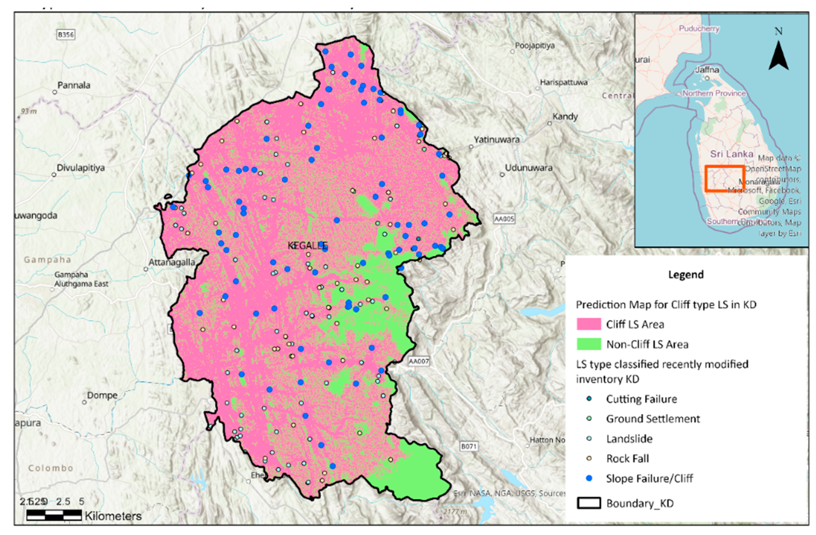
In Sri Lanka, landslides are classified into four types: slope failure, slides, debris flows, and rockfalls. The definitions of these classifications are quite similar in both Japan and Sri Lanka. Although landslides have been categorized in Sri Lanka, a more detailed classification system was introduced to the inventory in 2018 with the support of JICA . This updated classification is referred to as the recently modified inventory in this paper. Past disaster records are essential information for any kind of countermeasures. National Building Research Organization in Sri lanka has been collecting and managing a number of landslide records in the past. Since those have been stored in paper basis, without disaster type and in different formats, it is difficult to utilize for risk assessment and designing countermeasures [
5].
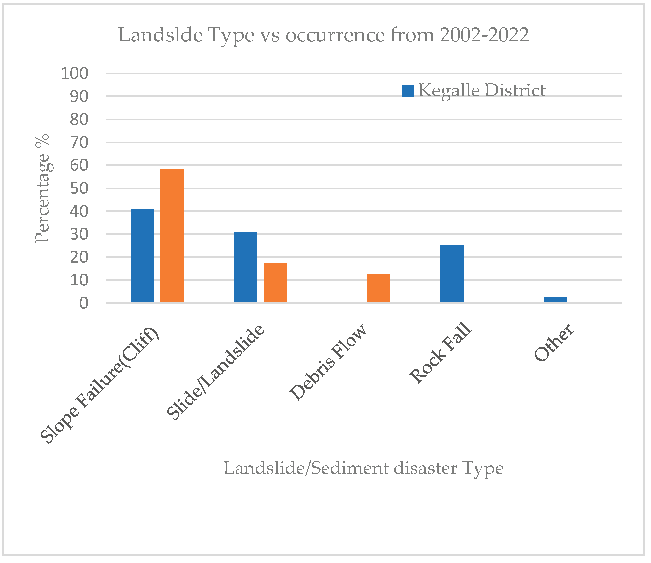
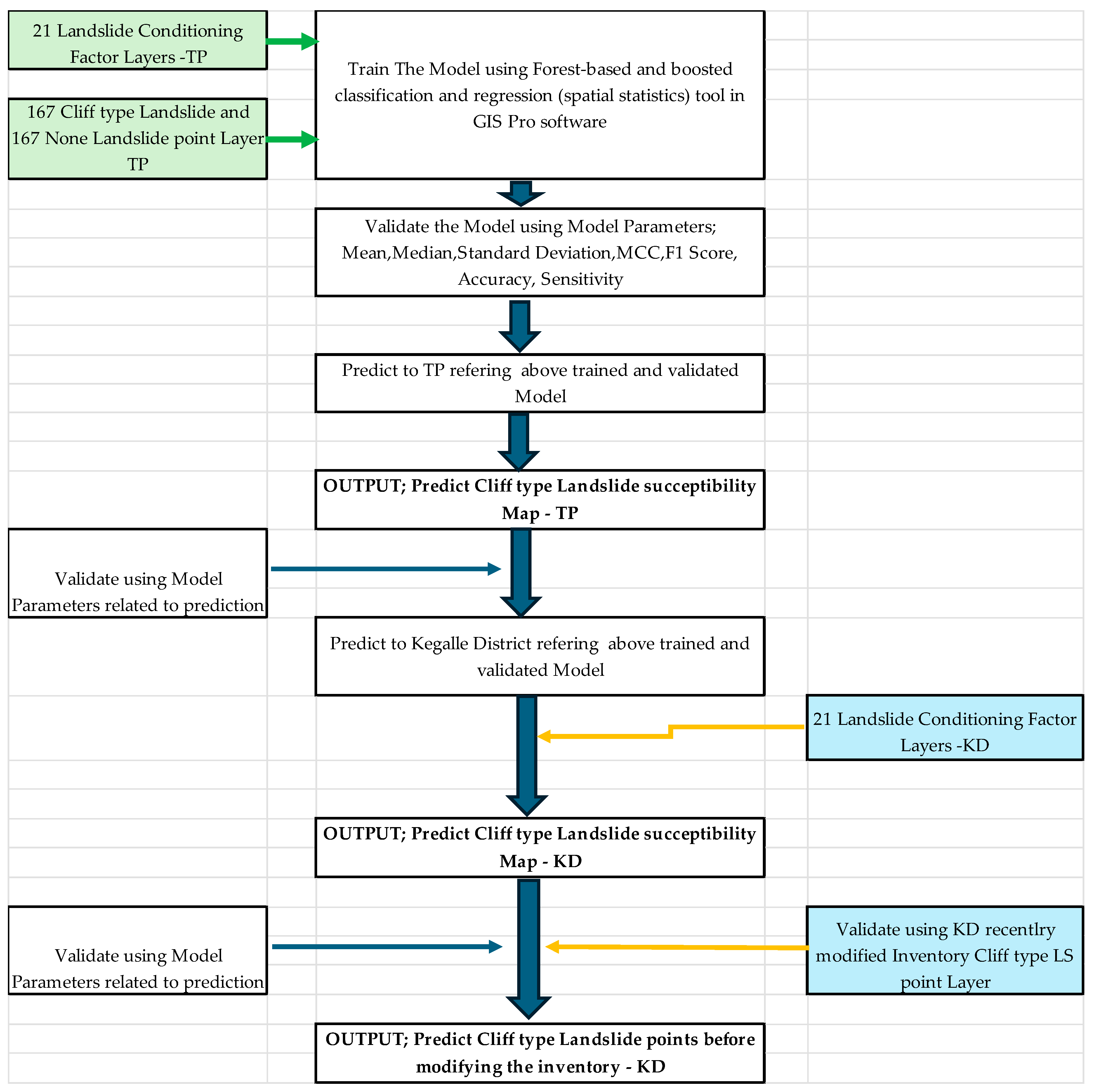
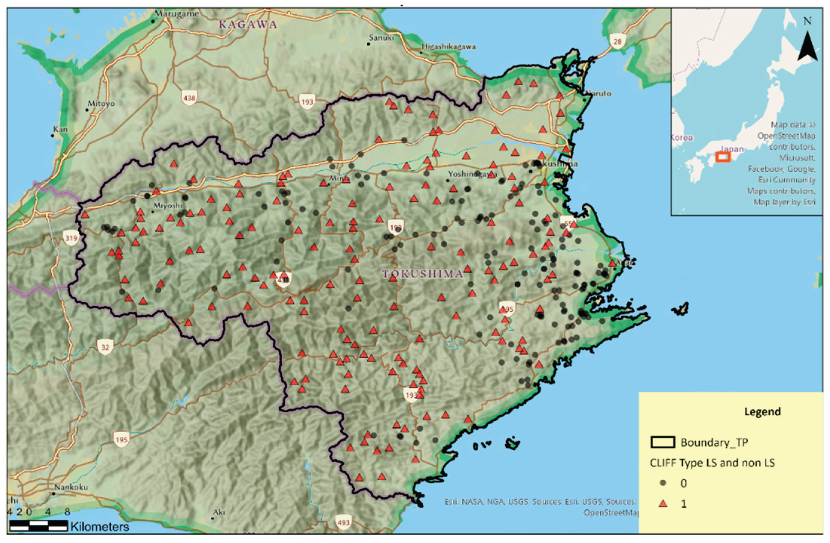
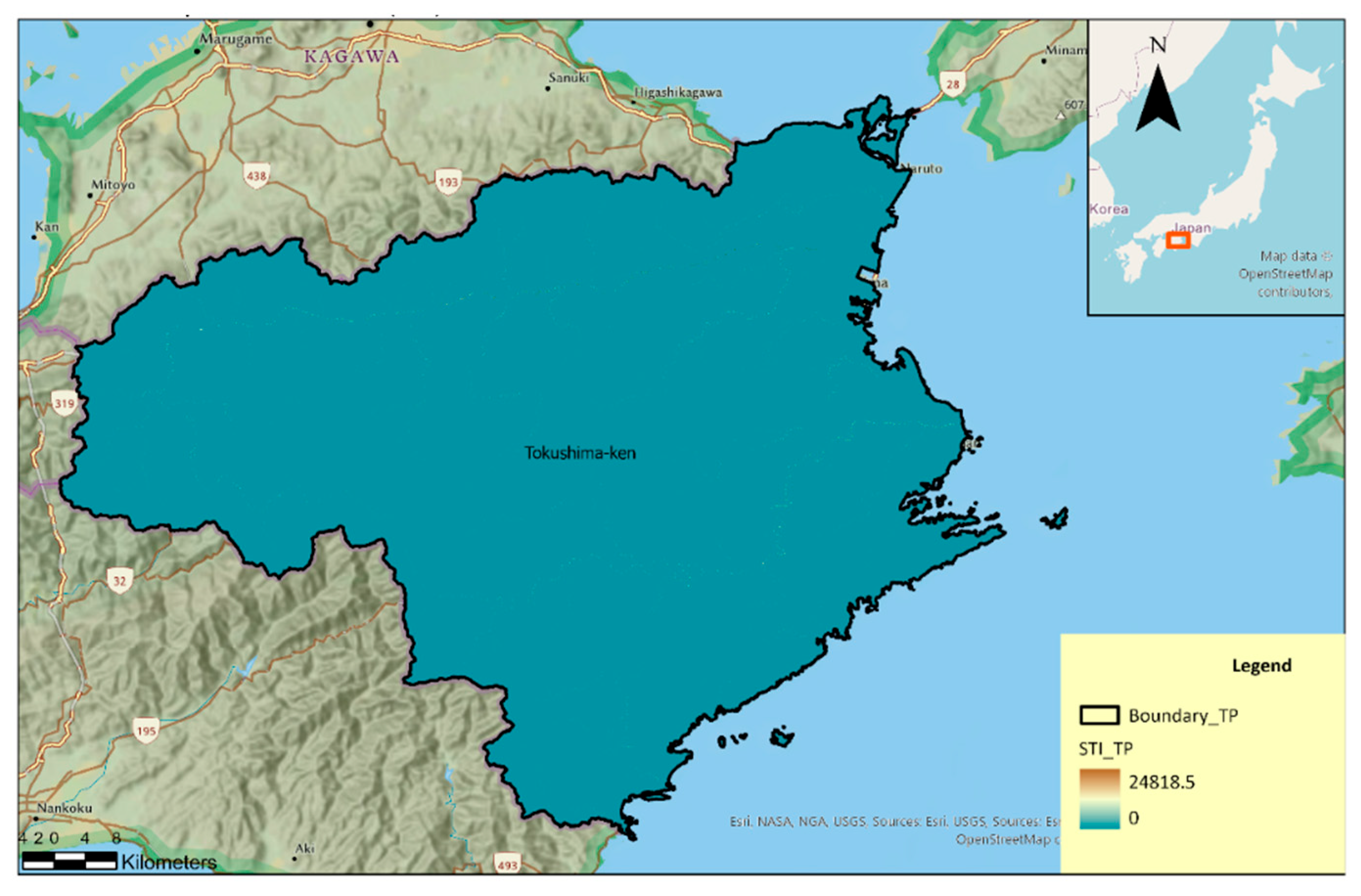
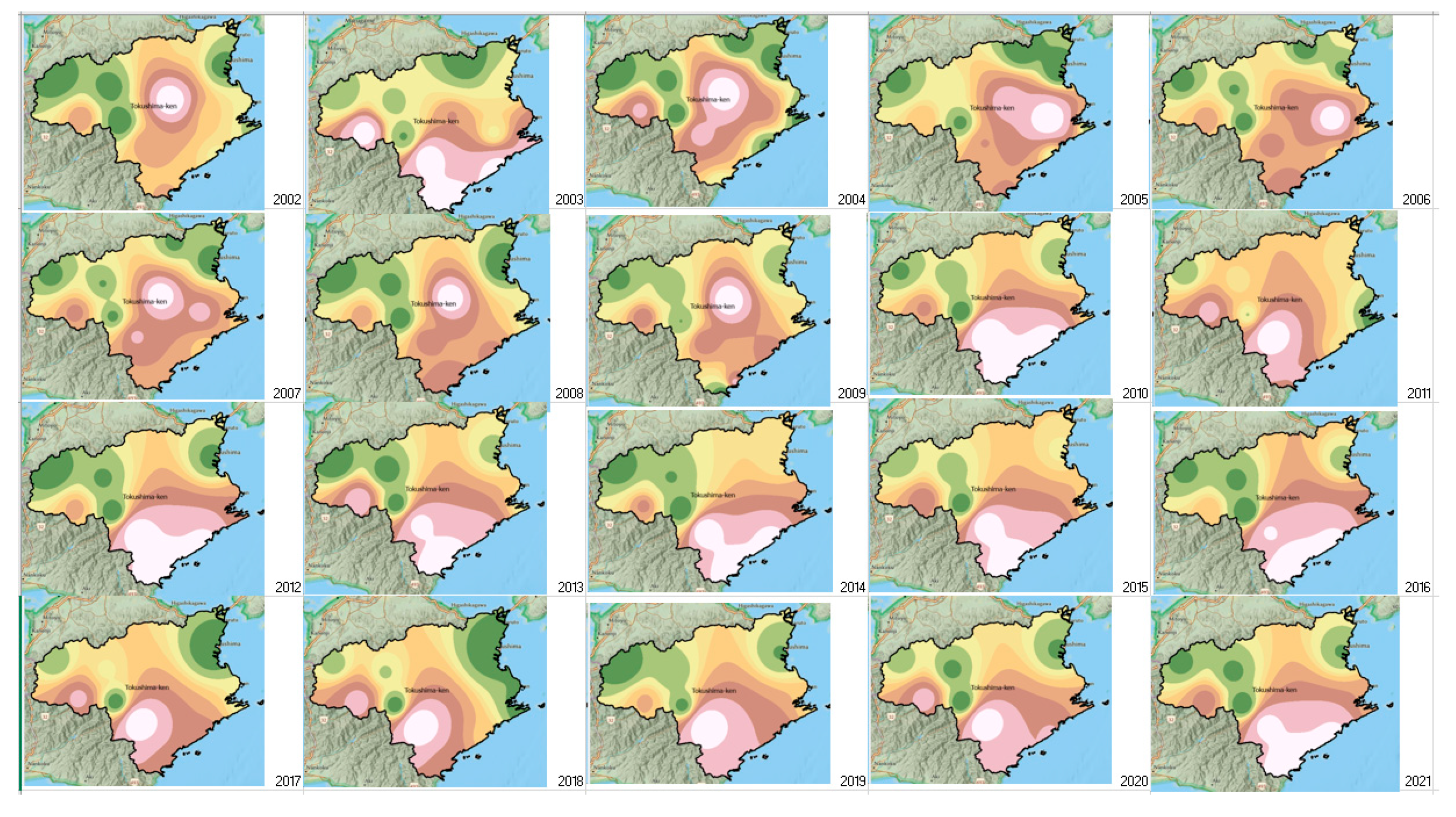
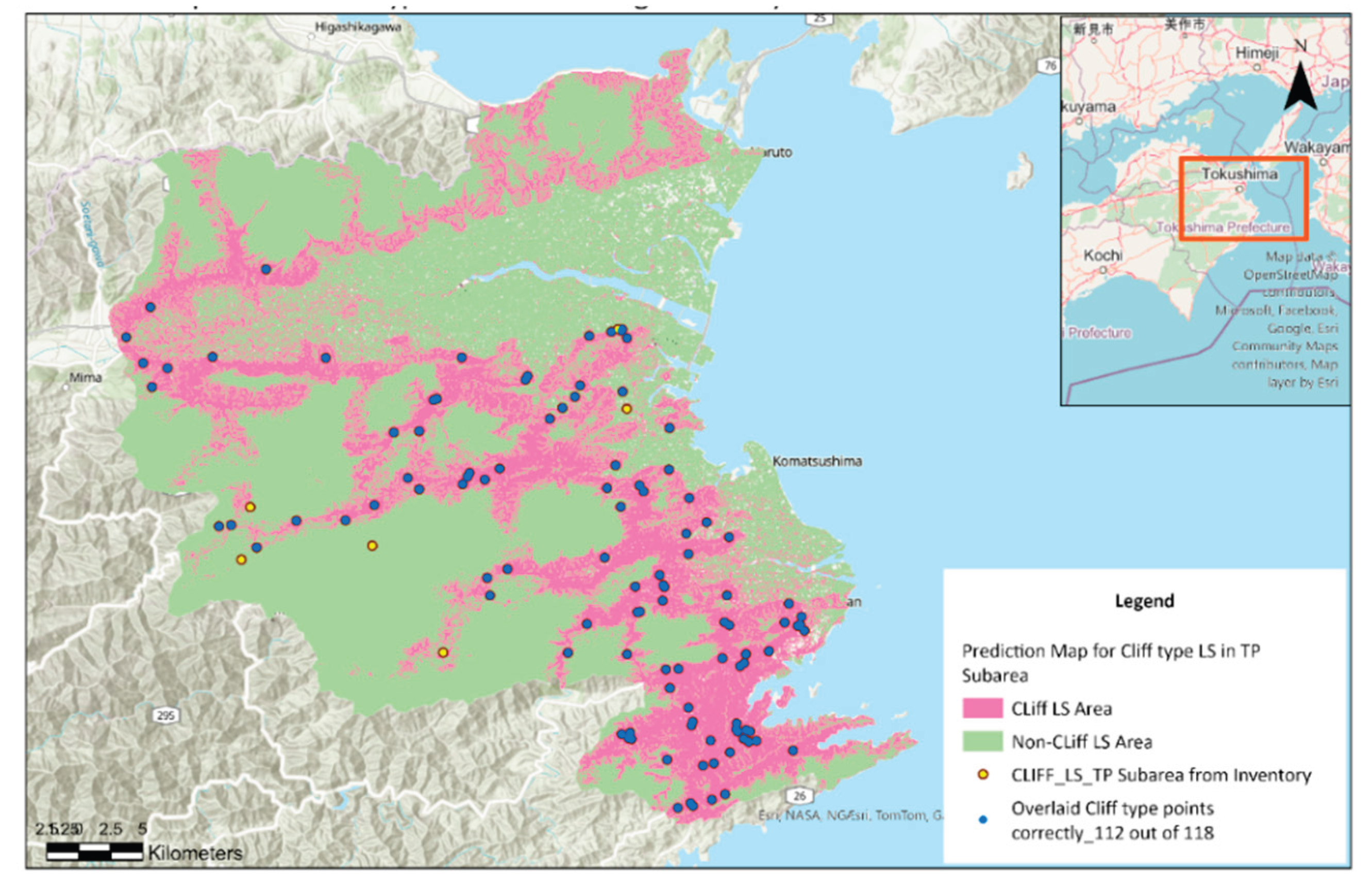
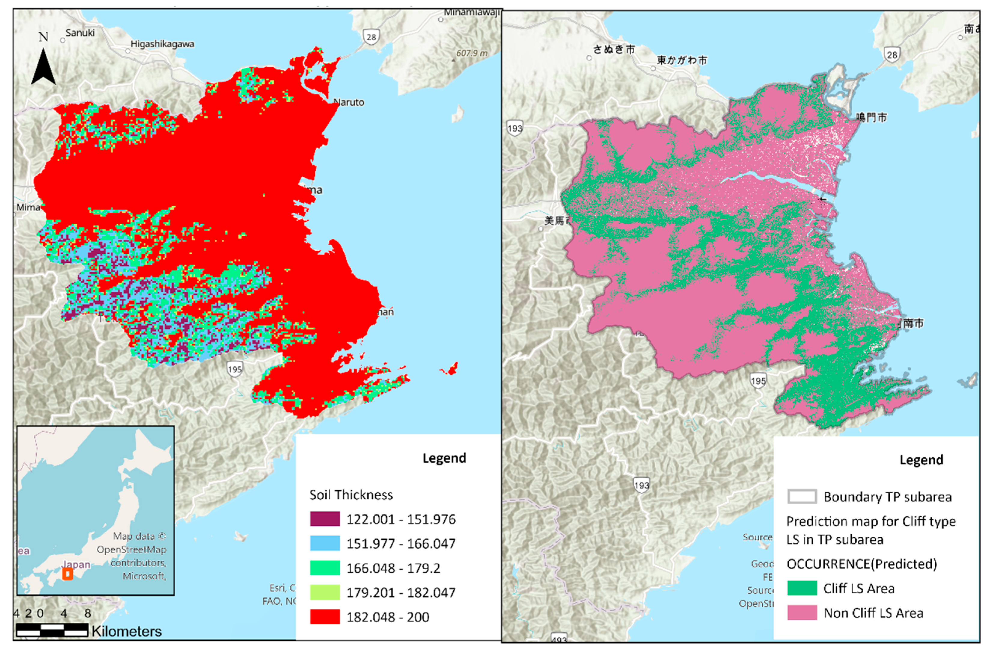
Figure 1 shows the distribution of landslide and sediment disaster types in Kegalle District, Sri Lanka, and Tokushima Prefecture, Japan, from 2002 to 2022. Slope failures are the predominant type in both regions, comprising 41% and 58% of recorded events, respectively. Slide/landslide events are more common in Kegalle (30%) than in Tokushima (18%), whereas debris flows occur only in Tokushima (13%). Rock falls account for 26% of events in Kegalle but are absent from the Tokushima records. Other types represent less than 5% in both datasets. For Kegalle District, a recently updated inventory was used to create
Figure 1.
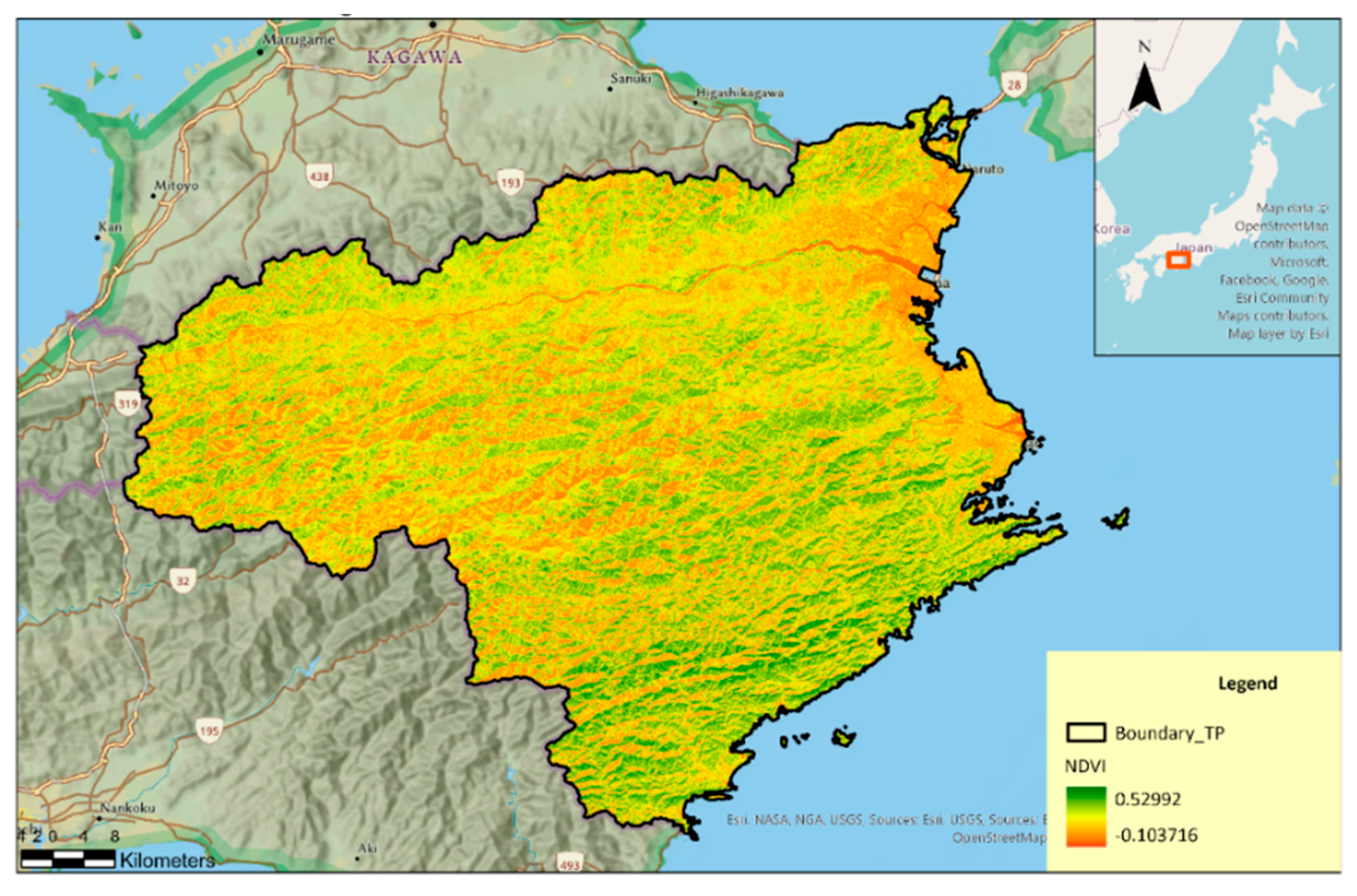
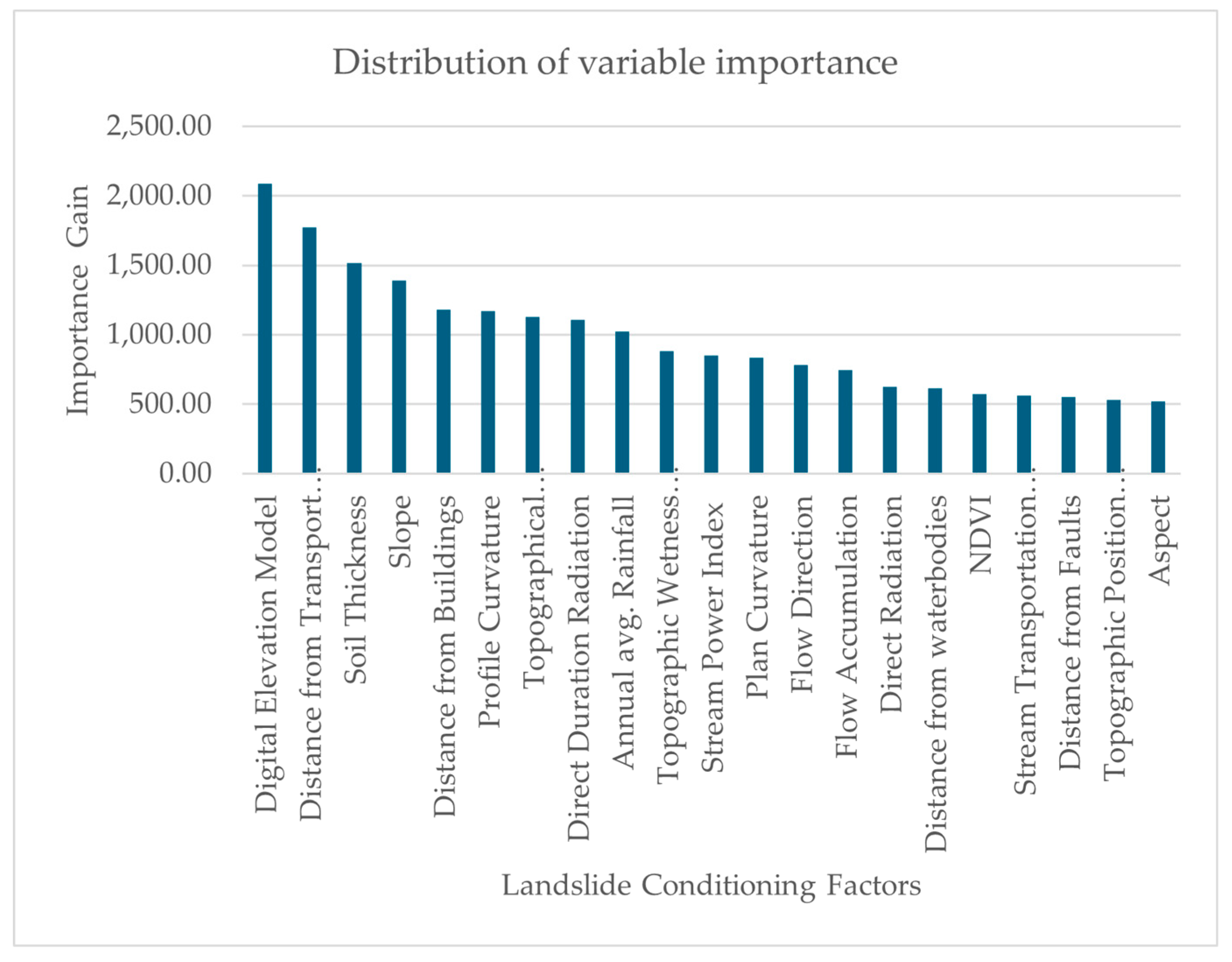
Numerous studies have explored the factors contributing to landslide occurrence, commonly referred to as landslide conditioning factors. These include topographic elements (e.g., slope, elevation, aspect), geological conditions (e.g., soil type, lithology), land use, and proximity to natural and built features such as water bodies, streams, and buildings. Various modeling approaches have been applied to evaluate the relative importance of these factors. A summary of recent research is presented in
Table 1, highlighting the numbers of conditioning factors and incidents considered, along with the associated conclusions.
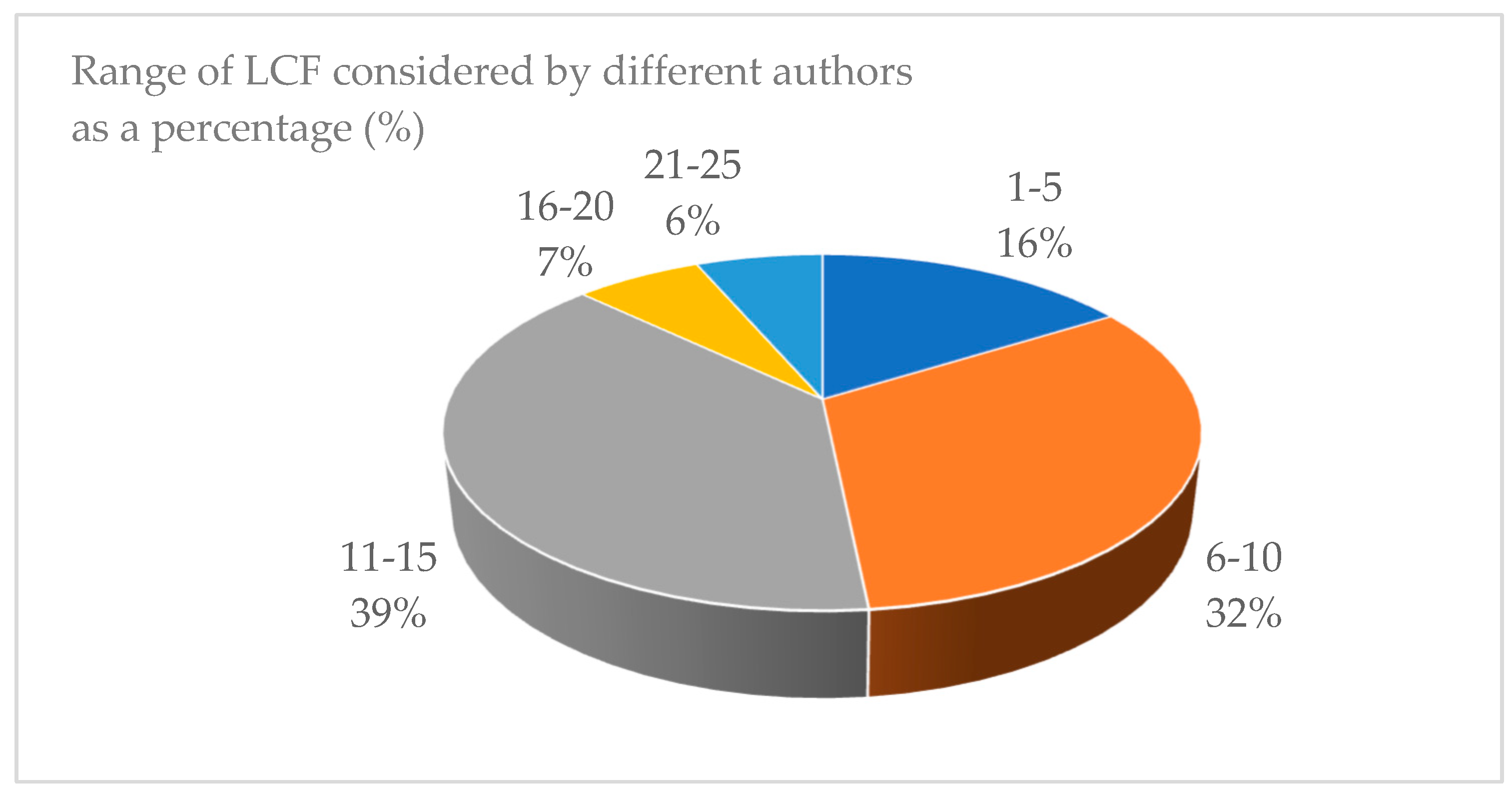
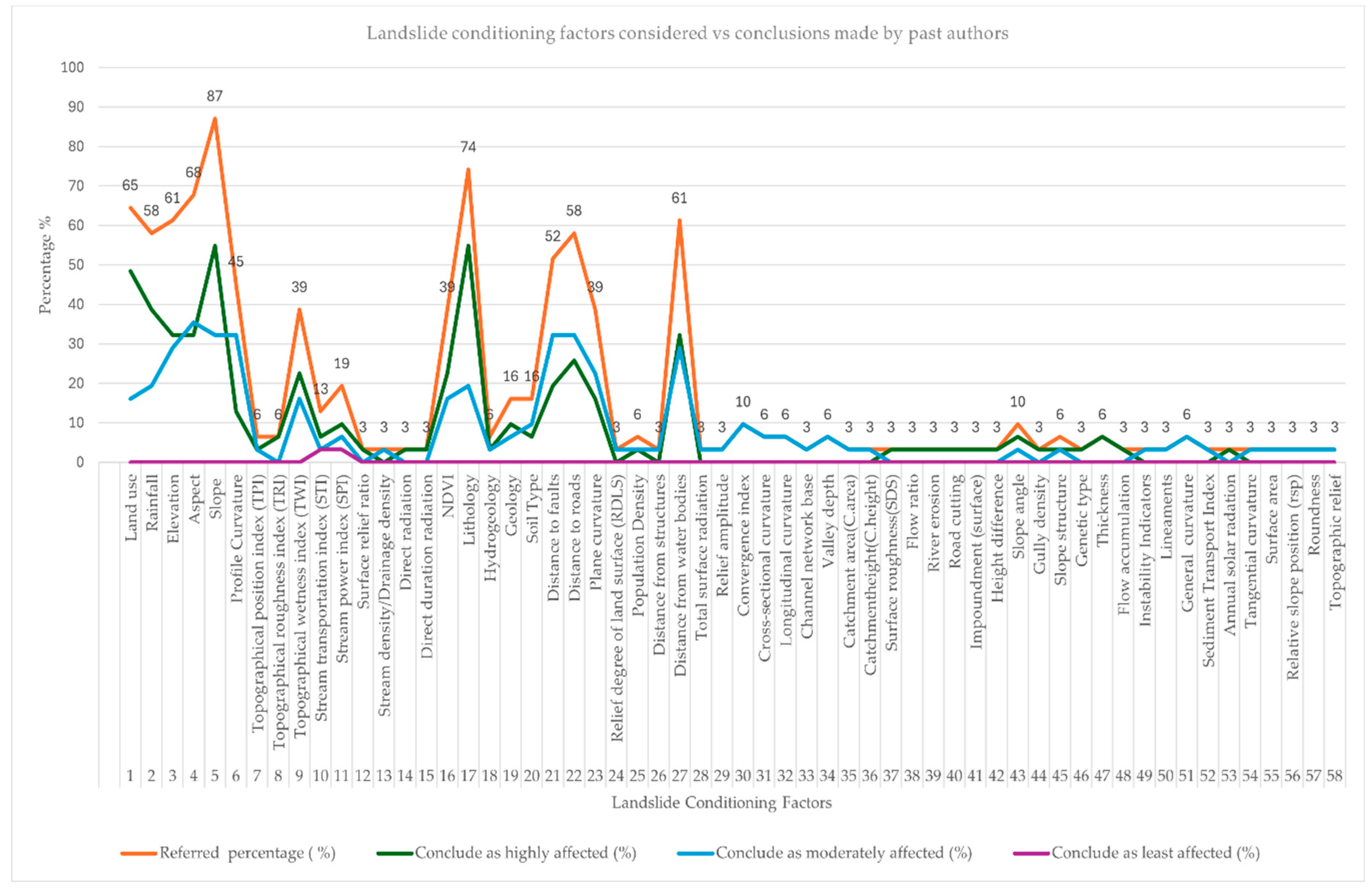
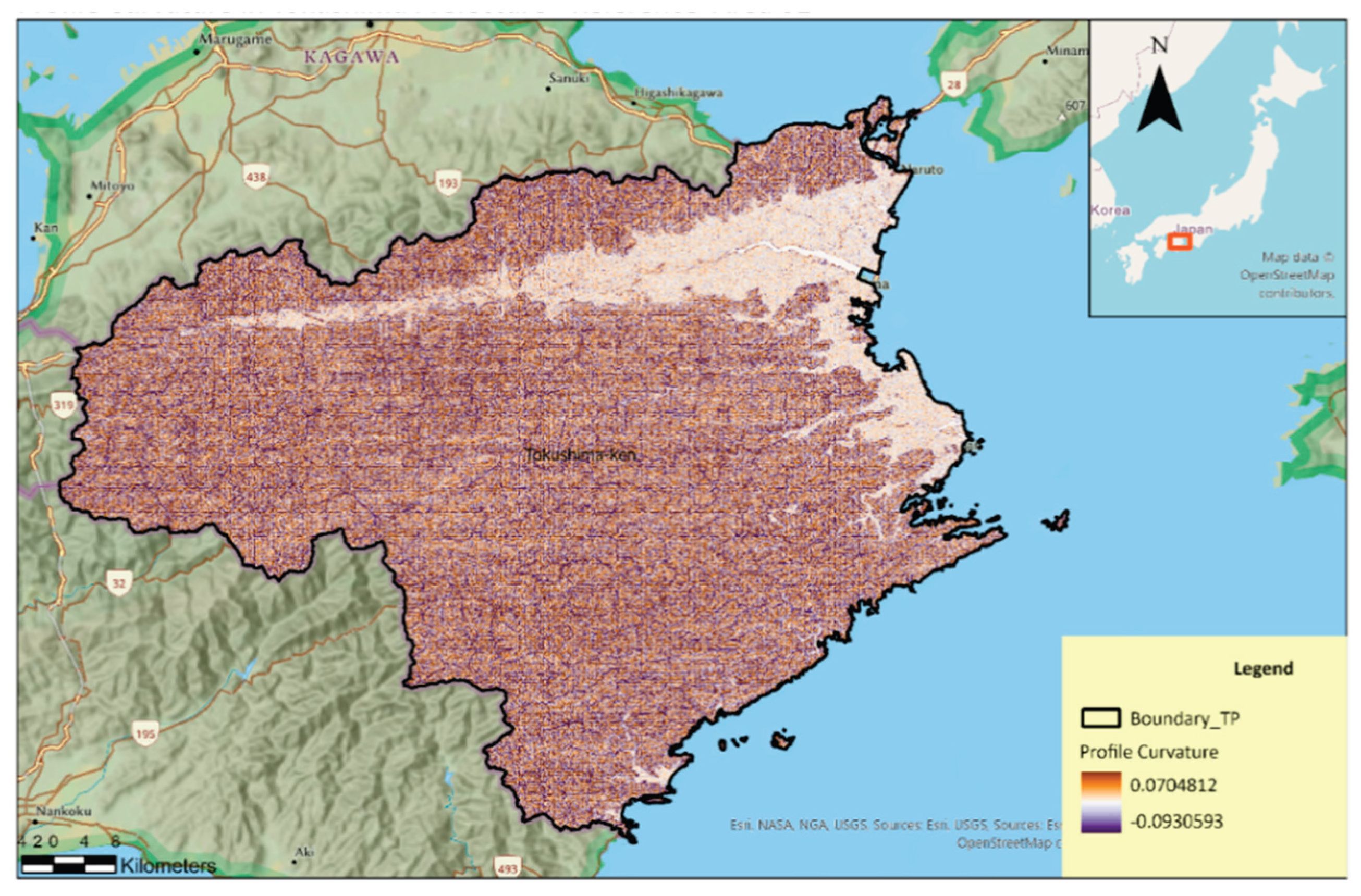
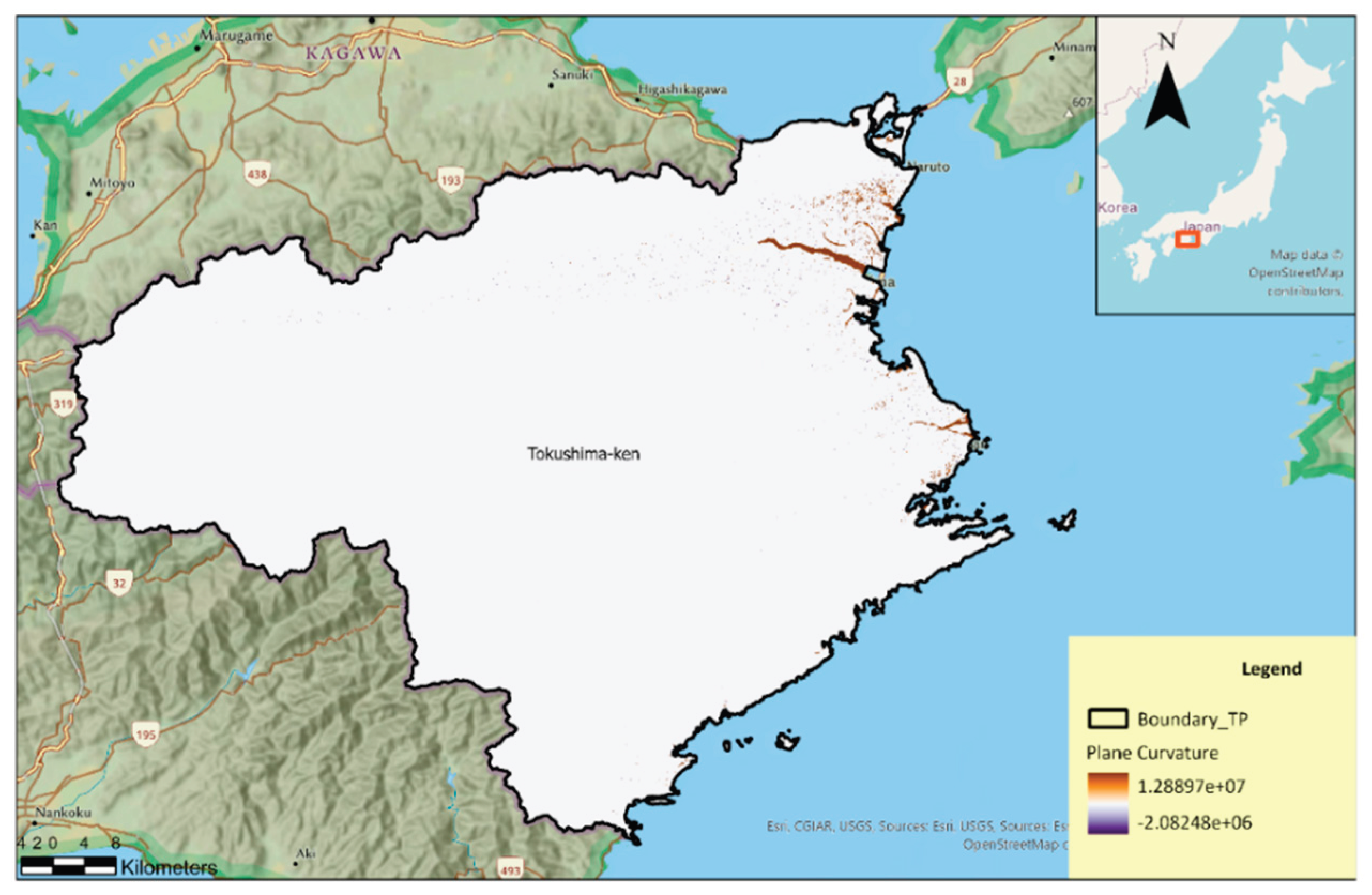
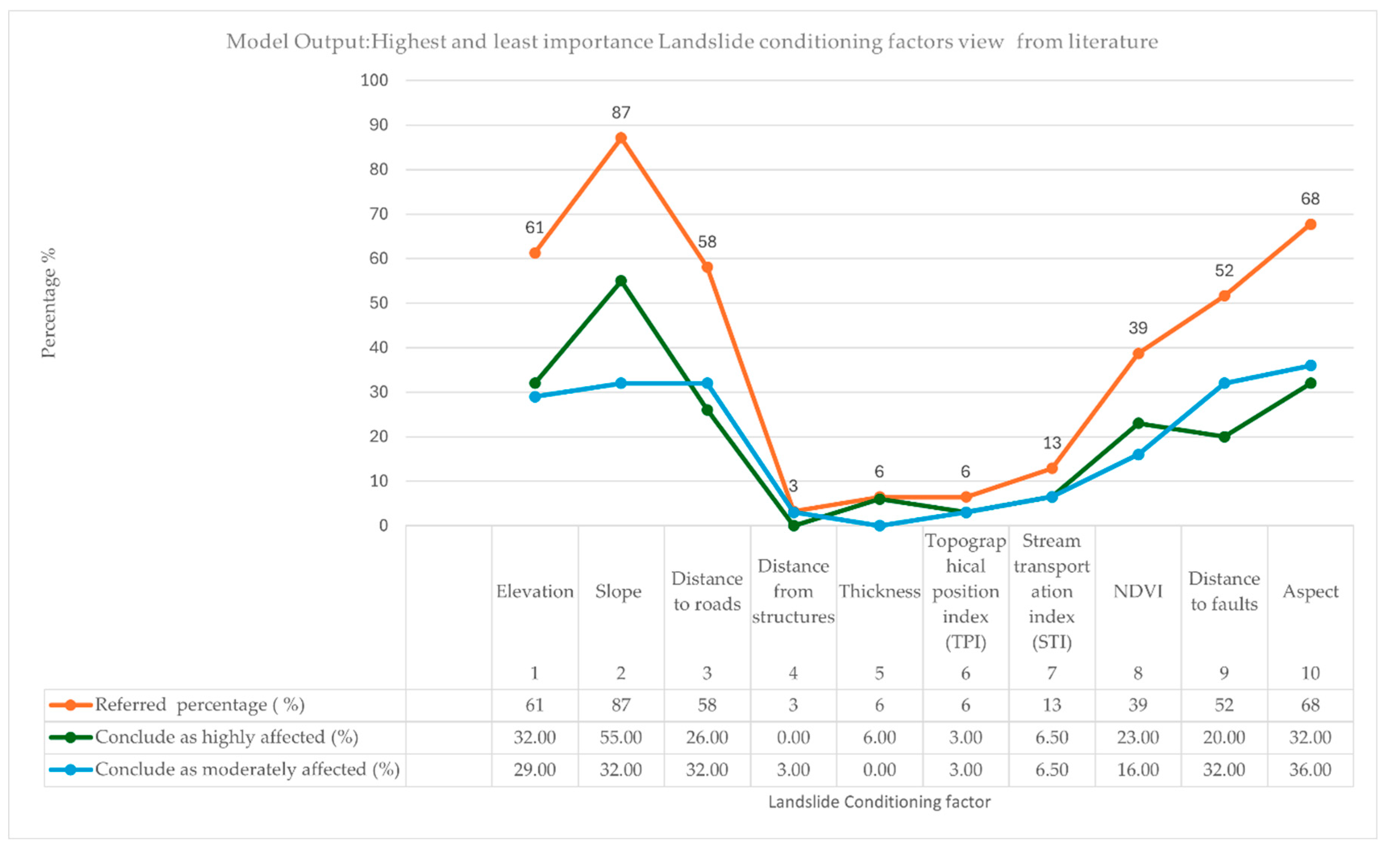
The matrix presented summarizes the consideration of various Landslide Conditioning Factors (LCFs) across multiple studies, categorized by the number of landslides (LS) examined in each case. The horizontal axis represents individual studies or datasets, with the respective number of LS considered indicated at the top of each column. The vertical axis lists the 24 LCFs that are commonly applied in landslide susceptibility modelling, including topographic, geological, hydrological, and anthropogenic parameters.
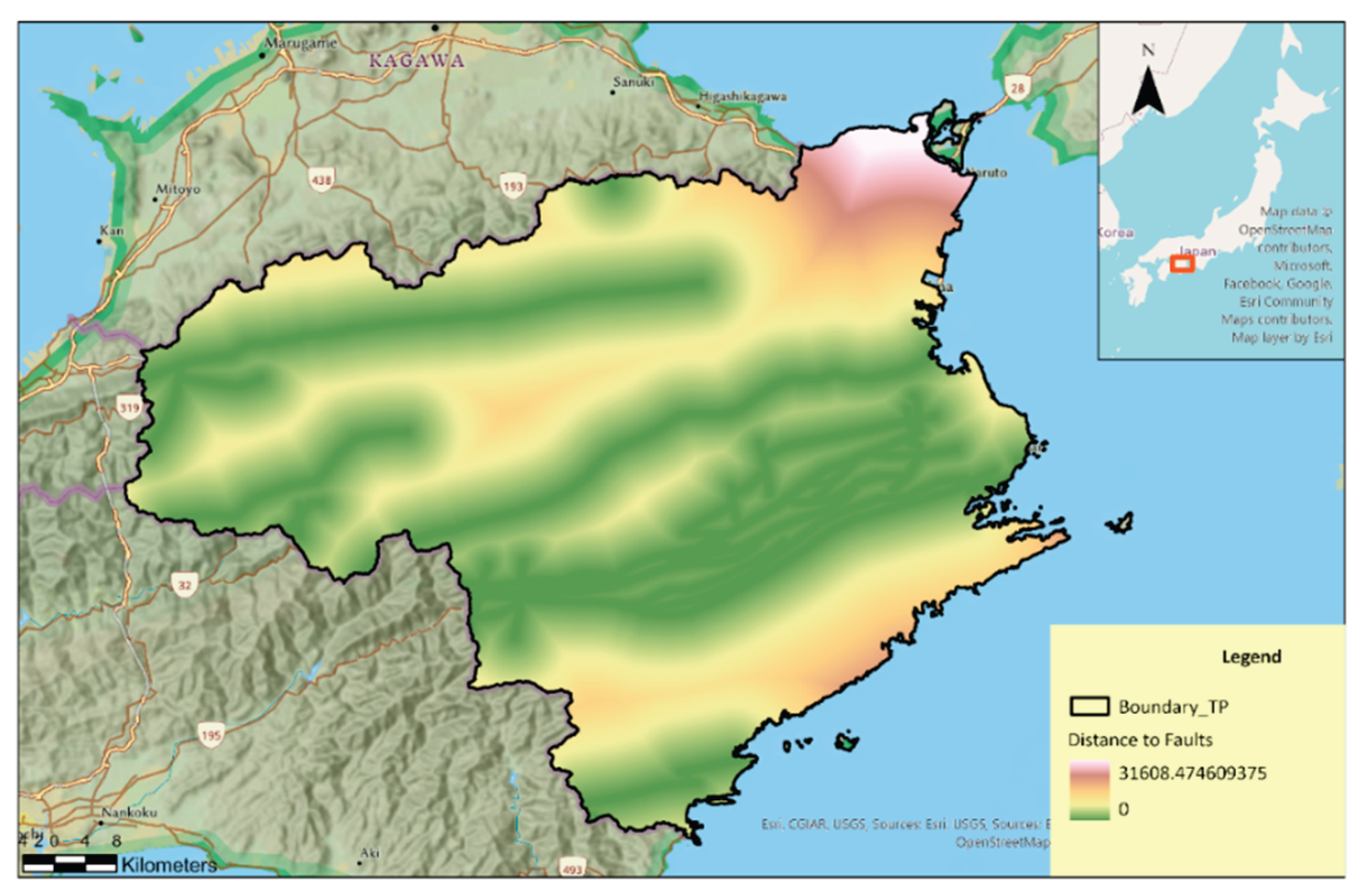
The analysis reveals that Land Use/Land Cover, Climate (Rainfall), Elevation/Altitude, Slope, and NDVI/Vegetation are the most consistently used LCFs, often classified as highly influential across datasets. In contrast, variables such as Thickness, Plane Curvature, Distance from Structures, and Flow Accumulation are less frequently considered. Some parameters, such as Soil Type and Distance to Faults, are included selectively and often marked as least influential, reflecting their varying importance depending on the local geological context.
The variation in LCF usage across studies reflects both the differences in data availability and the geomorphological context of the study areas. For example, hydrological factors such as TWI and SPI are predominantly considered in studies focusing on rainfall-induced landslides, whereas Distance to Epicenter is only relevant in seismically triggered events.
Overall, the comparative assessment highlights a trend toward prioritizing topographic and vegetation-related factors as primary determinants of landslide susceptibility, while certain localized parameters are incorporated on a case-by-case basis. Further information regarding LCF will be discussed under the first objective, which is to investigate the factors that affect landslide occurrence in the Materials and Methods section.
In Sri Lanka, landslides pose a serious threat, particularly within the central highlands, which encompass 12 districts recognized for their high susceptibility to slope instability [
17]. While some landslides occur due to natural factors such as intense rainfall or geological conditions, anthropogenic activities—such as deforestation, unregulated construction, and poor land-use practices—have significantly amplified the risk. Alarmingly, nearly 30% of the national population resides within these mountainous regions, increasing their exposure to such hazards. Major landslide events recorded in 2003, 2007, 2010, 2011, 2012, 2014, 2015, and 2016 collectively resulted in nearly 1,000 fatalities. Furthermore, approximately 20,000 km²—equivalent to 30.7% of Sri Lanka's total land area—is classified as highly landslide-prone [
18].
Given this alarming trend, the identification and mapping of landslide-prone zones are essential for disaster risk reduction and sustainable land-use planning. Landslide assessments are typically conducted through a tiered approach that includes susceptibility mapping (identifying areas likely to experience landslides), hazard mapping (considering frequency and magnitude), and risk mapping (accounting for both hazard and vulnerability) [
19].
Significance of the Study:
Historical disaster records are essential for developing effective and targeted countermeasures against landslides. In Sri Lanka, the National Building Research Organisation (NBRO) has been systematically collecting landslide-related data for many years. However, much of this information has traditionally been stored in paper-based formats or across disparate systems, making it difficult to access and analyze for risk assessment and mitigation planning. While NBRO currently maintains a disaster inventory that includes basic attributes such as the date of occurrence, location, scale, and rainfall data, there remains a critical need to organize and categorize this information in a structured digital format. To address this gap, NBRO has initiated the development of an Excel-based database that compiles key parameters, including disaster location, occurrence date, rainfall conditions, landslide type, event scale, and the resulting damage [
20]. Such a system would greatly enhance the ability to design context-specific structural and non-structural interventions.
Although landslide susceptibility models, such as logistic regression, have been widely developed, type of landslide is not considered in countries including Bangladesh, India, Indonesia, and Nepal, the significance and behavior of contributing variables are known to vary considerably between regions [
21]. Moreover, many existing models are applied at national or regional scales and often overlook the fact that landslides are influenced by distinct sets of conditioning factors [
22]. Failing to account for these differences may lead to generalized or ineffective mitigation measures.
Therefore, this study aims to enhance landslide risk management by predicting the type of landslide reported in the National Inventory, enabling the implementation of more appropriate and effective countermeasures. Given the severe consequences of landslides on human life, infrastructure, and the environment, improving predictive capability is a critical step toward reducing future impacts and enhancing community resilience.
Aim and Objectives:
Aim of this project is to develop a model for earthquake-unaffected regions to identify cliff-type landslides from a landslide inventory where the type is not specified. This will reference an area with a suitable inventory and a similar range of elevation and annual average rainfall.
Objectives are,
1.To investigate the factors that influence the occurrence of landslides.
2. To identify the most suitable techniques and tools for determining the relationship between Landslide Causative Factors (LCF) and landslide types.
3. To select an area that has an appropriate inventory and a comparable range of elevation and annual average rainfall.
4. To develop and train a model that finds the relationship between LCF and landslide type, including triggering LCF, and to validate the model.
5. To predict and validate cliff-type landslides in the inventory of the study area.
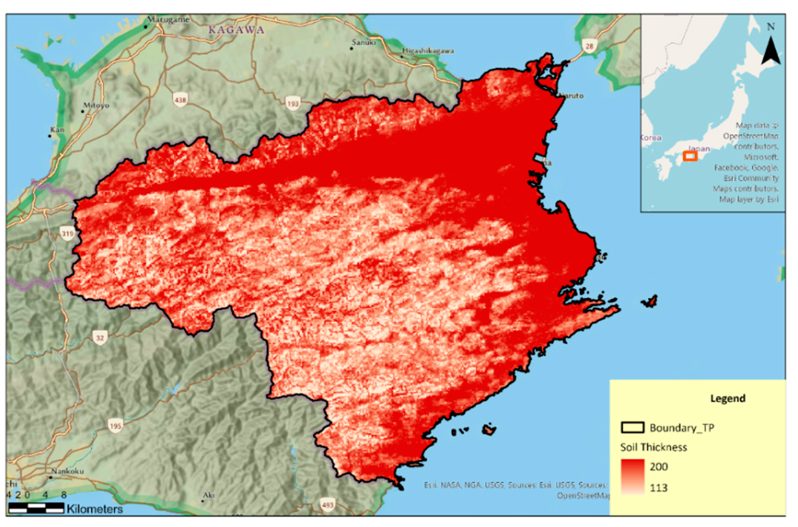
Study area:
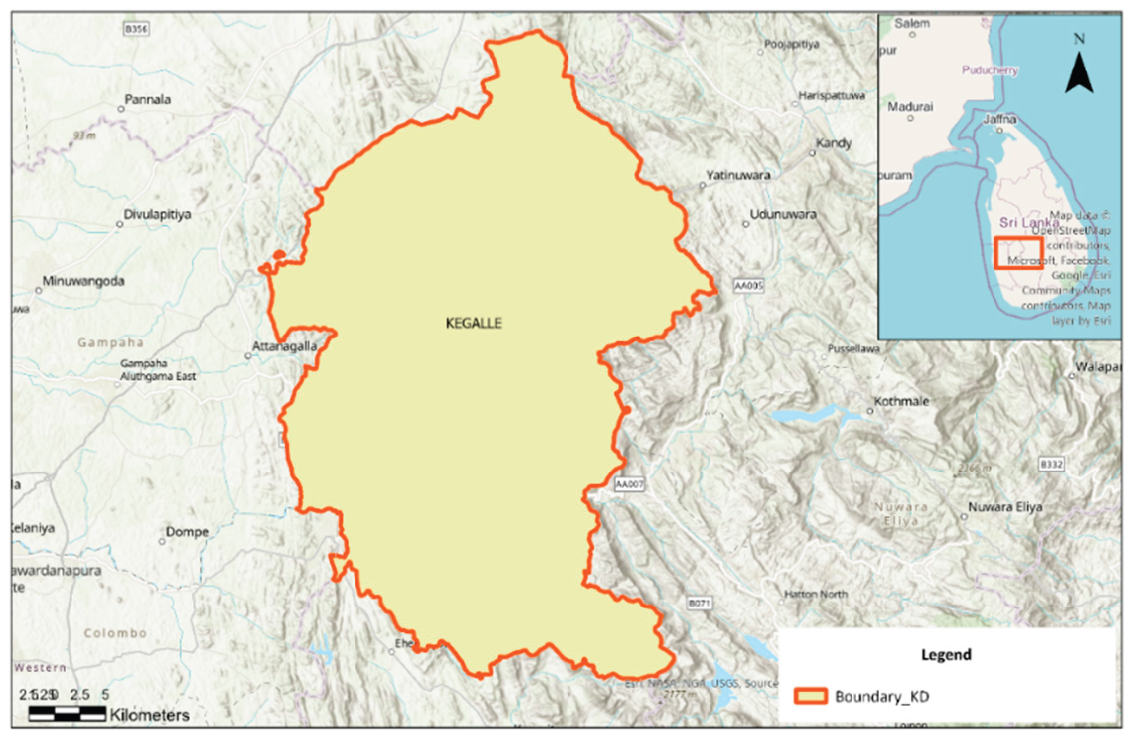
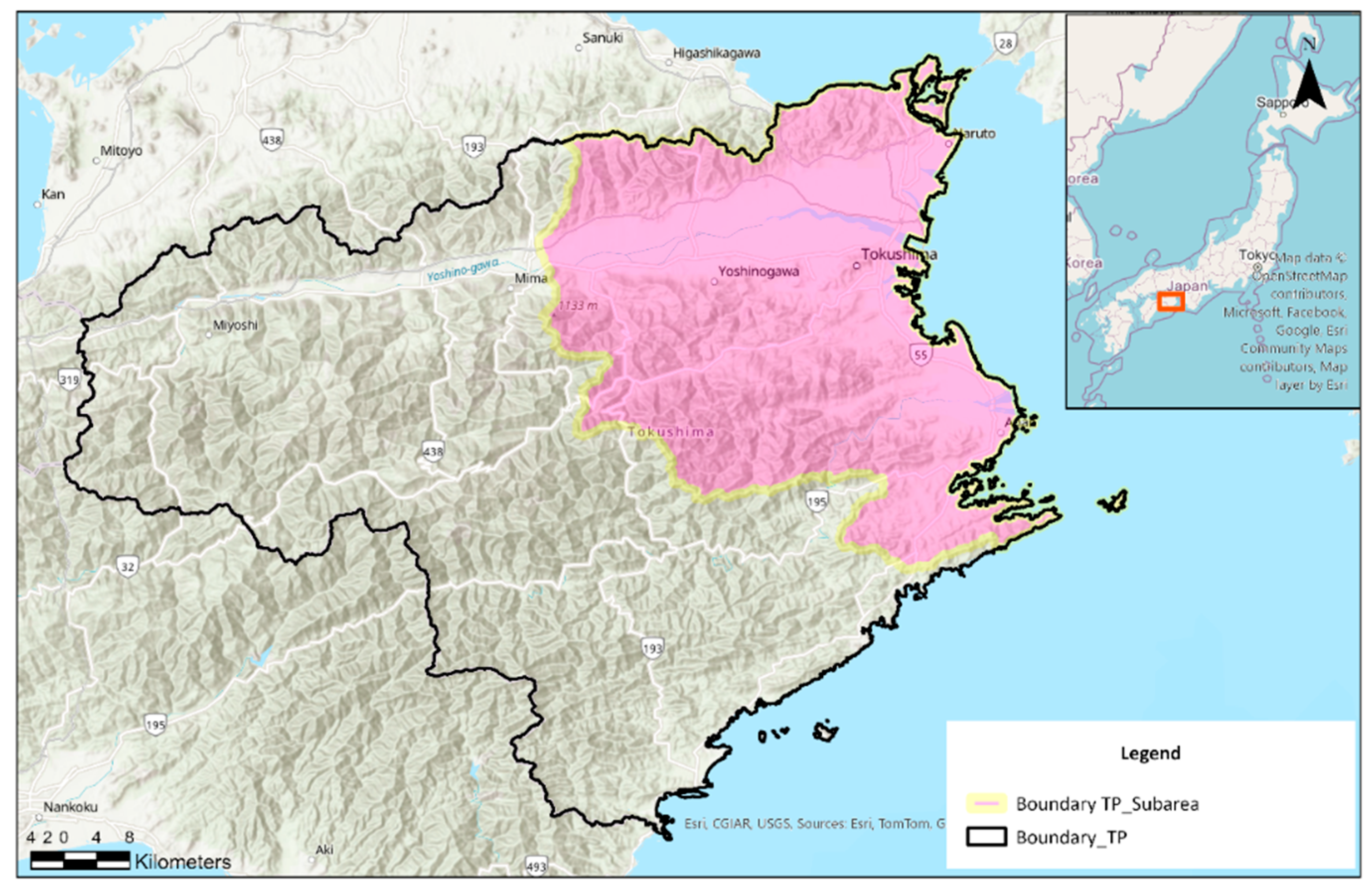
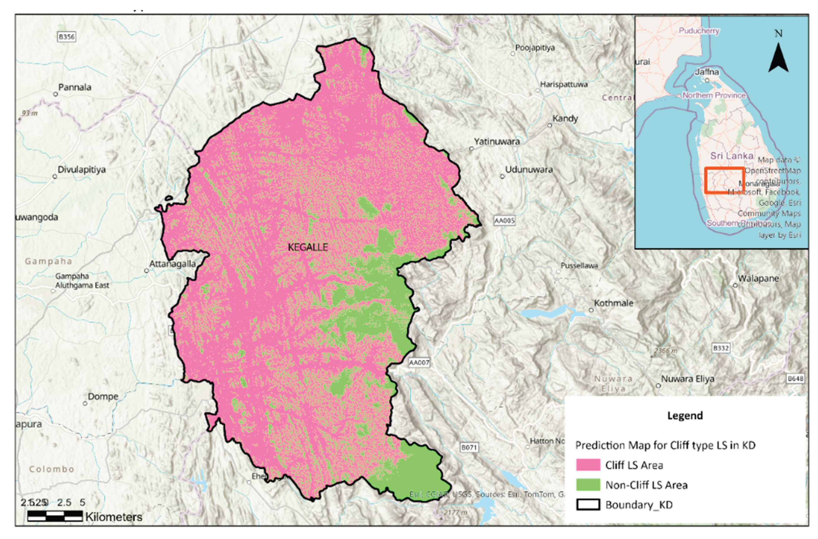
Sri Lanka is an island in South Asia, and the Kegalle District, indicated in
Figure 2 below, serves as the study area. The map delineates the administrative extent of Kegalle District (highlighted in light yellow with an orange boundary) within the Sabaragamuwa Province of Sri Lanka. The district boundary is clearly demarcated to differentiate it from surrounding administrative units.
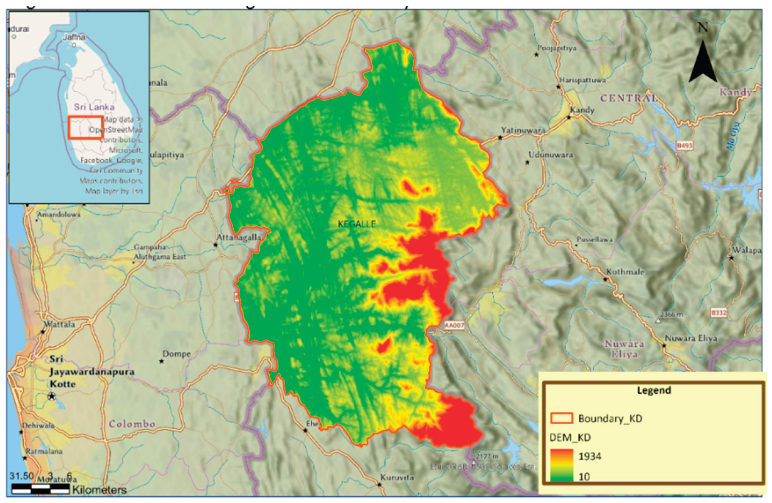
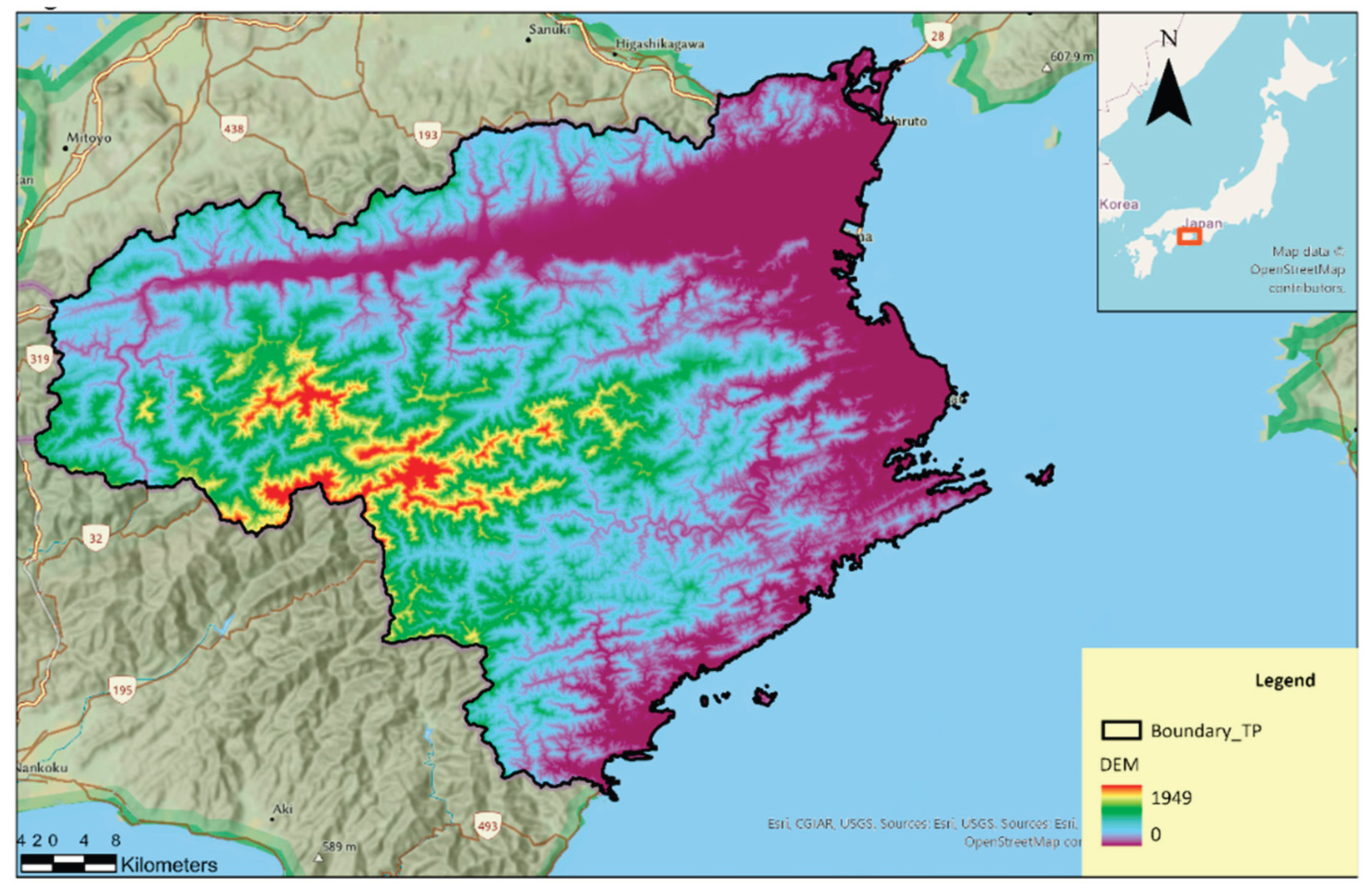
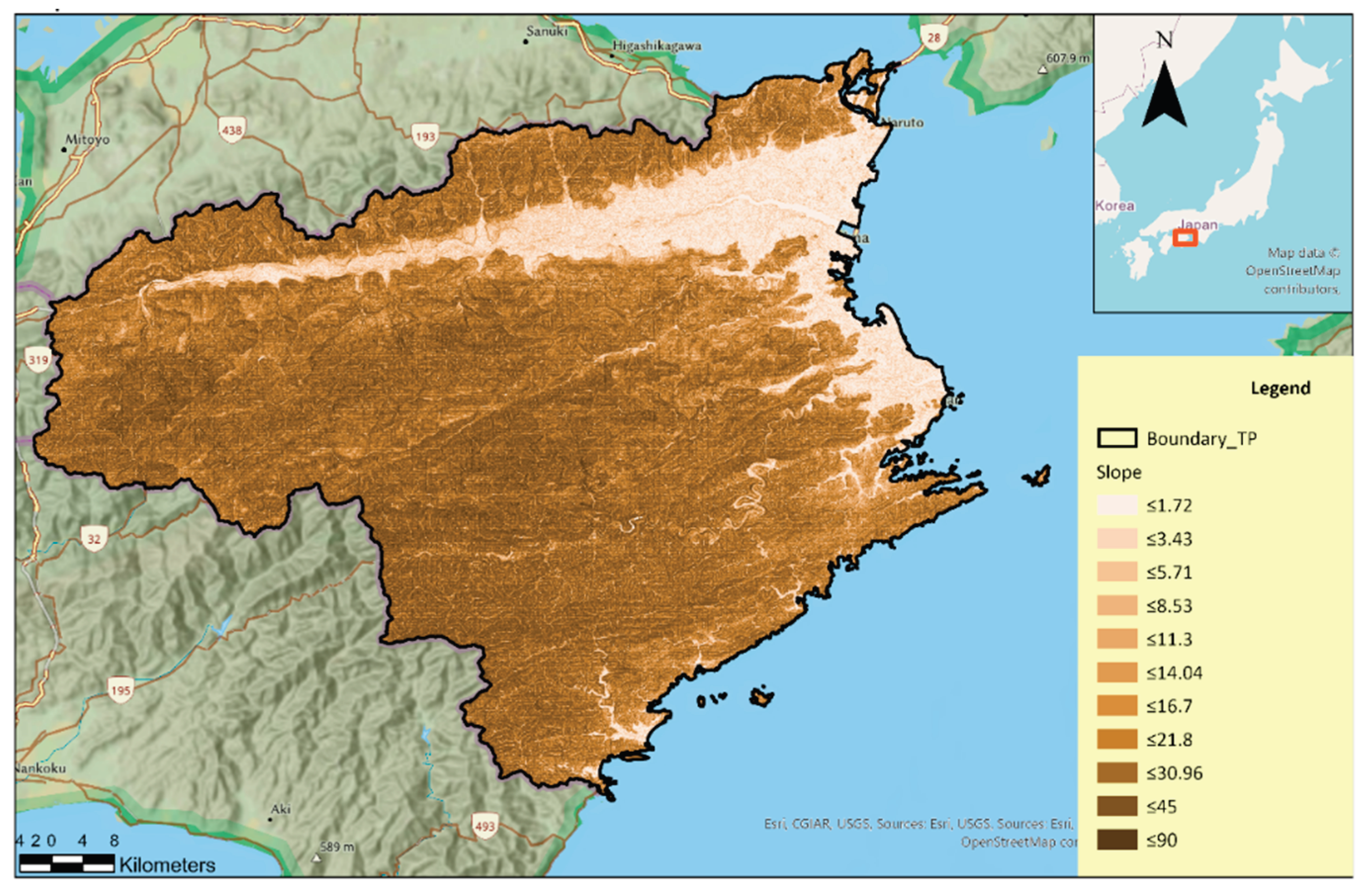
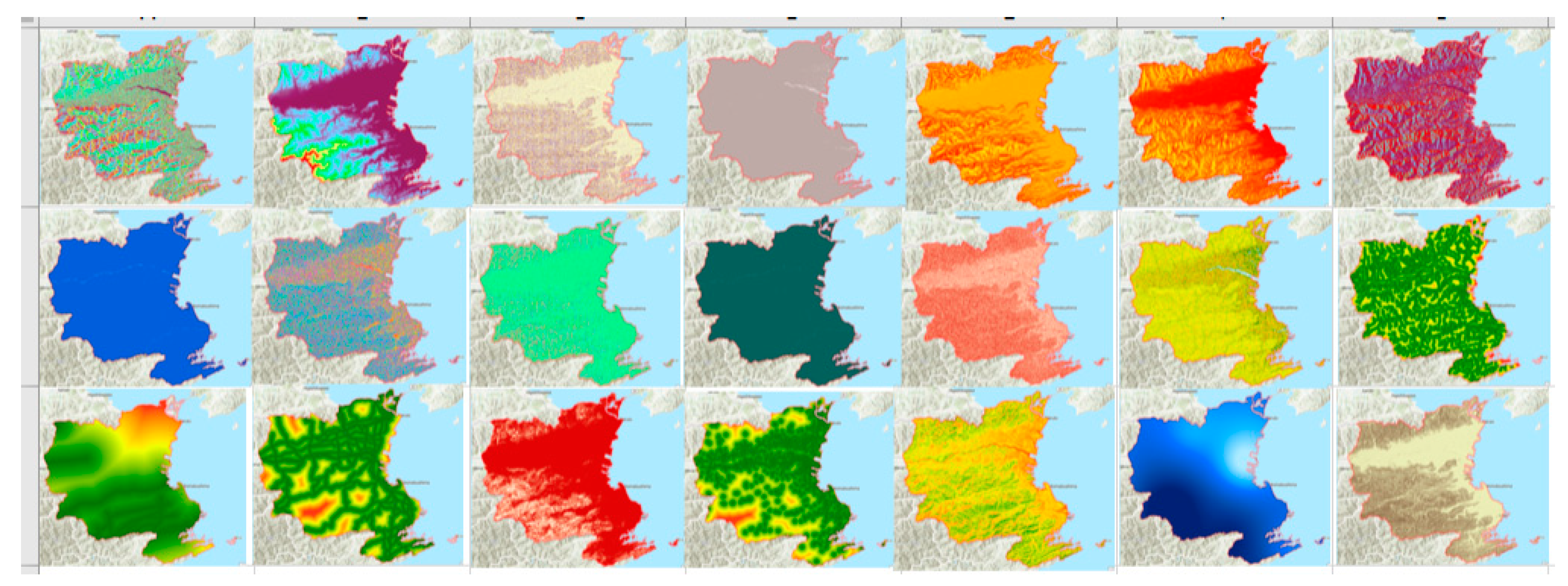
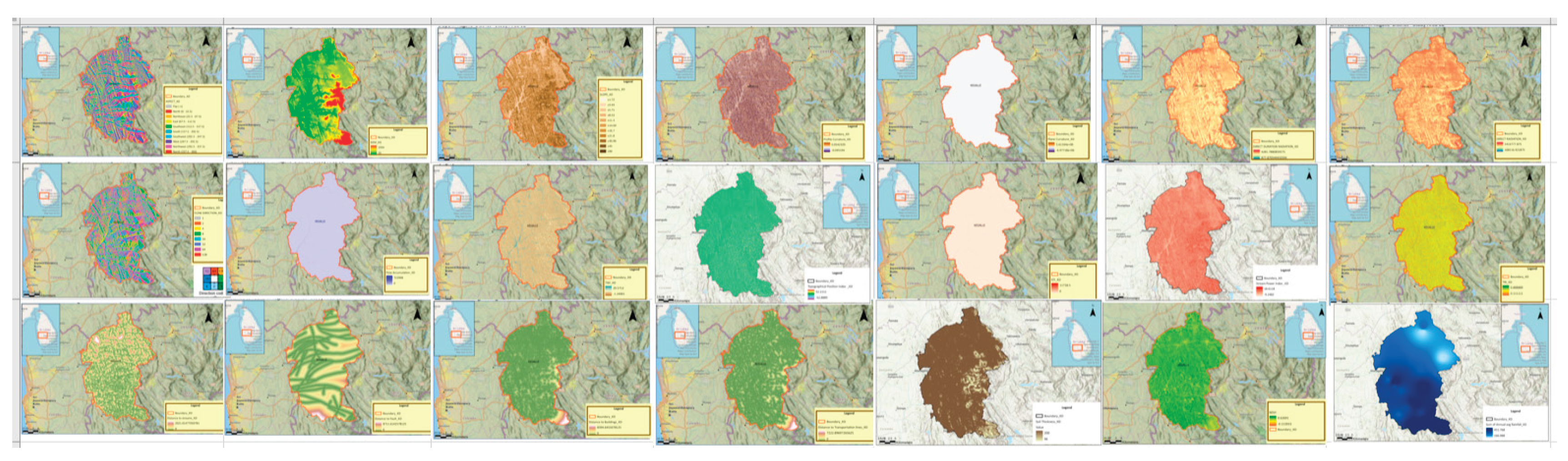
Figure 3 below illustrates the Digital Elevation Model (DEM) of the Kegalle District, Sri Lanka, highlighting the spatial variation in elevation across the region. The DEM values range from 10 m to 1,934 m above mean sea level, with lower elevations (depicted in green) concentrated in the western and central portions of the district, and higher elevations (depicted in red) predominantly located along the eastern boundary adjacent to the Central Province highlands. The district boundary is demarcated in orange for spatial reference. The inset map in the upper left corner shows the location of Kegalle District within Sri Lanka, providing geographical context for the study area. This elevation distribution reflects the district’s varied topography, which plays a critical role in influencing geomorphological processes and potential landslide susceptibility.
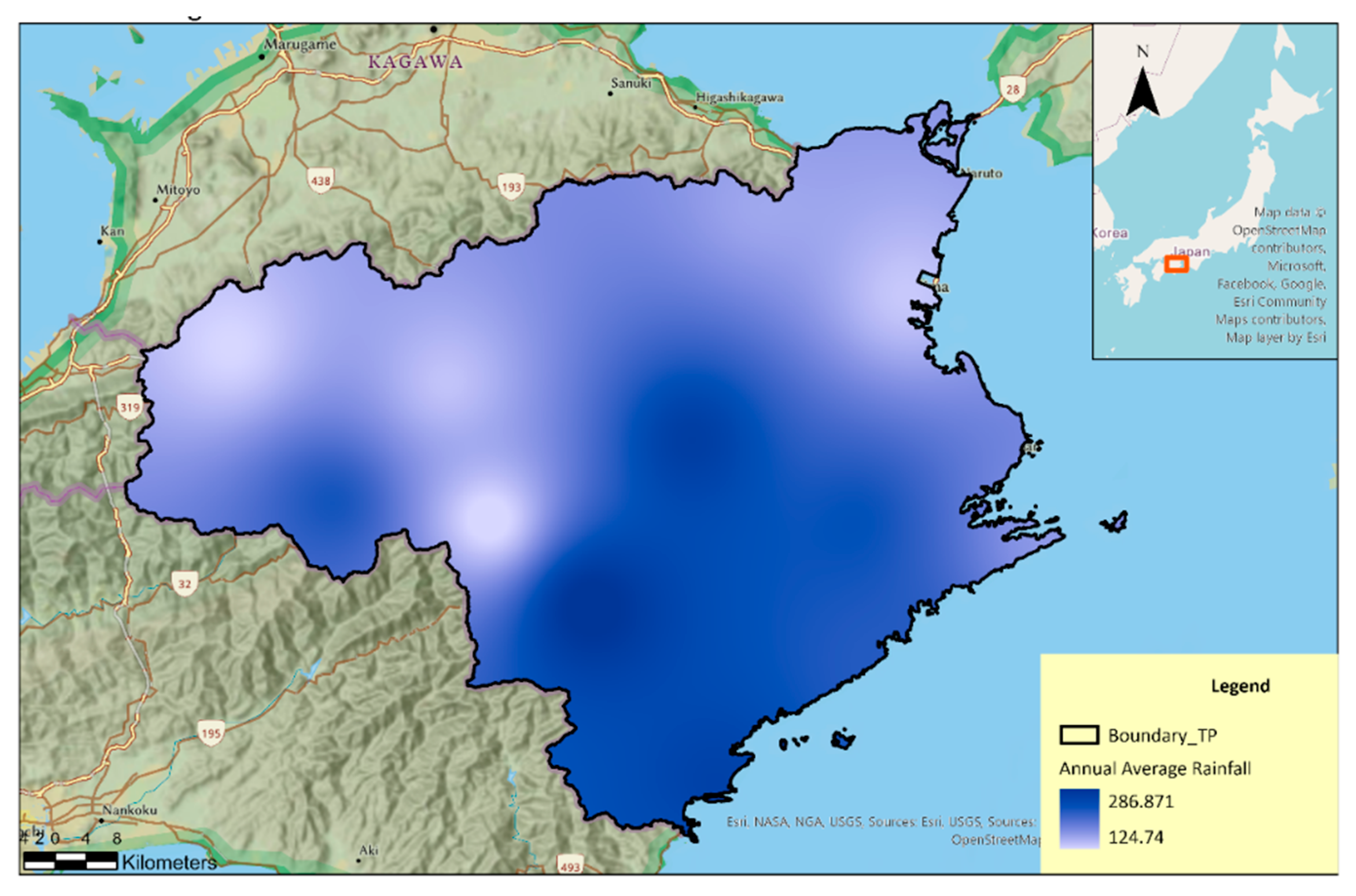
The
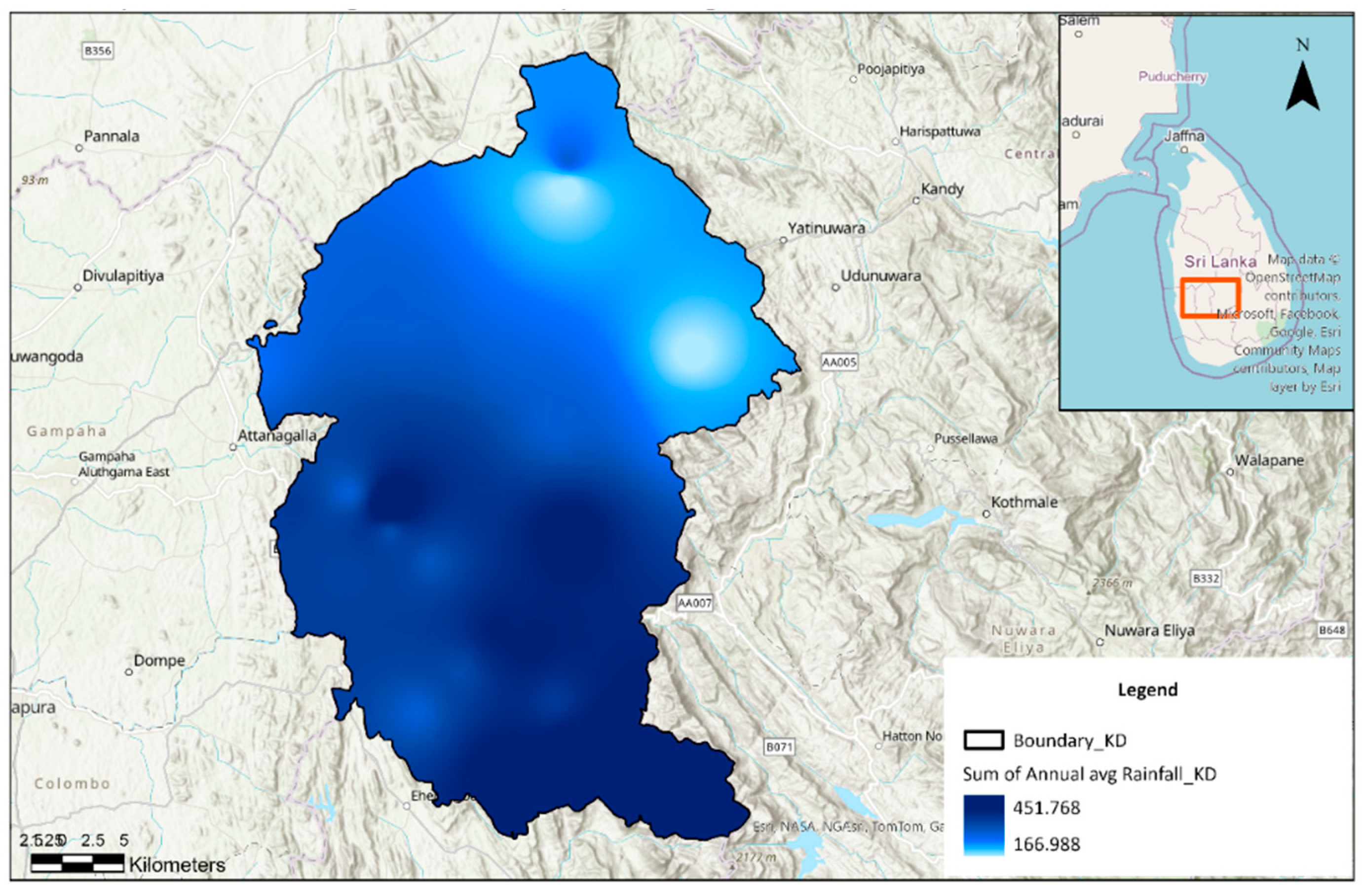
Figure 4 presents the spatial distribution of annual average rainfall within the defined study boundary, estimated using Inverse Distance Weighting. (IDW) interpolation. Rainfall intensity is depicted using a blue-scale gradient, where lighter tones (166.988 mm) indicate lower rainfall and darker tones (451.768 mm) represent higher rainfall concentrations.
The
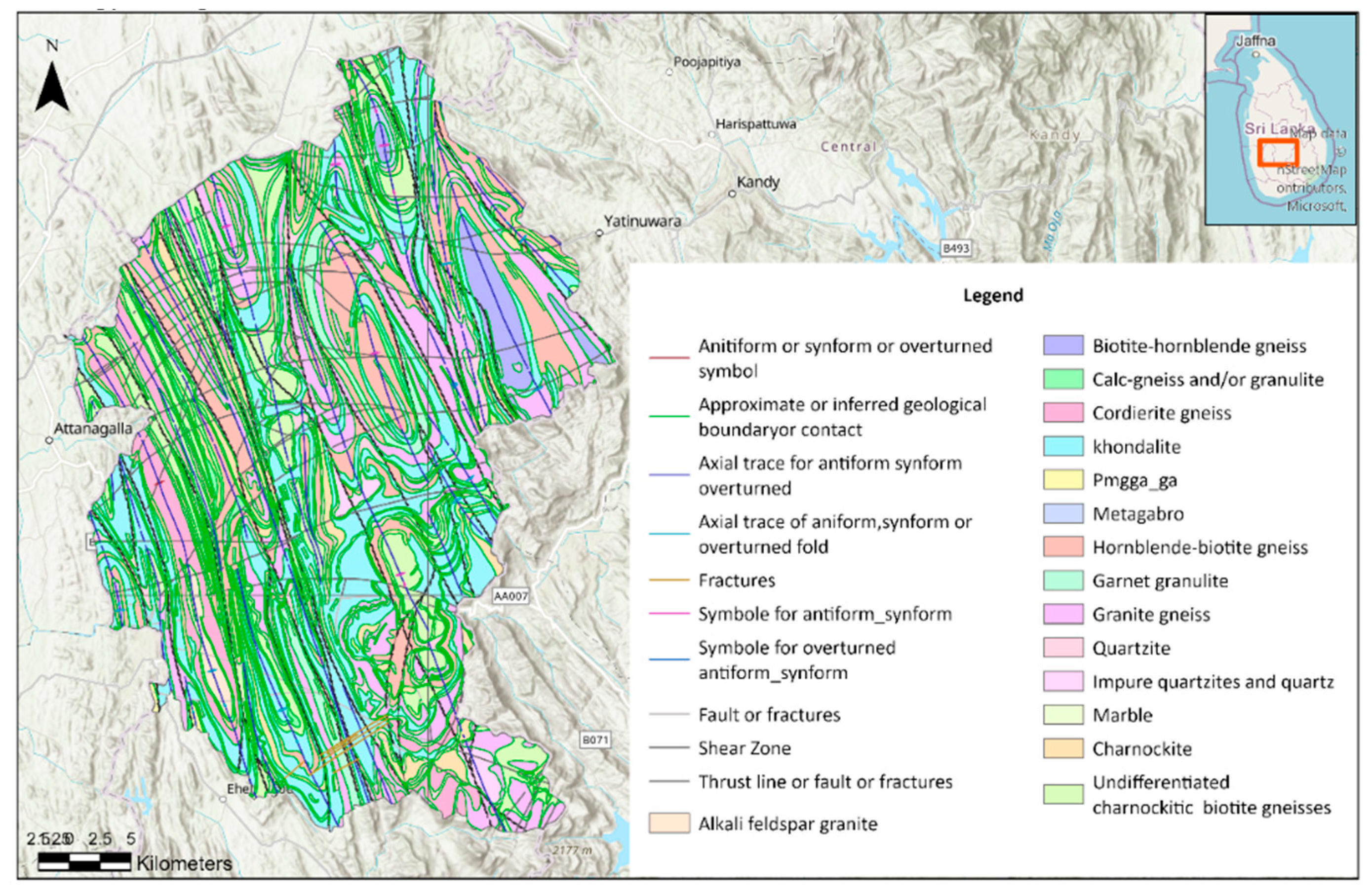
Figure 5 illustrates the structural geology and lithological composition of the study area within Kegalle District. Geological contacts and boundaries are shown using standardized symbols, including inferred and approximate geological boundaries, axial traces of folds, faults, shear zones, and thrust lines. Lithological units are color-coded, encompassing rock types such as biotite-hornblende gneiss, calc-gneiss, granite gneiss, quartzite, marble, charnockite, and garnet granulite. Structural features such as antiformal and synformal folds, fractures, and overturned structures are indicated with distinct symbology. The inset map (upper right) locates the study area within Sri Lanka, providing broader geographic context. The base map includes topographic relief to aid interpretation of structural patterns in relation to terrain.
The
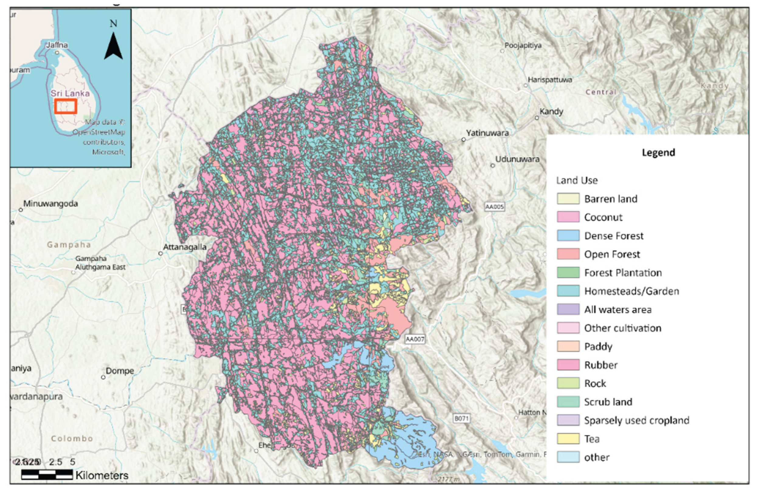
Figure 6 depicts the spatial distribution of land use categories within the Kegalle District boundary. Land use types are color-coded to represent barren land, coconut plantations, dense and open forests, forest plantations, homesteads/gardens, water bodies, other cultivation areas, paddy fields, rubber plantations, rock outcrops, scrub lands, sparsely used croplands, tea plantations, and other miscellaneous uses. The predominant land use types in the Kegalle District are homesteads/gardens (39.8%), paddy fields (25.6%), and rubber plantations (18.6%), reflecting a mixed agro-residential landscape.
In Sri Lanka, out of 25 districts, 10—specifically Badulla, Nuwara-Eliya, Kegalle, Kandy, Ratnapura, Matale, Kalutara, Matara, Galle, and Hambantota—are highly susceptible to landslides. According to statistics from 1974 to 2020, Kegalle District ranks fifth in the number of landslide incidents and second in fatalities associated with landslides [
23].