Preprint Technical Note Version 1 Preserved in Portico This version is not peer-reviewed

A Simple Procedure to Preprocess and Ingest High-Resolution Ocean Color Data into Google Earth Engine

Version 1 : Received: 26 August 2022 / Approved: 29 August 2022 / Online: 29 August 2022 (10:09:58 CEST)

A peer-reviewed article of this Preprint also exists.

Maúre, E.R.; Ilyushchenko, S.; Terauchi, G. A Simple Procedure to Preprocess and Ingest Level-2 Ocean Color Data into Google Earth Engine. Remote Sens. 2022, 14, 4906. Maúre, E.R.; Ilyushchenko, S.; Terauchi, G. A Simple Procedure to Preprocess and Ingest Level-2 Ocean Color Data into Google Earth Engine. Remote Sens. 2022, 14, 4906.

Abstract

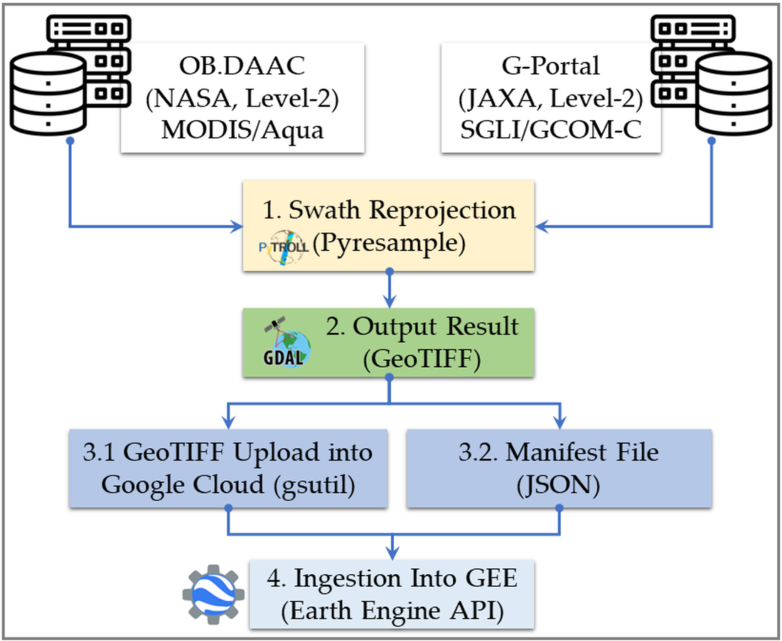
Data from ocean color (OC) remote sensing are considered a cost-effective tool for the study of biogeochemical processes globally. Satellite-derived chlorophyll, for instance, is considered an Essential Climate Variable since it is helpful in detecting climate change impacts. Google Earth Engine (GEE) is a planetary scale tool for remote sensing data analysis. Along with OC data, such tools allow an unprecedented spatial and temporal scale analysis of water quality monitoring in a way that has never been done before. Although OC data have been routinely collected at medium (~1 km) and more recently at high (~250 m) spatial resolution, only coarse resolution (≥4 km) data are available in GEE, making them unattractive for applications in the coastal regions. Data reprojection is needed prior to making OC data readily available in the GEE. In this paper, we introduce a simple but practical procedure to reproject and ingest OC data into GEE. The procedure is applicable to OC swath (Level-2) data and is easily adaptable to higher-level products. The results showed consistent distributions between swath and reprojected data, building confidence in the introduced framework. The study aims to start a discussion on making high resolution OC data readily available in GEE.
Keywords

remote sensing; ocean color; Google Earth Engine; MODIS/Aqua, SGLI/GCOM-C, swath reprojection, Earth Engine data ingestion

Subject

Environmental and Earth Sciences, Oceanography

Comments (0)

We encourage comments and feedback from a broad range of readers. See criteria for comments and our Diversity statement.

Leave a public comment
Send a private comment to the author(s)
* All users must log in before leaving a comment
Views 0
Downloads 0
Comments 0
Metrics 0


×
Alerts
Notify me about updates to this article or when a peer-reviewed version is published.
We use cookies on our website to ensure you get the best experience.
Read more about our cookies here.