Submitted:
12 August 2021
Posted:
16 August 2021
You are already at the latest version
Abstract
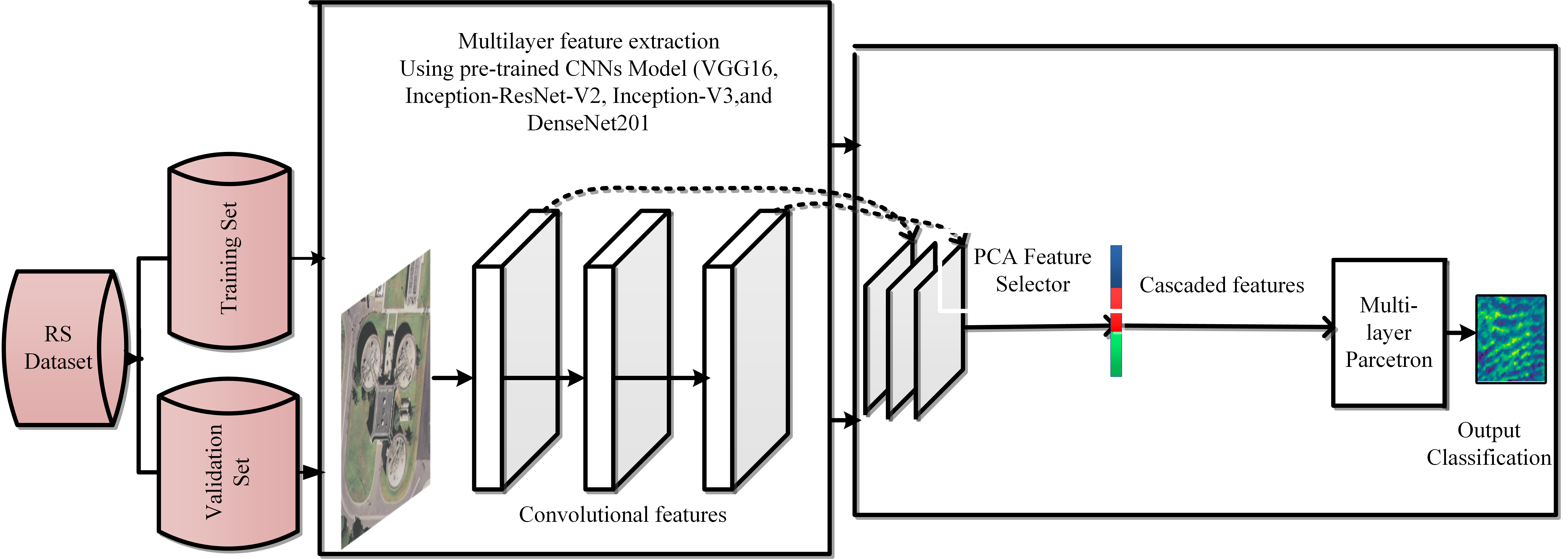
Deep learning classification is the state-of-the-art of machine learning approach. Earlier work proves that the deep convolutional neural network has successfully and brilliantly in different applications such as images or video data. Recognizing and clarifying the remote sensing aspect of the earth's surface and exploit land cover and land use (LCLU). First, this article summarized the remote sensing emerging application and challenges for deep learning methods. Second, we propose four approaches to learn efficient and effective CNNs to transfer image representation on the ImageNet dataset to recognize LCLU datasets. We use VGG16, Inception-ResNet-V2, Inception-V3, and DenseNet201 models to extract features from the EACC dataset. We use pre-trained CNNs on ImageNet to extract features. For feature selection we proposed principal component analysis (PCA) to improve accuracy and speed up the model. We train our model by multi-layer perceptron (MLP) as a classifier. Lastly, we apply the multi-granularity encoding ensemble model. We achieve an overall accuracy of 92.3% for the nine-class classification problem. This work will help remote sensing scientists understand deep learning tools and apply them in large-scale remote sensing challenges
Keywords:
Multi-granularity encoding neural networks (MGNNE)
; feature extraction
; multilayer perceptron (MLP)
; Principal component analysis (PCA)
; Remote Sensing image classification
; LCLU.
Copyright: This open access article is published under a Creative Commons CC BY 4.0 license, which permit the free download, distribution, and reuse, provided that the author and preprint are cited in any reuse.


