Submitted:
03 January 2021
Posted:
05 January 2021
Read the latest preprint version here
Abstract
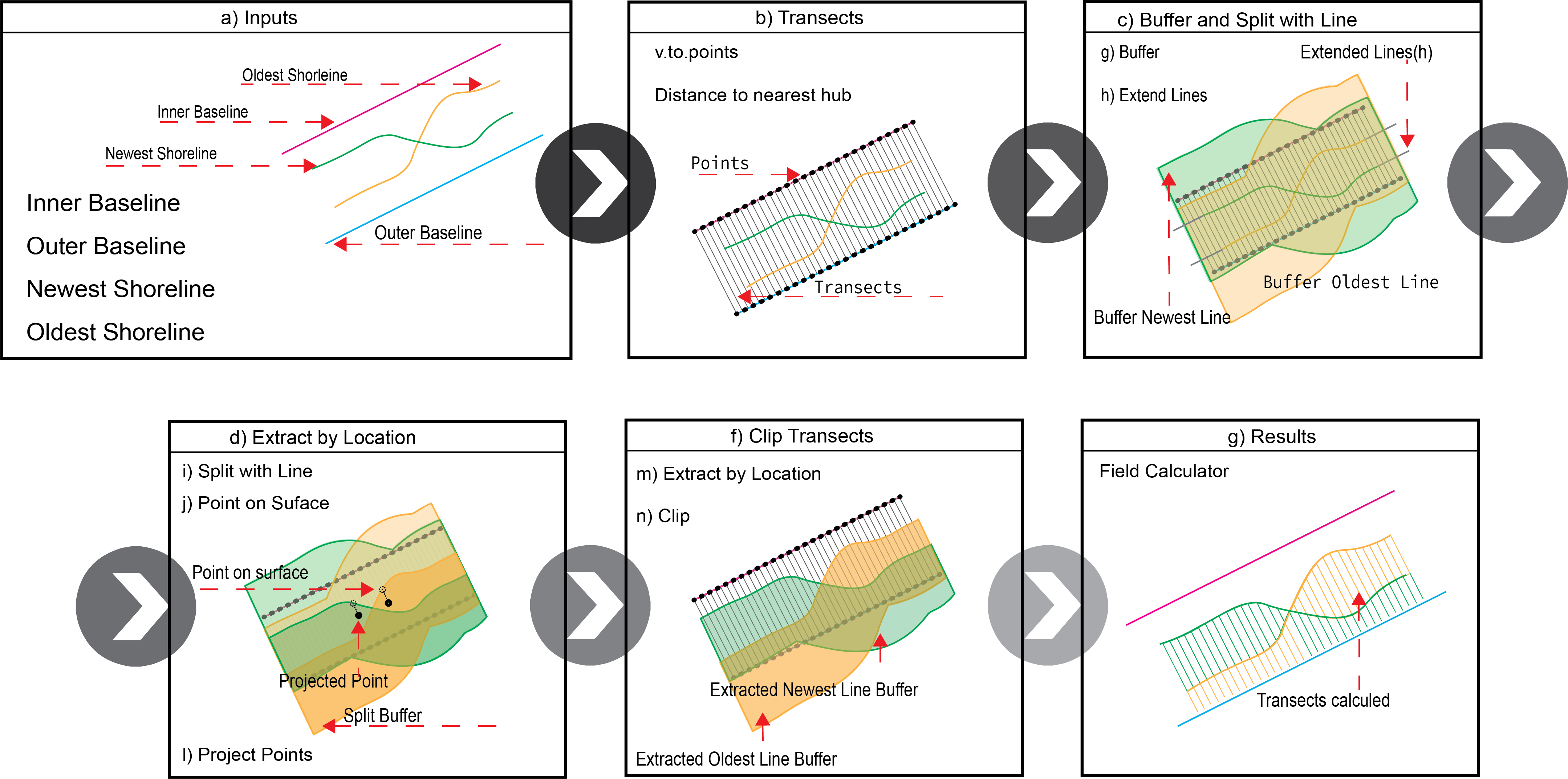
This paper presents the validation of the End Point Rate (EPR) tool for QGIS (EPR4Q), a tool built-in QGIS Graphical Modeler to calculate the shoreline change by End Point Rate method. The EPR4Q tries to fill the gap of user-friendly and free open-source tool for shoreline analysis in Geographic Information System environment, since the most used software - Digital Shoreline Analysis System (DSAS) - although is a free extension, is suited for commercial software. Besides, the best free open-source option to calculate EPR called Analyzing Moving Boundaries Using R (AMBUR), since it is a robust and powerful tool, the complexity and heavy processes can restrict the accessibility and simple usage. The validation methodology consists of applying the EPR4Q, DSAS, and AMBUR on different examples of shorelines found in nature, extracted from the U.S. Geological Survey Open-File. The obtained results of each tool were compared with Pearson correlation coefficient. The validation results indicate that the EPR4Q tool created acquired high correlation values with DSAS and AMBUR, reaching a coefficient of 0.98 to 1.00 on linear, extensive, and non-extensive shorelines, guarantying that the EPR4Q tool is ready to be freely used by the academic, scientific, engineering, and coastal managers communities worldwide.
Keywords:
Shoreline Evolution
; Open-Source Software
; GIS
; Modeling
Copyright: This open access article is published under a Creative Commons CC BY 4.0 license, which permit the free download, distribution, and reuse, provided that the author and preprint are cited in any reuse.


