
Submitted:
30 October 2018
Posted:
30 October 2018
You are already at the latest version
Abstract
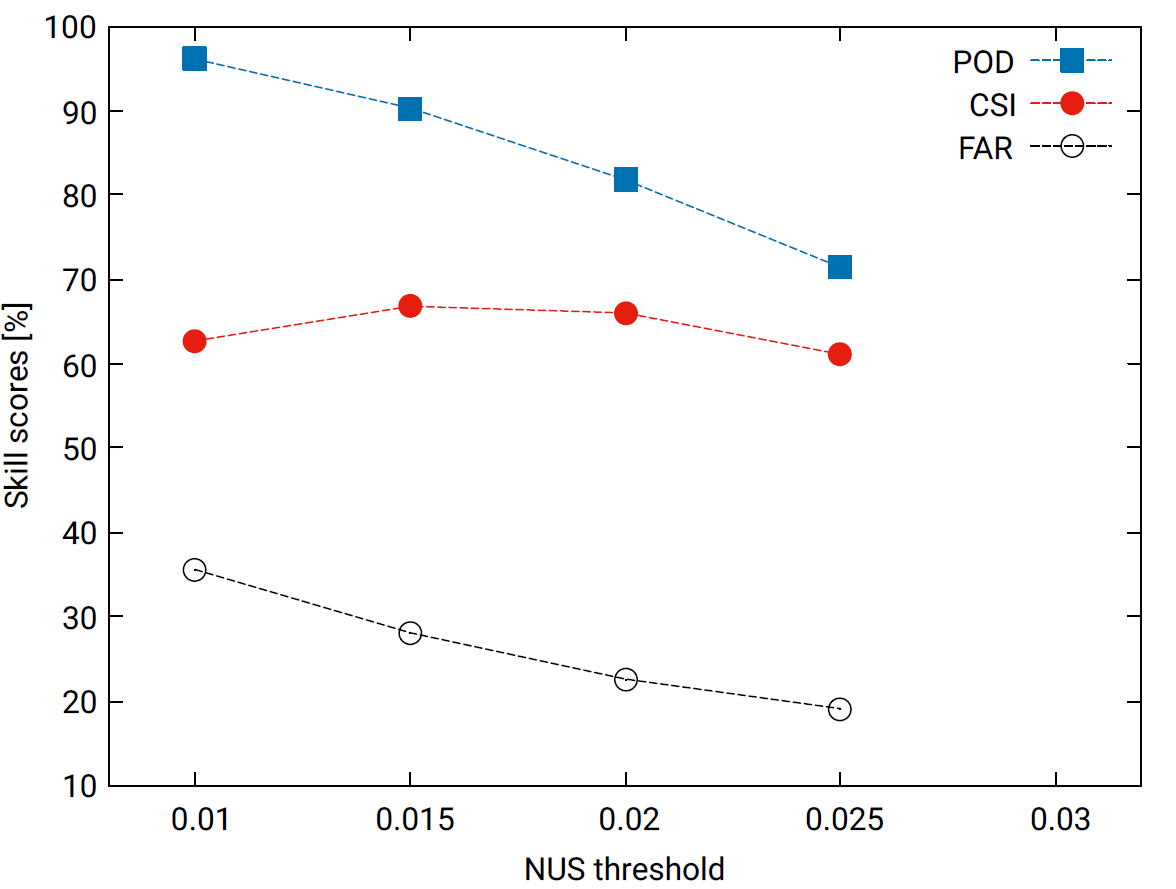
This study presents a novel approach for the early detection of developing thunderstorms. To date, methods for the detection of developing thunderstorms usually rely on accurate atmospheric motion vectors (AMVs) for the estimation of cooling rate of convective clouds, which corresponds to the updraft strength of the cloud objects. In this study we present a method for the estimation of the updraft strength that does not rely on AMVs. The updraft strength is derived directly from the satellite observations in the SEVIRI water vapor channels. For this purpose the absolute value of the vector product of two vectors derived from the observed radiances emitted by the water vapor channels in 2 subsequent satellite images is calculated. The x and y components of the vectors consists of the temporal change of the spatial brightness temperature gradients in x- and y-direction, the z component consists of the temporal variation of the brightness temperature at pixel level. The absolute value of the vector product is referred to as normalized updraft strength (NUS). The performance of the method has been investigated for 2 summer periods in 2016 and 2017 by validation with lightning data. Values of the Critical Success Index (CSI) of about 66 % for the 2016 period and 62 % for the 2017 period demonstrate the good performance of the method. The POD values for the experiments with the highest CSI values are 90.3 for 2016 period and 87.6 for the 2017 period, respectively The corresponding FAR values are 28.2% (2016) and 32.5 % (2017), respectively. In summary, the method has the potential to reduce the forecast lead time significantly, and can be quite useful in regions without a well maintained radar network.
Keywords:
developing thunderstorms
; convective initialization
; virtual brightness temperature fluxes
; normalized updraft strength.
Copyright: This open access article is published under a Creative Commons CC BY 4.0 license, which permit the free download, distribution, and reuse, provided that the author and preprint are cited in any reuse.


