
Submitted:
03 November 2026
Posted:
04 November 2026
You are already at the latest version
Abstract
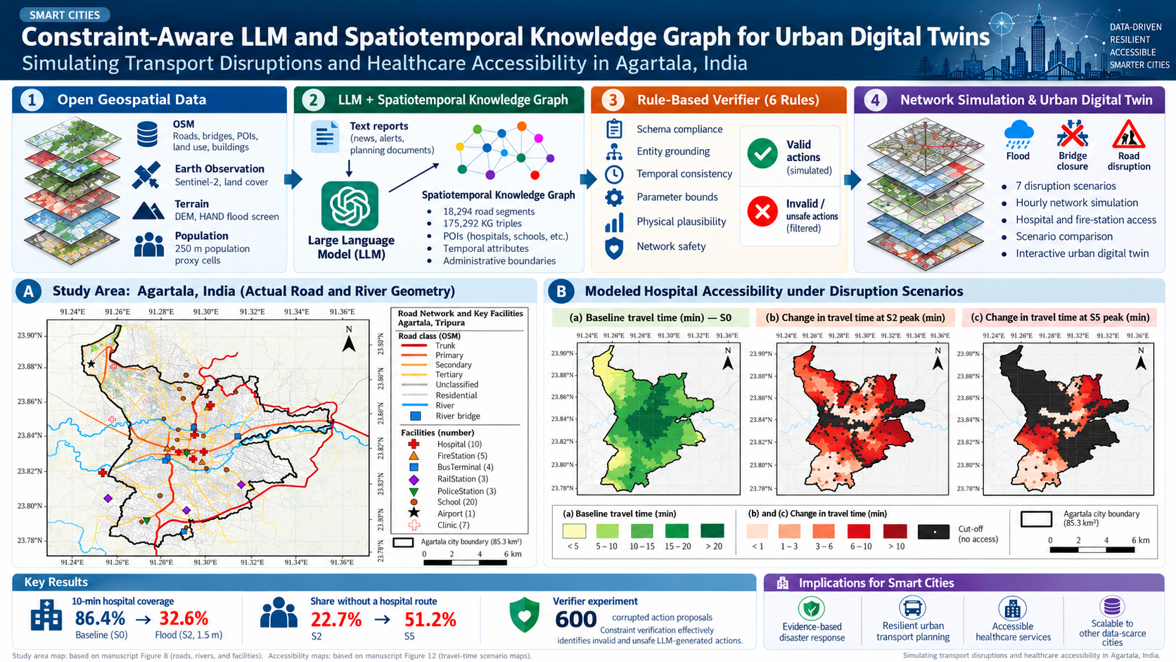
Most urban digital twins assume sensor feeds, traffic counts and calibrated flood models that mid-sized South Asian cities lack. Agartala, capital of Tripura in north-east India, is a case in point: its drains are largely unmapped, about 2% of its road segments carry a name in OpenStreetMap, and the Haora River rose above its danger level in August 2026. We couple a large language model (LLM) interface with a spatiotemporal knowledge graph (STKG), built from open data alone, and a six-rule constraint verifier, so that plain-language disruption reports become network states a simulator can use. Inundation was screened with a flow-routed height-above-nearest-drainage surface and converted to speed loss with a published depth–disruption curve. At a 1.5 m stage, demand within 10 min of a hospital fell from 86.4% to 32.6% at peak and 22.7% of demand lost all hospital access; closing the 31 river bridges as well raised that share to 51.2%. In 600 corrupted action proposals the verifier rejected every hallucinated, invalid, implausible and network-unsafe action and repaired every misspelled road name, but it missed all substitutions of one flood-prone road for another. The LLM is best treated as a translator whose output is always checked against the graph.
Keywords:
urban digital twin
; large language model
; knowledge graph
; constraint verification
; flood
; road network accessibility
; height above nearest drainage
; OpenStreetMap
; data-scarce cities
; Agartala
Copyright: This open access article is published under a Creative Commons CC BY 4.0 license, which permit the free download, distribution, and reuse, provided that the author and preprint are cited in any reuse.