
Submitted:
26 May 2026
Posted:
27 May 2026
You are already at the latest version
Abstract
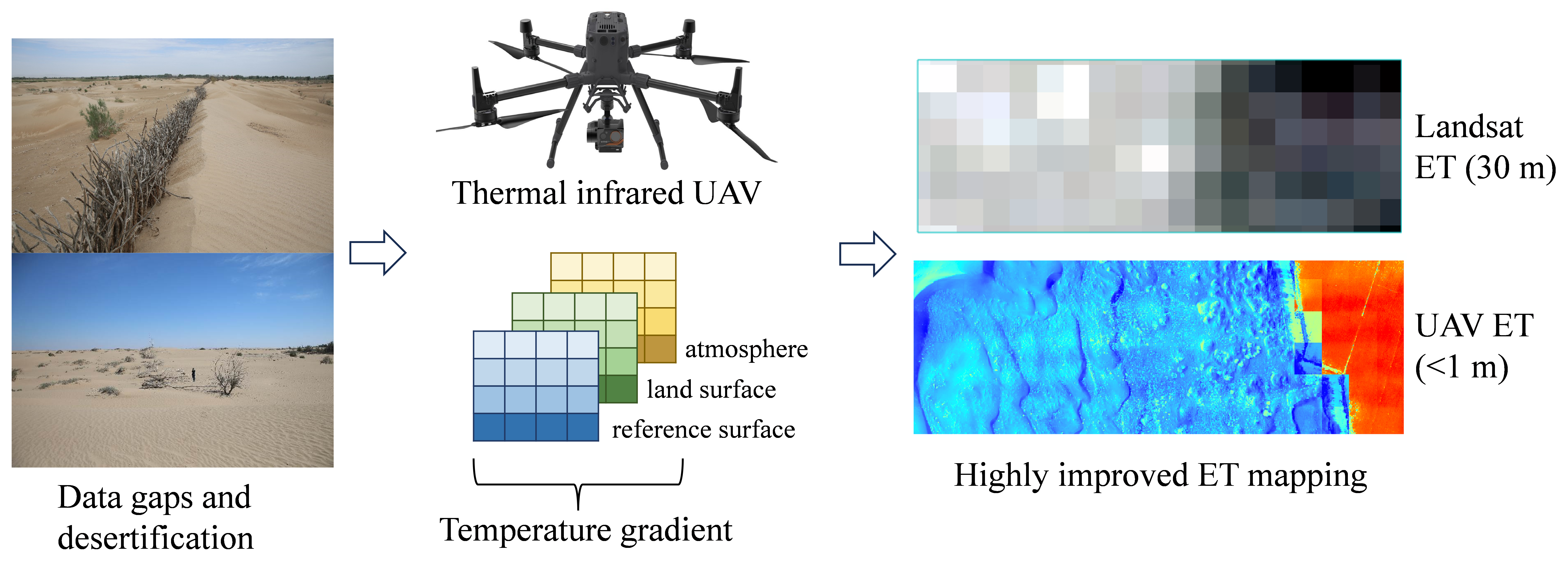
The desert-oasis ecotone is a critical ecological buffer in arid regions, and its evapo-transpiration (ET) process is vital for local water cycling and ecosystem stability. However, due to sparse meteorological stations and the coarse spatial resolution of satellite remote sensing, traditional methods struggle to accurately capture the highly heterogeneous spatial patterns of ET in these transition zones. This study focuses on typical desert-oasis ecotones in the Hexi Corridor and proposes a novel method for high-resolution ET estimation by integrating unmanned aerial vehicle (UAV)-based thermal infrared remote sensing with a Three-Temperature (3T) model. A UAV equipped with a thermal infrared camera was used to acquire land surface tempera-ture (LST) data at meter-scale resolution. Combined with meteorological data and vegetation parameters, the 3T model was constructed and solved to produce high-precision ET maps. The model's performance was validated spatially against the Surface Energy Balance Algorithm for Land (SEBAL) model and at the point scale against a two -source model. The results show that: 1) The 3T model effectively cap-tured the spatial gradient of decreasing ET from cropland, through shelterbelts, to de-sert areas, with ET values ranging from 0.12 to 10.69 mm d⁻¹; 2) The model performed well in validation, with coefficients of determination (R²) of 0.80–0.98, indices of agreement (IOA) of 0.83–0.99 against SEBAL, and a mean absolute error of 0.38 mm d⁻¹ against the two-source model; 3) The model performed best in cropland areas (R²=0.92, RMSE=0.24 mm d⁻¹), while a slight overestimation was observed in structurally com-plex shelterbelts. This study demonstrates the effectiveness of combining UAV thermal infrared data with the 3T model for high-resolution ET simulation in complex ecologi-cal transition zones, providing a reliable technical approach for detailed ecohydrolog-ical monitoring and optimized water resource allocation in arid regions.
Keywords:
evapotranspiration
; UAV thermal infrared
; three-temperature model
; desert-oasis ecotone
; high-resolution mapping
; model validation
Copyright: This open access article is published under a Creative Commons CC BY 4.0 license, which permit the free download, distribution, and reuse, provided that the author and preprint are cited in any reuse.


