Submitted:
18 May 2026
Posted:
19 May 2026
You are already at the latest version
Abstract
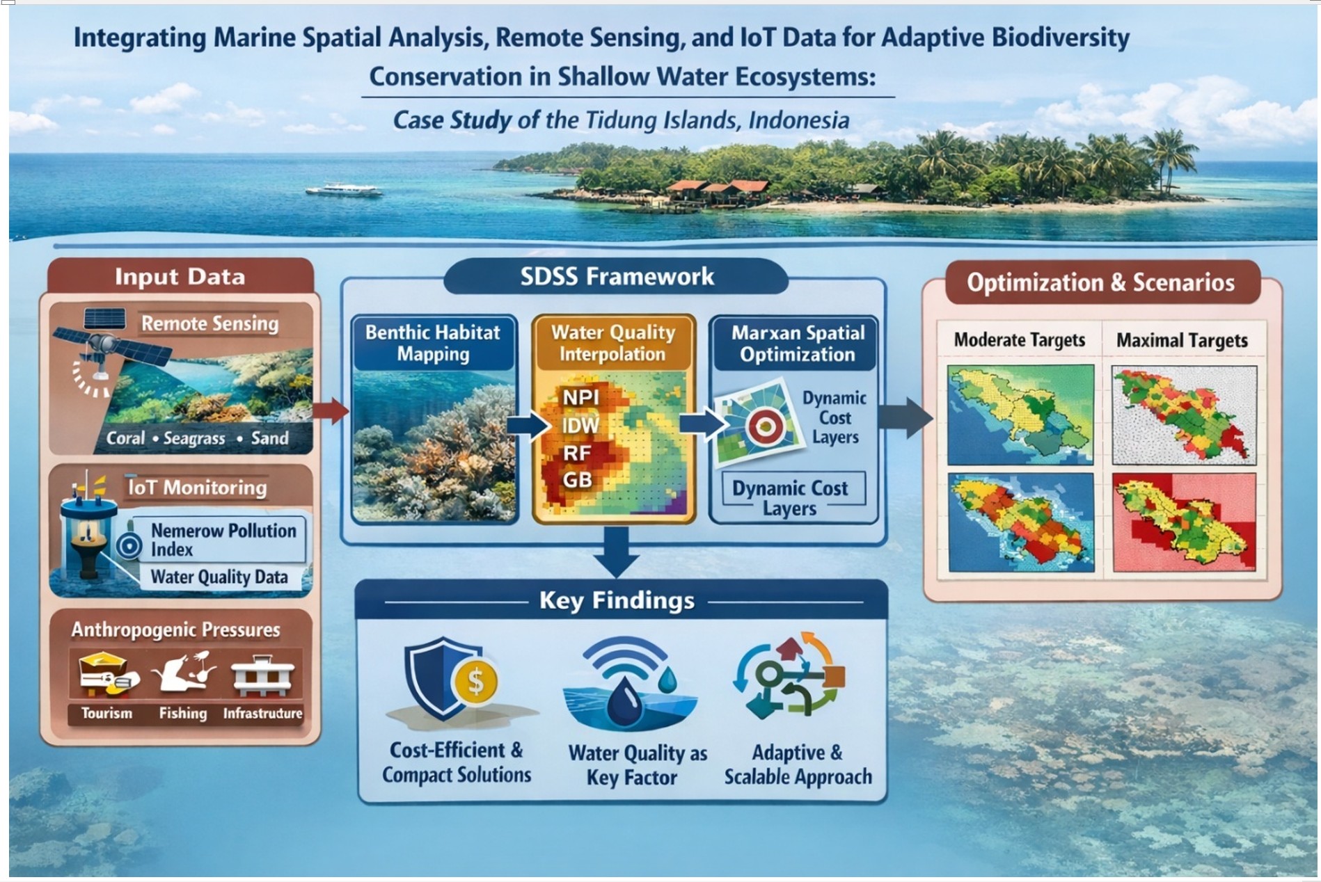
Coastal biodiversity conservation is challenged by fragmented datasets and the limited integration of environmental conditions into marine spatial planning (MSP). This study develops an operationalized adaptive Marine Spatial Planning (MSP) to support biodiversity conservation by linking remote sensing data, IoT-based water quality measurements, and spatial optimization within Spatial Decision Support System (SDSS). The Tidung Islands are used as a case study, where benthic habitats are mapped from 3 m PlanetScope imagery. Water quality observations are processed into the Nemerow Pollution Index (NPI) and subsequently interpolated through an ensemble approach that combines inverse distance weighting, random forest, and gradient boosting. A key innovation of this study is the incorporation of the Nemerow Pollution Index (NPI) as a dynamic environmental cost layer within Marxan-based conservation prioritization. These data were incorporated alongside anthropogenic pressures to evaluate multiple conservation scenarios The ensemble interpolation demonstrated strong predictive performance (R²=0.76;MAE=0.0306), enabling reliable spatial representation of environmental conditions. The results show that integrating environmental quality into MSP significantly improves spatial efficiency, reduces fragmentation, and enhances ecological representation compared to conventional approaches based on static variables. Moderate conservation targets (≈30%) produced the most optimal solutions (~2,200 cost; ~11 km boundary), while more ambitious targets resulted in fragmented and inefficient spatial configurations. The proposed framework offers a transferable approach for data-limited coastal regions, contributing to the advancement of adaptive biodiversity conservation strategies.
Keywords:
marine spatial planning
; remote sensing
; marxan
; nemerow pollution index
; benthic habitat
; and adaptive biodiversity conservation
Copyright: This open access article is published under a Creative Commons CC BY 4.0 license, which permit the free download, distribution, and reuse, provided that the author and preprint are cited in any reuse.


