Submitted:
03 January 2025
Posted:
06 January 2025
You are already at the latest version
Abstract
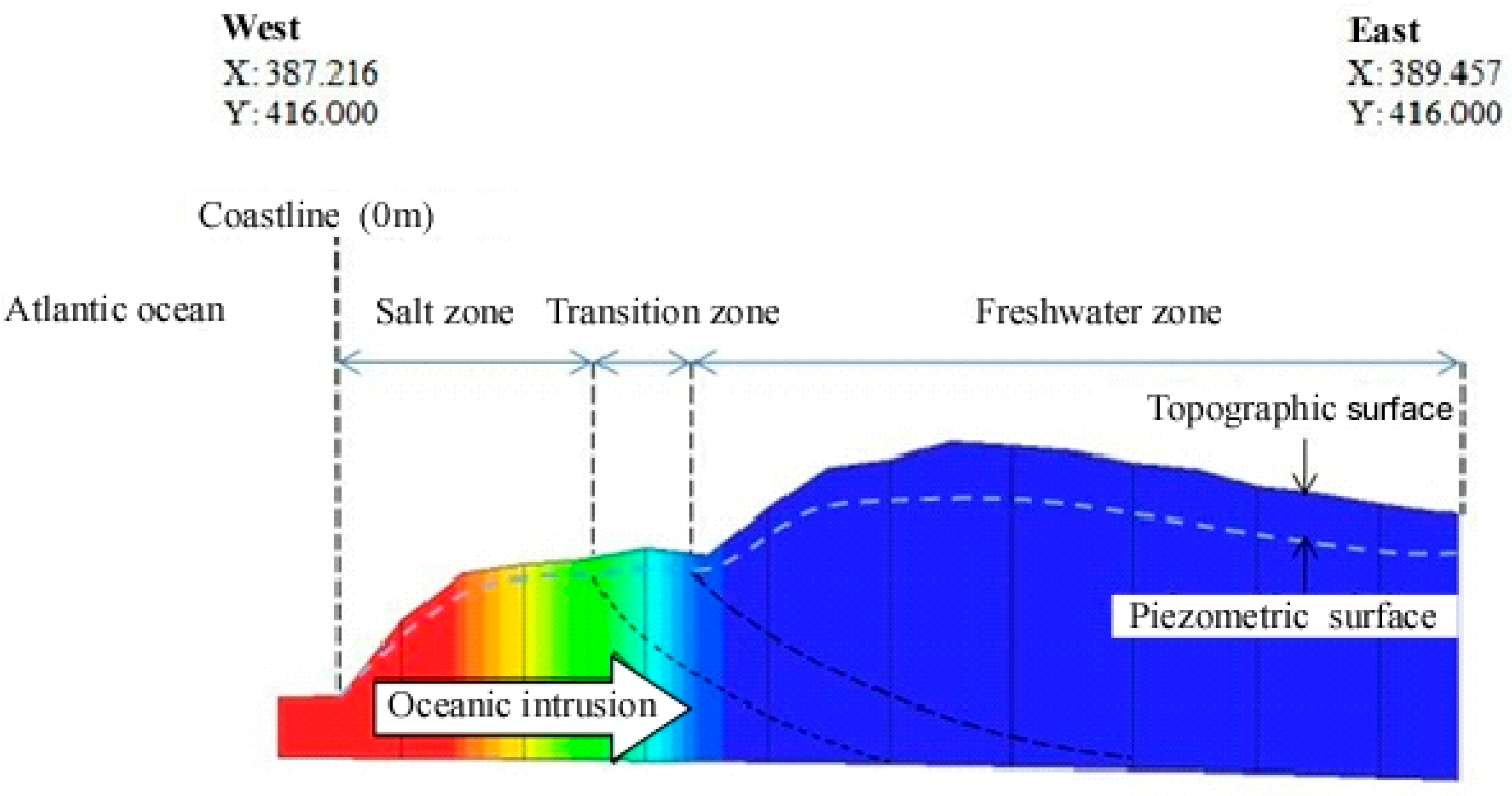
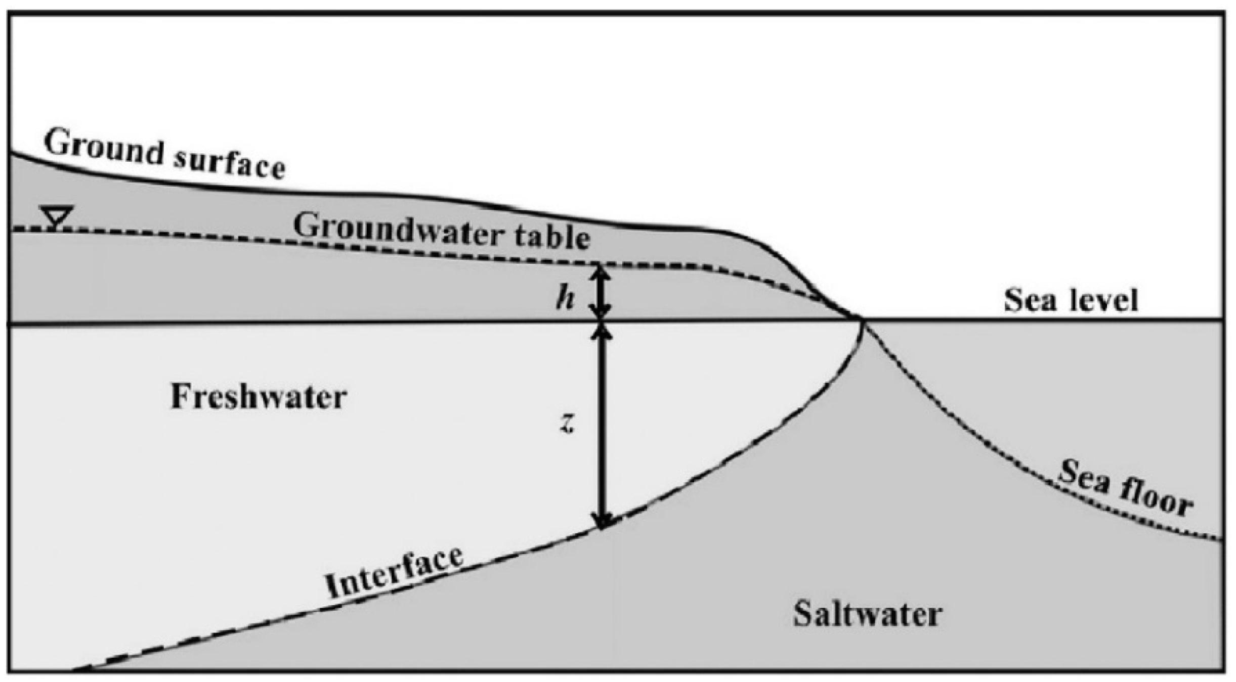
The article presents a hydrogeological study through numerical modeling of the coastal basin of Rharb, located in the northwest of Morocco, a region characterized by a semi-arid environment. This basin consists of two aquifers of Plioquaternary and Upper Quaternary age, separated by a lower Quaternary aquitard. The Plioquaternary aquifer hosts abundant and good-quality groundwater, while the Upper Quaternary aquifer hosts a mediocre quality groundwater with negligible hydrogeological interest. In this semi-arid context, for health reasons, a significant portion of the population exploits the second, deeper aquifer. Unfortunately, this is not the case for the majority of the population, who cannot access the second aquifer due to financial constraints (exploitation costs). Overexploitation of the Plioquaternary aquifer by agricultural pumping causes water stress, leading to a decline in piezometric levels and seawater intrusion, causing a degradation of the local hydrosystem. The main objective of the study is to develop a decision support tool, in the form of a Multicodes numerical environment, to understand the circulation and storage mode of groundwater, aimed at maintaining this resource and preserving the environment, considering both quantitative and qualitative constraints. The creation of this digital environment detailing the intrinsic characteristics of the basin leads to monitoring the quantity and quality of both aquifers in response to external influences such as recharge, exploitation and pollution. The development of a transient hydrodynamic model over a 15 years period confirms that overexploitation of the deep aquifer is the main cause of the decline in groundwater level. Subsequently, the development of a hydrodispersive model indicates higher salt concentrations in the shallow aquifer than in the deeper aquifer, and locates the seawater. Despite the qualitative constraints, the quality of the deep aquifer is relatively preserved thanks to the clayey aquitard acting as a barrier against the infiltration of agricultural pollutants in the central basin, and the renewal of these waters in the recharge zones at the peripheries. However, deficit hydraulic balances signal the beginning of a relatively critical period.
Keywords:
1. Introduction
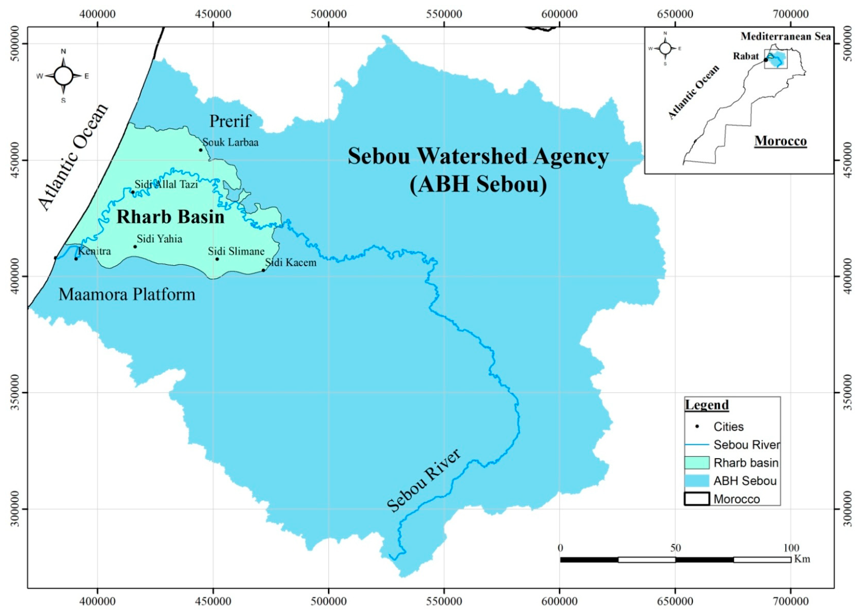
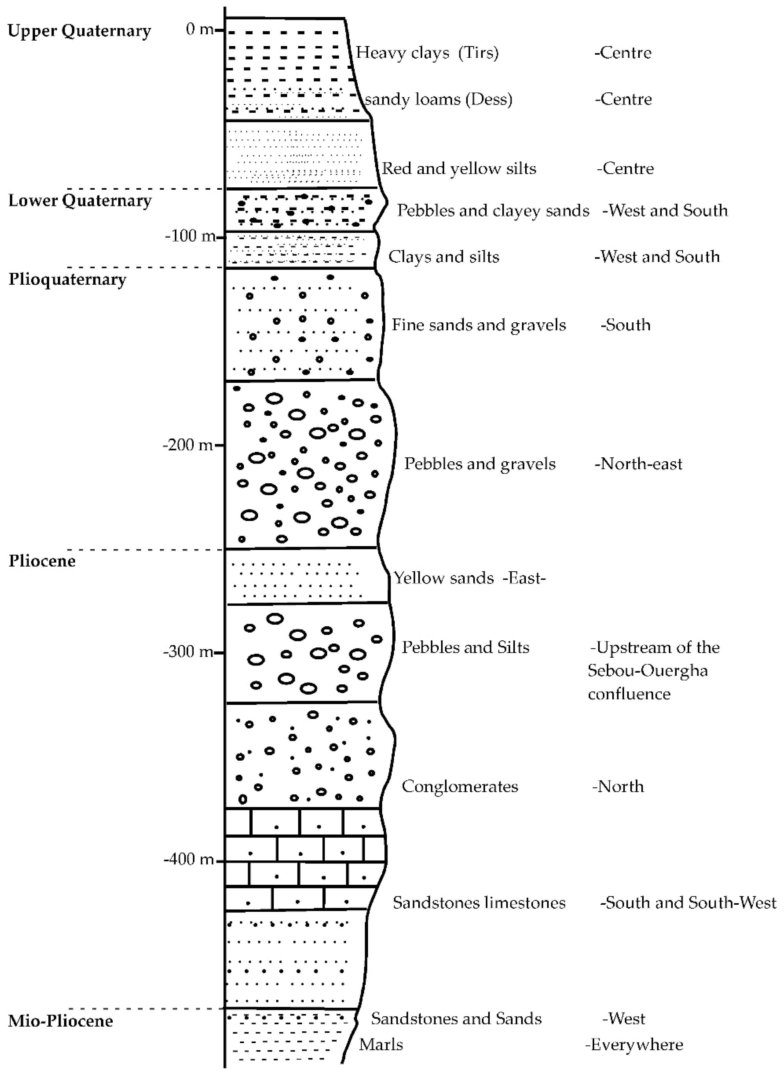
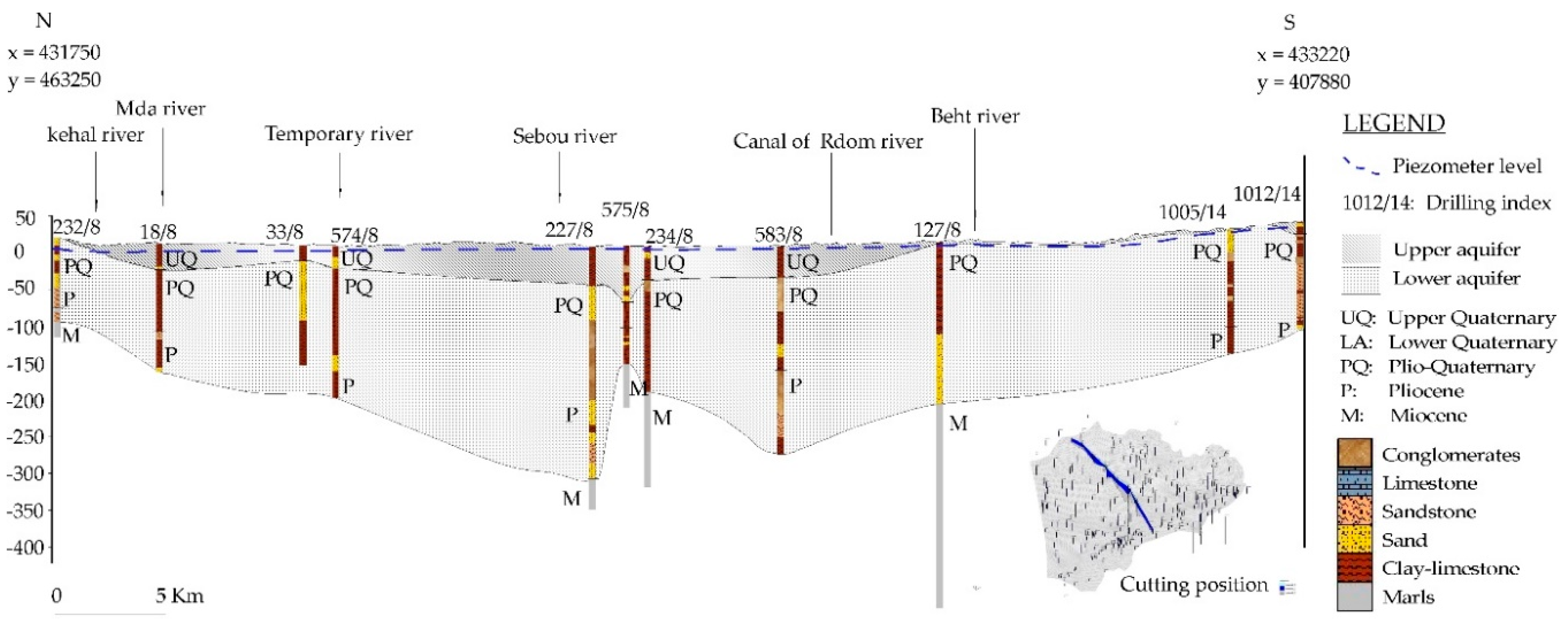
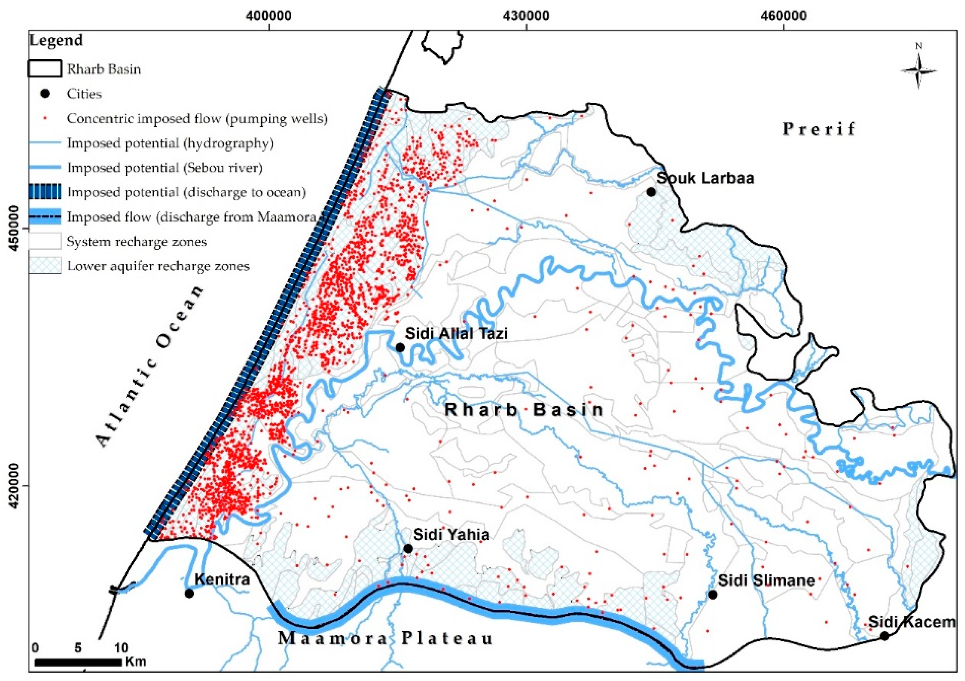
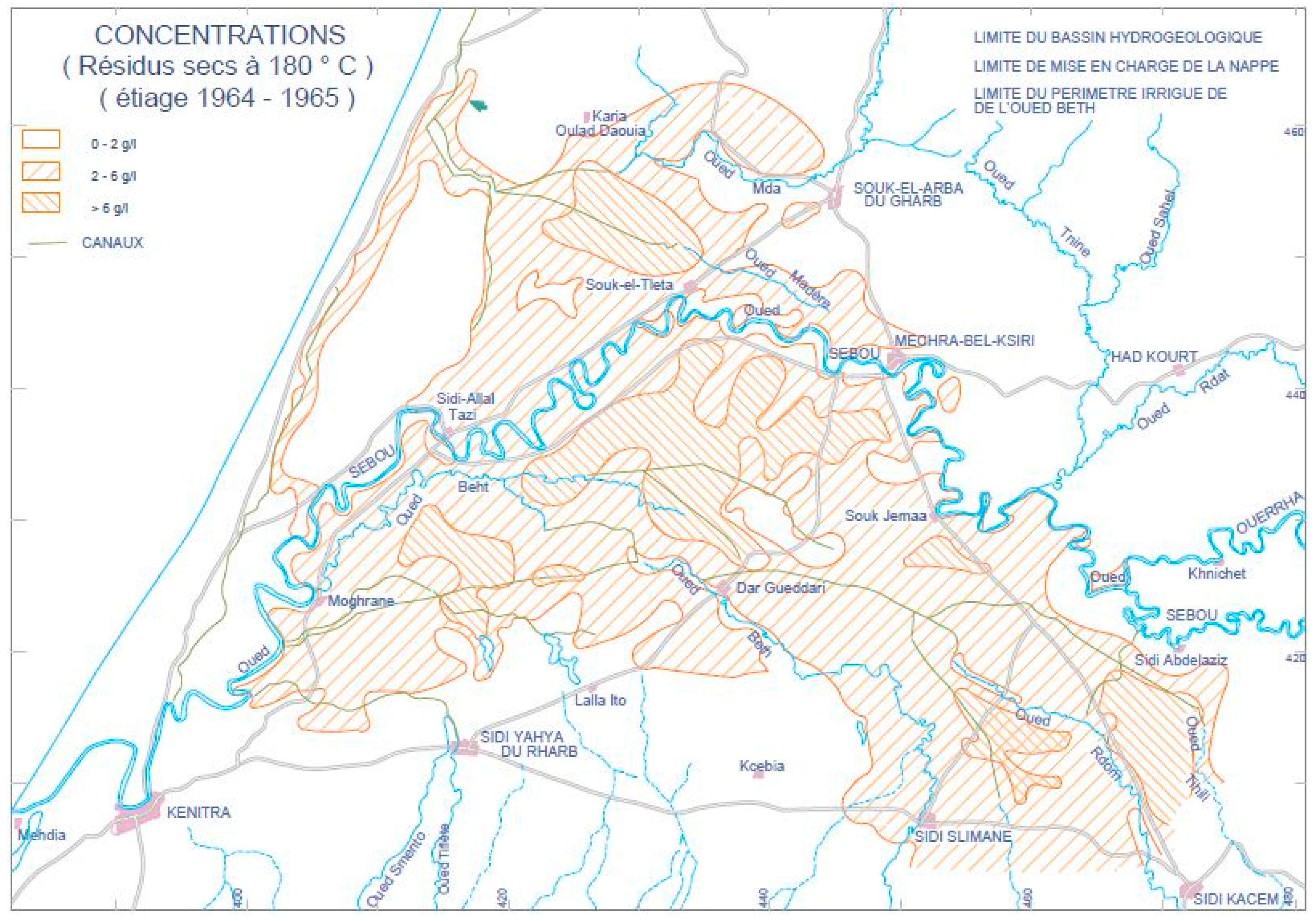
2. Geographical, Geological, and Hydrogeological Framework
3. Transient Hydrodynamic Model
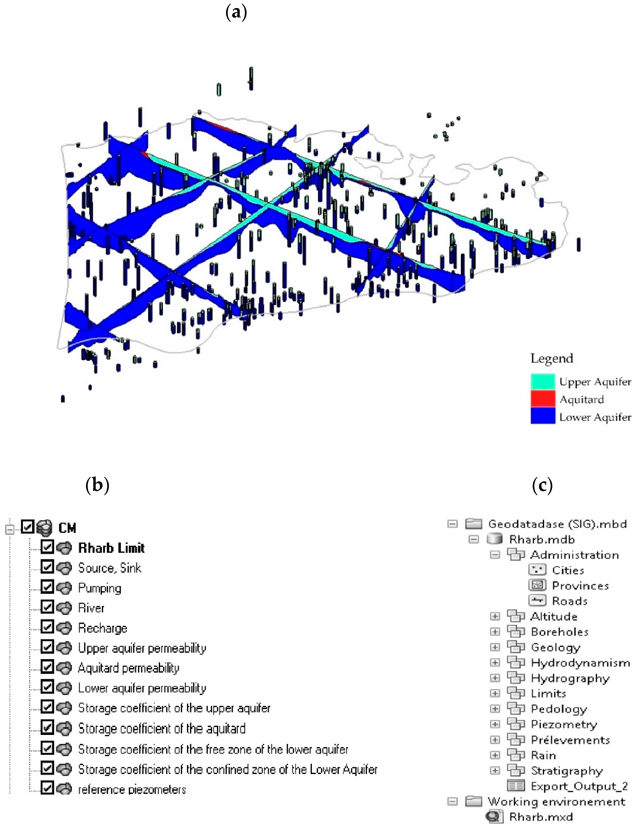
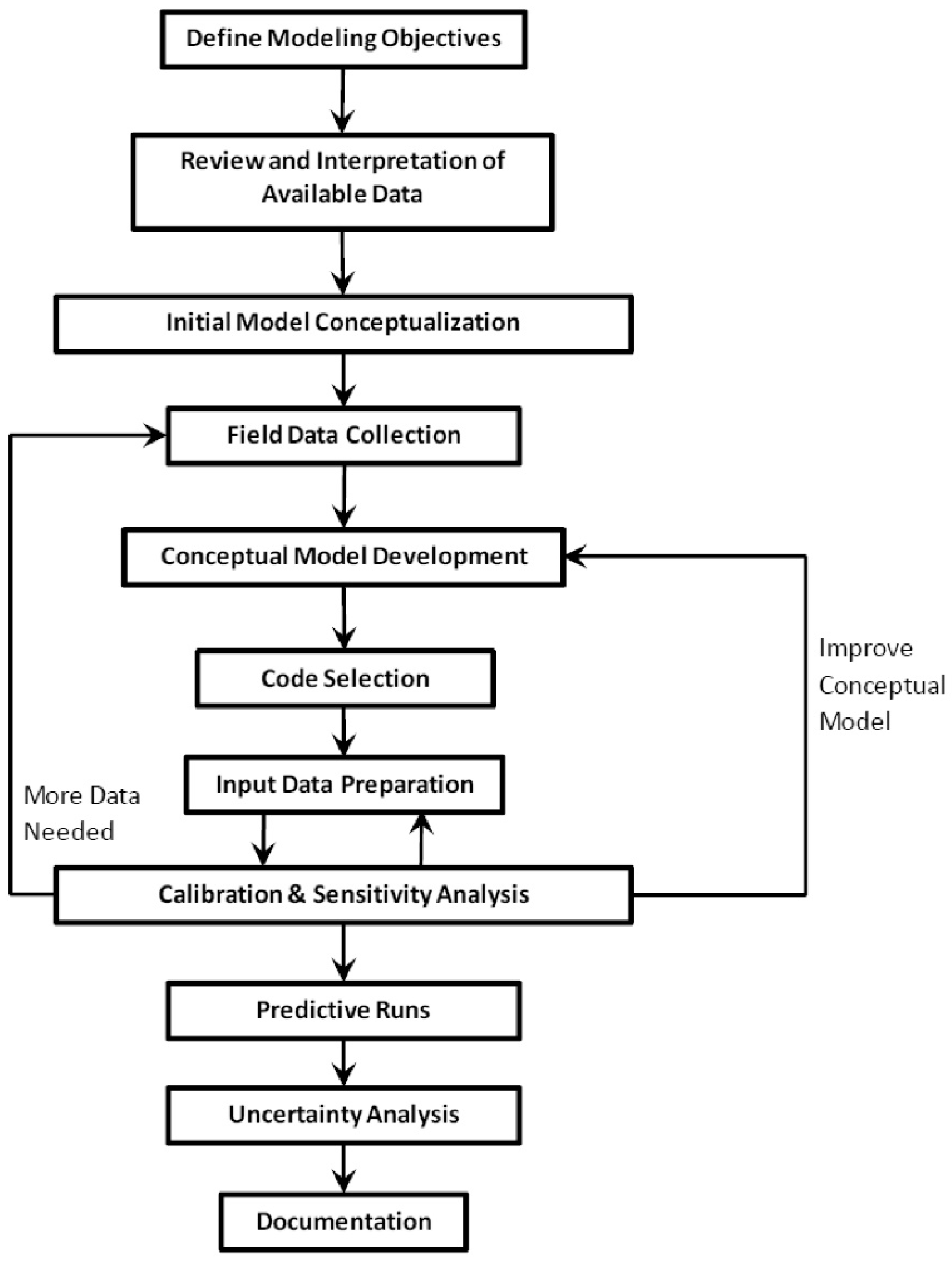
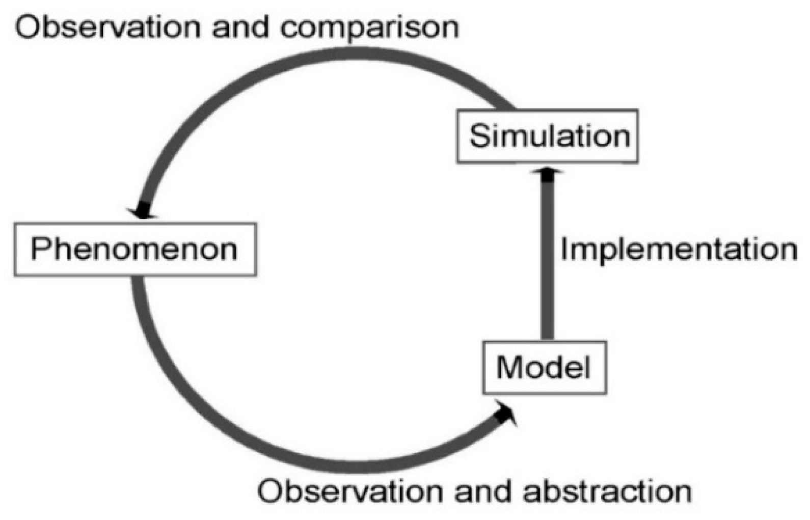
3.1. Method and Tools
3.1.1. Simulation Period, Spatio-Temporal Discretization, and Boundary Conditions
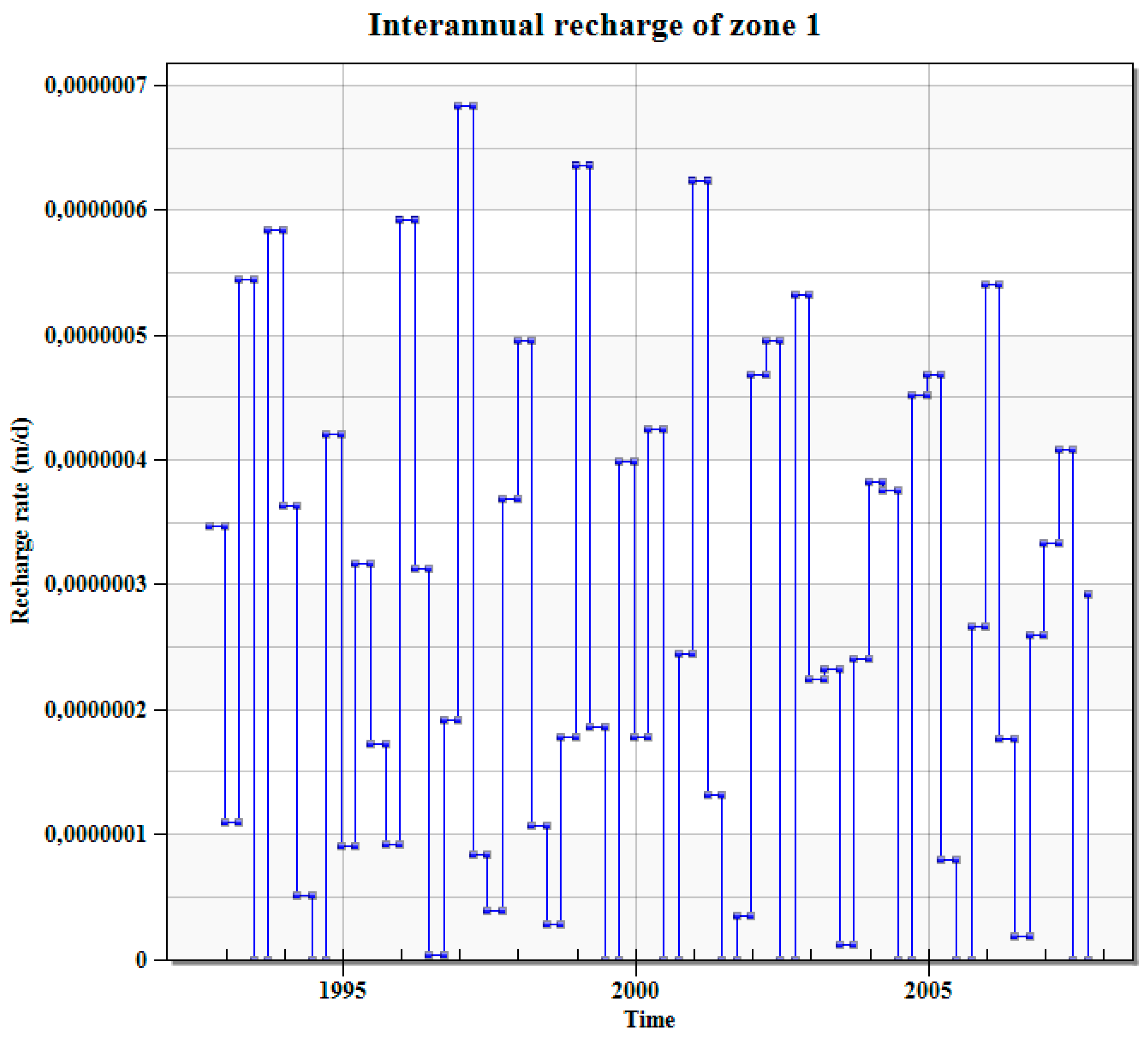
3.1.2. Inputs and Outputs of the Transient Model Include
3.2. Results and Discussion
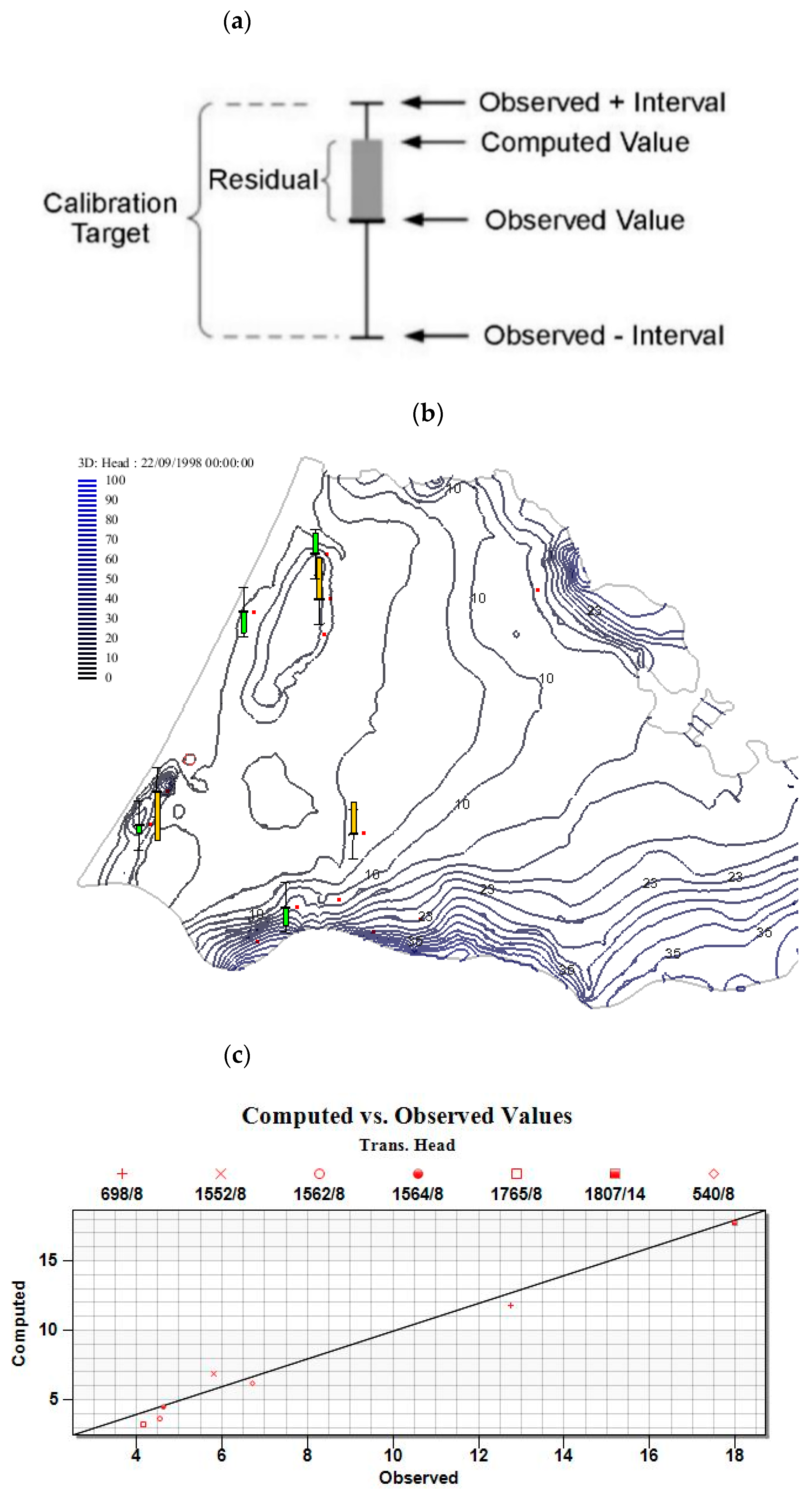
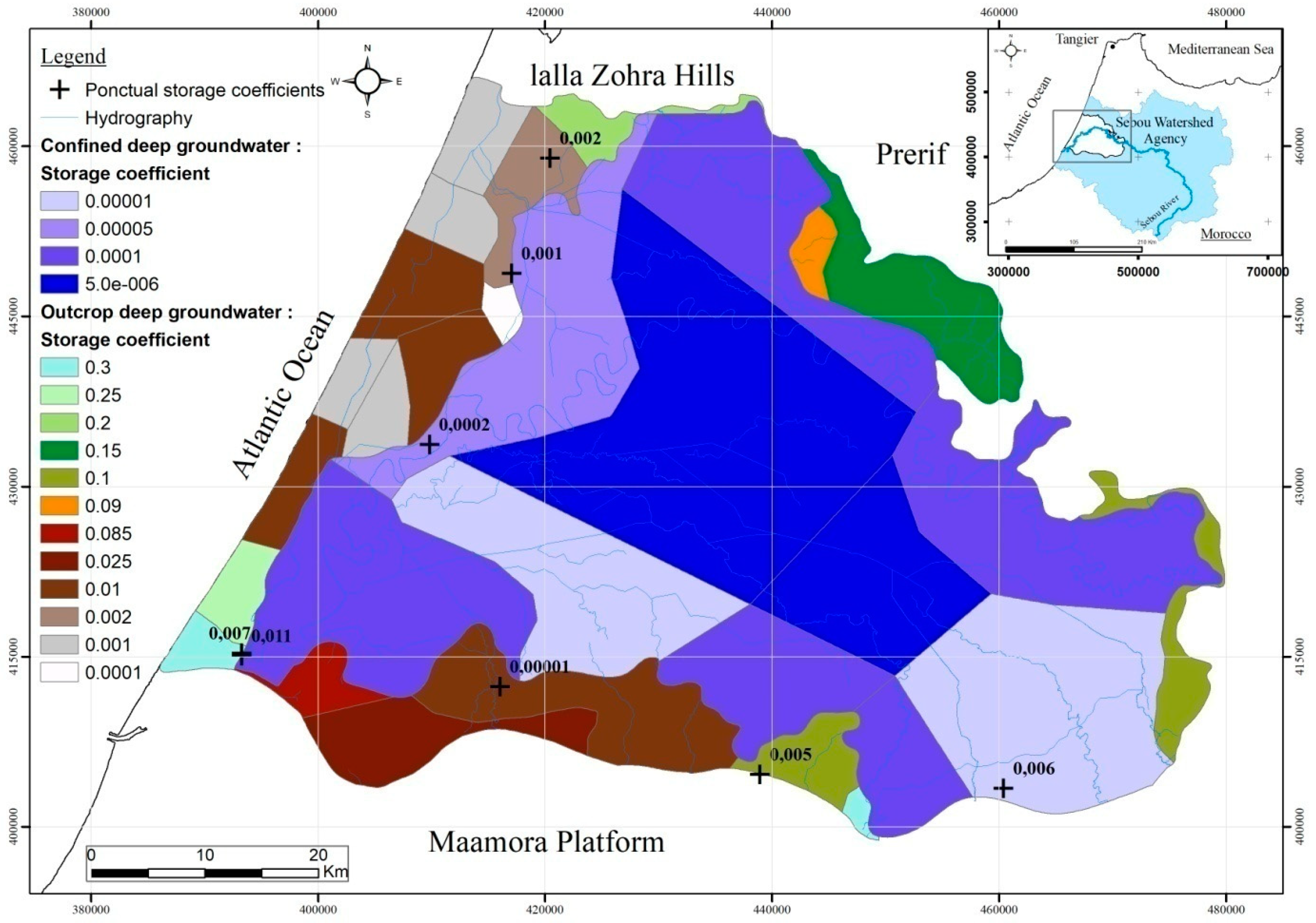
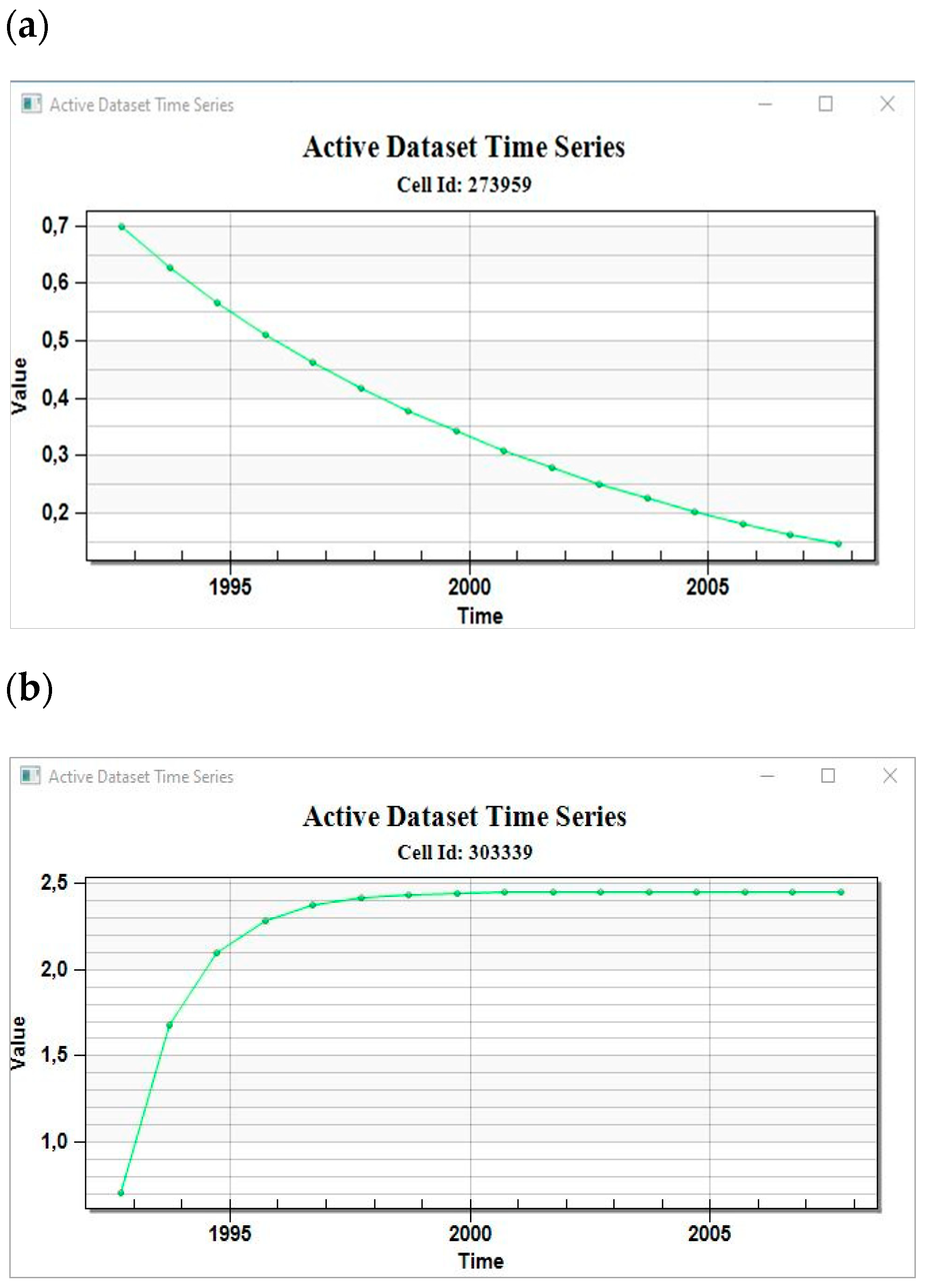
3.2.1. Storage Coefficients of the Plioquaternary Aquifer
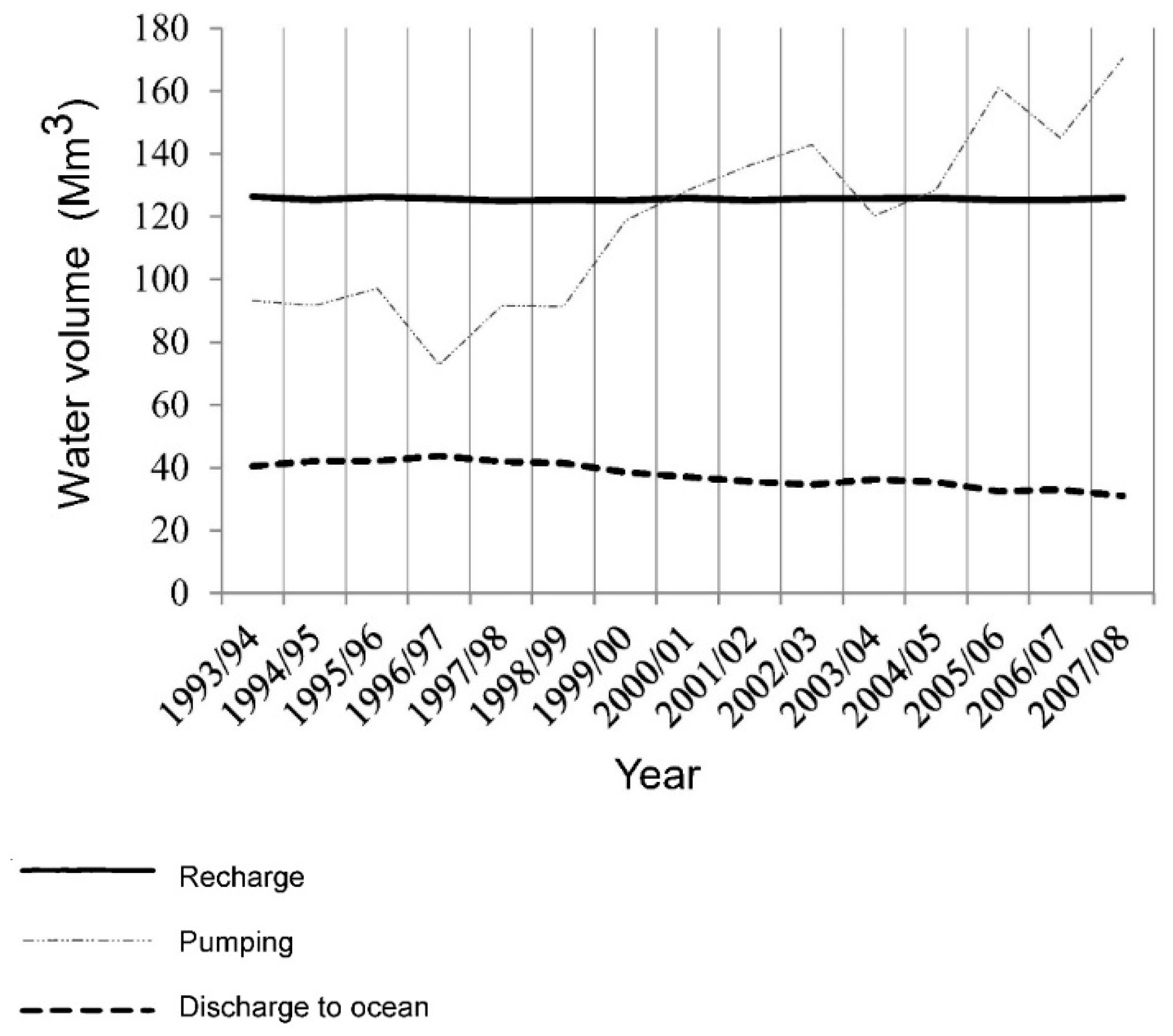
3.2.2. Water Balances
4. Hydrodispersive Model
4.1. Methodology and Tools
4.1.1. Input for the Hydrodispersive Model
- Mass transport model (MT3DMS)

| Data | Description |
|---|---|
| Geometry | Stratigraphic trilayer model. |
| Hydrogeological parameters | Hydraulic conductivities, Porosity, Dispersivity, etc. |
| External stresses and initial conditions | Initial water concentrations : rain, groundwater, etc. |
| Boundary conditions | Imposed volumic concentration of the nappe-ocean boundary. |
- +Variable Density Flow Model (SEAWAT)
| Variable | Reference Value | Slope |
|---|---|---|
| Density | 1,000 kg/m3 | n/a |
| Salt Concentration | 0 mg/L | 0.714 |
| Temperature | 25 oC | -0.375 kg/m3 / oC |
| Pressure Head | 0 m | 4.46x10⁻³ kg/m4 |
4.1.2. Simulation Period and Boundary Conditions
4.2. Results and Discussion
4.2.1. Mass Transport Model (MT3DMS)
4.2.2. Variable Density Model (SEAWAT)
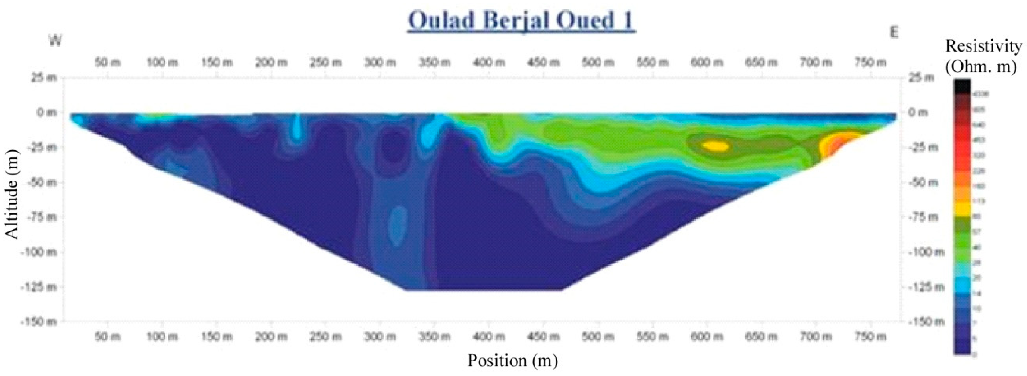
4.2.3. Limitation of the Hydrodispersive Model: ‘’The Representation of the Displacement of the Sea Wedge’’
5. Conclusion
Author Contributions
Funding
Data Availability Statement
Acknowledgements
Conflicts of Interest
Appendix A
| IRE | X (m) | Y (m) | S |
| 1521 | 417025 | 448800 | 0.001 |
| 1541 | 420400 | 458950 | 0.002 |
| 1716 | 438900 | 404600 | 0.005 |
| 1819 | 409800 | 433700 | 0.0002 |
| 3312 | 460350 | 403350 | 0.006 |
| 3415 | 393270 | 415270 | 0.007 |
| 3416 | 393242 | 415040 | 0.11 |
Appendix B
| From | To (m) | Lithology | Stratigraphy | Z (m) |
| 0 | 3 | Topsoil | UQ | 5.32 |
| 3 | 9 | Yellow clayey sand | PQ | 2.32 |
| 9 | 11 | Compact clay | PQ | -3.68 |
| 11 | 24 | Yellow sandy clay | PQ | -5.68 |
| 24 | 30 | Yellow clayey sand | PQ | -18.68 |
| 30 | 33 | Sandstone and Yellow Sand | PQ | -24.68 |
| 33 | 35 | Sandy clay | PQ | -27.68 |
| 35 | 43 | Sandstone and Yellow Sand | PQ | -29.68 |
| 43 | 45 | Red sandy clay | PQ | -37.68 |
| 45 | 46 | Compact marl | PQ | -39.68 |
| 46 | 54 | Clay | PQ | -40.68 |
| 54 | 61 | Sandstone and Sand | PQ | -48.68 |
| 61 | 73 | Red Clay and Sand | PQ | -55.68 |
| 73 | 76 | Clay | PQ | -67.68 |
| 76 | 81 | Clay and Sand | PQ | -70.68 |
| 81 | 84 | Yellow clay | PQ | -75.68 |
| 84 | 88 | Yellow sandstone | PQ | -78.68 |
| 88 | 94 | Clay | PQ | -82.68 |
| 94 | 118 | Yellow Sands and Sandstone | PQ | -88.68 |
| 118 | 127 | Red sand | PQ | -112.68 |
| 127 | 151 | Sandstone, Yellow Clay and Sand | PQ | -121.68 |
| 151 | 153 | Compact marl | PQ | -145.68 |
| 153 | 164 | Sandstone and Sand | PQ | -147.68 |
| - | - | -158.68 |
References
- ABHS, 2011. Etude d’actualisation du plan directeur d’aménagement intégré des ressources en eau du bassin hydraulique de Sebou. Agence du Bassin Hydraulique de Sebou: Fès, Morocco, p. 103.
- Ormvag, O.R., 1996. Étude pédologique au 1/20 000 de la troisième tranche d’irrigation (TTI). Zone centrale et Zone sud. Office Régional de Mise en Valeur Agricole du Gharb: Kénitra, Morocco, Rapport inédit, 452 p.
- Hakimi, S.; Hessane, M.A.; Lyazidi, R. Elaboration of a steady-state hydrodynamic model: The case of the Gharb basin, Morocco. Comunic. Geol. 2020, 106, 11–27.
- Lyazidi, R.; Hessane, M.A.; Filali, J.M.; Bahir, M.; Ouhamdouch, S. Système d’aide à la décision pour la gestion de la ressource en eau en zones semi-arides - Cas de l’aquifère Gareb-Bouareg (Rif, Maroc). Comunic. Geol. 2017, 104, 43–52. https://www.lneg.pt/iedt/unidades/16/paginas/26/30/247.
- Flinch, J.F. Tectonic evolution of the Gibraltar Arc. Ph.D. Thesis, Rice University: Houston, TX, USA, 1993, p. 212.
- Zouhri, L.; Gorini, C.; Mania, J.; Deffontaines, B.; El, A.; Zerouali, H. Spatial distribution of resistivity in the hydro-geological systems, and identification of the catchment area in the Rharb basin, Morocco. Hydrol. Sci. J. 2004, 49, 3.
- Cirac, P., 1985. Le bassin sud rifain occidental au Néogène supérieur. Evolution de la dynamique sédimentaire et de la Paléographie au cours d’une phase de comblement. Thèse, Doct. d’État, Univ. Bordeaux: Bordeaux, France, p. 285.
- Toto, E.A.; El Miloudi, A.; El Basri, M.; Hafid, L.; Zouhri, L.; El Mouraouah, S.; Benammi, M.; El Mouraouah, A.; Iben-Brahim, A.; Birouk, A.; Kasmi, M. New geophysical and geological evidence for the present-day southernmost active deformational front of the Rif thrust and fold belt and the oceanic accretionary prism of Cadiz: the Dhar Doume Lalla Zahra fault, Northwestern Atlantic Coastal Morocco. Environ. Earth Sci. 2012, 67, 2411–2422.
- Tahayt, A.; Mourabit, T.; Rigo, A.; Feigl, K.L.; Fadil, A.; McClusky, S.; Reilinger, R.; Seroukh, M.; Ouazzani-Touhami, A.; BenSari, D.; Vernant, P. Mouvements actuels des blocs tectoniques dans l’arc Bético-Rifain à partir des mesures GPS entre 1999 et 2005. C.R. Geoscience 2008, 400–413.
- Koulali, A.; Ouazar, D.; Tahayt, A.; King, R.W.; Vernant, P.; Reilinger, R.E.; McClusky, S.; Mourabit, T.; Davila, J.M.; Amraoui, N. New GPS constraints on active deformation along the Africa-Iberia plate boundary. Earth Planet. Sci. Lett. 2011, 308, 1, 211–217. [CrossRef]
- Platt, J.P.; Whitehouse, M.J.; Kelley, S.P.; Carter, A.; Hollick, L. The ultimate arc: Differential displacement, oroclinal bending, and vertical axis rotation in the External Betic-Rif arc. Tectonics 2003, 22, 3.
- McDonald, M.G. A Modular Three-Dimensional Finite-Differences Ground-Water Flow Model. U.S. Geological Survey: Dallas, TX, USA, 1984.
- Wels, C.; Mackie, D.; Scibek, J. Guidelines for Groundwater Modelling to Assess Impacts of Proposed Natural Resource Development Activities. British Columbia Ministry of Environment: Victoria, British Columbia, Canada, 2012, p. 289.
- Tranouez, P. Contribution à la modélisation et à la prise en compte informatique de niveaux de descriptions multiples. Application aux écosystèmes aquatiques. Thèse de Doctorat, Univ. du Havre: Le Havre, France, 2005, p. 191.
- De Marsily, G. Cours d’Hydrogéologie. Université Pierre et Marie Curie: Paris, France, 2004, p. 226.
- Combe, M., 1969. Carte hydrogéologique de la plaine du Gharb au 1/100 000. Notes et Mémoires, Service Géologique du Maroc: Rabat, Morocco, p. 221 bis.
- Zheng, C.; Wang, P. MT3DMS: A Modular Three-Dimensional Multispecies Transport Model for Simulation of Advection, Dispersion, and Chemical Reactions of Contaminants in Groundwater Systems; Documentation and User’s Guide. U.S. Army Corps of Engineers: Washington, D.C., USA, 1999.
- Kili, M.; El Mansouri, B.; Taky, A.; Chao, J. Nouvelle approche d’estimation des prélèvements d’eau d’irrigation à partir des ressources souterraines : Cas de la nappe côtière du Gharb. Bull. Inst. Sci., Rabat, Sci. Terre 2006, 28, 31–39.
- Toto, E.A.; El Miloudi, A.; El Basri, M.; Hafid, L.; Zouhri, L.; El Mouraouah, S.; Benammi, M.; El Mouraouah, A.; Iben-Brahim, A.; Birouk, A.; Kasmi, M. New geophysical and geological evidence for the present-day southernmost active deformational front of the Rif thrust and fold belt and the oceanic accretionary prism of Cadiz: the Dhar Doume Lalla Zahra fault, Northwestern Atlantic Coastal Morocco. Environ. Earth Sci. 2012, 67, 2411–2422.
- Dassargues, A. Modèles mathématiques en hydrogéologie et paramétrisation des aquifères. Revue d’Hydrogéologie 2007, 15, 3, 45-67.

| Data | Infiltration (INPUT) | Pumping Well (OUTPUT) | Storage coefficients |
|---|---|---|---|
| time series | 22/09/1992 – 22/09/2007 | - | |
| Entity | 156 polygons | 2368 points | 8 points |
| Time (interval) | seasonal | annual | - |
| Reference piezometer | X (m) | Y (m) |
|---|---|---|
| 540/8 | 421070 | 420144 |
| 698/8 | 397061 | 425246 |
| 1552/8 | 394915 | 421195 |
| 1562/8 | 416958 | 448815 |
| 1564/8 | 416468 | 454357 |
| 1765/8 | 407665 | 447225 |
| 1807/14 | 412817 | 411091 |
| September 1993 | In (m3/d) | Out (m3/d) | September 2007 | In (m3/d) | Out (m3/d) |
|---|---|---|---|---|---|
| Recharge | 346.217 | 0 | Recharge | 344919 | 0 |
| Maamora | 182.220 | 0 | Maamora | 176.652 | 0 |
| Ocean | 0 | -110.654 | Ocean | 0 | -84.826 |
| Rivers | 126.829 | -140.910 | Rivers | 157.537 | -148.621 |
| Drains | 0 | -80.831 | Drains | 0 | -66.891 |
| Well | 0 | -255.249 | Well | 0 | -466.723 |
| Storage | 45 | -109.767 | Storage | 6.611 | -18.827 |
| Total | 655.311 | -697.411 | Total | 685719 | -785888 |
| Deficit | -15.4 Mm3/year | Deficit | -36.6 Mm3/year | ||
Disclaimer/Publisher’s Note: The statements, opinions and data contained in all publications are solely those of the individual author(s) and contributor(s) and not of MDPI and/or the editor(s). MDPI and/or the editor(s) disclaim responsibility for any injury to people or property resulting from any ideas, methods, instructions or products referred to in the content. |
© 2025 by the authors. Licensee MDPI, Basel, Switzerland. This article is an open access article distributed under the terms and conditions of the Creative Commons Attribution (CC BY) license (http://creativecommons.org/licenses/by/4.0/).


