Submitted:
05 March 2024
Posted:
06 March 2024
You are already at the latest version
Abstract
This article describes the history of research and development of surface-penetrating radar, starting from the 60s in the USSR, and ending today in Russia and neighboring states formed after the collapse of the USSR. The outstanding role played in the initial period of this technology development by Prof. M.I. Finkelstein and his colleagues is highlighted. Their research had a significant impact on subsequent developments in modern Russia and the neighboring countries.
Keywords:
History of GPR development
; Ground-penetrating radar (GPR) and Georadar
; Non-destructive testing
; Subsurface radar
; Surface-penetrating radar
I. What Is GPR?
In radar technology, there is a special area of research that is associated with the examination of optically opaque dielectric media, but which are partially permeable to electromagnetic waves in the radio and microwave (MW) ranges from 10 MHz to 10 GHz. Such media include soil, rock, fresh and sea ice, building constructions and many structural materials and composites. In these media, electromagnetic waves are subject to attenuation, sometimes very strong, but at the same time it remains possibility to register the reflected signal from inhomogeneities located in the medium under consideration. The advantage of radar sensing of media, for example, over X-ray sensing, is the ability to examine the medium with one-way access to it. This circumstance is especially pronounced when examining soils, because in this case the Earth is a one-sided surface. Many building and engineering structures also do not allow two-way access. This makes it possible to use such radars as a means of non-destructive testing.
Radars of this kind have received various names in the scientific literature: Subsurface Radar or Ground-Penetrating Radar (GPR). The abbreviation GPR is commonly used to refer to Surface-Penetrating Radar. However, the fist term is much narrower than the latter. But the scientific tradition historically favors this abbreviation. It is worth noting that in Russian-language literature the term georadar is also often used. This is due to its use in geophysical research.
II. Beginning of GPR Research in the Ussr
The beginning of research in subsurface radar in the Soviet Union in 60-80s is inextricably linked with the name of an outstanding scientist, Professor Moses I. Finkelstein (1922–1992), who worked at the Riga Institute of Civil Aviation Engineers (RICAE), Riga, Latvia, Figure 1. In that time Latvia was a part of the Soviet Union.
In the initial period, this research was associated with the need to remotely measure the thickness of sea ice from an aircraft board. The task was of paramount importance to the Soviet Union because of the need for shipping in the Arctic. Due to its importance, this way had its own name, the Northern Sea Route (NSR). These studies were successfully completed in the late 80s with the development of the Aquamarine airborne device. The subsurface radar was tested in the ice of the Arctic on NSR, and a prize from the Government of the USSR was awarded for its development in 1984. However, due to the collapse of the USSR, this area of work did not receive further development.
Similar efforts were launched to develop instruments capable of measuring the thickness of freshwater ice on rivers and lakes. The relevance of these studies is related to the need to ensure the safety of transport convoys in Siberia in winter, where the road network is extremely rare, and bridges and crossings over water barriers are absent in many places. Moreover, transport often moved on the ice of frozen rivers, because the land routes were completely impassable.
Another project was started by RICAE on geophysical radars for near-surface soil sounding in 1972. The fundamentals of constructing GPR and processing of recorded signals had been developed in that time. The studies of M. Finkelstein and his students had an exceptional influence on subsequent work in this area in the USSR and later in Russia. This period was marked by publishing a few papers and books that influenced greatly on researches related to GPR in the Soviet Union [1,2,3,4,5,6,7].
III. Transition from Analog to Digital Devices
The first developed GPRs were extremely imperfect and required long signal processing in the laboratory. Moreover, these were rather primitive samples as if were created by radio amateur. This was largely due to the lack of small-sized means of displaying information capable for working in the field conditions and suitable electronic components. An undoubted breakthrough in the early 80s was the appearance of the first industrial subsurface radar YL-R2 created by the Japanese company OYO, Figure 2. This device, although it was still analog, made it possible to receive information in real time at place of measurements from built-in printers, and if it is needed to repeat measurements at once. The appearance of this device on the market had a significant impact on the further development of the GPR technology not only in the USSR, but throughout the world.
In the 80s, digital signal processing using analog-to- digital converters began to be introduced in the USSR. This literally revolutionized the entire field of GPR, making it possible to create instruments with real-time information display.
Considering that, at the same time, electronic components made it possible to generate and record shorter and shorter pulses, which led to a reduction in the size of antennas and an improvement in spatial resolution, in the USSR, as well as throughout the world, interest arose in the use of GPR to detect underground mines.
IV. Experiments on Recording MW Images of
Subsurface Mines
Military conflicts all over the world are characterized by widespread use of both antipersonnel and antitank mines. From the 1960s onward, a significant proportion of deployed mines had plastic casings, and some had almost no metal parts, making them difficult to detect by metal detectors that were main instrument of sappers. The main threat of the widespread occurrence of mines is not so much for the warring parties, who usually have the means and experience to deal with them, but for the civilians during and chiefly after the end of the conflict.
This required the development of new effective demining tools that would reduce the cost of these works, increase their productivity, and also reduce losses among sappers.
A major problem encountered in mine clearance is the high rate of false alarms when using standard mine clearance tools, such as metal detectors. One of the ways to reduce the level of false alarms against the background of reflections from soil inhomogeneities and third-party objects was the ability to see the shape of an underground object.
In the late 80s, the Remote Sensing Laboratory [8], Moscow proposed the use of subsurface radar technologies to obtain microwave images of mines in the ground in the survey plane of the earth’s surface. An experimental set-up for recording such images was designed by Laboratory staff, Figure 3.
The setup had line array of a few of sensitive elements with operational frequency of 600 MHz. Italian and Soviet anti-tank mines in plastic and metal casings were used as search objects. An Italian plastic-body mine is shown in Figure 4.
One such obtained radar image is shown in Figure 5. There are two antitank mines (metal and plastic bodies) in centre of trial mine field, a piece of metal pipe in the left, metal plate in the right bottom corner and a brick in the right top corner.
Such images were recorded in 1990. Apparently, this was for the first time in the world. It took a long time to obtain the necessary permissions to publish these results at the international humanitarian demining conferences MD’98 in Edinburgh, UK [9]. The report at the MD’98 conference was soon republished in the journal IEEE Aerospace and Electronic Systems Magazine [10].
In the Soviet Union, the possibilities for international scientific cooperation were strictly limited not only for political reasons, but also for reasons of secrecy. These restrictions have largely been lifted in modern Russia. Considering that the task of humanitarian demining is international in nature, the Laboratory staff was able to quickly establish contacts with scientists from other countries and began joint research in this area [11,12,13,14].
V. Research and Designing of Holographic Subsurface Radars
Another research direction that began to develop by the Remote Sensing Laboratory in the middle of 90s was the creation of holographic subsurface radars designed to examine building structures and for non-destructive testing of composite materials that used in the aerospace industry, [15,16,17]. For these purposes, small-sized holographic subsurface radar RASCAN was created, Figure 6. Later, the same technology was used to survey cultural heritage objects and archeology sites [18,19,20,21].
It should be noted that although these studies and developments were started in the Laboratory, they were later continued in close cooperation with colleagues from the USA, Italy, Japan and the UK. And research was supported by international (ISTC, NATO, EU COST Action) and Russian (RFBR and RSF) grants. International scientific cooperation and grant support have had a beneficial effect on the development of subsurface radar technology in Russia. Russian scientists took an active part in international GPR and IWAGPR conferences, gave presentations and served on the organizing committees of these conferences.
One of the landmark events associated with this research was participation in the summer exhibition of the Royal Society of London in 2010. As part of a joint international project related to humanitarian demining, RASCAN holographic subsurface radar developed at the Remote Sensing Laboratory was presented. Her Majesty Queen Elizabeth II of England visited the laboratory’s stand to get acquainted with this new Russian technology, Figure 7.
Holographic subsurface radars are designed to survey shallow depths that are sufficient for many technological applications in the field of non-destructive testing of dielectric materials and structures [22]. Their advantage is high resolution in the sounding plane, which is especially important, for example, for examining works of art [20]. However, since the 80s, impulse subsurface radars have been considered the main stream of GPR development. Due to their design features, they are able to achieve the maximum penetration depth into lossy media [23].
VI. GPR Production in Russia
The main manufacturer of impulse subsurface radars in Russia is the LOGIS-Geotech Group of Companies goes back to 1989 when the leading designers of the V.V. Tikhomirov Scientific Research Institute of Instrument Design (NIIP) (Zhukovsky, Moscow region) within the defense industry conversion were reoriented to development and manufacture of advanced geophysical equipment on the basis of the accumulated scientific and technical potential. In 1992 the NIIP management and the key staff members founded the LOGIS Company (Ramenskoye, Moscow region), which commenced series production of GPR and seismic equipment while keeping the development of explosives detectors.
Active development of the LOGIS Company and expansion of its activity resulted in opening of a new direction, i.e. engineering surveys with geophysical equipment system. The company was transformed into the Geotech Group of Companies which enveloped the Scientific and Production Center of GPR Technologies (GEOTECH Company) [24]. GEOTECH works not only for promotion of geophysical equipment, but it also develops and practices new techniques of engineering surveys as well as performs integrated geophysical research for different sectors of the national economy.
During the last years the significance of geophysical surveys has been steadily growing in Russia. To date the devices and services of the Geotech Group of Companies are widely popular in railways, roadways, oil and gas industry, construction activity and many other sectors of national and foreign industries.
The last GPR produced by GEOTECH is the OKO-3 device. It is a portable lightweight low-prices system designed for non-destructive environmental monitoring. The OKO-3 GPR includes the control unit and antennas in a few frequency bands. All antennas are interchangeable and meet the needs of a broad range of applications. The main merit of the LOGIS-GEOTEC company is that it satisfied main needs of the Russian market for GPR, which in their consumer properties were not inferior to foreign analogues, but were significantly cheaper.
VII. Production GPR in Latvia
Direct heir to research and development carried out in the 60-80s under the leadership of Prof. M.I. Finkelstein is company Radar Systems, Inc. created by his students and followers [27].
This company was established in 1989 on the basis of Aviation Subsurface Radiolocation Problem Laboratory (ASRPL), Riga Aviation University (RAU), to become ASRPL’s legal successor in research and development for GPR techniques, hardware and software used to solve tasks of nondestructive environmental monitoring, engineering geological surveys, thickness measurements of sea and fresh water ice, etc.
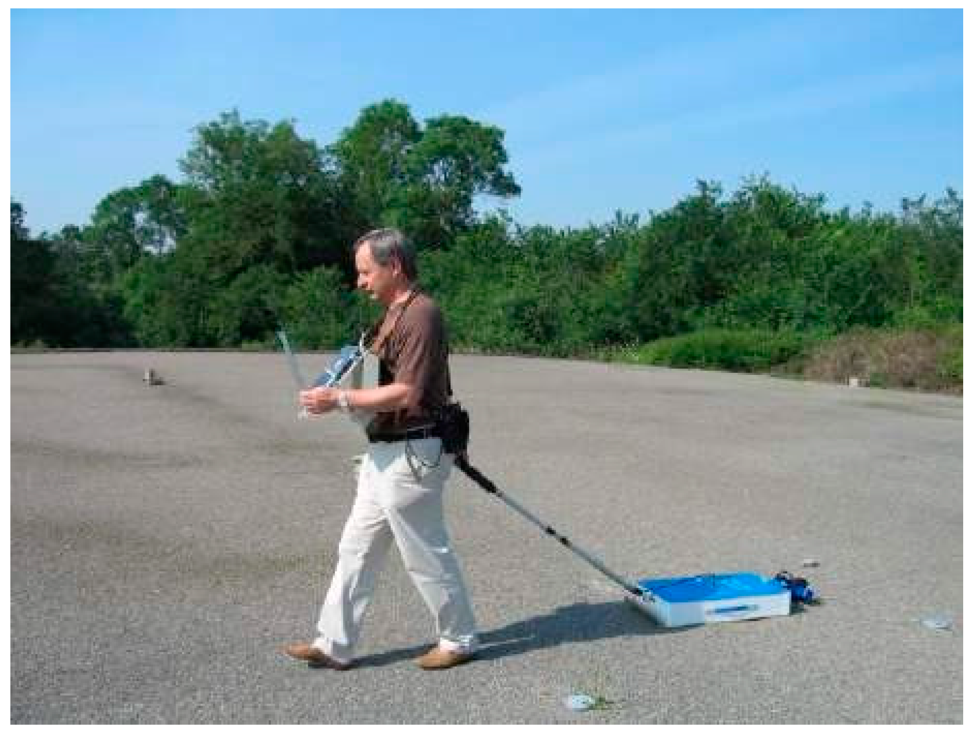
These studies were crowned with development of a number of GPR series ZOND, LOUCH, PROFILE and PYTHON. The latter is a land analogue of the space radar used for subsurface soil sounding of Mars (Project Mars-96) and designed by Radar Systems, Inc. researchers in close cooperation with their colleagues from National Space Agency of France (CNES) and Service d’Aeronomie Institute (France). Currently, one type of subsurface radars is manufactured in lots, namely Zond-12 (versatile and multifunctional unit), Figure 8.
VIII. Ukrainian GPR Manufacturer
Transient Technologies LLC [28], Kiev is a leading Ukrainian developer and manufacturer of GPR equipment. Company’s engineers are carrying out the research and development in the field of ultra-wide band technologies since 1998.
Transient Technologies’ progressive manufacturing and the vast technical experience of the staff both ensure the best solutions for searching for underground items and nondestructive subsurface inspection considering all the most exacting demands of the customers. More than 15 countries provide distribution and ensure full technical support of GPR products of Transient Technologies LLC. Innovative technologies being used in designing of GPR equipment and its reliability allowed company products to become the best Ukrainian producer with recognizable brand among worlds’ leading GPR manufacturers and to create such excellent Ground Penetrating Radars as VIY®3 series.
Funding
Support for this work was provided by the Russian Science Foundation under project # 21-19-00043, https://rscf.ru/en/project/21-19-00043/.
Acknowledgments
The author would like to thank Vladimir P. Zolotarev, Radar Systems, Inc. Riga, Latvia, for his help and valuable advices.
References
- M. I. Finkelstein, “Subsurface Radar: Principal Problems of Development and Practical Use,” [Proceedings] IGARSS’91 Remote Sensing: Global Monitoring for Earth Management, Espoo, Finland, 1991, pp. 2145-2147. [CrossRef]
- V. N. Metelkin, and M. I. Finkelstein, “Digital Processing by Sea Ice Thickness Measuring,” [Proceedings] IGARSS’91 Remote Sensing: Global Monitoring for Earth Management, Espoo, Finland, 1991, pp. 2481-2482. [CrossRef]
- N. Peshkov, M. I. Finkelstein, A. I. Smutov, A. G. Vasin, and K. I. Klemiato, “Using of Radiolocation Measuring Devices of Freshwater Ice Thickness,” [Proceedings] IGARSS’91 Remote Sensing: Global Monitoring for Earth Management, Espoo, Finland, 1991, pp. 1575-1575. [CrossRef]
- M. I. Finkelstein, V. A. Kutev, and V. P. Zolotarev; Ed. M. I. Finkelstein, Application of radar subsurface sounding in engineering geology. M.: “Nedra”, 1986, P. 128. (in Russian).
- M. I. Finkelstein, V. I. Karpukhin, V. A. Kutev, and V. N. Metelkin; Ed. M. I. Finkelstein, Subsurface radar, M.: “Radio and communication”, 1994. P. 216. (in Russian).
- M. I. Finkelstein, Some issues of radar sounding of thin layered media, Radio engineering and electronics, 1974. Vol.19, No. 3. pp. 528-536. (in Russian).
- V. I. Karpukhin, A. N. Peshkov, M. I. Finkelstein, Probing of agricultural crops with nanosecond radio pulses, Radio engineering and electronics, 1989, Vol. 34, No. 3. pp. 550-556. (in Russian).
- https://www.rslab.ru/english/, accessed on 26 September 2023.
- S. I. Ivashov, V. N. Sablin, I. A. Vasilyev, N. V. Nikiforov, and V. E Minkov, Wide-Span Systems of Mine Detection. Second International Conference on the Detection of Abandoned Land Mines, MD’98. Edinburgh, UK, 12-16 October 1998, pp. 78-80. [CrossRef]
- S. I. Ivashov, V. N. Sablin, and I. A. Vasilyev, Wide-span systems of mine detection, IEEE Aerospace and Electronic Systems Magazine, vol. 14, no. 5, pp. 6-8, May 1999. [CrossRef]
- S. I. Ivashov, V. I. Makarenkov, V. V. Razevig, V. N. Sablin, A. P. Sheyko, and I. A. Vasiliev, Remote Control Mine Detection System with GPR and Metal Detector. Eight International Conference on Ground-Penetrating Radar, GPR’2000, May 23-26, 2000, University of Queensland, Gold Coast, Queensland, Australia, pp. 36-39. [CrossRef]
- L. Capineri, S. Ivashov, T. Bechtel, A. Zhuravlev, P. Falorni, C. Windsor, G. Borgioli, I. Vasiliev, and A. Sheyko, Comparison of GPR Sensor Types for Landmine Detection and Classification, 12th International Conference on Ground Penetrating Radar, June 16-19, 2008, Birmingham, UK. https://api.semanticscholar.org/CorpusID:55130760.
- T. Bechtel, L. Capineri, P. Falorni, M. Inagaki, S. Ivashov, and C. Windsor, Investigation of Holographic Radar Capabilities for the Detection of Shallow Buried Plastic Antipersonnel Landmines, Progress In Electromagnetics Research Symposium, PIERS 2012 in Kuala Lumpur, Malaysia, on March 27-30, 2012. doi: 10.13140/2.1.3784.5442. [CrossRef]
- T. Bechtel, L. Capineri, C. Windsor, M. Inagaki, and S. Ivashov, Comparison of ROC curves for landmine detection by holographic radar with ROC data from other methods, 2015 8th International Workshop on Advanced Ground Penetrating Radar (IWAGPR), 2015, pp. 1-4. [CrossRef]
- Vasiliev, S. I. Ivashov, V. I. Makarenkov, V. N. Sablin, and P. Sheyko, “RF band high resolution sounding of building structures and works,” in IEEE Aerospace and Electronic Systems Magazine, vol. 14, no. 5, pp. 25-29, May 1999. [CrossRef]
- S. I. Ivashov, V. I. Makarenkov, V. V. Razevig, V. N. Sablin, A. P. Sheyko, and I. A. Vasiliev, Concrete Floor Inspection with Help of Subsurface Radar. Eight International Conference on Ground- Penetrating Radar, GPR’2000, May 23-26, 2000, University of Queensland, Gold Coast, Queensland, Australia, pp. 552-555. [CrossRef]
- A. Zhuravlev, V. Razevig, M. Chizh, and S. Ivashov, Non- Destructive Testing of Foam Insulation by Holographic Subsurface Radar, 9th International Workshop on Advanced Ground Penetrating Radar, IWAGPR 2017, Edinburgh, UK, 28-30 June 2017. [CrossRef]
- L. Bossi, P. Falorni, C. Windsor, F. Zandonai, F. Bizzarini, M. Delfino, L. Giusberti, T. Bechtel, M. Chizh, S. Ivashov, and L. Capineri, The imaging of subsurface crocodile remains in a limestone slab using holographic radar, GPR 2020, 18th International Conference on Ground Penetrating Radar, Golden, Colorado USA, June 14–19, 2020, pp. 6-9. [CrossRef]
- S. Ivashov, T. Bechtel, V. Razevig, L. Capineri, and M. Inagaki, A proposed radar method for non-destructive investigation of Egyptian pyramids, Insight: Non-Destructive Testing and Condition Monitoring, January 2021, Vol. 63, No 1, pp. 12-19. [CrossRef]
- S. I. Ivashov, V. V. Razevig, D. L. Sergeev, A. S. Bugaev, F. Zhou, E. I. Prokhanova, A. V. Shcherbakova, S. N. Dobrynin, and M. Vasilenkov, An Example of Microwave Holography Investigation of an Old Orthodox Russian Icon Dated to 19th Century, Heritage, 2022, 5, 2804-2817. [CrossRef]
- L. Capineri, P. Falorni, S. Ivashov, A. Zhuravlev, I. Vasiliev, V. Razevig, T. Bechtel, and G. Stankiewicz, Combined holographic subsurface radar and infrared thermography for diagnosis of the conditions of historical structures and artworks, Near Surface Geophysics, Volume 8, Issue 5, Feb 2010, pp. 355–364. [CrossRef]
- V. V. Razevig, S. I. Ivashov, I. A. Vasiliev, A. V. Zhuravlev, T. Bechtel, and L. Capineri, Advantages and Restrictions of Holographic Subsurface Radars. Experimental evaluation, Proceedings of the XIII International Conference on Ground Penetrating Radar, Lecce, Italy, 21-25 June 2010, pp. 657-662. [CrossRef]
- D. J. Daniels, Surface-Penetrating Radar, Institution of Electrical Engineers Radar Series; ERA Technology: London, UK, 1996; ISBN 0-85296-862.
- https://geotechru.com/, accessed on 26 September 2023.
- N. Pudova, A. Urusova, M. Shirobokov, and A. Marchkov, “Developing GPR surveys, data processing and interpretation techniques for criminal gravesites location,” 2016 16th International Conference on Ground Penetrating Radar (GPR), Hong Kong, China, 2016, pp. 1-5. [CrossRef]
- N. Pudova, M. Shirobokov, and A. Kuvaldin, “Application of the Attribute Analysis for Interpretation of GPR Survey Data,” 2018 17th International Conference on Ground Penetrating Radar (GPR), Rapperswil, Switzerland, 2018, pp. 1-4. [CrossRef]
- https://www.radsys.lv/en/about-company/, accessed on 26 September 2023.
- https://geo-matching.com/companies/transient-technologies-llc, accessed on 26 September 2023.
Figure 1.
Prof. M.I. Finkelstein (in center) and his colleagues V.G. Glushnev and E.I. Lazarev in 80s.
Figure 1.
Prof. M.I. Finkelstein (in center) and his colleagues V.G. Glushnev and E.I. Lazarev in 80s.
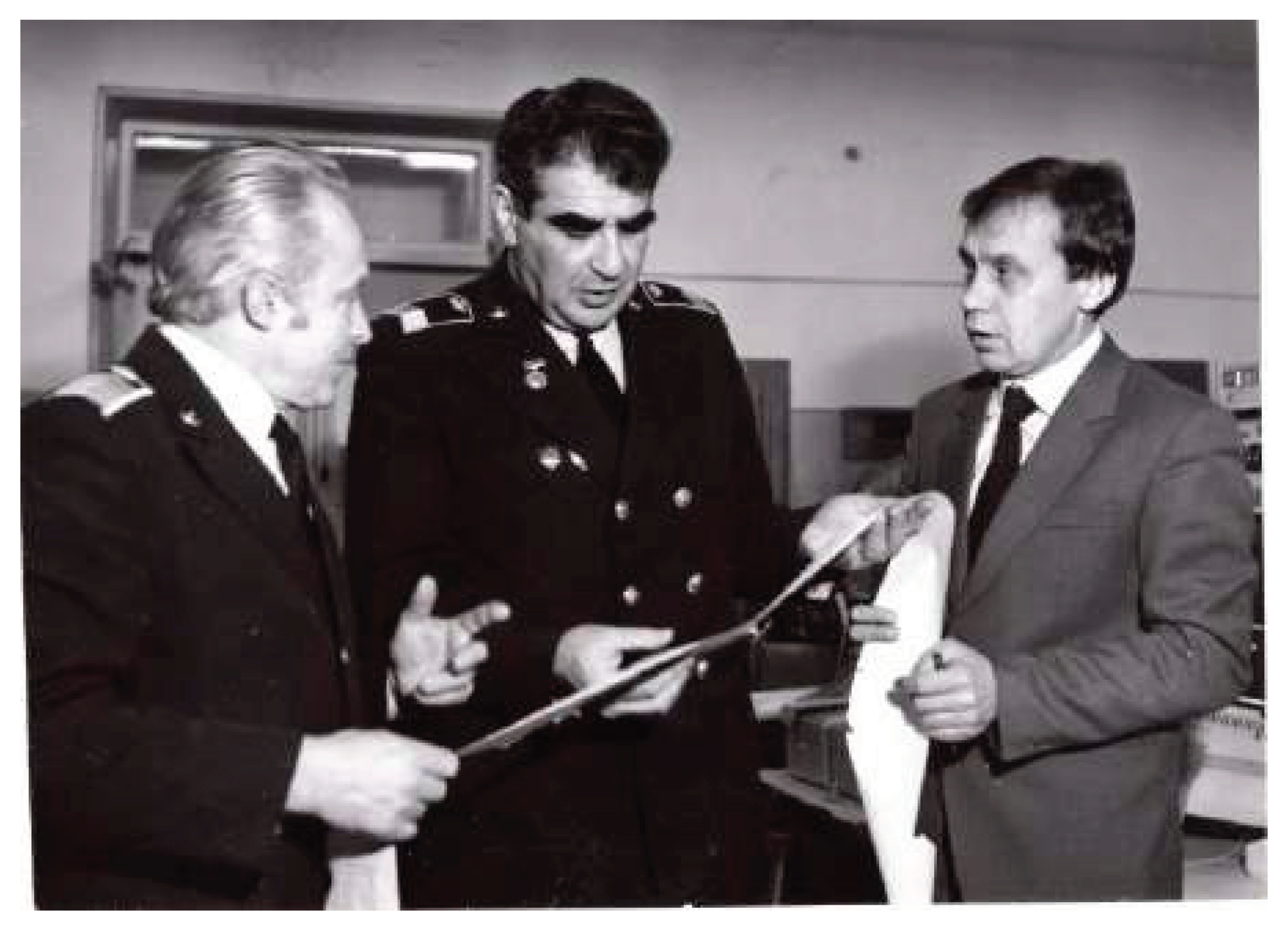
Figure 2.
Ground-Penetrating Radar YL-R2 produced by OYO Corporation, Japan.
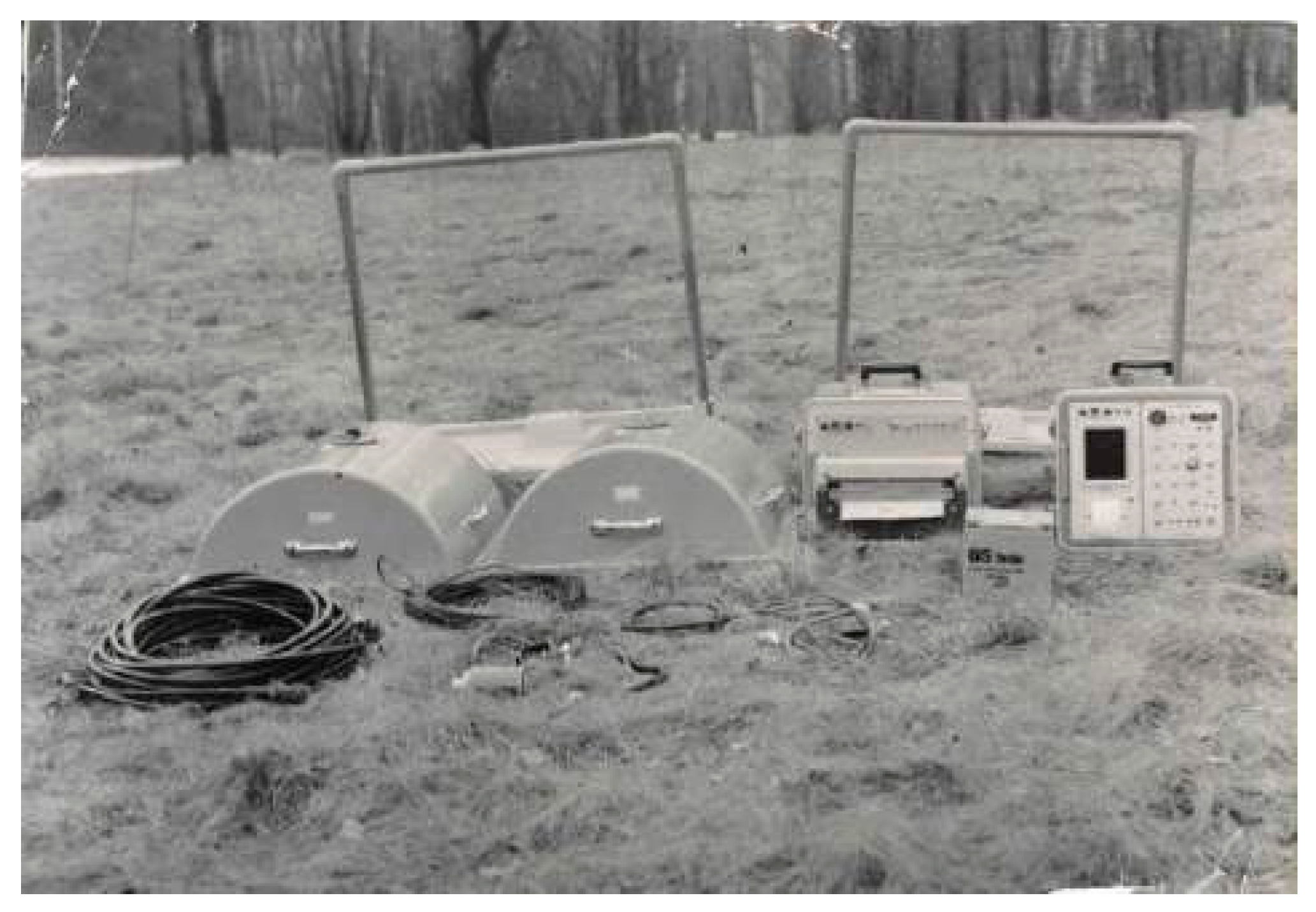
Figure 3.
Experimental setup designed for recording MW images of subsurface mines.
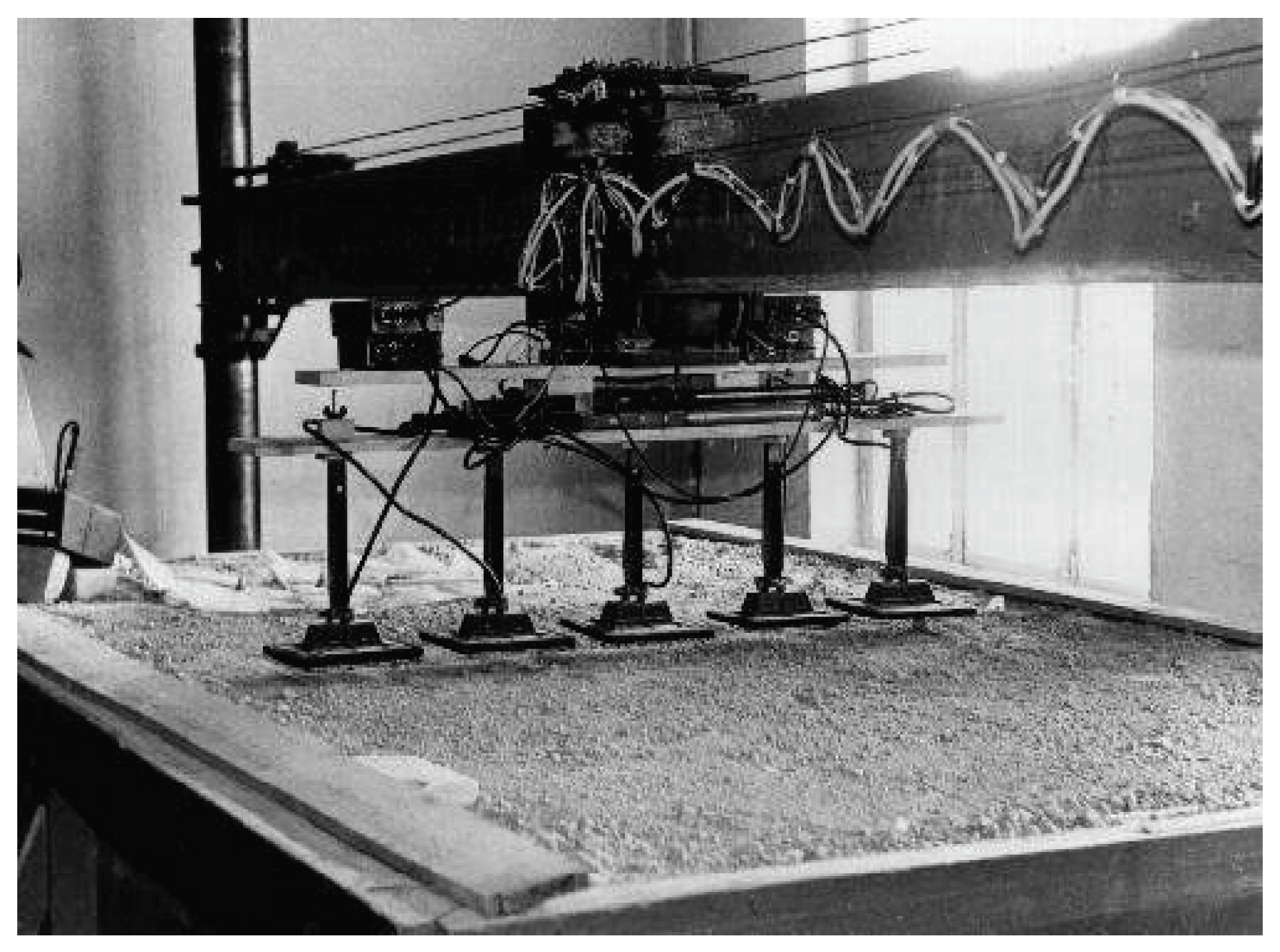
Figure 4.
Italian TC-6.1 plastic-body antitank mine.
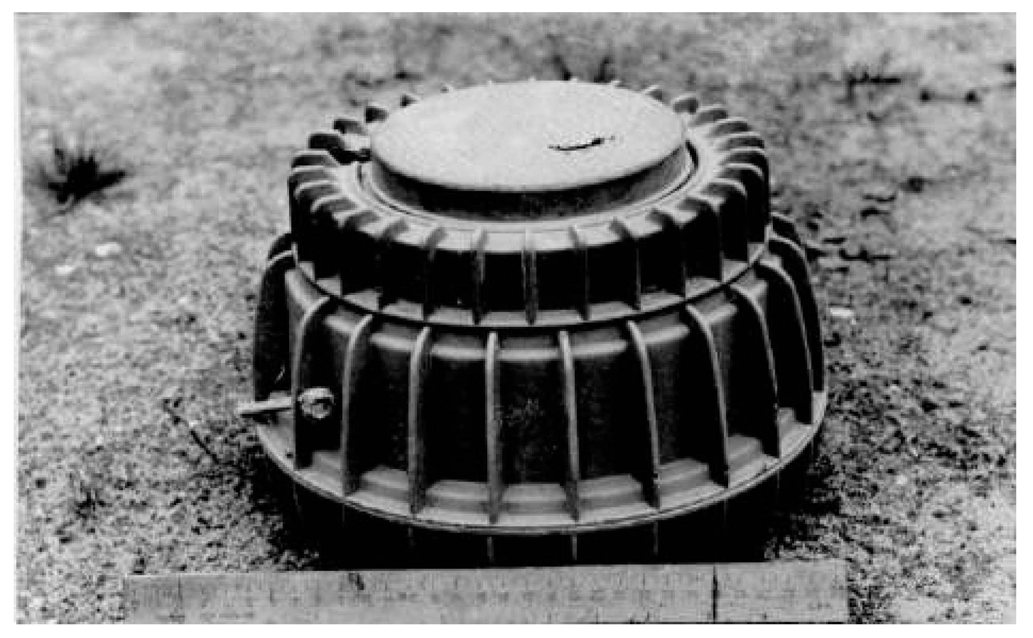
Figure 5.
MW image of two mine (in centre), metal pipe (in the left) and metal plate (in the right).
Figure 5.
MW image of two mine (in centre), metal pipe (in the left) and metal plate (in the right).
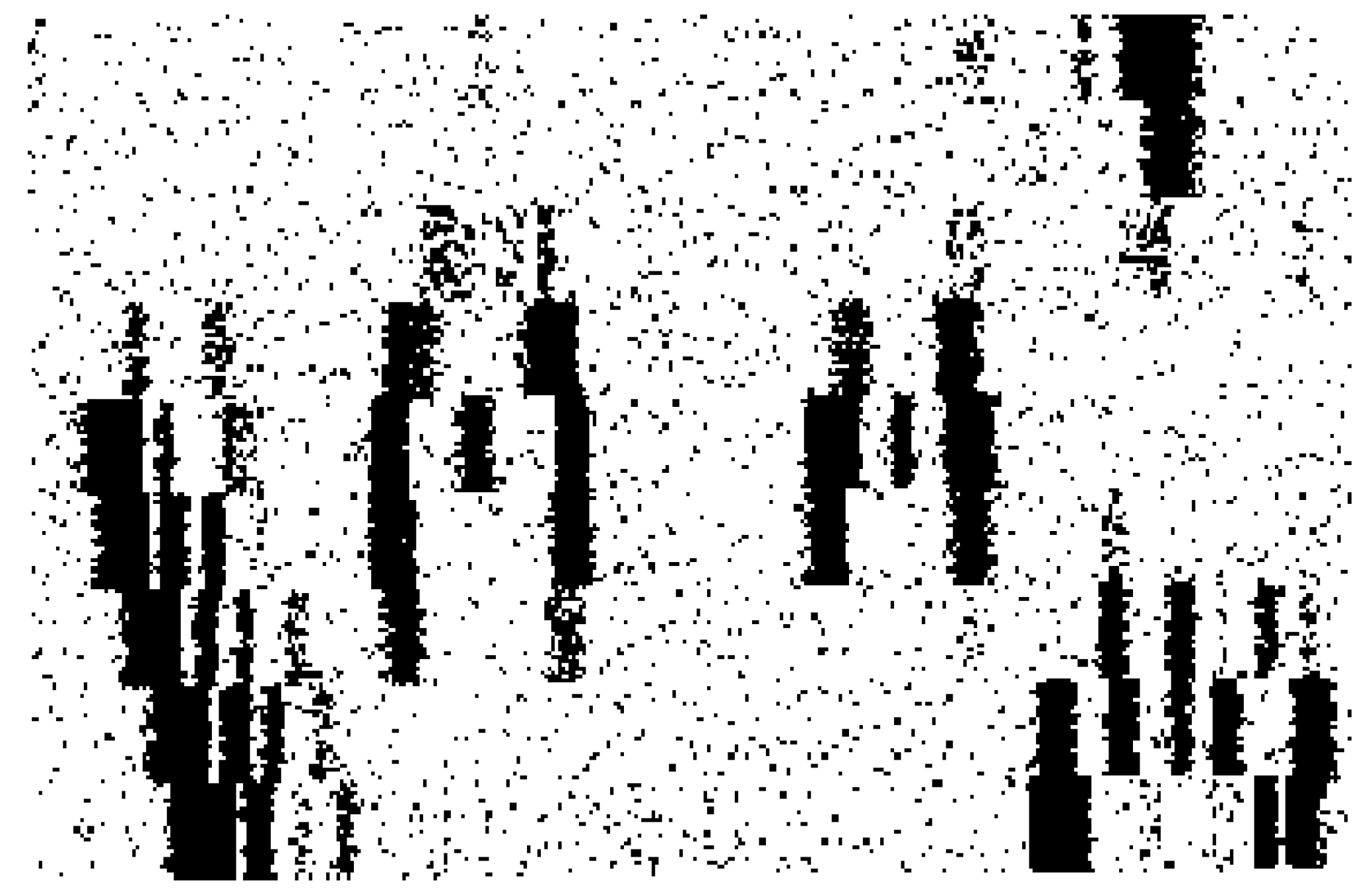
Figure 6.
Holographic subsurface radar RASCAN designed in the Remote Sensing Laboratory.
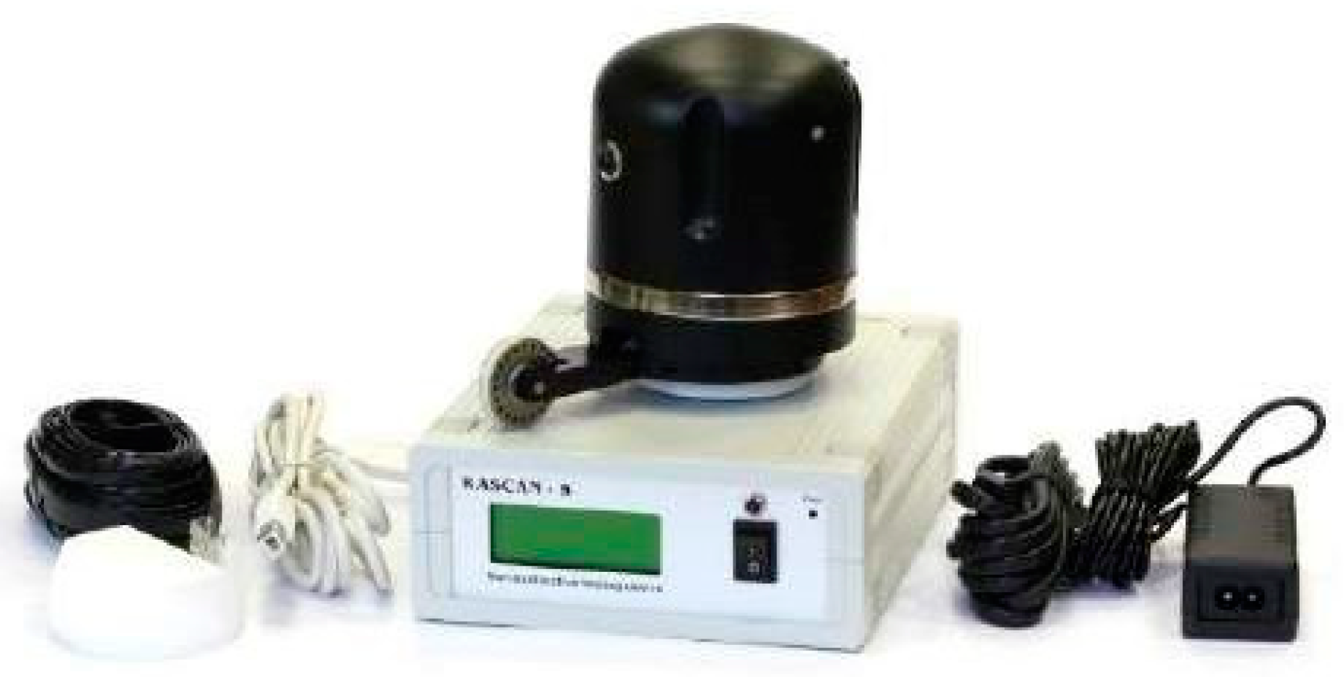
Figure 7.
Queen of England Elizabeth II to get acquainted with the Russian subsurface radar technology.
Figure 7.
Queen of England Elizabeth II to get acquainted with the Russian subsurface radar technology.
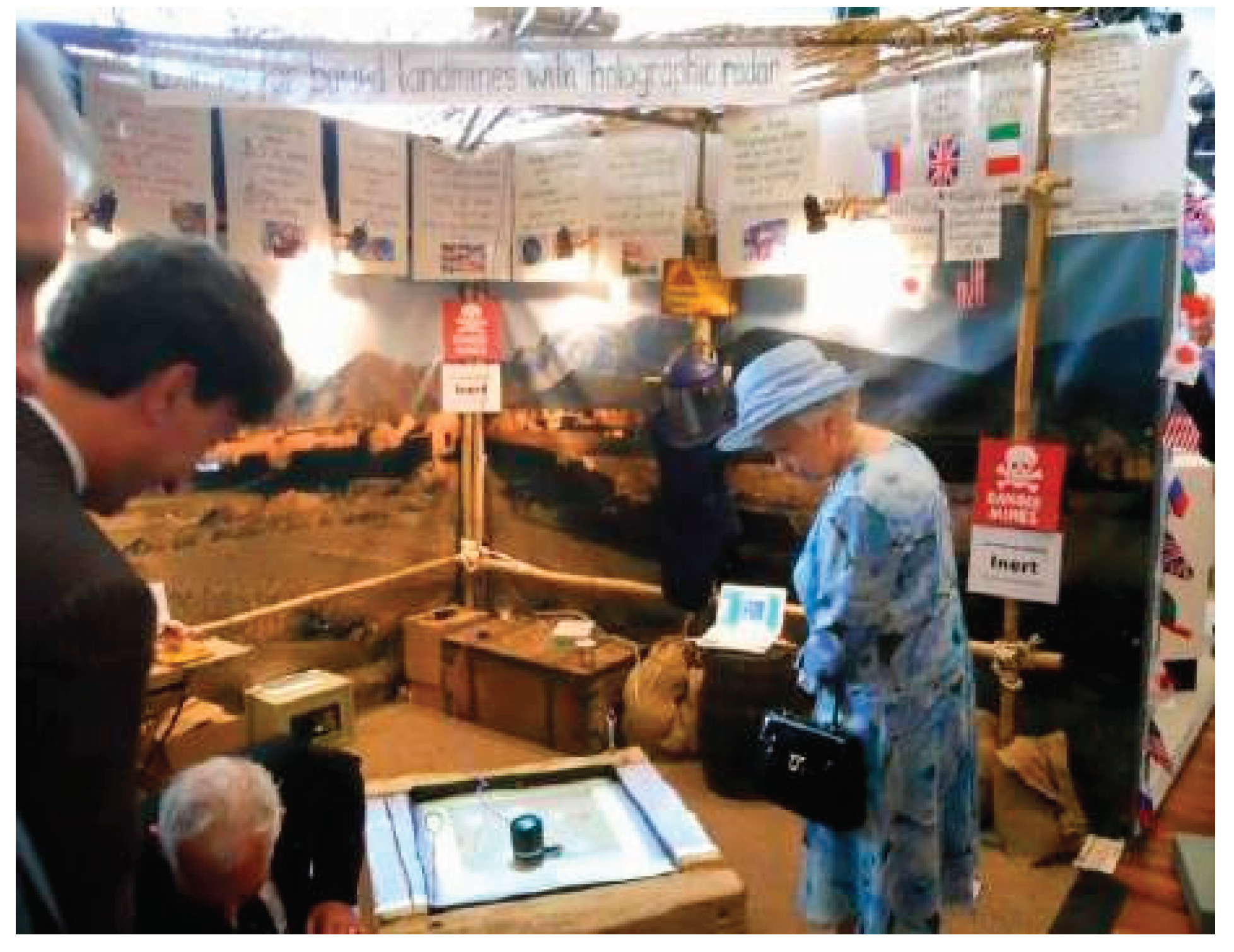
Figure 8.
ZOND-12 GPR with 300 MHz antenna.
Disclaimer/Publisher’s Note: The statements, opinions and data contained in all publications are solely those of the individual author(s) and contributor(s) and not of MDPI and/or the editor(s). MDPI and/or the editor(s) disclaim responsibility for any injury to people or property resulting from any ideas, methods, instructions or products referred to in the content. |
© 2024 by the authors. Licensee MDPI, Basel, Switzerland. This article is an open access article distributed under the terms and conditions of the Creative Commons Attribution (CC BY) license (http://creativecommons.org/licenses/by/4.0/).
Copyright: This open access article is published under a Creative Commons CC BY 4.0 license, which permit the free download, distribution, and reuse, provided that the author and preprint are cited in any reuse.


