
Submitted:
15 March 2021
Posted:
16 March 2021
You are already at the latest version
Abstract
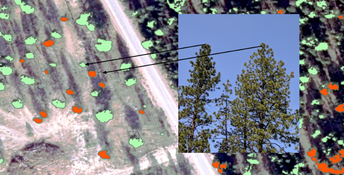
Ponderosa pine is an integral part of the forested landscape in the western US; it is the dominant tree species on landscapes that provide critical ecosystem services. Moderate drought tolerance allows it to occupy the transition zone between forests and open woodlands and grasslands. Increases in stand density resulting from wildfire suppression, combined with lengthening, intensifying and more frequent droughts have resulted in reduced tree vigor and stand health in dry ponderosa pine throughout its range. To address a management need for efficient landscape-level surveys of forest health, we used Random Forests to develop an object-oriented classification of individual tree crowns (ITCs) into vigor classes using existing, agency acquired 4-band aerial imagery. Classes of tree vigor were based on quantitative physiological and morphological attributes established in a previous study. We applied our model across a landscape dominated by ponderosa pine with a variety of forest treatments to assess their impacts on tree vigor and stand health. We found that stands that were both thinned and burned had the lowest proportion of low vigor ITCs, and that stands treated before the 2014-2016 drought had lower proportions of low vigor ITCs than stands treated more recently (2016). Upland stands had significantly higher proportions of low vigor trees than lowland stands. Maps identifying the low vigor ITCs would assist managers in identifying priority stands for treatment and marking trees for harvest or retention. These maps can be created using already available imagery and GIS software.
Keywords:
tree vigor
; ponderosa pine
; remote sensing
; aerial imagery
; dry pine forest
; fuel treatments
; forest restoration
; random forest
Copyright: This open access article is published under a Creative Commons CC BY 4.0 license, which permit the free download, distribution, and reuse, provided that the author and preprint are cited in any reuse.


