Submitted:
03 December 2020
Posted:
04 December 2020
You are already at the latest version
Abstract
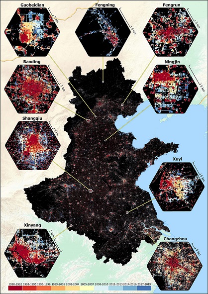
Long-term, high-accuracy mapping of built-up land dynamics is essential for understanding urbanization and its consequences for the environment. Despite advances in remote sensing and classification algorithms, built-up land mapping using early satellite imagery (e.g., from the 2000s and earlier) remains prone to uncertainty. We mapped the extent of built-up land in the North China Plain, one of China’s most important agricultural regions, from 1990 to 2019 at three-year intervals. Using dense time-stack Landsat data, we applied discrete Fourier transformation to create temporal predictors and reduce mapping uncertainties for early years. We improved overall accuracy by 8% compared to using spectral and indices predictors alone. We implemented a temporal correction algorithm to remove inconsistent pixel classifications, further improving accuracy to a consistently high level (>94%) across years. A cross-product comparison showed that our study achieved the highest levels of accuracy across years. Total built-up land in the North China Plain increased from 37,941 km2 in 1990–1992 to 131,578 km2 in 2017–2019. Consistent, high-accuracy built-up land mapping provides a reliable basis for policy planning in one of the most rapidly urbanizing regions of the planet.
Keywords:
Built-up land
; Fourier transformation
; high-accuracy mapping
; temporal correcti
Copyright: This open access article is published under a Creative Commons CC BY 4.0 license, which permit the free download, distribution, and reuse, provided that the author and preprint are cited in any reuse.


