
Submitted:
30 March 2020
Posted:
31 March 2020
You are already at the latest version
Abstract
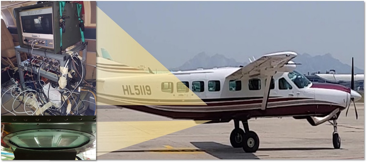
Autonomous unmanned aerial vehicles (UAVs) require highly reliable navigation information. Generally, navigation systems with the inertial navigation system (INS) and global navigation satellite system (GNSS) have been widely used. However, the GNSS is vulnerable to jamming and spoofing. The terrain referenced navigation (TRN) technique can be used to solve this problem. In this study, to obtain reliable navigation information even if a GNSS is not available or the degree of terrain roughness is not determined, we propose a federated filter based INS/GNSS/TRN integrated navigation system. we also introduce a TRN system that combines batch processing and an auxiliary particle filter to ensure stable flight of UAVs even in a long-term GNSS-denied environment. As an altimeter sensor for the TRN system, we use an interferometric radar altimeter (IRA) to obtain reliable navigation accuracy in high altitude flight. In addition, a parallel computing technique with general-purpose computing on graphics processing units (GPGPU) is applied to process a high resolution terrain database and a nonlinear filter in real time on board. Finally, we verify the performance of the proposed system through software-in-the-loop (SIL) tests and captive flight tests in a GNSS unavailable environment.
Keywords:
Terrain Referenced Navigation (TRN)
; Federated Filter
; Interferometric Radar Altimeter (IRA)
; Batch Processing
; Auxiliary Particle Filter
; Digital Elevation Model (DEM)
; Captive Flight Test
Copyright: This open access article is published under a Creative Commons CC BY 4.0 license, which permit the free download, distribution, and reuse, provided that the author and preprint are cited in any reuse.


