Submitted:
25 January 2020
Posted:
26 January 2020
You are already at the latest version
Abstract
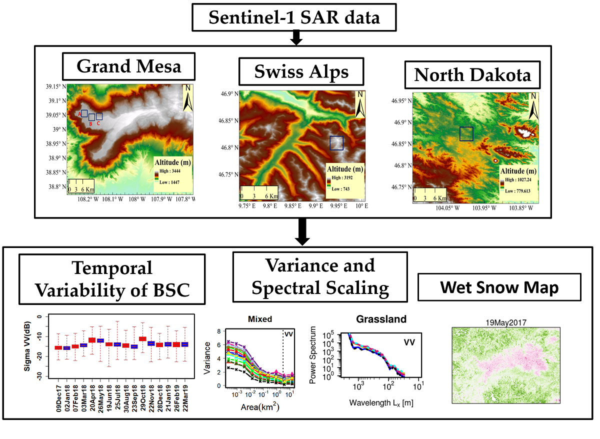
This study investigates the spatial signatures of seasonal snow in Synthetic Aperture Radar (SAR) observations at different spatial scales and for different physiographic regions. Sentinel-1 C-band (SAR) backscattering coefficients (BSC) were analyzed in the Swiss Alps (SA), in high elevation forest and grasslands in Grand Mesa (GM), Colorado, and in North Dakota (ND) croplands. GM BSC exhibit 10dB sensitivity to wetness at small scales (~100 m) over homogeneous grassland. Sensitivity decreases to 5 dB in the presence of trees, and it is demonstrated that VH BSC sensitivity enables wet snow mapping below the tree-line. Area-variance scaling relationships show minima at ~100 m and 150-250 m respectively in barren and grasslands in SA and GM, increasing up to 1 km and longer in GM forests and ND agricultural fields. The spatial organization of BSC (as described by 1D-directional BSC wavelength spectra) exhibits multi-scaling behavior in the 100 -1,000 m range with a break at (180-360 m) that is also present in UAVSAR L-band measurements in GM. Spectral slopes in GM forested areas steepen during accumulation and flatten in the melting season with mirror behavior for grasslands reflecting changes in scattering mechanisms with snow depth and wetness, and vegetation mass and structure. Overall, this study reveals persistent patterns of SAR scattering variability spatially organized by land-cover, topography and regional winds with large inter-annual variability tied to precipitation. This dynamic scaling behavior emerges as an integral physical expression of snowpack variability that can be used to model sub-km scales and for downscaling applications.
Keywords:
snow
; synthetic aperture radar
; Sentinel-1
; spatial variability
; spectral scaling
; topography
; wet snow
Copyright: This open access article is published under a Creative Commons CC BY 4.0 license, which permit the free download, distribution, and reuse, provided that the author and preprint are cited in any reuse.


