Submitted:
29 October 2019
Posted:
30 October 2019
You are already at the latest version
Abstract
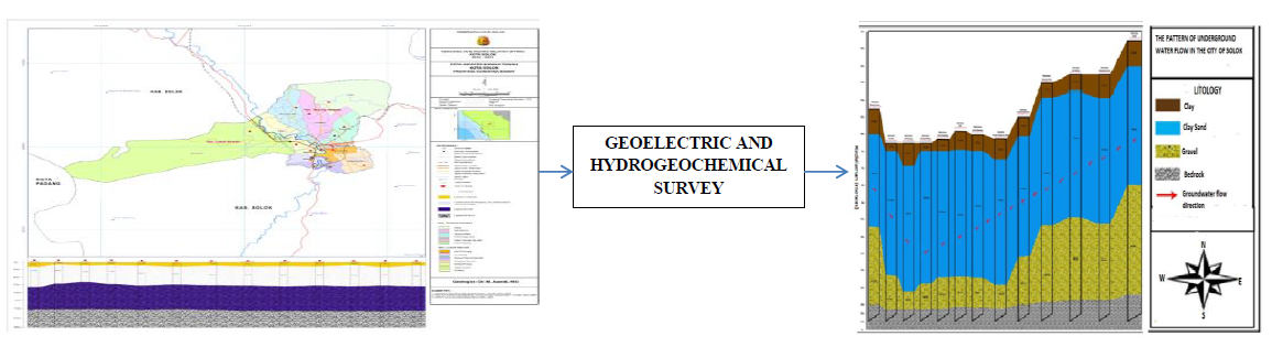
The purpose of this study was to recommend to the government about the appropriate land use based on geoelectric and hydrochemical works. The results were supposed to be used as models for effective land use. During the study, a groundwater survey using a geoelectrical method was conducted and was used to map an aquifer flow. In general, Solok groundwater mapping was meant to provide information necessary to optimize follow-up activities for the use of clean water. It was also intended to minimize the negative impacts of exploitation and utilization of groundwater. This research aimed to provide information on groundwater conditions in Solok. It focused on the survey of groundwater sources, the inversion of measurement data on Sclumberger electrode configuration geoelectric in thirteen districts, and chemical analysis of pH, Fe, Nitrite, and DHL. The results show there was a great potential for groundwater-unconfined aquifers.
Keywords:
potential
; groundwater
; geoelectrical
; chemical parameter
; physical parameter
Copyright: This open access article is published under a Creative Commons CC BY 4.0 license, which permit the free download, distribution, and reuse, provided that the author and preprint are cited in any reuse.


