
Submitted:
07 August 2019
Posted:
08 August 2019
You are already at the latest version
Abstract
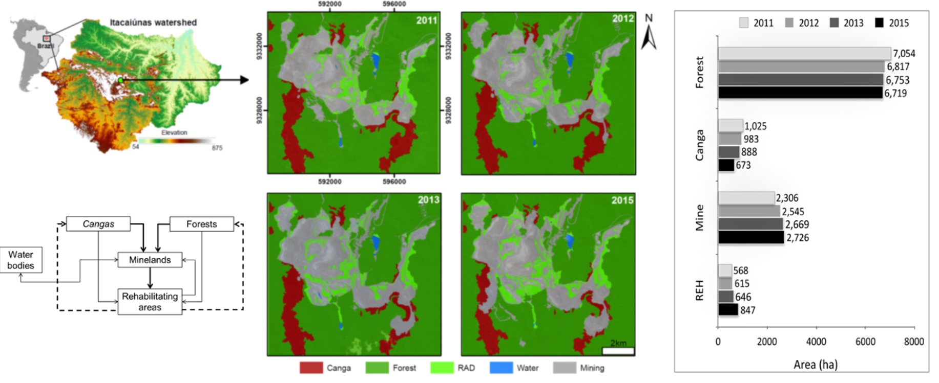
Remote sensing technologies may play a fundamental role in the environmental assessment of open-cast mining and the accurate quantification of mine land rehabilitation efforts. Here, we developed a systematic geographic object-based image analysis (GEOBIA) approach to map the amount of revegetated area and to quantify the land-use changes in open-cast mines in the Carajás region situated in the eastern Amazon. Based on high-resolution satellite images from 2011 to 2015 from different sensors (GeoEye, WorldView-3 and Ikonos), we quantified forests, cangas (natural metalliferous savanna ecosystems), mine land, revegetated areas and water bodies. Based on the GEOBIA approach, threshold values were established to discriminate land cover classes using spectral bands, and the NDVI and NDWI indices and LiDAR digital ground and slope models. The overall accuracy was higher than 90%, and the Kappa indices varied between 0.82 and 0.88. During the observation period, the mining complex expanded; for that, canga and forest vegetation was converted to mine land. At the same time, the amount of revegetated area increased. Thus, we conclude that our approach is capable of providing consistent information regarding land cover changes in mines, with a special focus on the amount of revegetation necessary to fulfill environmental liabilities.
Keywords:
GEOBIA
; canga ecosystem
; Carajás National Forest
; mine land revegetation
; satellite images
; environmental assessment
Copyright: This open access article is published under a Creative Commons CC BY 4.0 license, which permit the free download, distribution, and reuse, provided that the author and preprint are cited in any reuse.


