Submitted:
24 May 2018
Posted:
25 May 2018
You are already at the latest version
Abstract
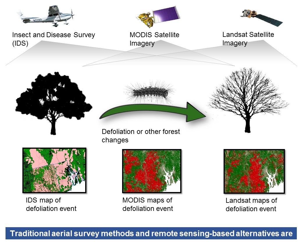
The Operational Remote Sensing (ORS) program leverages Landsat and MODIS data to detect forest disturbances across the conterminous United States (CONUS). The ORS program was initiated in 2014 as a collaboration between the US Department of Agriculture Forest Service Geospatial Technology and Applications Center (GTAC) and the Forest Health Assessment and Applied Sciences Team (FHAAST). The goal of the ORS program is to supplement the Insect and Disease Survey (IDS) and MODIS Real-Time Forest Disturbance (RTFD) programs with imagery-derived forest disturbance data that can be used to augment traditional IDS data. We developed three algorithms and produced ORS forest change products using both Landsat and MODIS data. These were assessed over Southern New England and the Rio Grande National Forest. Reference data were acquired using TimeSync to conduct an independent accuracy assessment of IDS, RTFD, and ORS products. Overall accuracy for all products ranged from 77.64% to 93.51% (kappa 0.09–0.59) in the Southern New England study area and 59.57% to 79.57% (kappa 0.09–0.45) in the Rio Grande National Forest study area. In general, ORS products met or exceeded the overall accuracy and kappa of IDS and RTFD products. This demonstrates the current implementation of ORS is sufficient to provide data to augment IDS data.
Keywords:
Landsat
; MODIS
; change detection
; forest disturbance
; forest health
Copyright: This open access article is published under a Creative Commons CC BY 4.0 license, which permit the free download, distribution, and reuse, provided that the author and preprint are cited in any reuse.


