
Submitted:
01 May 2018
Posted:
02 May 2018
You are already at the latest version
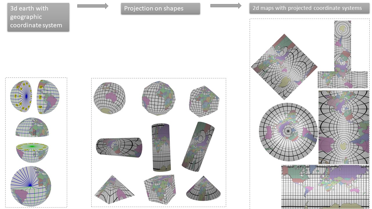
Abstract
This work presents datasets that can be used for getting a good understanding of an essential geoscience content knowledge that describe earth’s coordinate systems. This include coordinate system used for spherical/spheroidal earth with latitudes and longitudes and their subsequent transformations to 2d maps on a variety of media (paper as well as digital) using the process of map projections. The datasets include PDF documents that are embedded with 3d models, animations and mathematical equations. The dataset has separate PDF documents for geographic (for spherical earth) and projected (2d) coordinate systems. Additionally, the data set include individual 3d models that can be used in various digital systems (including apps) and the animations in mp4 format that can be watched on most of the modern digital devices.
Keywords:
map projections
; coordinate systems
; earth's 3D models
; earth's 2D representation
Copyright: This open access article is published under a Creative Commons CC BY 4.0 license, which permit the free download, distribution, and reuse, provided that the author and preprint are cited in any reuse.


