Submitted:
03 April 2018
Posted:
04 April 2018
You are already at the latest version
Abstract
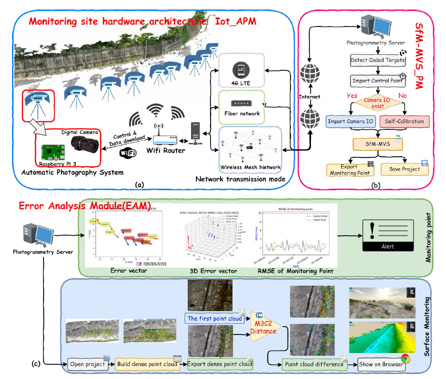
Multi-view stereo (MVS) employs multi-point photography for image point positioning and three-dimensional reconstruction technology. Recently, this technology has been introduced into the monitoring of road slopes due to advances in photography and computing technology. In general, the various phases of post-image processing procedures are applied to various photographic data. In this study a novel, automated image-monitoring system is proposed to improve the ability of automatic processing. First, an Internet of things (IoT)-based digital photography system architecture was constructed to provide automatic control of camera photography and real-time transmission of image data. In addition, a visual SfM-MVS 3D reconstruction technique was used to develop related software and hardware interfaces based on the built-in Python computing framework of Photoscan Pro. The software integrates fully automatic photography, image transmission, monitoring of data processing and product release programs. The experimental results show that the system architecture can be applied to fully automatic three-dimensional monitoring of road slopes.
Keywords:
monitoring
; SfM-MVS
; photogrammetry
; internet of things
; M3C2
Copyright: This open access article is published under a Creative Commons CC BY 4.0 license, which permit the free download, distribution, and reuse, provided that the author and preprint are cited in any reuse.


