
Submitted:
04 January 2018
Posted:
05 January 2018
You are already at the latest version
Abstract
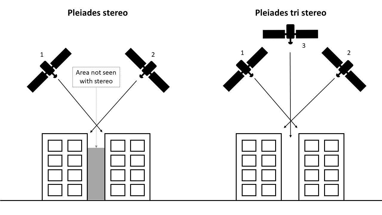
A very high-resolution DSM covering an area of 400km2 over the Athens Metropolitan Area has been produced using Pleiades 1B 0,5m panchromatic tri-stereo images. Applied Remote Sensing and Photogrammetry tools have been used resulted in a 1x1m DSM over the study area. DSM accuracy has been evaluated by comparison with measured elevations with D-GPS and a reference DSM provided by the National Cadaster & Mapping Agency S.A. In addition, different combinations of stereo images have been prepared for further exploitation of the quality of the produced DSM by stereo vs. tri-stereo images. Results show that the produced by the tri-stereo images DSM has an RMSE of 1.17m in elevation (z), which is among the best reported in the relevant literature. Stereo based DSMs from the same sensor have worst performance to this end. Satellite Remote Sensing (SRS) based DSMs over urban areas provide the best cost-effective approach in comparison to airborne-based datasets due to high spatial coverage, lower cost and high temporal coverage. Pleiades-based high-quality DSM products can serve the domains of urban planning/climate, hydrological modelling and natural hazards, as major input for simulation models and morphological analysis at local scale.
Keywords:
tri-stereo
; DSM
; validation
; urban surface morphology
Copyright: This open access article is published under a Creative Commons CC BY 4.0 license, which permit the free download, distribution, and reuse, provided that the author and preprint are cited in any reuse.


