
Submitted:
28 July 2026
Posted:
29 July 2026
You are already at the latest version
Abstract
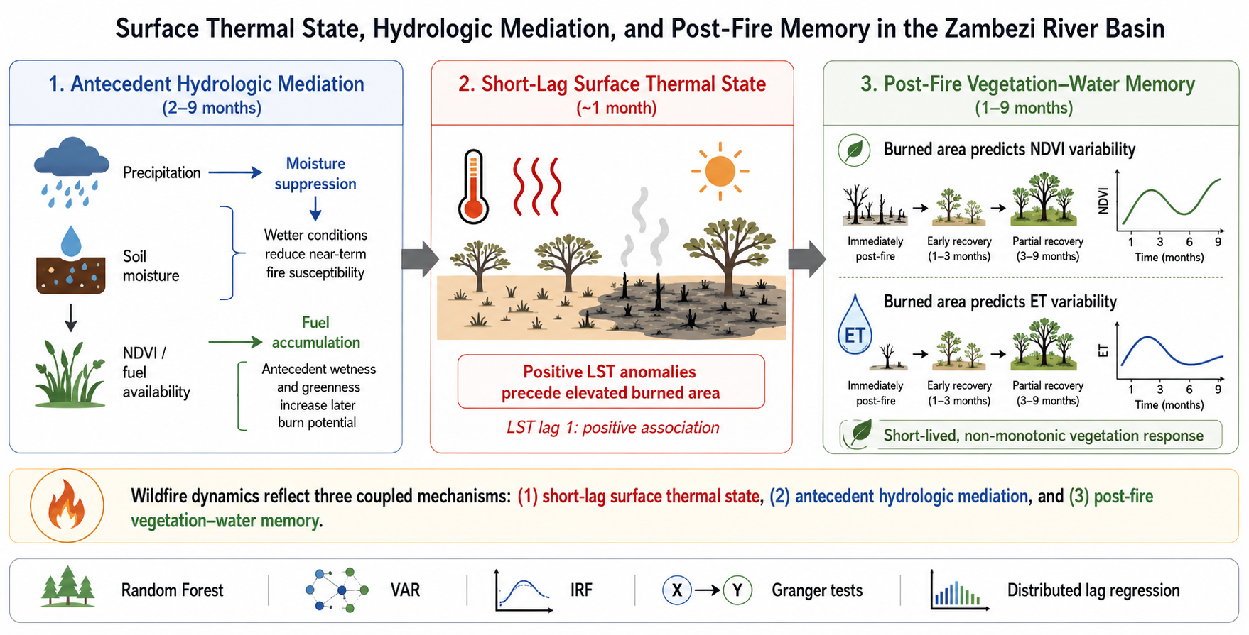
Wildfire regimes in African savannas reflect interactions among surface heating, fuel availability, moisture constraints, and post-fire vegetation recovery. These processes are often analyzed jointly, making it difficult to distinguish near-term fire susceptibility from antecedent fuel–moisture controls and post-fire land-surface feedbacks. We examine these coupled processes in the Zambezi River Basin using monthly basin-aggregated satellite time series from January 2003 through November 2024 for burned area, land surface temperature (LST), precipitation, soil moisture, evapotranspiration (ET), and normalized difference vegetation index (NDVI). Random Forest regression, vector autoregression, impulse-response analysis, Granger predictive tests, and distributed lag regression are assigned non-overlapping inferential roles. Among the included predictors, surface soil moisture is the dominant contemporaneous land-surface signal in the Random Forest, while positive LST anomalies are associated with elevated burned-area anomalies at a one-month lag. Precipitation, soil moisture, NDVI, and ET predict burned area over seasonal lags through moisture-suppression and fuel-accumulation pathways. Burned-area history also improves prediction of subsequent NDVI and ET variability, indicating post-fire vegetation–water memory. The results support a three-component framework separating short-lag surface thermal state, antecedent hydrologic mediation, and post-fire vegetation–water response.
Keywords:
wildfire
; Zambezi River Basin
; Earth observation
; MODIS
; ecohydrology
; soil moisture
; land surface temperature
; vector autoregression
; post-fire recovery
Copyright: This open access article is published under a Creative Commons CC BY 4.0 license, which permit the free download, distribution, and reuse, provided that the author and preprint are cited in any reuse.


