Submitted:
22 April 2026
Posted:
24 April 2026
You are already at the latest version
Abstract
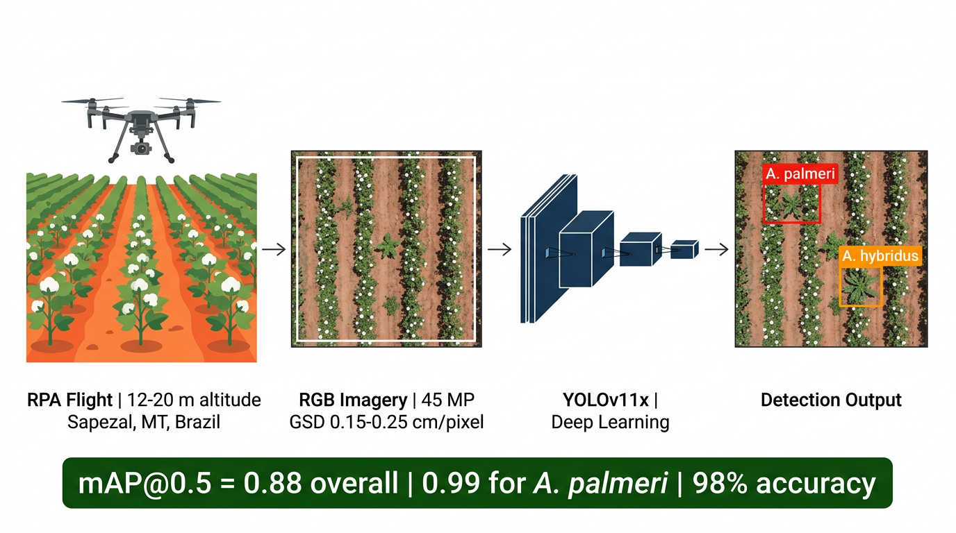
Amaranthus palmeri has become established in agricultural areas of the Brazilian Cerrado, where it threatens soybean and cotton yields. Conventional field scouting cannot cover the large properties typical of the region fast enough to detect infestation foci before seed set. We tested an automated detection approach using aerial images from a remotely piloted aircraft (RPA), a DJI Matrice 300 RTK with a Zenmuse P1 camera (45 megapixels, MP), processed with YOLOv11x (You Only Look Once, version 11, extra-large). Four field campaigns in Sapezal, Mato Grosso, produced roughly 40,000 images over soybean and cotton at different weed growth stages; flight tests at 90, 20, and 12 m showed that 12–20 m altitude is needed to resolve individual plants. Two specialists annotated 382 Amaranthus individuals (A. palmeri and A. hybridus), split 70/30 for training and validation. Overall performance reached 84% precision, 84% recall, and 88% mean average precision at Intersection-over-Union 0.5 (mAP@0.5); for A. palmeri alone the figures were 95%, 93%, and 99%, respectively, with 98% accuracy in the confusion matrix and virtually no cross-class confusion. Within these limits, RPA imagery and deep learning can replace manual scouting for A. palmeri at the farm scale.
Keywords:
Amaranthus palmeri
; deep learning
; YOLO
; weed detection
; remotely piloted aircraft
; Cerrado
; object detection
; precision agriculture
Copyright: This open access article is published under a Creative Commons CC BY 4.0 license, which permit the free download, distribution, and reuse, provided that the author and preprint are cited in any reuse.


