Submitted:
30 January 2026
Posted:
03 February 2026
You are already at the latest version
Abstract
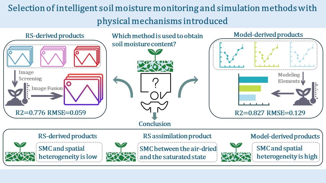
The simulation accuracy and error sources of remote sensing (RS)-derived products, model-derived products, and RS-based assimilation products remain poorly understood across varying terrain conditions. Here, we investigated watershed-scale soil moisture (SM) dynamics across different slope positions using RS data assimilation, with the targeted area located in New South Wales, Australia. After evaluating and comparing the accuracy of existing SM products, a daily 1 km resolution surface SM dataset was generated through data fusion. This product was then integrated with Soil and Water Assessment Tool (SWAT) model simulations using a Kalman filter approach, yielding a 10 m resolution dataset with enhanced physical mechanism. Our results revealed that physically constrained products generally outperformed standalone RS inversions or hydrological model simulations, with their performance varied across slope positions. Furthermore, we demonstrated that high soil moisture content (SMC) and spatial heterogeneity amplified SWAT model dominance in assimilated outcomes, whereas low SMC and spatial heterogeneity elevated RS contributions; the assimilated dataset consistently overcame limitations of standalone RS and hydrological model simulations across all slope positions. Our results demonstrated significant variations in the accuracy of RS-derived and model-derived products across distinct slope positions. This study systematically analyzed the underlying error mechanisms, contributing to intelligent water resource monitoring and water management decisions.
Keywords:
multi-source remote sensing
; hydrological model
; fine-scale mapping
; physical mechanism
; terrain factor
; soil moisture
Copyright: This open access article is published under a Creative Commons CC BY 4.0 license, which permit the free download, distribution, and reuse, provided that the author and preprint are cited in any reuse.


