
Submitted:
01 July 2021
Posted:
02 July 2021
You are already at the latest version
Abstract
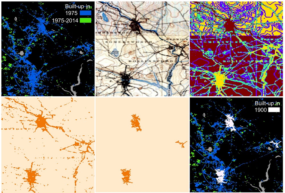
Abstract: Spatially explicit, fine-grained datasets describing historical urban extents are rarely available prior to the era of operational remote sensing. However, such data are necessary to better understand long-term urbanization and land development processes and for the assessment of coupled nature-human systems, e.g., the dynamics of the wildland-urban interface. Herein, we propose a framework that jointly uses remote sensing derived human settlement data (i.e., the Global Human Settlement Layer, GHSL) and scanned, georeferenced historical maps to automatically generate historical urban extents for the early 20th century. By applying unsupervised color segmentation to the historical maps, spatially constrained to the urban extents derived from the GHSL, our approach generates historical settlement extents for seamless integration with the multi-temporal GHSL. We apply our method to study areas in countries across four continents, and evaluate our approach for two U.S. study sites against historical settlement extents derived from the Historical Settlement Data Compilation for the US, HISDAC-US, achieving Area-under-the-Curve values >0.9. Our results are largely in agreement with model-based urban areas from the HYDE database, and demonstrate that the integration of remote sensing derived observations and historical cartographic data sources opens up new, promising avenues for assessing urbanization, and long-term land cover change in countries where historical maps are available.
Keywords:
urbanization
; long-term settlement patterns
; built-up land data
; global human settlement layer
; historical maps
; topographic map processing
; data integration.
Copyright: This open access article is published under a Creative Commons CC BY 4.0 license, which permit the free download, distribution, and reuse, provided that the author and preprint are cited in any reuse.


