Submitted:
13 February 2021
Posted:
16 February 2021
You are already at the latest version
Abstract
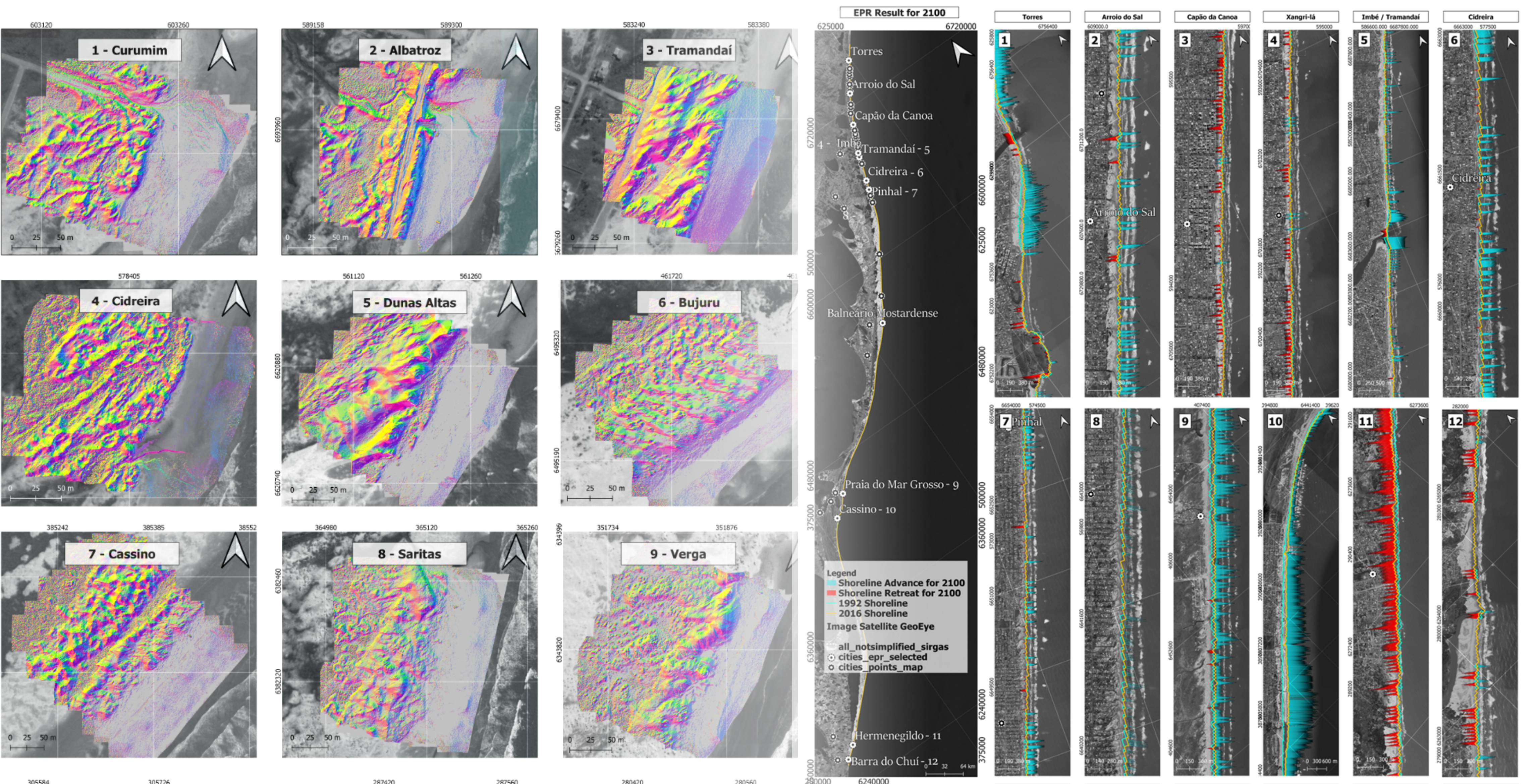
This work assesses sea-level rise using three different models created on Free and Open-Source Software for Geographic Information System (FOSS4GIS). Based on regional projections of Special Report on Climate Change and Oceans and Cryosphere (SROCC) of the Intergovernmental Panel on Climate Change (IPCC), the models were applied to a case of study on Rio Grande do Sul coast – Brazil under different sea-level rise scenarios by the end of this century. The End Point Rate for QGIS (EPR4Q), calculates a shoreline projection using End Point Rate method. The Uncertainty Bathtub Model (uBTM), analyses the sea-level rise impact by the uncertainty of sea-level projec-tions and vertical error of the Digital Elevation/Terrain Model (DEM/DTM). The Bruun Rule for Google Earth Engine Model (BRGM) predicts the shoreline position with sea-level rise, using topographic and bathymetric data from Unmanned Aerial Vehicles (UAV) and Coastal Modelling System (SMC – Brazil), respectively. The results indicated a maximum shoreline retreat for 2100 of -502 m and -1727 m using EPR4Q and BRGM, correspondingly. The uBTM using the land-use of Mapbiomas showed a maximum of 44.57 km2 of urban area impacted by the sea-level flood. This research highlights the possibility of performing coastal management analysis in GIS environ-ment using non-commercial software.
Keywords:
Climate Change
; Modeling
; Coastal Hazards
; End Point Rate
; Uncertainty Bathtub
; Bruun Rule
Copyright: This open access article is published under a Creative Commons CC BY 4.0 license, which permit the free download, distribution, and reuse, provided that the author and preprint are cited in any reuse.


