
Submitted:
19 December 2019
Posted:
21 December 2019
You are already at the latest version
Abstract
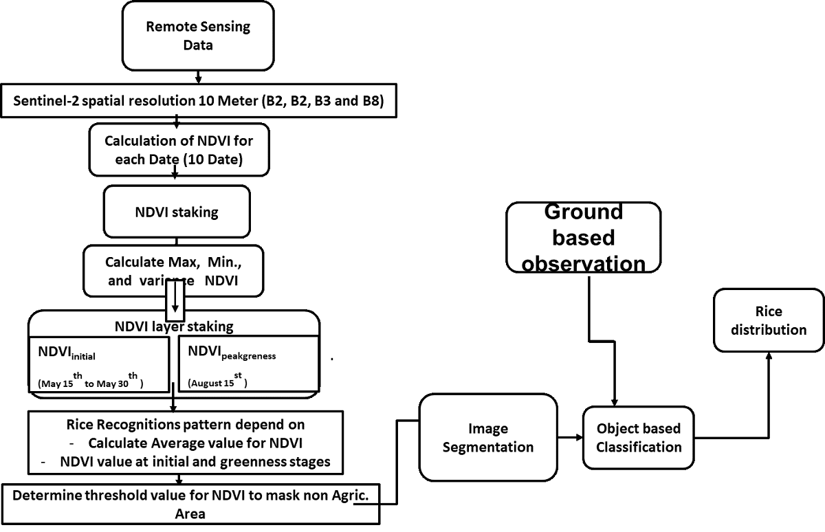
Rice is an essential crop for national food security in Egypt. Increasing the population calls for regular increases in rice production. At the same time, cultivated rice crop areas should be decreased because of the gradual scarcity of irrigation water. This means more rice production should be gained from less rice area. This situation calls for the annual accurate system for rice monitoring and yield estimation. Therefore, it is necessary to apply a remotely sensed based system for rice cultivation assessment using satellite imagery parallel with field measurements of some biophysical parameters. Multi-temporal normalized difference vegetation index (NDVI) extracted from twelve sentinel-2 imagery cover the whole summer season with variance and maximum value assessed by ground control points (GCPs), were used to isolate uncultivated areas, then to isolate rice areas and other vegetation covers. object-based classification methods with kappa co-efficient 0.9261 and overall accuracy 94.92% was generated to discriminate rice crop area and other summer crops on the study area. Leaf area index (LAI) for the experiment the l site was calculated using the surface energy balance algorithm for Land (SEBAL) model and then tested versus measured (LAI). NDVI and LAI were used to generate an empirical ran rice yield prediction model. Then, this model was used to produce rice to yield a map. The study was carried out in an experimental site in Kafr Elsheikh governorate with a total area of 5040 Hectare. Produced cultivated land use map showed 95% overall accuracy. High similarity was observed between measured and calculated (LAI) with high accuracy of R2 = 0.94. of Rice, yield map showed expected to yield more to than a month before harvest. The generated yield map was tested using a correlation coefficient between actual yield and estimated yield with high accuracy R2 = 0.9. This method is applicable to estimate the acreage and productivity of rice in the northern Nile delta in adequate time before harvest.
Keywords:
Sentinal-2
; NDVI
; LAI
; rice
; yield
Copyright: This open access article is published under a Creative Commons CC BY 4.0 license, which permit the free download, distribution, and reuse, provided that the author and preprint are cited in any reuse.


