Submitted:
03 July 2019
Posted:
04 July 2019
You are already at the latest version
Abstract
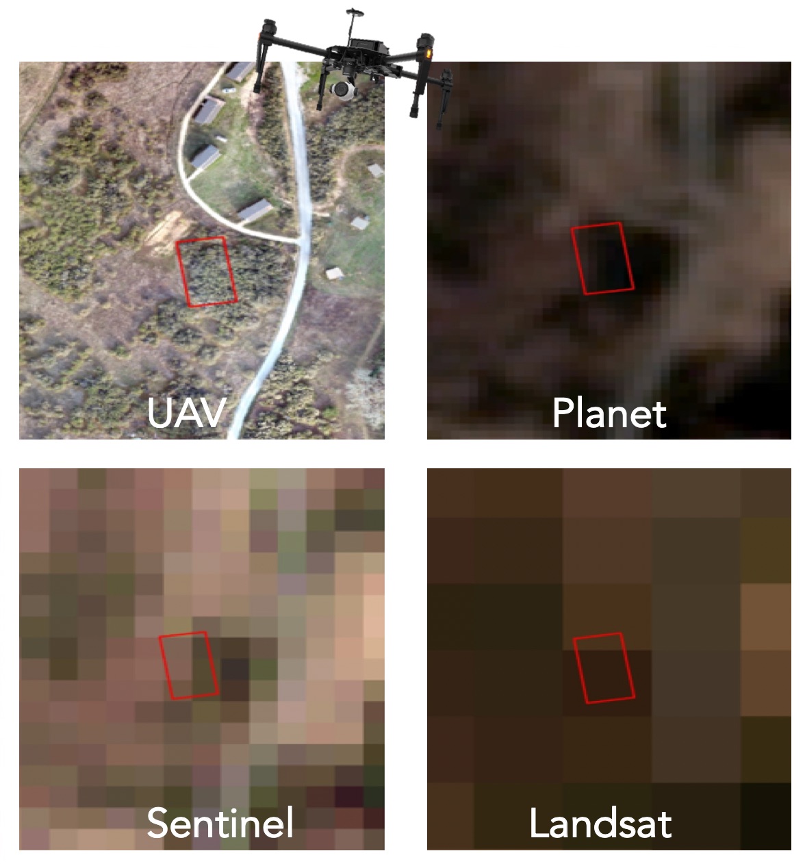
Unmanned aerial vehicles (UAVs) equipped with multispectral sensors present an opportunity to monitor vegetation with on-demand high spatial and temporal resolution. In this study, we use multispectral imagery from quadcopter UAVs to monitor the progression of a water manipulation experiment on a common shrub, Baccharis pilularis (coyote brush), at the Blue Oak Ranch Reserve (BORR) near San Jose, California. We recorded multispectral data from the plants at several altitudes with nearly hourly intervals to explore the relationship between two common spectral indices, NDVI and NDRE, and plant water content and water potential, as physiological metrics of plant water status, across a gradient of water deficit. An examination of the spatial and temporal thresholds at which water limitations were most detectable revealed that the best separation between levels of water deficit were at higher resolution (lower flying height), and in the morning (NDVI) and early morning (NDRE). We found that both measures were able to identify moisture deficit in plants and distinguish them from control and watered plants; however, NDVI was better able to distinguish between treatments than NDRE and was more positively correlated with field measurements of plant water content than NDRE. Finally, we explored how relationships between spectral indices and water status changed when the imagery was scaled to courser resolutions provided by satellite-based imagery (PlanetScope) and found that PlanetScope data was able to capture the overall trend in treatments but was not able to capture subtle changes in water content. These kinds of experiments that evaluate the relationship between direct field measurements and UAV camera sensitivity are needed to enable translation of field-based physiology measurements to landscape or regional scales.
Keywords:
unmanned aerial vehicles
; vegetation water status
; drought
; NDVI
; NDRE
; Baccharis pilularis
Copyright: This open access article is published under a Creative Commons CC BY 4.0 license, which permit the free download, distribution, and reuse, provided that the author and preprint are cited in any reuse.


