
Submitted:
06 February 2019
Posted:
07 February 2019
You are already at the latest version
Abstract
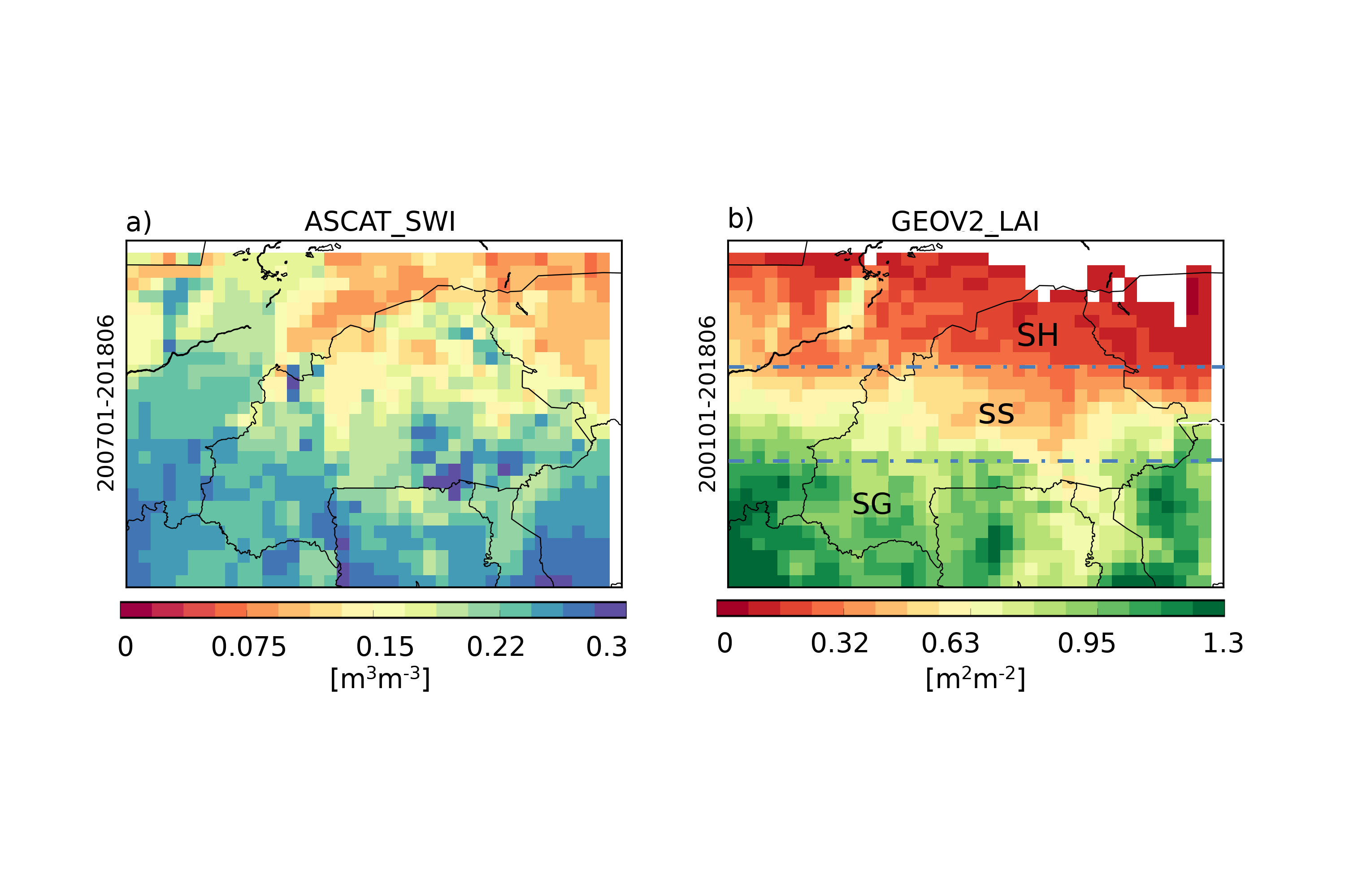
This study focuses on the ability of the global land data assimilation system LDAS-Monde to improve the representation of land surface variables (LSVs) over Burkina Faso through the joint assimilation of satellite derived Surface Soil Moisture (SSM) and Leaf Area Index (LAI) from January 2001 to June 2018. The LDAS-Monde offline system is forced by the latest European Centre for Medium-Range Weather Forecasts (ECMWF) atmospheric reanalysis ERA5, leading to a 0.25° x 0.25° spatial resolution reanalysis of the LSVs. Within LDAS-Monde, SSM and LAI observations from the Copernicus Global Land Service (CGLS) are assimilated using the CO2-responsive version of the ISBA (Interactions between Soil, Biosphere and Atmosphere) land surface model (LSM). First, it is shown that ERA5 better represents precipitation and incoming solar radiation than ERA-Interim former reanalysis from ECMWF. Results of two experiments are compared: open-loop simulation (i.e. no assimilation) and analysis (i.e. joint assimilation of SSM and LAI). After jointly assimilating SSM and LAI, it is noticed that the assimilation is able to impact soil moisture in the first top soil layers (the first 20 cm), and also in deeper soil layers (from 20 cm to 60 cm and below). The assimilation is able to improve the simulation of both SSM and LAI. For LAI in particular, the southern region of the domain (dominated by a Sudan-Guinean climate) highlights a strong impact of the assimilation compared to the other two sub-regions of Burkina Faso (dominated by Sahelian and Sudan-Sahelian climates). In the southern part of the domain, differences between the model and the observations are the largest, prior to any assimilation. These differences are linked to the model failing to represent the behavior of some specific vegetation species, which are known to put on leaves before the first rains of the season. The LDAS-Monde analysis is very efficient at compensating for this model weakness. Evapotranspiration estimates from the Global Land Evaporation Amsterdam Model (GLEAM) project as well as upscaled carbon uptake from the FLUXCOM project are used in the evaluation process, again demonstrating improvements in the representation of evapotranspiration and gross primary production after assimilation.
Keywords:
Land surface reanalysis
; remote sensing
; data assimilation
Copyright: This open access article is published under a Creative Commons CC BY 4.0 license, which permit the free download, distribution, and reuse, provided that the author and preprint are cited in any reuse.


