Submitted:
29 October 2018
Posted:
29 October 2018
You are already at the latest version
Abstract
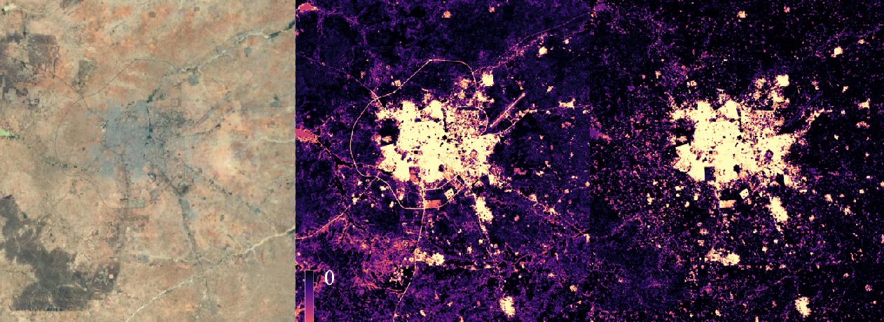
The rapid urbanization that takes place in developing regions such as Sub-Saharan Africa is associated with a large range of environmental and social issues. In this context, remote sensing is essential to provide accurate and up-to-date spatial information to support risk assessment and decision making. However, mapping urban areas remains a challenge because of their heterogeneity, especially in developing regions where the highest rates of misclassification are observed. Nevertheless, urban areas located in arid climates --- which are among the most vulnerables to anthropogenic impacts, suffer from the spectral confusion occurring between built-up and bare soil areas when using optical imagery. Today, the increasing availability of satellite imagery from multiple sensors allow to tackle the aforementioned issues by combining optical data with Synthetic Aperture Radar (SAR). In this paper, we assess the complementarity of the Landsat 8 and Sentinel-1 sensors to map built-up areas in twelve Sub-Saharan African urban areas, using a pixel-level supervised classification based on the Random Forest classifier. We make use of textural information extracted from SAR backscattering data in order to reduce the speckle noise and to introduce contextual information at the pixel level. Results suggest that combining both optical and SAR features consistently improves classification performances, mainly by enhancing the differentiation between built-up and bare lands. However, the fusion was less beneficial in mountainous case studies, suggesting that including features derived from a Digital Elevation Model (DEM) could improve the reliability of the proposed approach. As suggested by previous studies, combining features computed from both VV and VH polarizations consistently led to better classification performances. On the contrary, introducing textures computed from different spatial scales did not improve the classification performances.
Keywords:
Urban Remote Sensing
; Sentinel-1
; Landsat 8
; Built-Up
; Data Fusion
; Texture
; Africa
Copyright: This open access article is published under a Creative Commons CC BY 4.0 license, which permit the free download, distribution, and reuse, provided that the author and preprint are cited in any reuse.


