Submitted:
13 October 2018
Posted:
16 October 2018
You are already at the latest version
Abstract
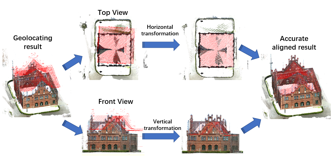
Recent advances in open data initiatives allow us to free access to a vast amount of open LiDAR data in many cities. However, most of these open LiDAR data over cities are acquired by airborne scanning, where the points on façades are sparse or even completely missing due to the viewpoint and object occlusions in the urban environment. Integrating other sources of data, such as ground images, to complete the missing parts is an effective and practical solution. This paper presents an approach for improving open LiDAR data coverage on building façades by using point cloud generated from ground images. A coarse-to-fine strategy is proposed to fuse these two different sources of data. Firstly, the façade point cloud generated from terrestrial images is initially geolocated by matching the SFM camera positions to their GPS meta-information. Next, an improved Coherent Point Drift algorithm with normal consistency is proposed to accurately align building façades to open LiDAR data. The significance of the work resides in the use of 2D overlapping points on the outline of buildings instead of limited 3D overlap between the two point clouds and the achievement to a reliable and precise registration under possible incomplete coverage and ambiguous correspondence. Experiments show that the proposed approach can significantly improve the façades details of buildings in open LiDAR data and improving registration accuracy from up to 10 meters to less than half a meter compared to classic registration methods.
Keywords:
open LiDAR
; terrestrial images
; building reconstruction
; point cloud registration
Copyright: This open access article is published under a Creative Commons CC BY 4.0 license, which permit the free download, distribution, and reuse, provided that the author and preprint are cited in any reuse.


