
Submitted:
12 September 2018
Posted:
12 September 2018
You are already at the latest version
Abstract
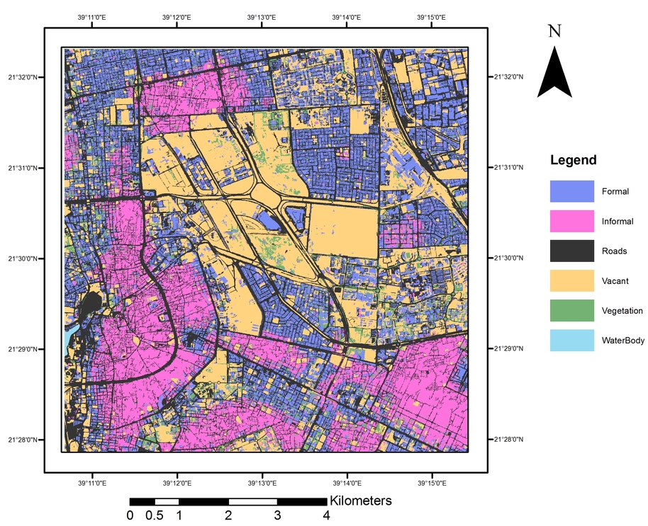
The identification of informal settlements in urban areas is an important step in developing and implementing pro-poor urban policies. Understanding when, where and who lives inside informal settlements is critical to efforts to improve their resilience. This study aims to analyse the capability of machine-learning (ML) methods to map informal areas in Jeddah, Saudi Arabia, using very-high-resolution (VHR) imagery and terrain data. Fourteen indicators of settlement characteristics were derived and mapped using an object-based ML approach and VHR imagery. These indicators were categorised according to three different spatial levels: environ, settlement and object. The most useful indicators for prediction were found to be density and texture measures, (with random forest (RF) relative importance measures of over 25% and 23% respectively). The success of this approach was evaluated using a small, fully independent validation dataset. Informal areas were mapped with an overall accuracy of 91%. Object-based ML as a hybrid approach performed better (8%) than object-based image analysis alone due to its ability to encompass all available geospatial levels.
Keywords:
informal settlement indicators
; very high resolution (VHR)
; urbanisation
; sustainable development goals
; object-based image analysis (OBIA)
; machine learning (ML)
; random forest (RF)
Copyright: This open access article is published under a Creative Commons CC BY 4.0 license, which permit the free download, distribution, and reuse, provided that the author and preprint are cited in any reuse.


