
Submitted:
28 April 2018
Posted:
29 April 2018
You are already at the latest version
Abstract
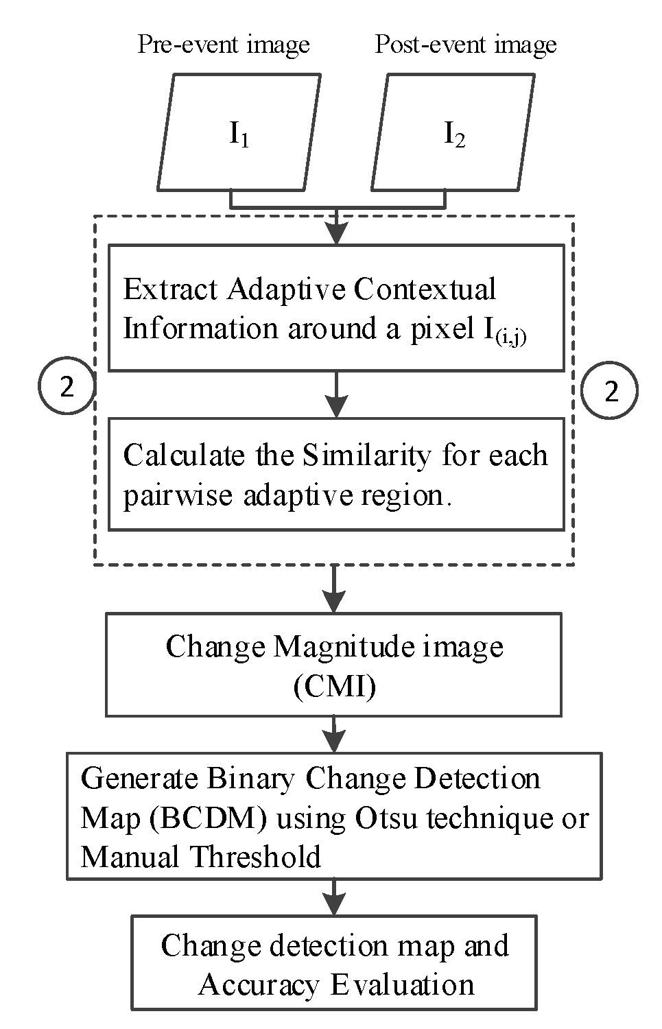
Land cover change detection (LCCD) based on bi-temporal remote sensing images plays an important role in the inventory of land cover change. Due to the benefit of having spatial dependency properties within the image space while using remote sensing images for detecting land cover change, many contextual information based change detection methods have been proposed during past decades. However, there is still a space for improvement in accuracies and usability of LCCD. In this paper, a LCCD method based on adaptive contextual information is proposed. First, an adaptive region is constructed by gradually detecting the spectral similarity surrounding a central pixel. Second, the Euclidean distance between pairwise extended regions is calculated to measure the change magnitude between the pairwise central pixels of bi-temporal images. While the whole bi-temporal images are scanned pixel-by-pixel, the change magnitude image (CMI) can be generated. Then, the Otsu or a manual threshold is employed to acquire the binary change detection map (BCDM). The detection accuracies of the proposed approach are investigated by two land cover change cases with Landsat bi-temporal remote sensing images. In comparison to several widely used change detection methods, the proposed approach can achieve a land cover change inventory map with a competitive accuracy.
Keywords:
land cover change detection
; adaptive contextual information
; bi-temporal remote sensing images
Copyright: This open access article is published under a Creative Commons CC BY 4.0 license, which permit the free download, distribution, and reuse, provided that the author and preprint are cited in any reuse.


