
Submitted:
03 April 2018
Posted:
04 April 2018
You are already at the latest version
Abstract
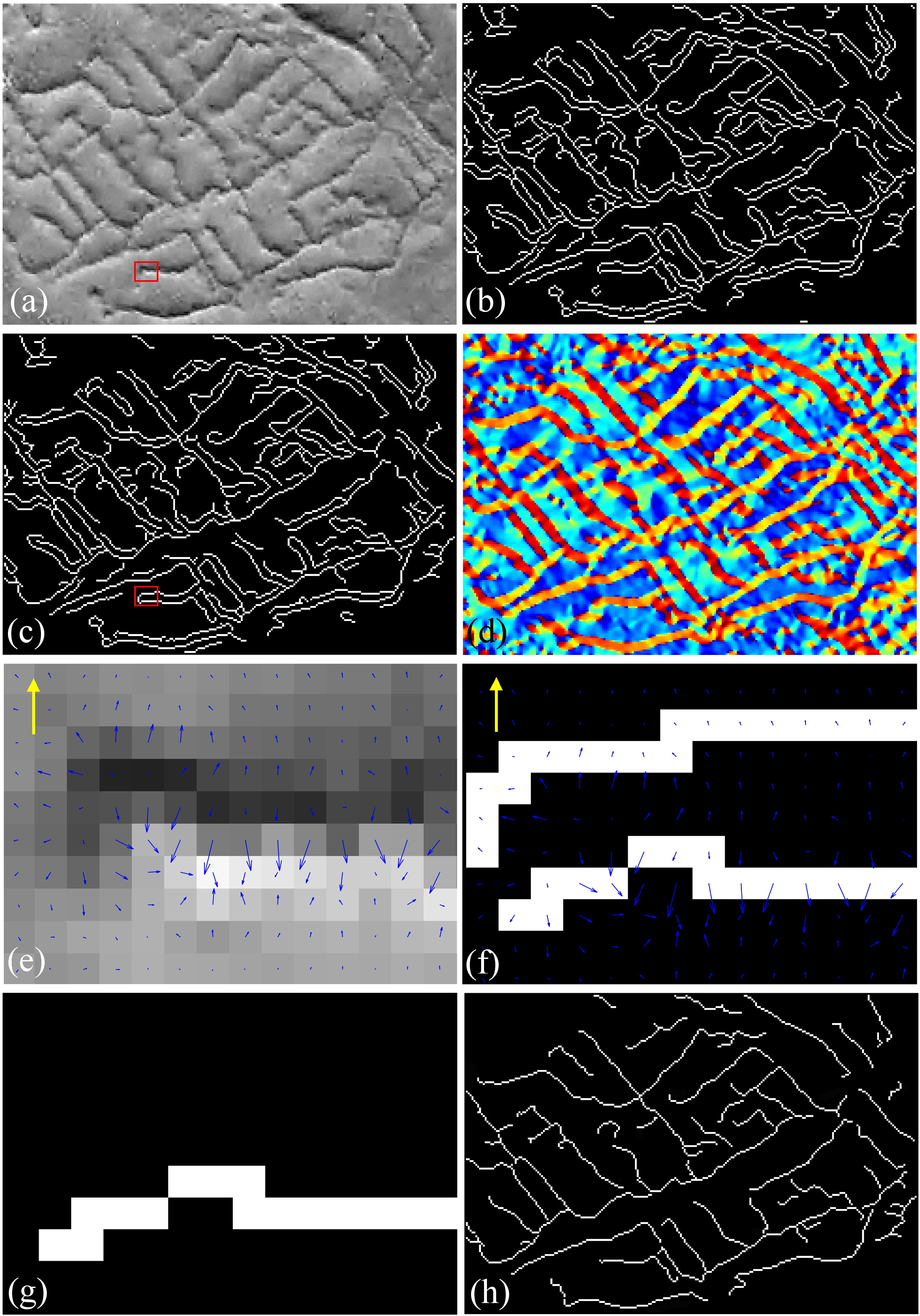
This paper describes the use of the Chinese Gaofen-1 (GF-1) satellite imagery to automatically extract tertiary Linear Archaeological Traces of Tuntian Irrigation Canals (LATTICs) located in the Miran site. The site is adjacent to the ancient Loulan Kingdom at the eastern margin of the Taklimakan Desert in western China. GF-1 data was processed following atmospheric and geometric correction, and spectral analyses were carried out for multispectral data. The low values produced by SSI indicate that it is difficult to distinguish buried tertiary LATTICs from similar backgrounds using spectral signatures. Thus, based on the textual characteristics of high-resolutionGF-1 panchromatic data, this paper proposes an automatic approach that combines joint morphological bottom and hat transformation with a Canny edge operator. The operator was improved by adding stages of geometric filtering and gradient vector direction analysis. Finally, the detected edges of tertiary LATTICs were extracted using the GIS-based draw tool and converted into shapefiles for archaeological mapping within a GIS environment. The proposed automatic approach was verified with an average accuracy of 95.76% for 754 tertiary LATTICs in the entire Miran site and compared with previous manual interpretation results. The results indicate that GF-1 VHR PAN imagery can successfully uncover the ancient tuntian agricultural landscape. Moreover, the proposed method can be generalized and applied to extract linear archaeological traces such as soil and crop marks in other geographic locations.
Keywords:
auto-extraction
; remote sensing archaeology
; tuntian
; LATTICs
; GF-1
; Silk Road
; Miran
Copyright: This open access article is published under a Creative Commons CC BY 4.0 license, which permit the free download, distribution, and reuse, provided that the author and preprint are cited in any reuse.


