
Submitted:
08 October 2026
Posted:
10 October 2026
You are already at the latest version
Abstract
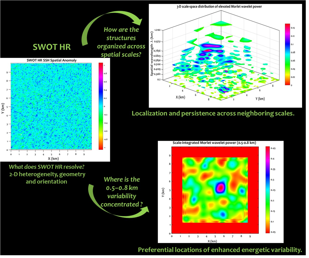
Coastal water levels during storms result from interacting tides, storm surges, waves, currents, bathymetry, and coastal geometry, producing spatially heterogeneous responses that remain difficult to characterize from point observations alone. The Surface Water and Ocean Topography (SWOT) mission provides a new opportunity to investigate this complexity through wide-swath High-Resolution (HR) observations of sea surface height (SSH). Here, SWOT HR water levels are first evaluated against five tide gauges in the English Channel and subsequently analyzed at three contrasting sites, Cherbourg, Villers-sur-Mer, and Étretat, using complementary spatial and scale-resolved approaches. SWOT HR shows strong agreement with tide gauges at the best-performing sites, with RMSE values of approximately 0.11 m and correlations exceeding 0.99, while accuracy remains site dependent. Beyond point-based validation, the two-dimensional HR fields reveal pronounced spatial heterogeneity, including localized and elongated SSH anomalies with distinct geometries and orientations. EOF decomposition shows that more than half of the variance remains beyond the first six modes at all three sites, highlighting the complexity of the HR spatial signal. These residual structures are spatially organized rather than random, while their point-by-point relationship with radar backscatter (σ⁰) remains negligible. Two-dimensional Morlet wavelet analysis identifies a recurrent energetic range of approximately 0.5–1.0 km across the three domains, showing strongly contrasting intensity, localization, geometry, and persistence across neighboring scales. Comparison with independent wave, surface-current, and bathymetric fields further shows that this variability occurs within markedly different hydrodynamic and morphological environments, consistent with the combined influence of storm forcing and local coastal configuration rather than a single controlling process. The complementarity of these analyses demonstrates the added value of SWOT HR for resolving the two-dimensional, multiscale complexity of storm-time coastal SSH, providing new spatial information for understanding coastal dynamics and for high-resolution model validation and data assimilation.
Keywords:
SWOT
; coastal altimetry
; storm events
; spatial variability
; coastal hydrodynamics
Copyright: This open access article is published under a Creative Commons CC BY 4.0 license, which permit the free download, distribution, and reuse, provided that the author and preprint are cited in any reuse.