
Submitted:
14 March 2018
Posted:
14 March 2018
You are already at the latest version
Abstract
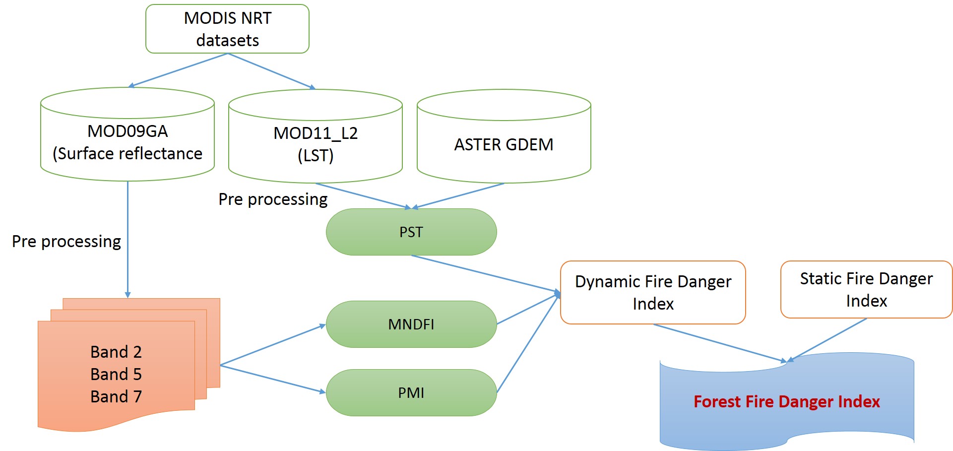
Forest fire is a major ecological disaster, which has economic, social and environmental impacts on humans and also causes the loss of biodiversity. Forest officials issue the warnings to the public on the basis of fire danger index classes. There is no fire danger index for the country India due to the sparsely distributed meteorological stations. Previous studies suggest that Static Fire Danger Index (SFDI) as well as Dynamic Fire Danger Index (DFDI) have been derived from the satellite datasets. In this study, we have made an attempt to integrate both the Static and Dynamic fire danger indices and also used the Near Real Time (NRT) data sets that can be available for download through NASA FTP server after one hour of the satellite overpass. In this study, DFDI has been calculated from the MODIS Terra NRT Land Surface Temperature (MOD11_L2) and MODIS TERRA NRT surface reflectance MOD09. Finally, The Forest Fire Danger Index (FFDI) has been developed from the static and dynamic fire danger indices by the additive model and the overall accuracy was around 81.27%. Thus, the FFDI has been useful to predict the fire danger accurately and can be useful anywhere, where the meteorological stations are un-available.
Keywords:
Forest fire danger index
; MODIS
; MOD11
; MOD09
; MOD14
Copyright: This open access article is published under a Creative Commons CC BY 4.0 license, which permit the free download, distribution, and reuse, provided that the author and preprint are cited in any reuse.


