
Submitted:
05 April 2019
Posted:
08 April 2019
You are already at the latest version
Abstract
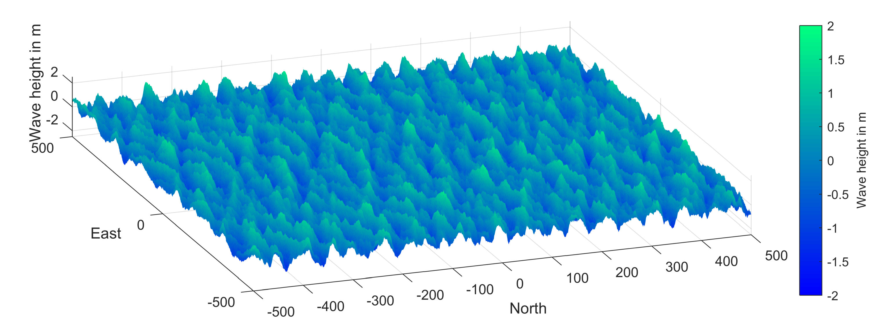
The signal-to-noise ratio (SNR) data is part of the global navigation satellite systems (GNSS) observables. In a marine environment, the oscillation of the SNR data can be used to derive reflector heights. Since the attenuation of the SNR oscillation is related to the roughness of the sea surface, the significant wave height (SWH) of the water surface can be calculated from the analysis of the attenuation. The attenuation depends additionally on the relation between the coherent and the incoherent part of the scattered power. The latter is a function of the correlation length of the surface waves. Because the correlation length changes with respect to the direction of the line of sight relative to the wave direction, the attenuation must show an anisotropic characteristic. In this work, we present a method to derive the wave direction from the anisotropy of the attenuation of the SNR data. The method is investigated based on simulated data as well by the analysis of experimental data from a GNSS station in the North Sea.
Keywords:
GNSS
; reflectometry
; SNR
; wave direction
Copyright: This open access article is published under a Creative Commons CC BY 4.0 license, which permit the free download, distribution, and reuse, provided that the author and preprint are cited in any reuse.


